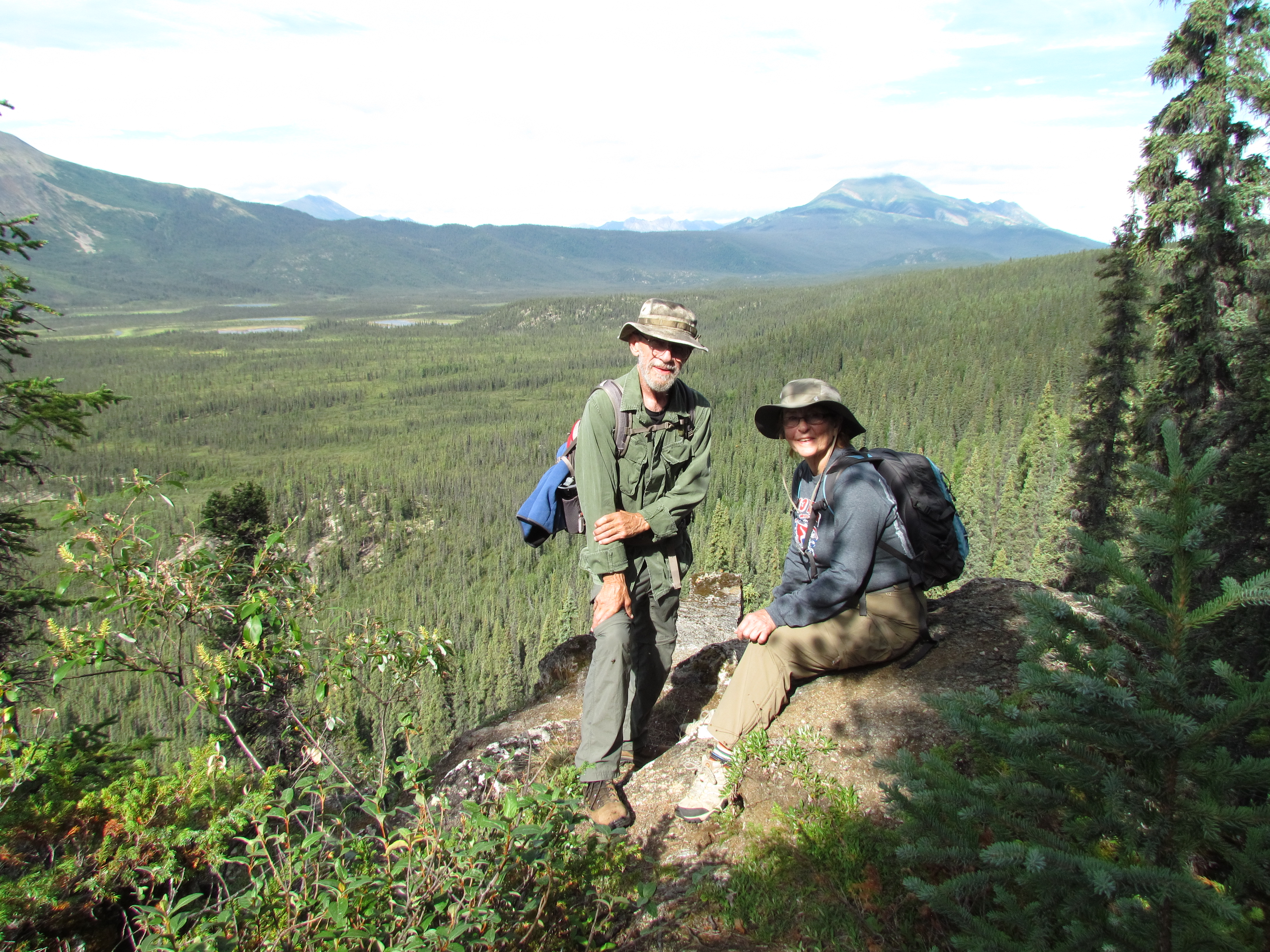
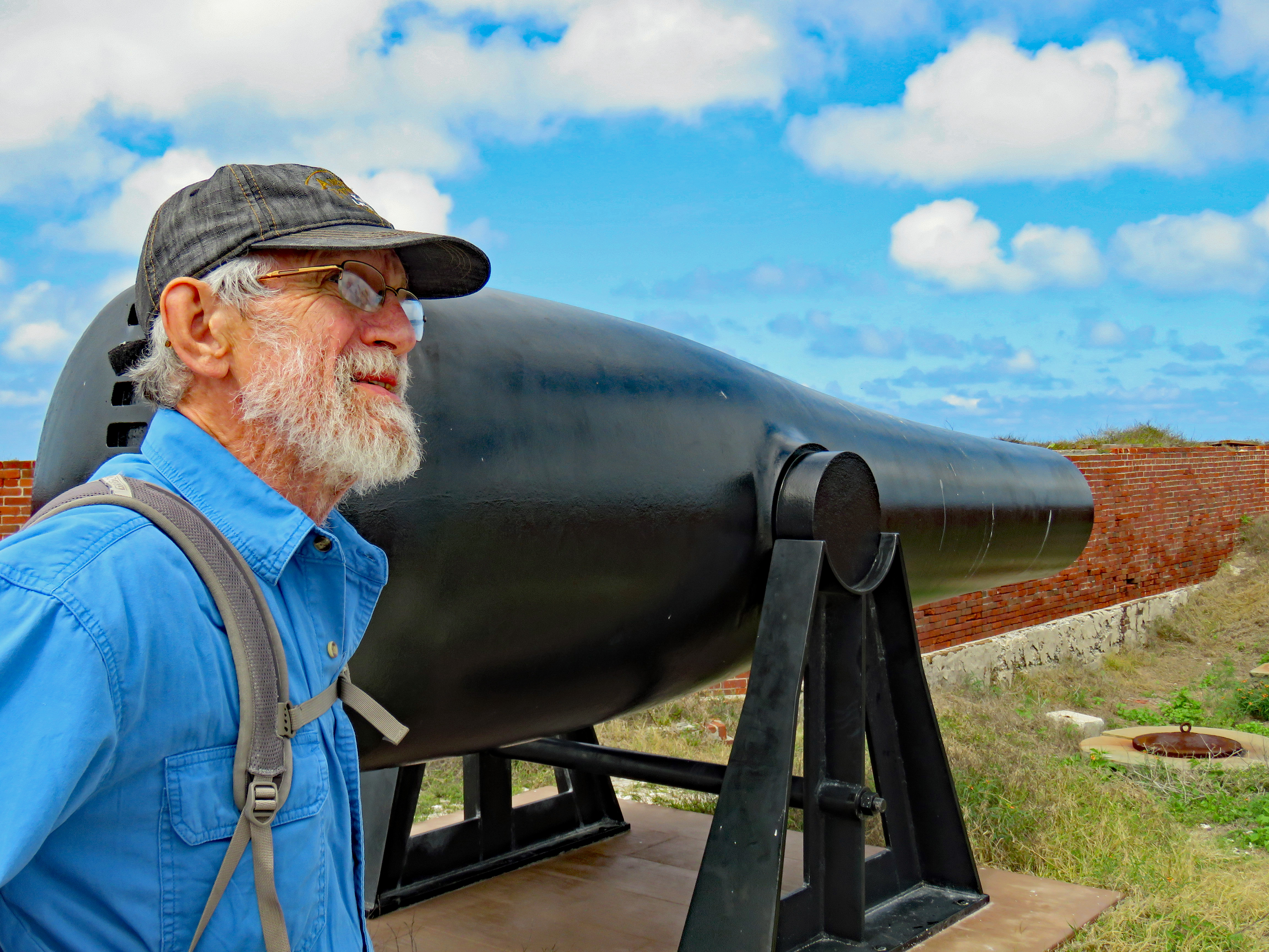
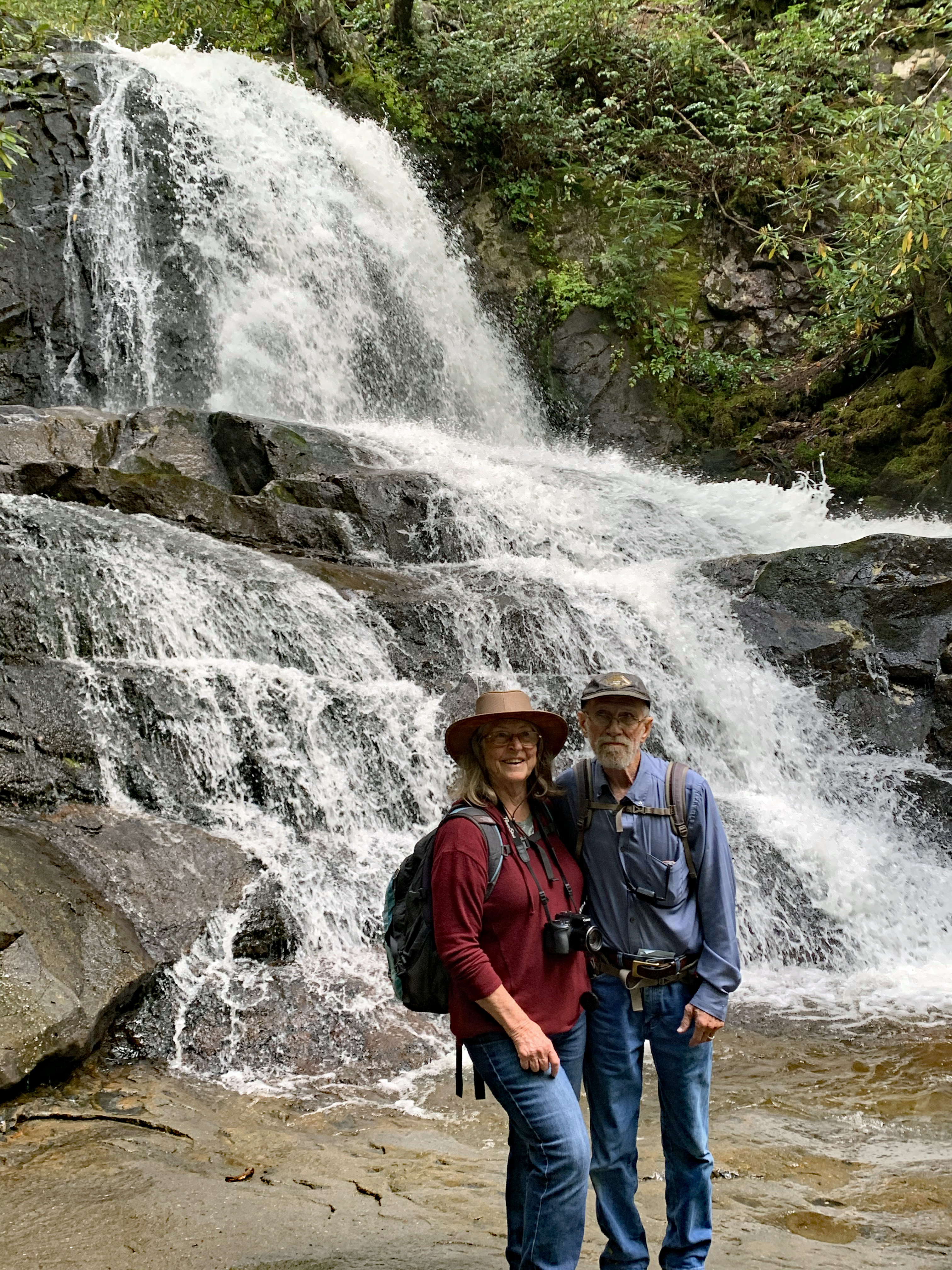
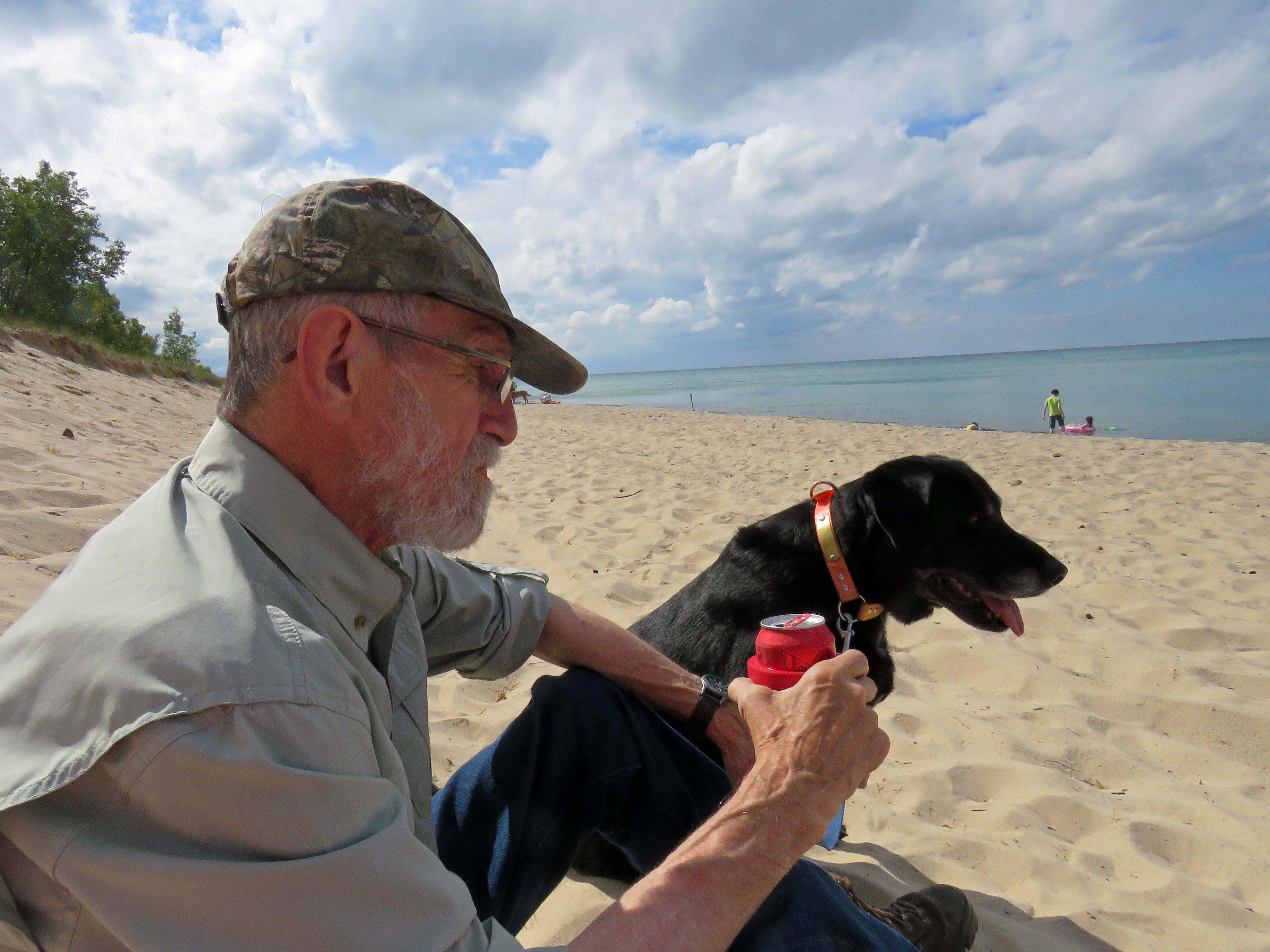
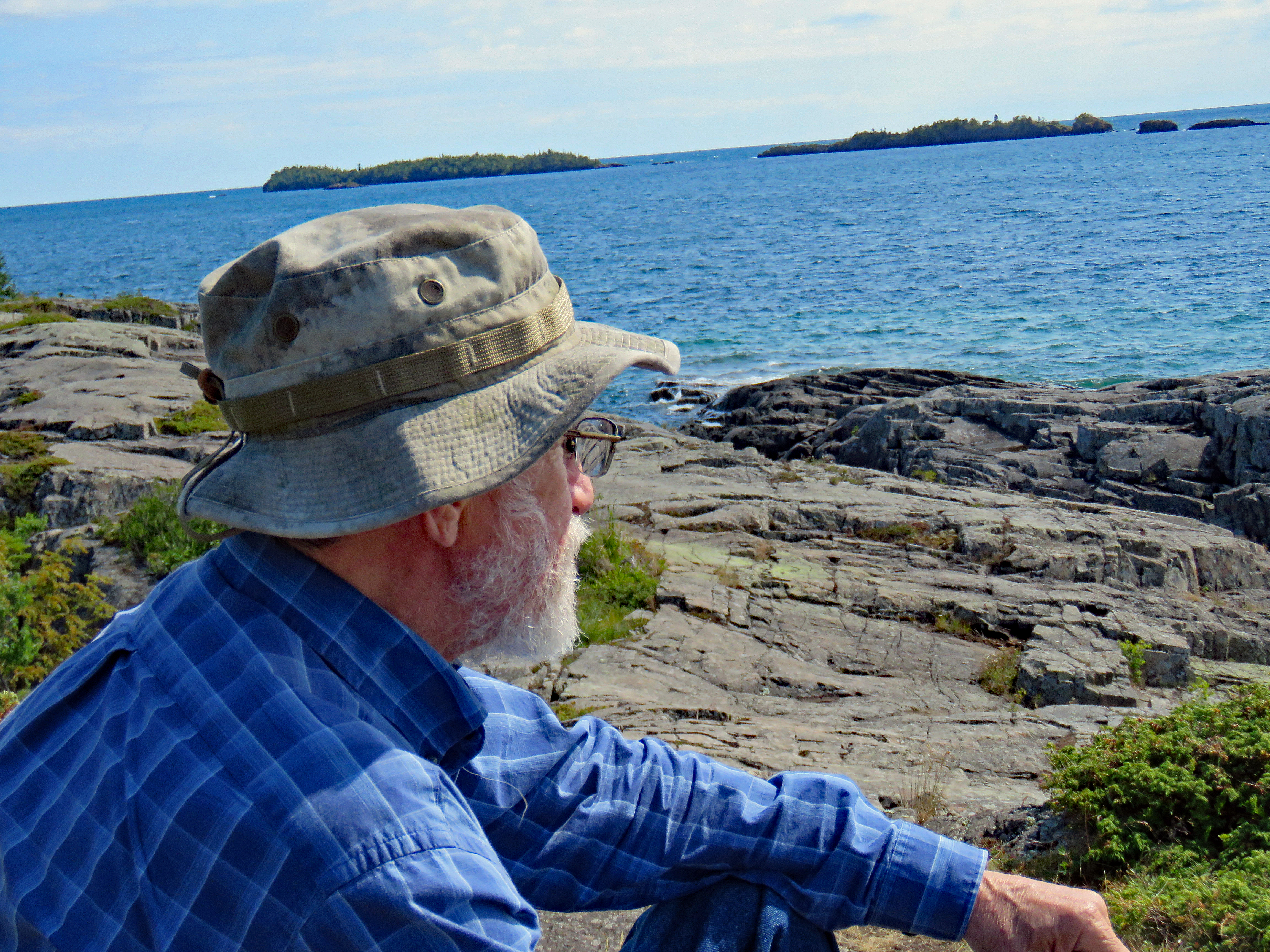
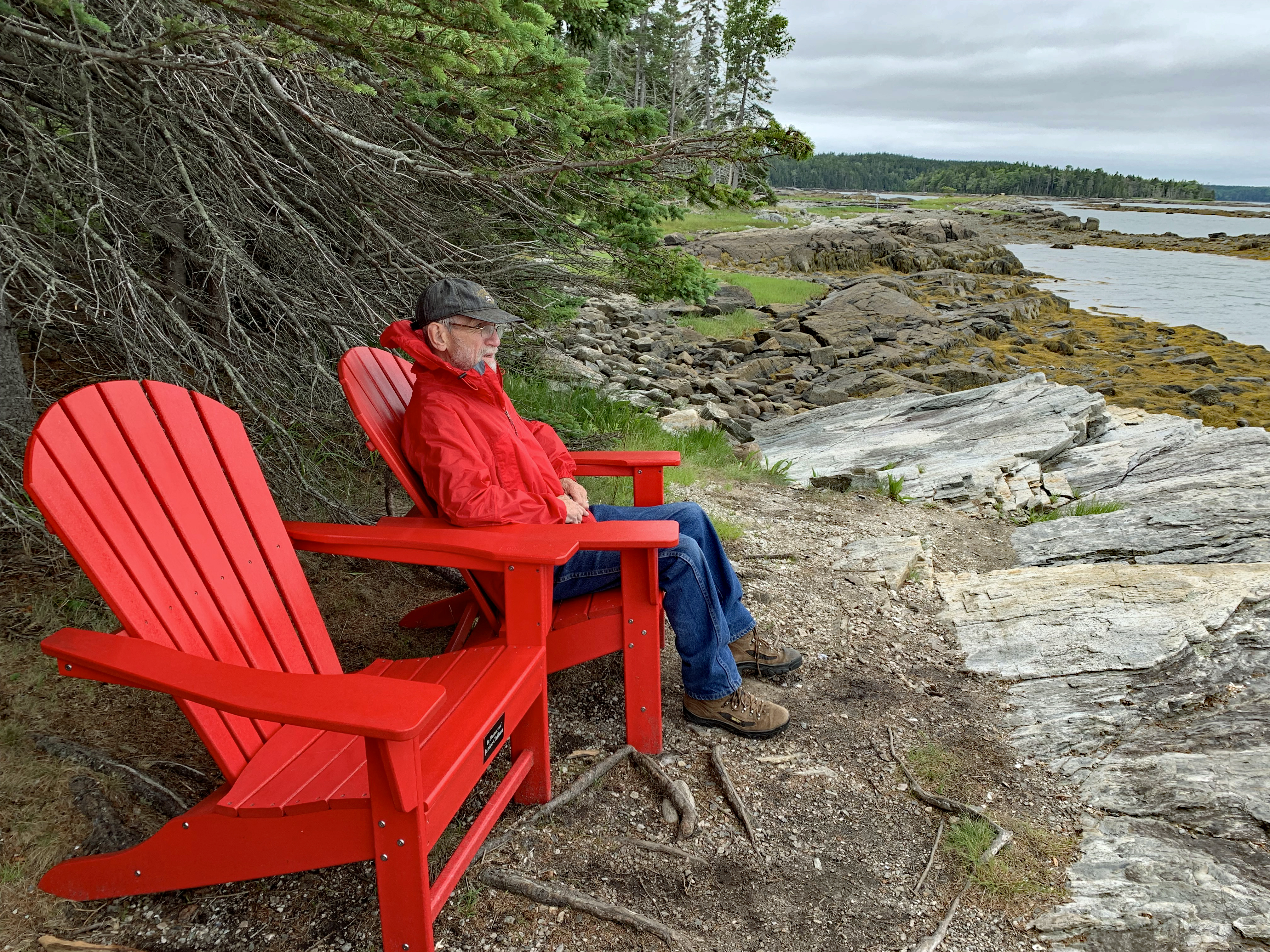
It’s with a heavy heart that I share the passing of Tom Hummell, my husband, love, best friend and soulmate and travel companion. He fought the good fight but cancer won.
We had many adventures, accomplished our goal of visiting all 63 National Parks, and enjoyed the outdoors together as well as our quiet times at home. Whether being at the cabin, having friends and relatives visit, whitewater rafting, hiking, traveling with our camper, attending Hummell family reunions and 173rd Airborne reunions or even our annual chainsaw wood-cutting expeditions, we were in it together and had a good time. He was a good man who will be greatly missed by many.
Tom always read my blogs before I posted them and often had good suggestions for improvement or clarity. I have park units we visited that I haven’t written about and intend to do that. There’s a book about our parks travels started in my head so hopefully I’ll actually get it written. My journey through the parks will certainly be different but I cherish the memories of our travels together.
Gates of the Arctic National ParkDry Tortugas National ParkGreat SmokyMountains National ParkIndiana Dunes National ParkIsle Royale National ParkAcadia National ParkGates of the Arctic National ParkWhite Sands National Park
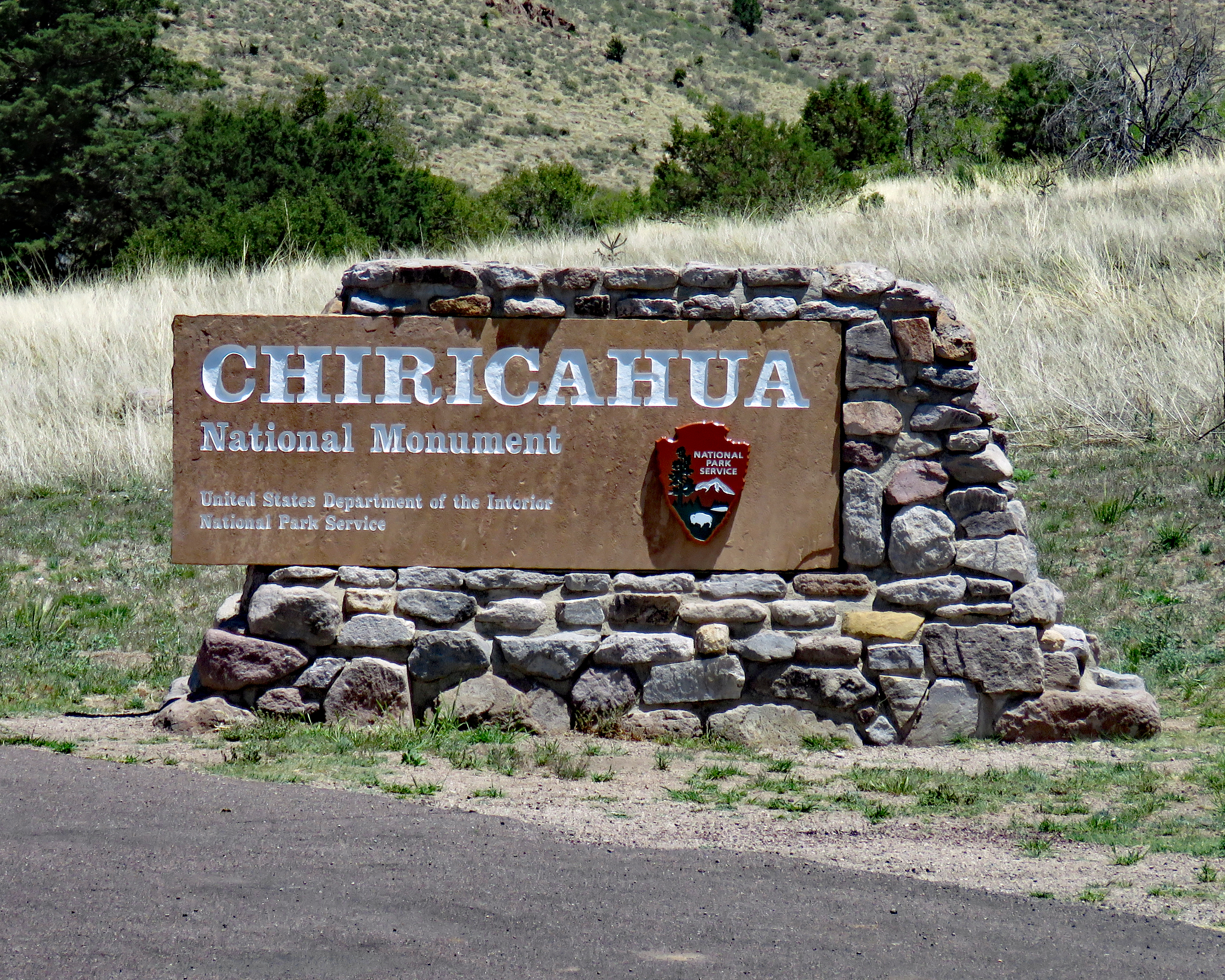
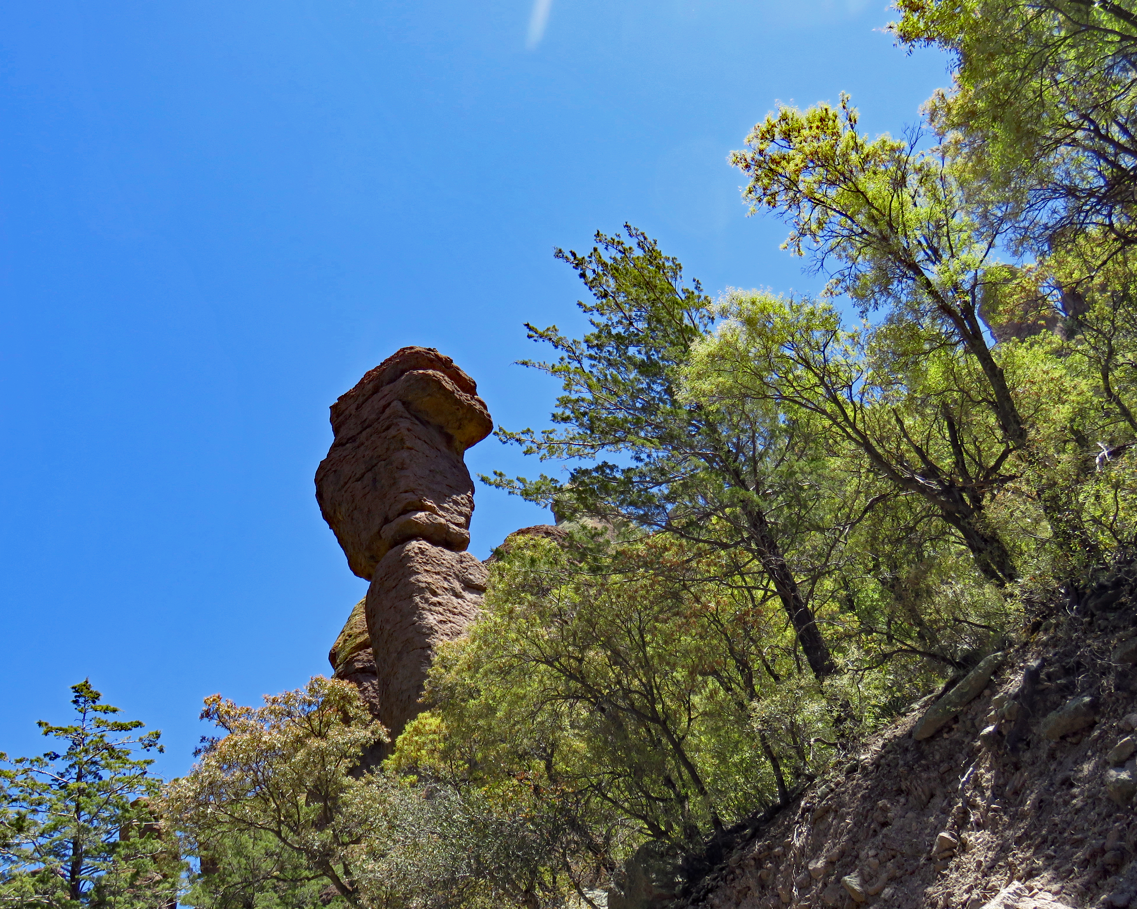
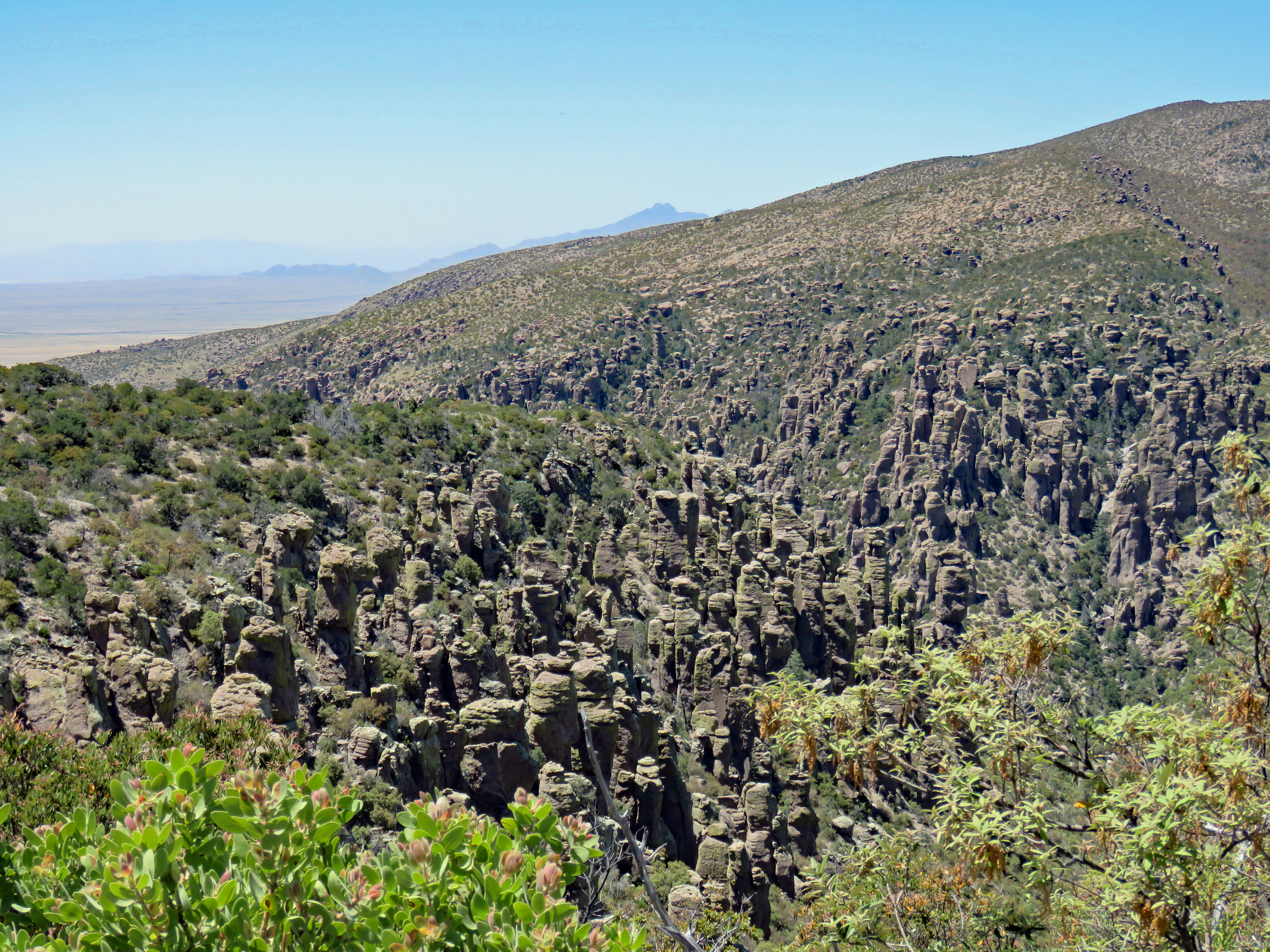
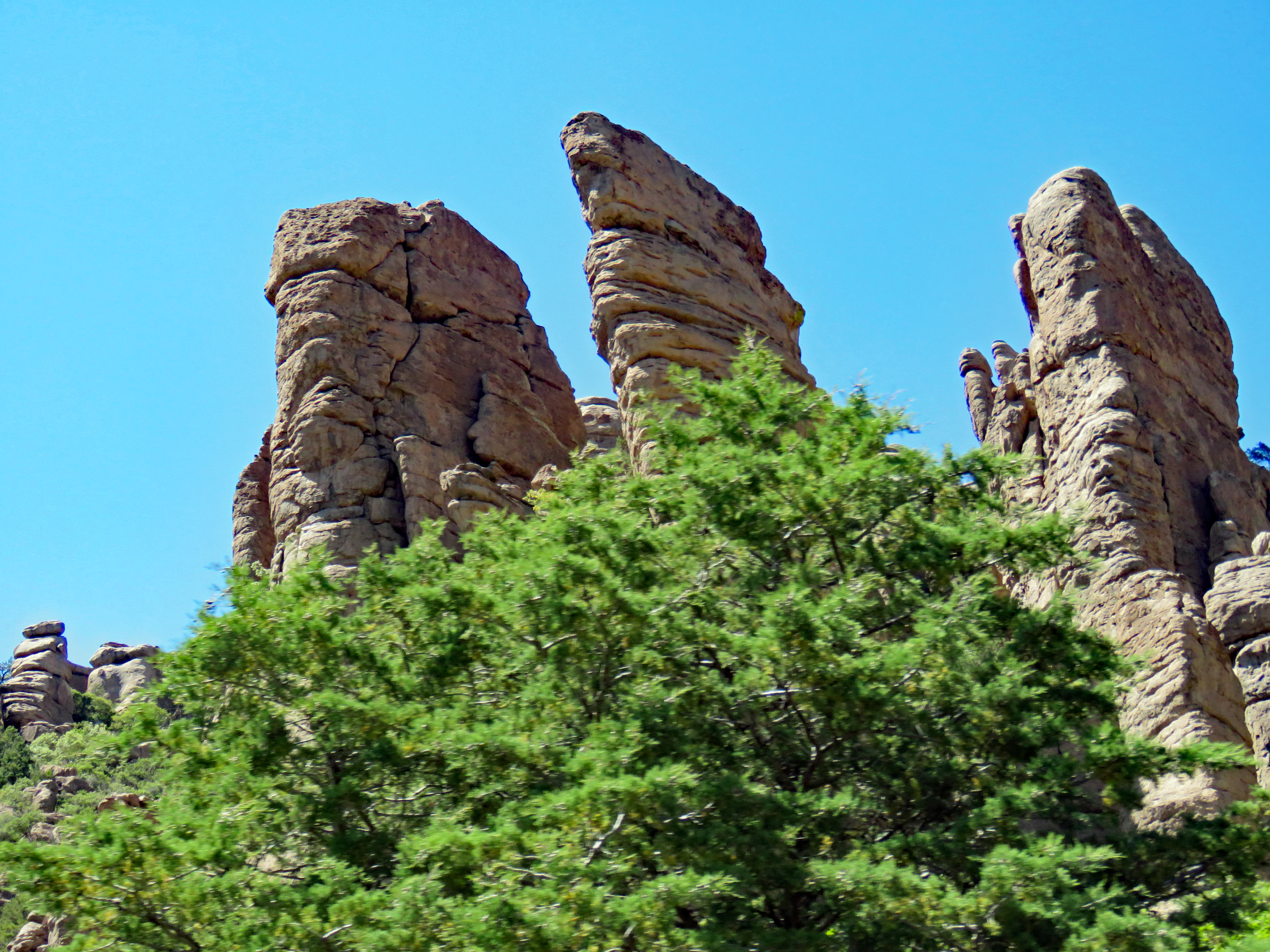
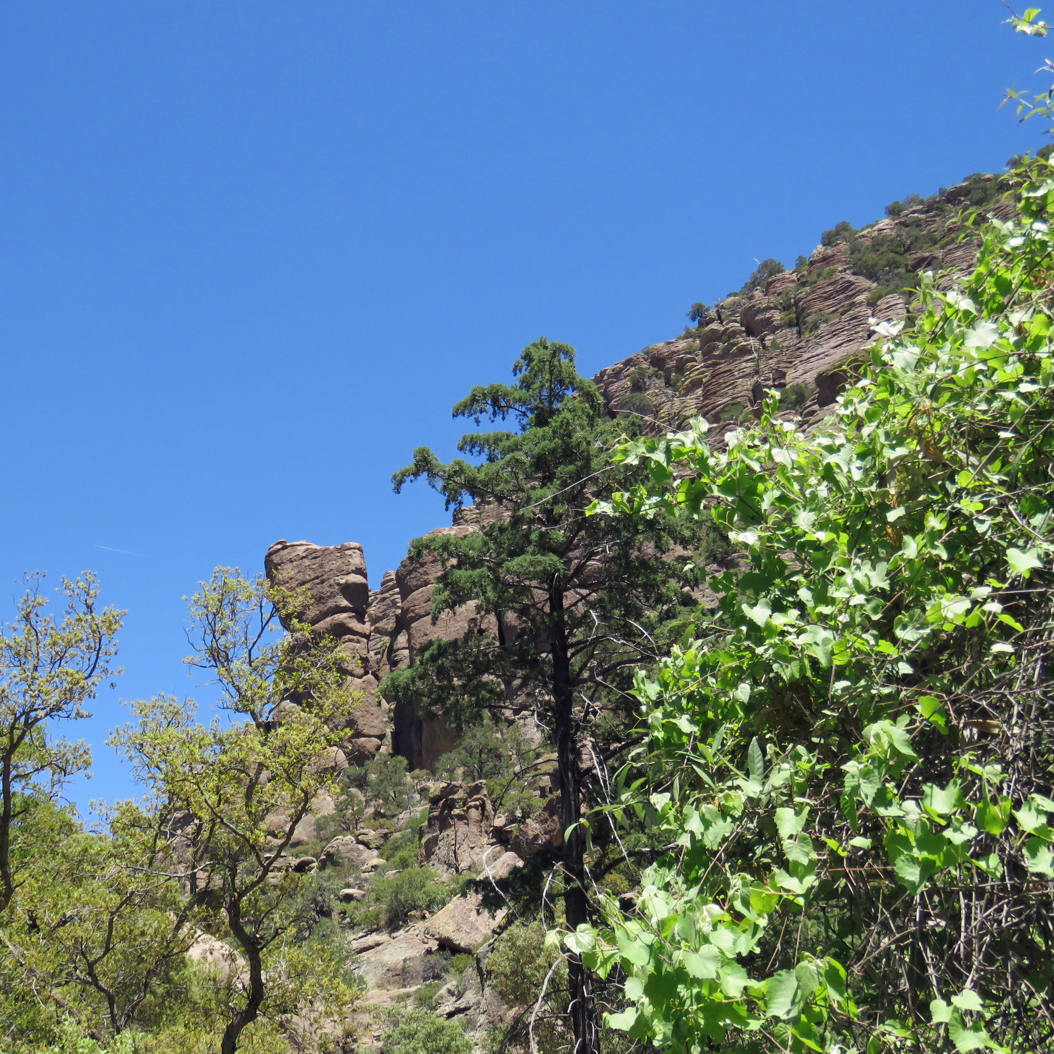
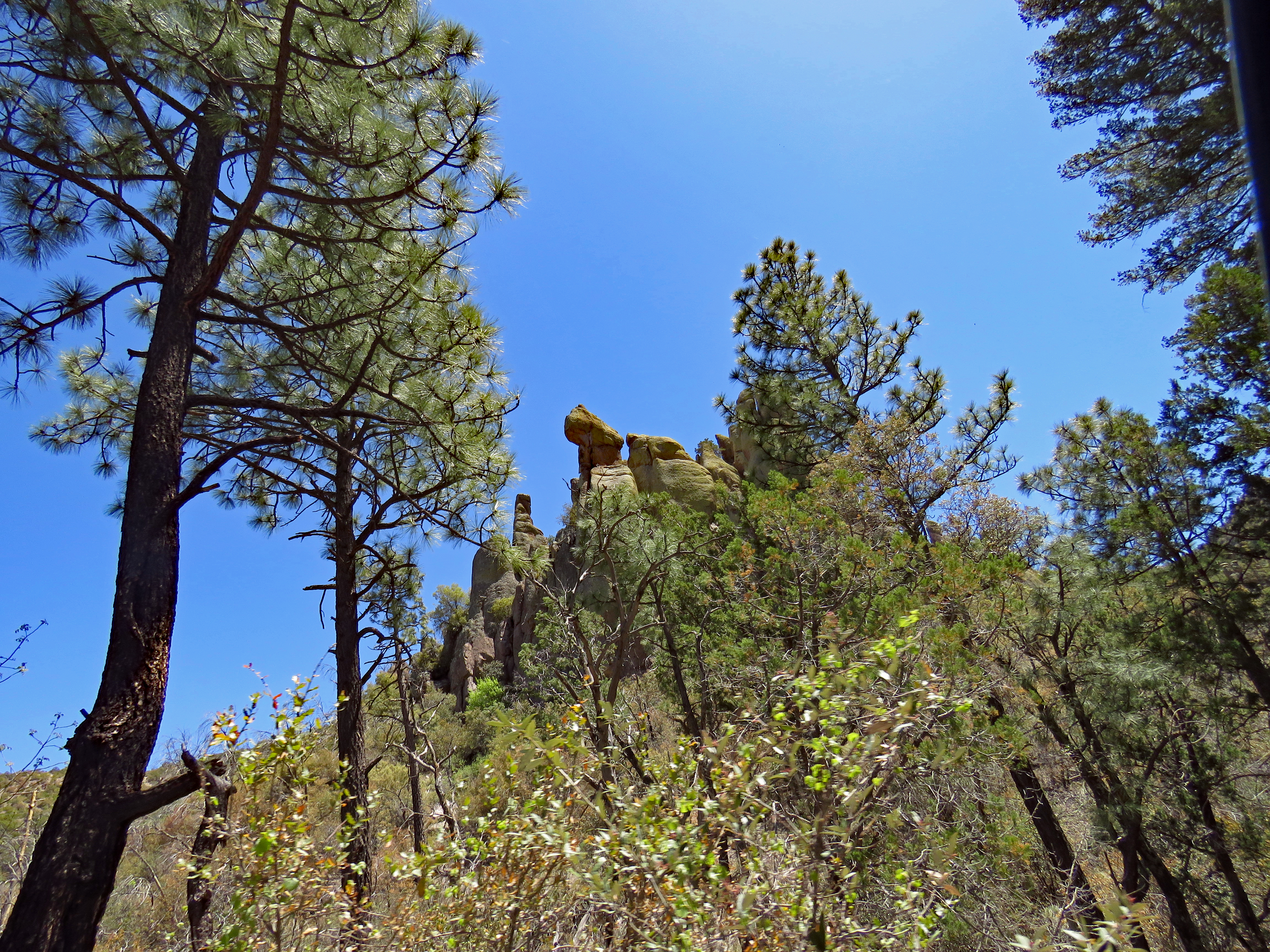
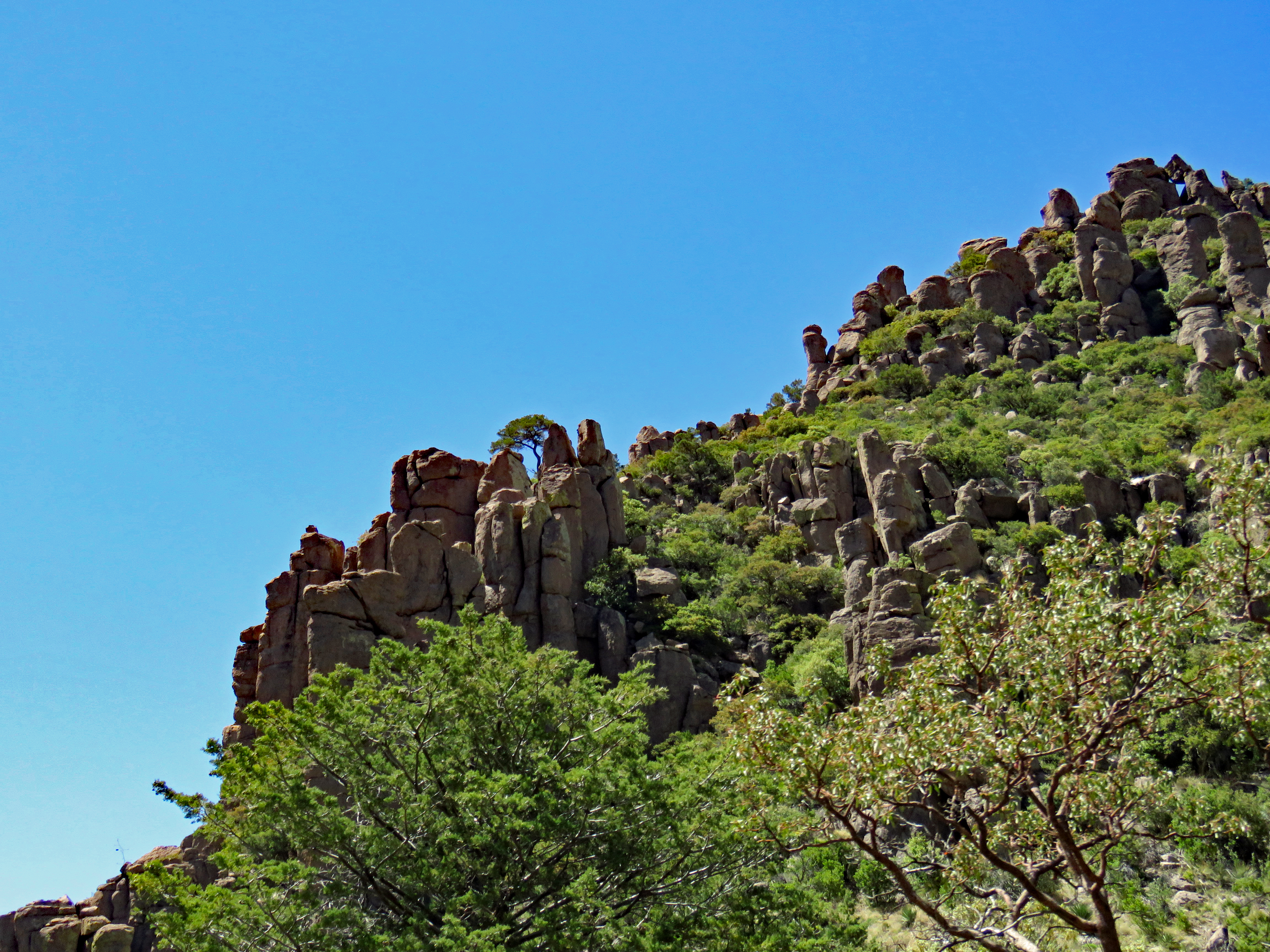
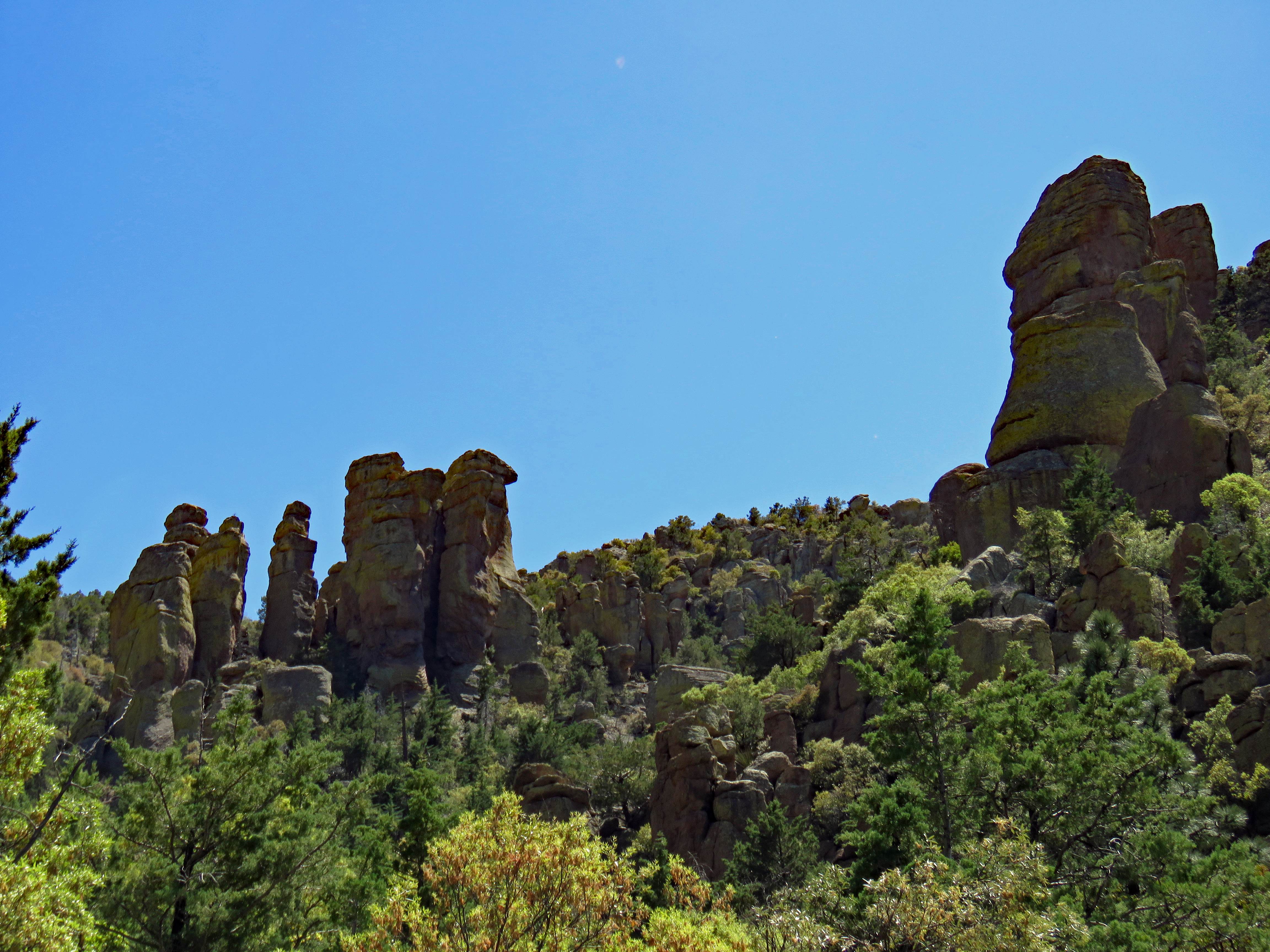
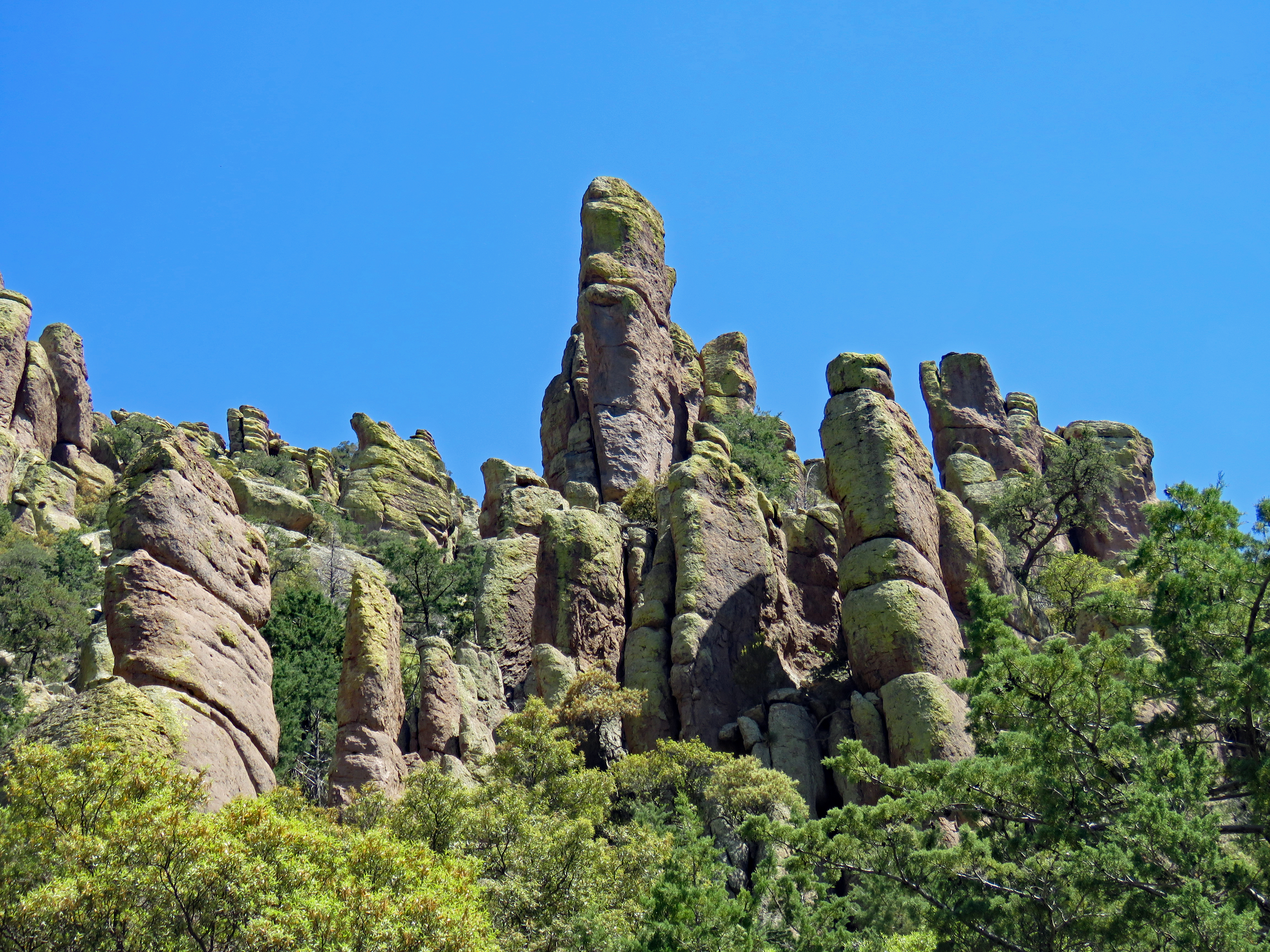
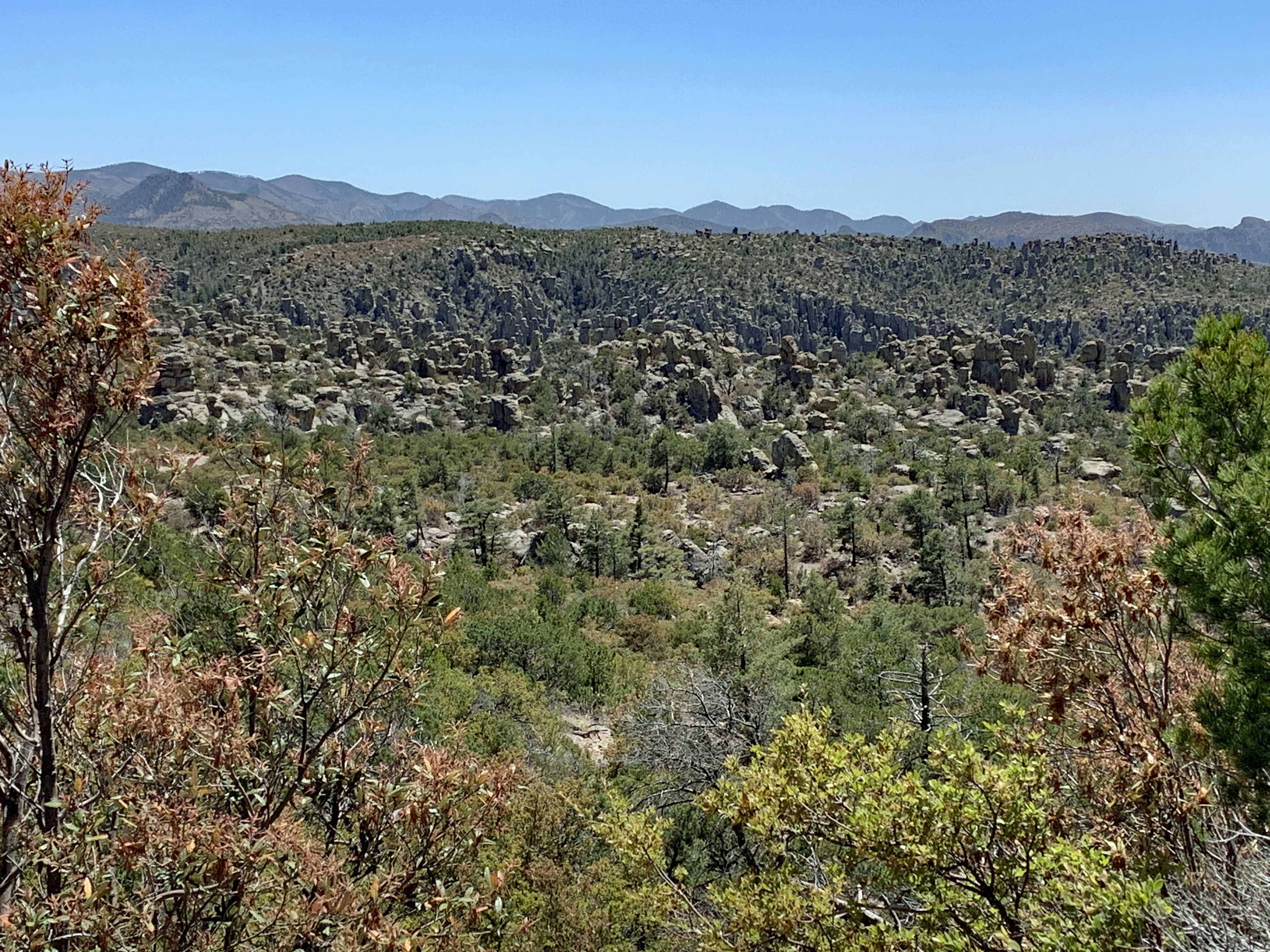
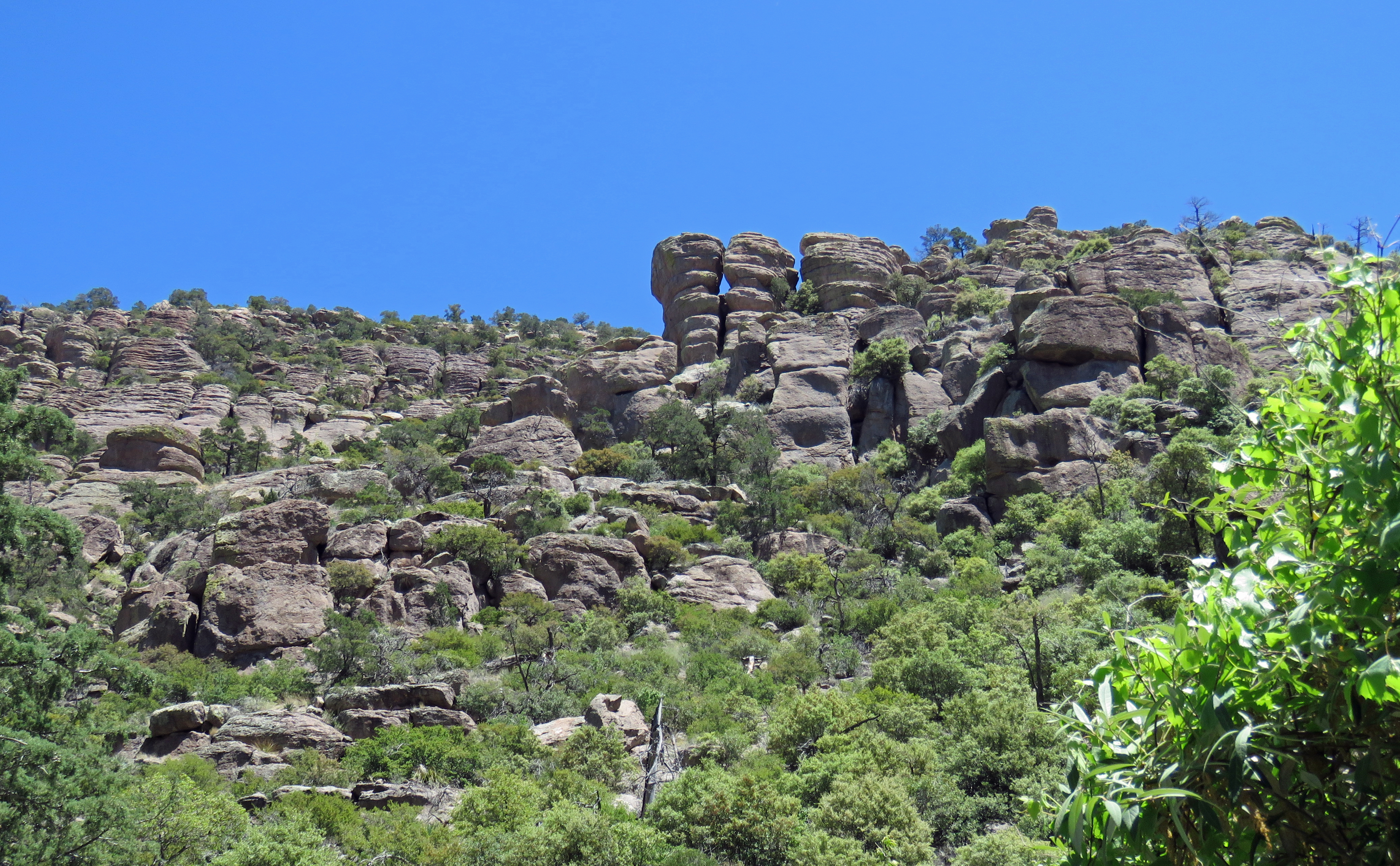
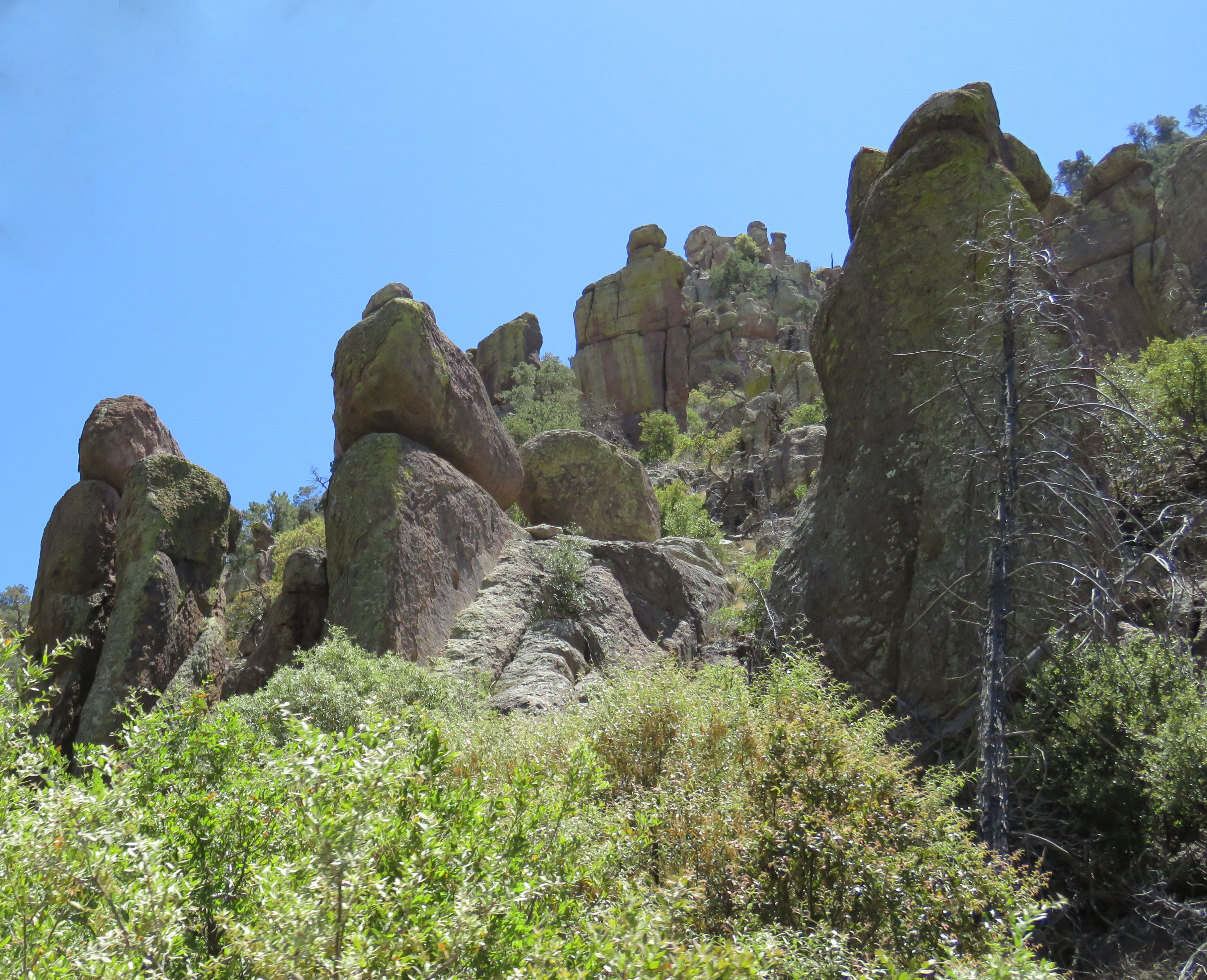
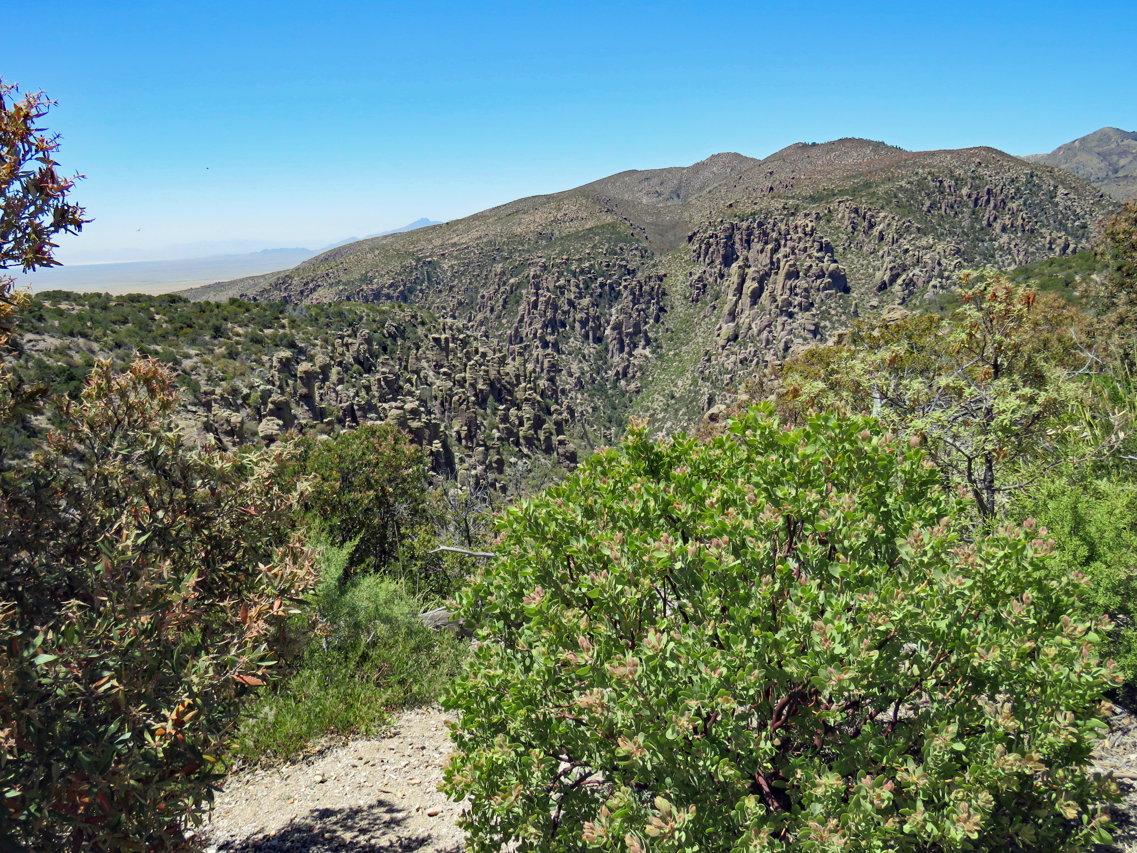
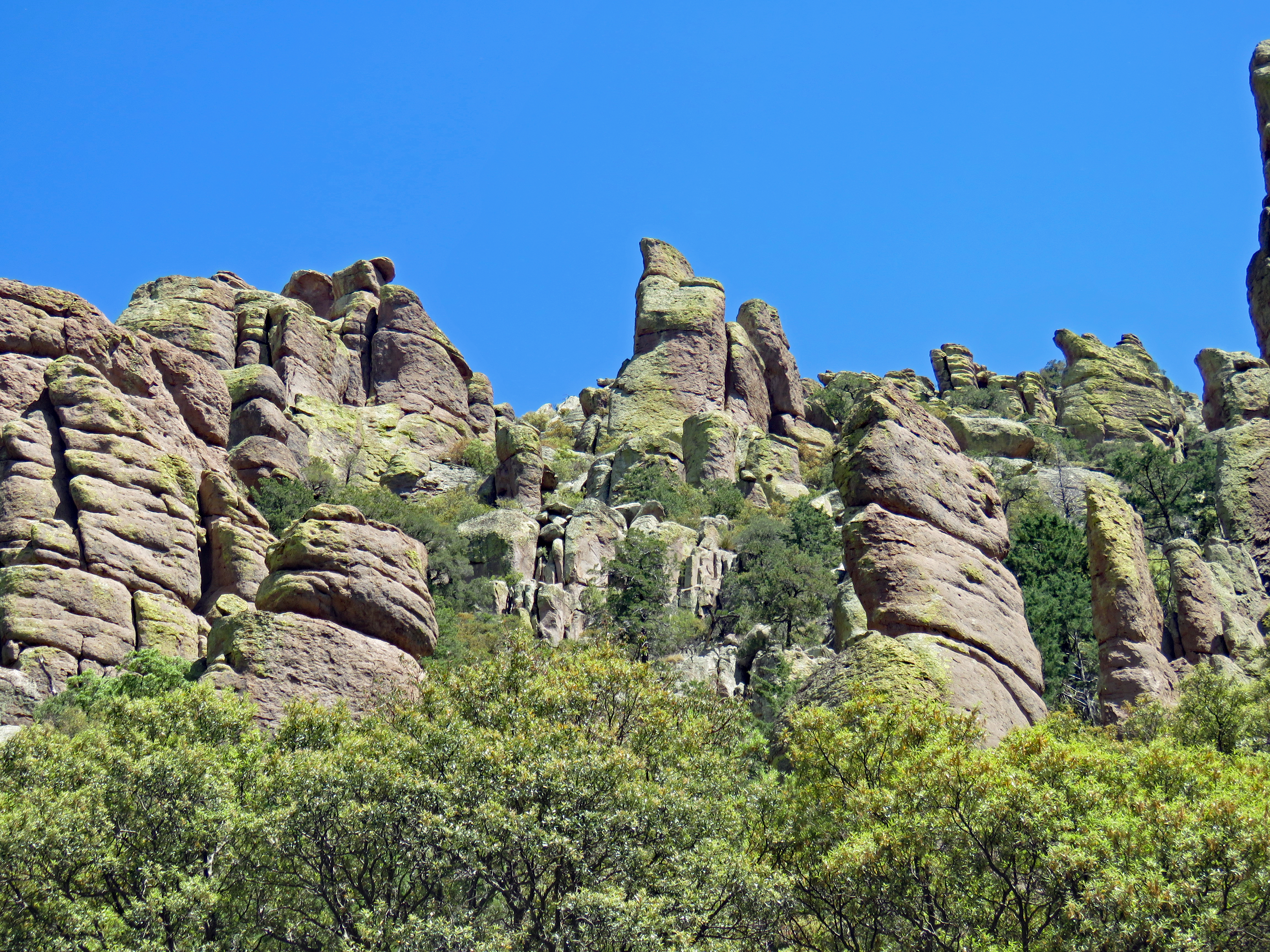
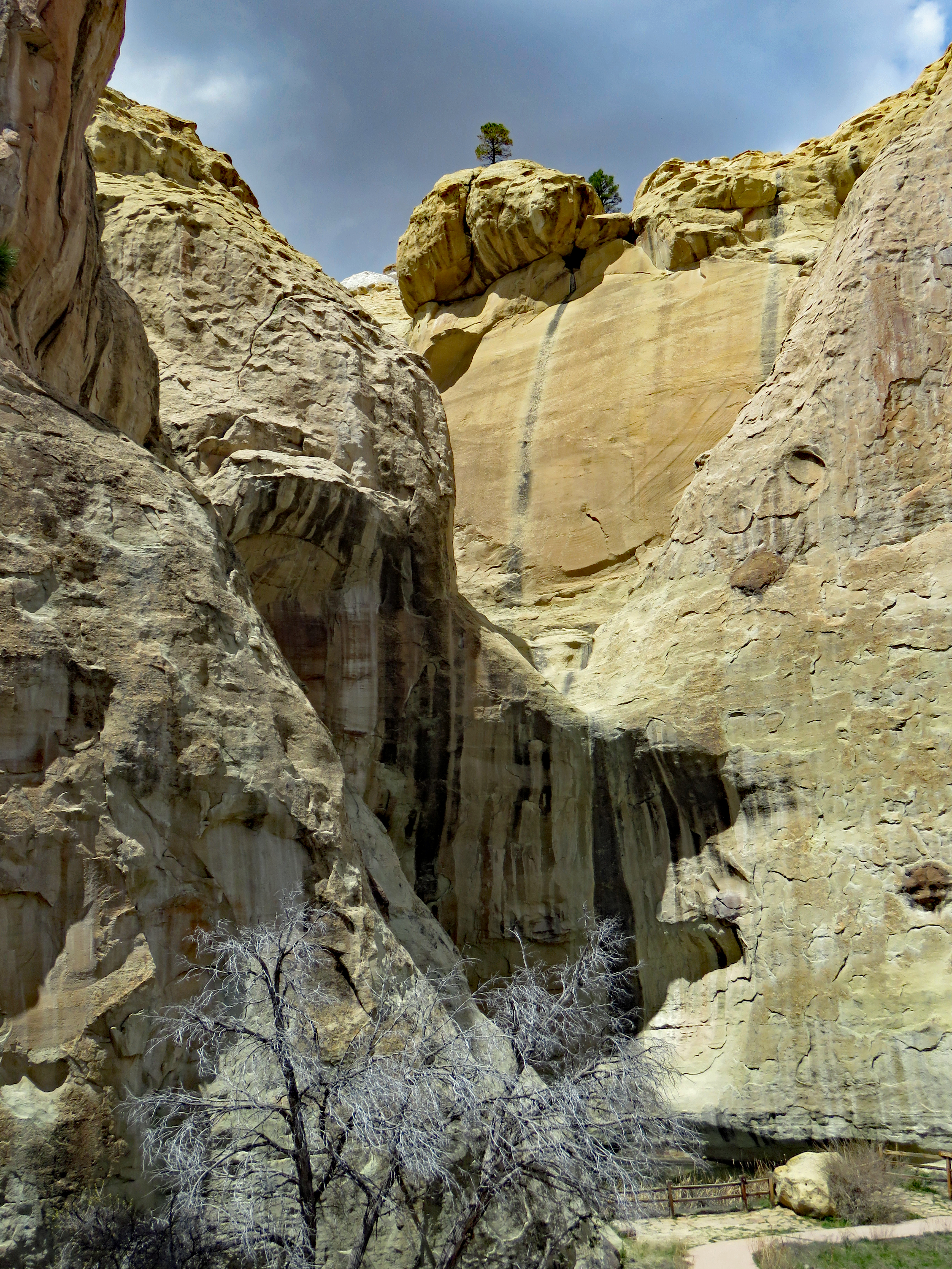
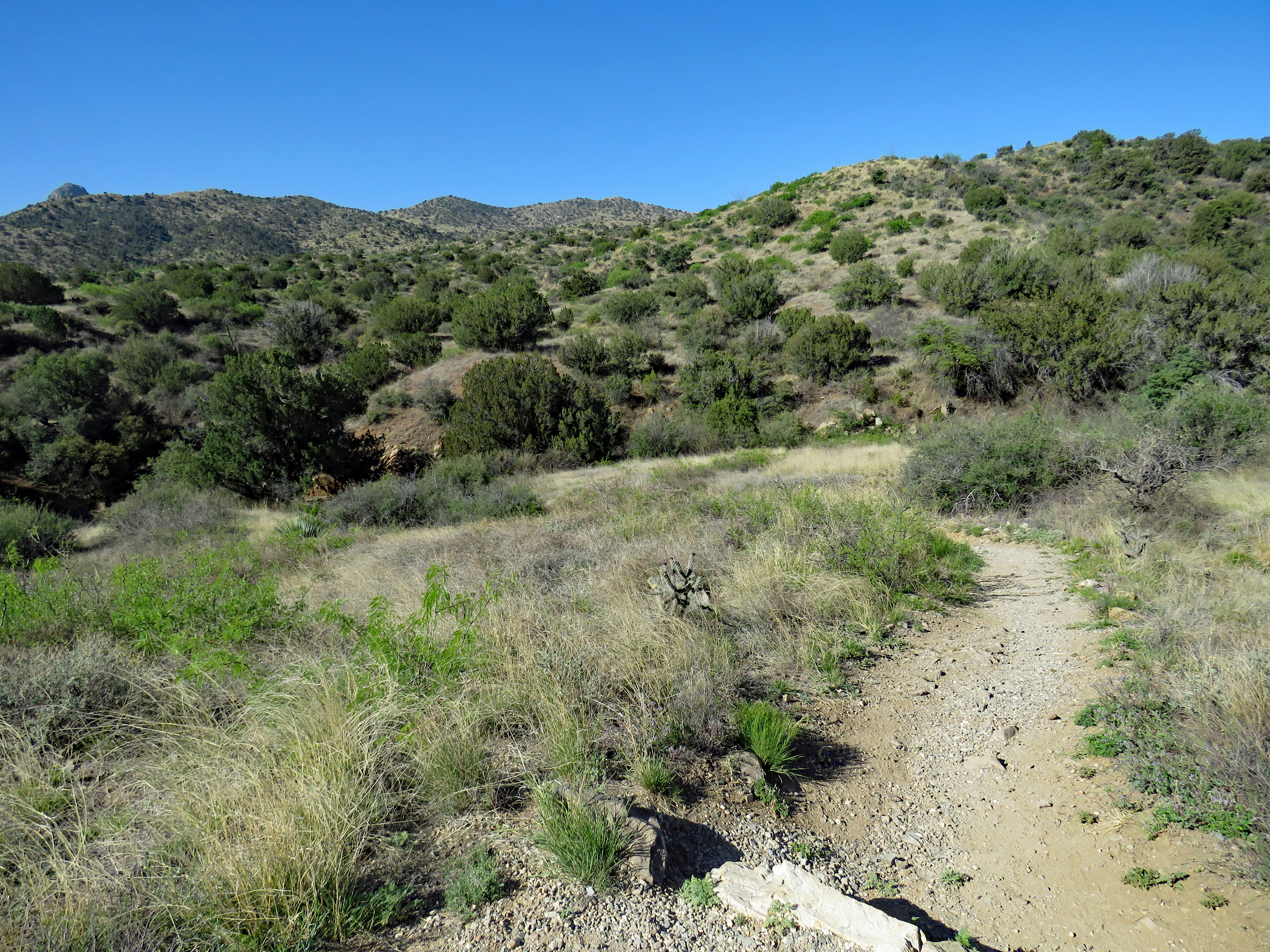
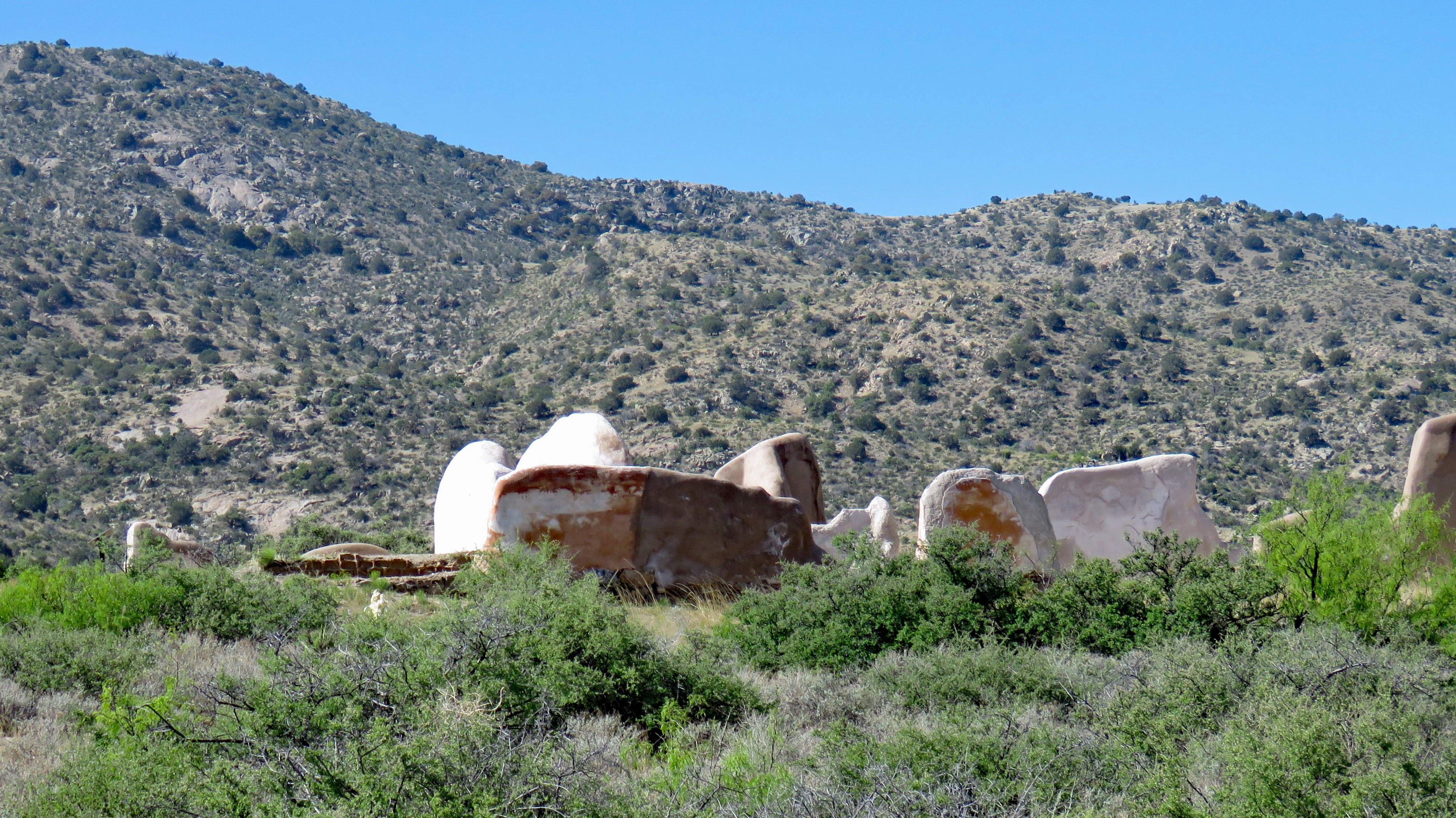
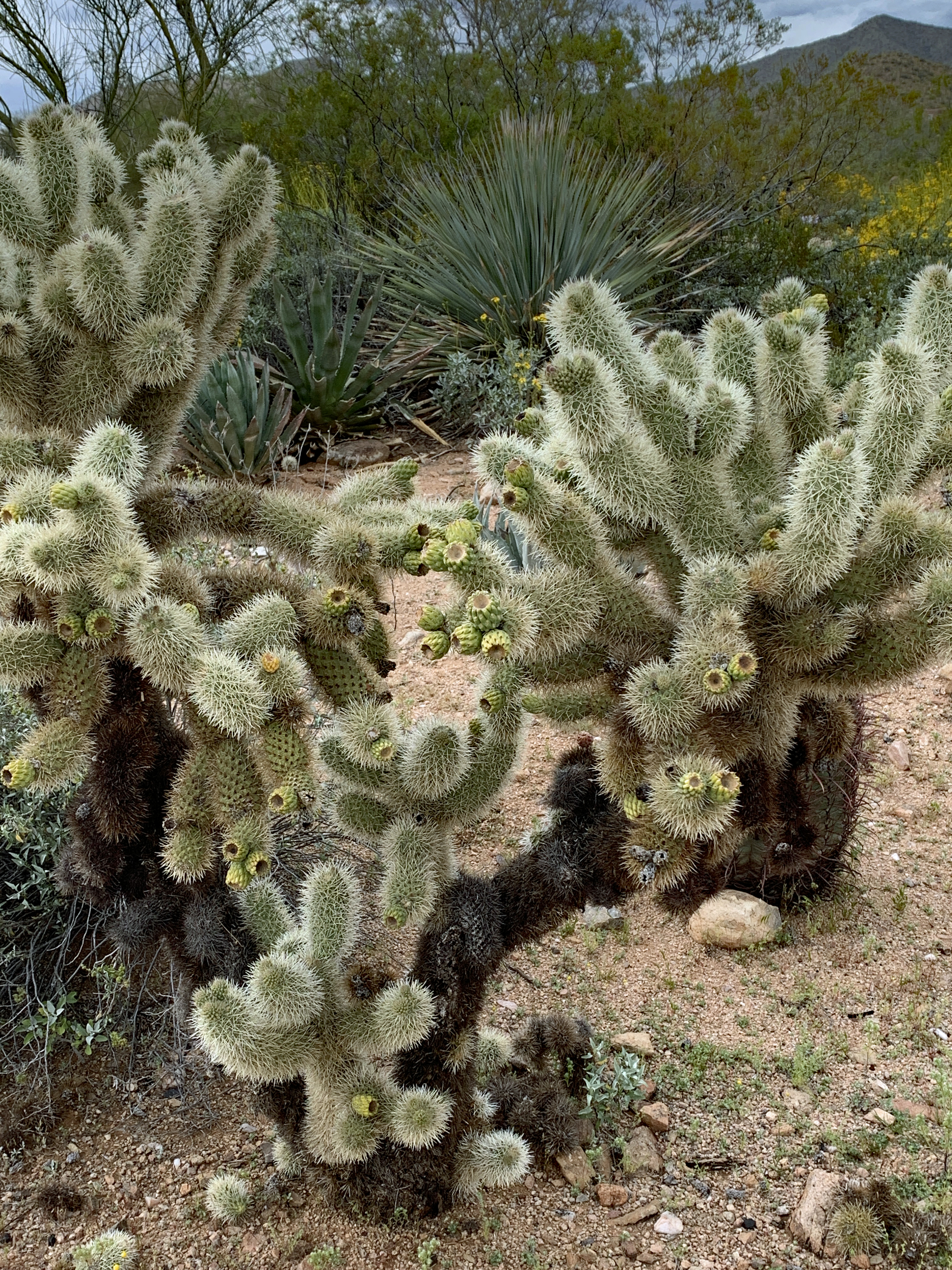
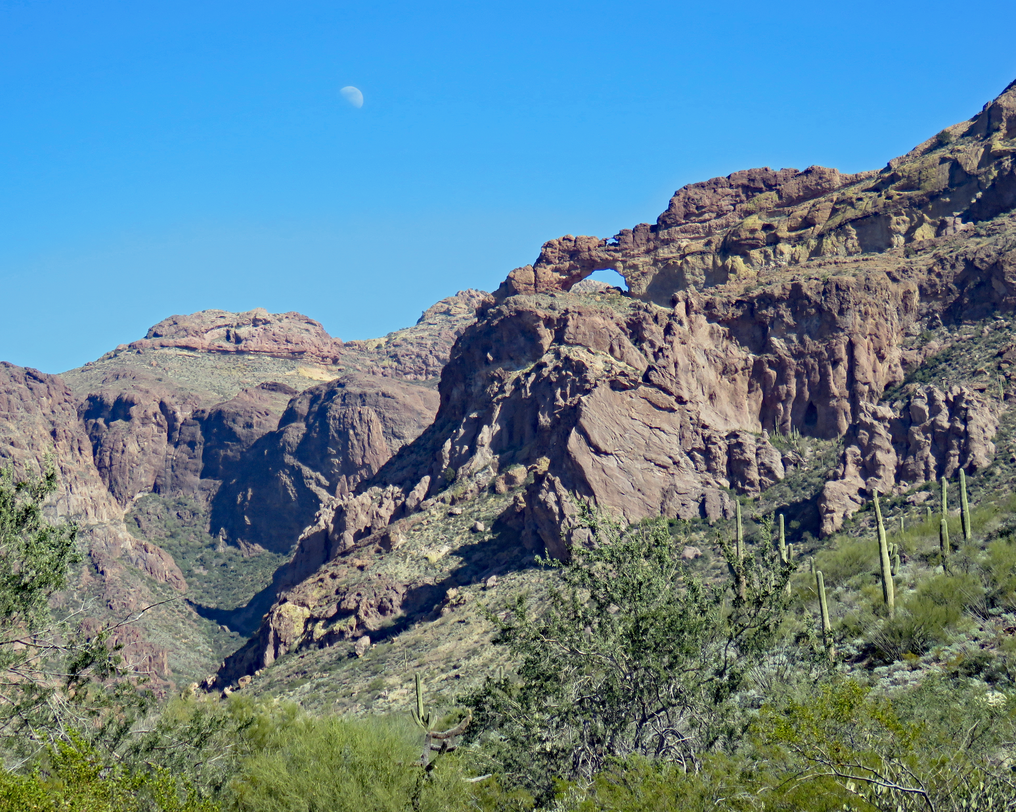
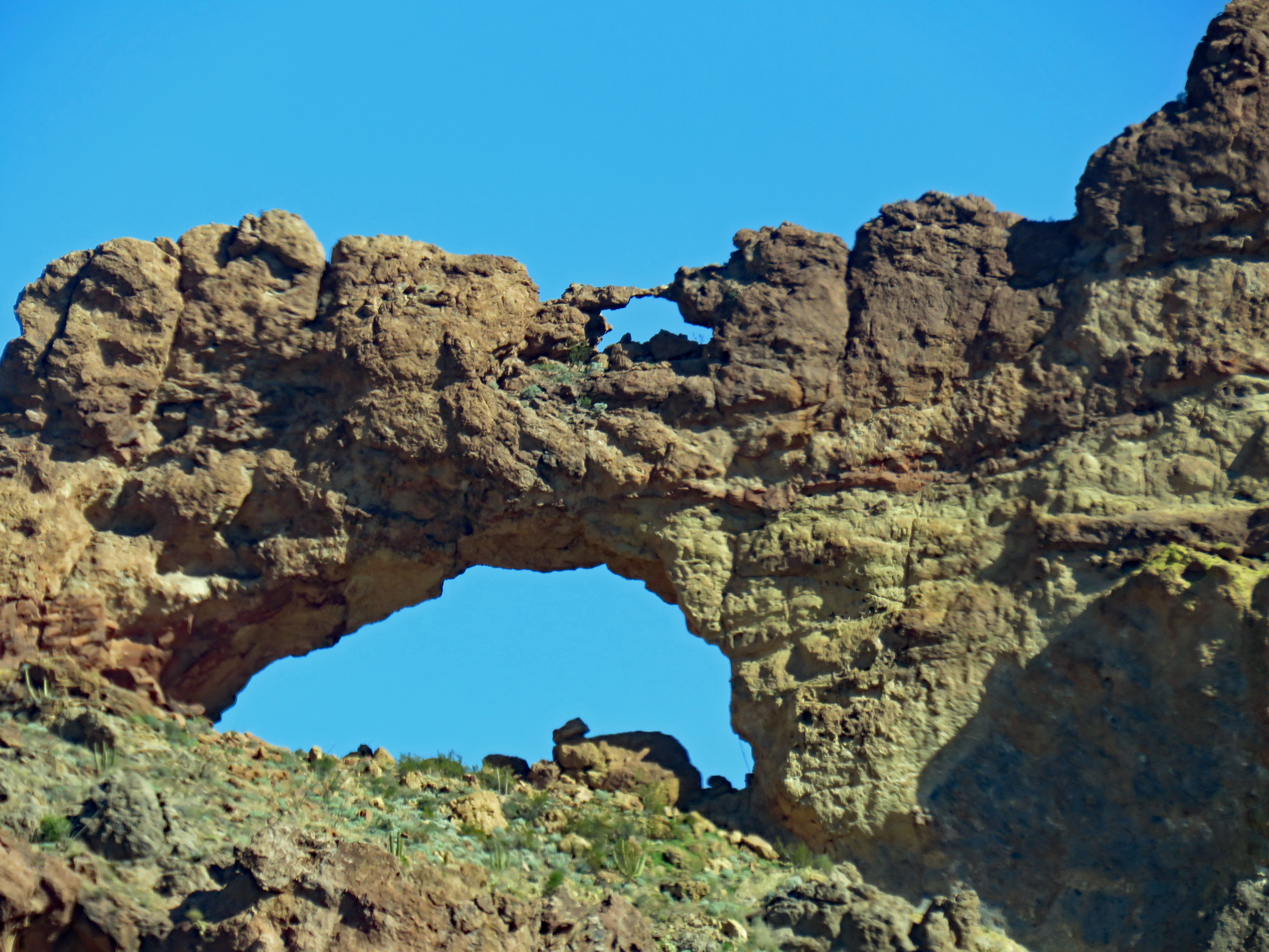
Through a combination of geologic forces and erosion, the canyons and hilltops of Chiricahua National Monument contain spires, balanced rocks and columns. To the Chiricahua Apaches, it was the Land of Standing-Up Rocks. Pioneers called it the Wonderland of Rocks.
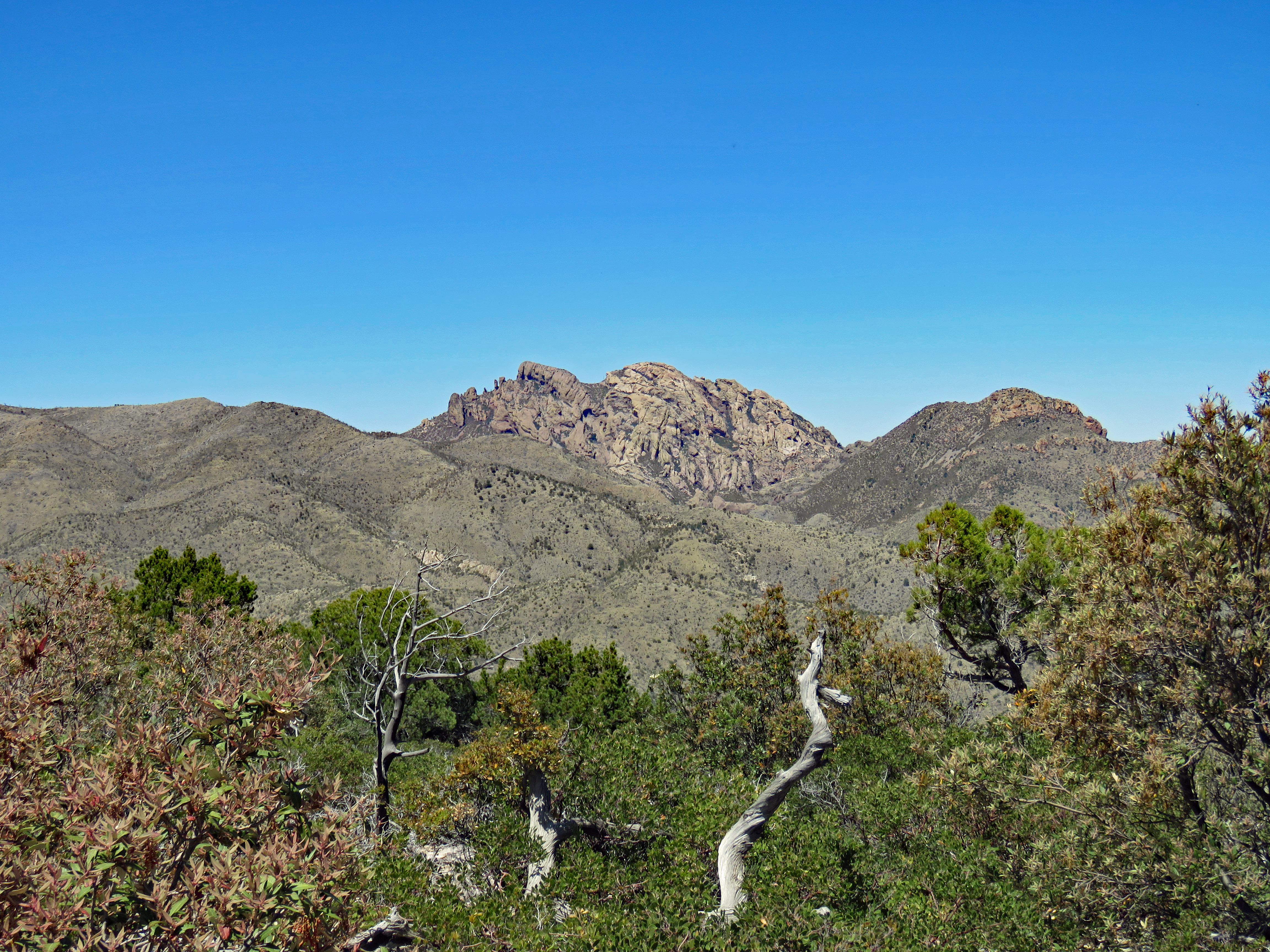
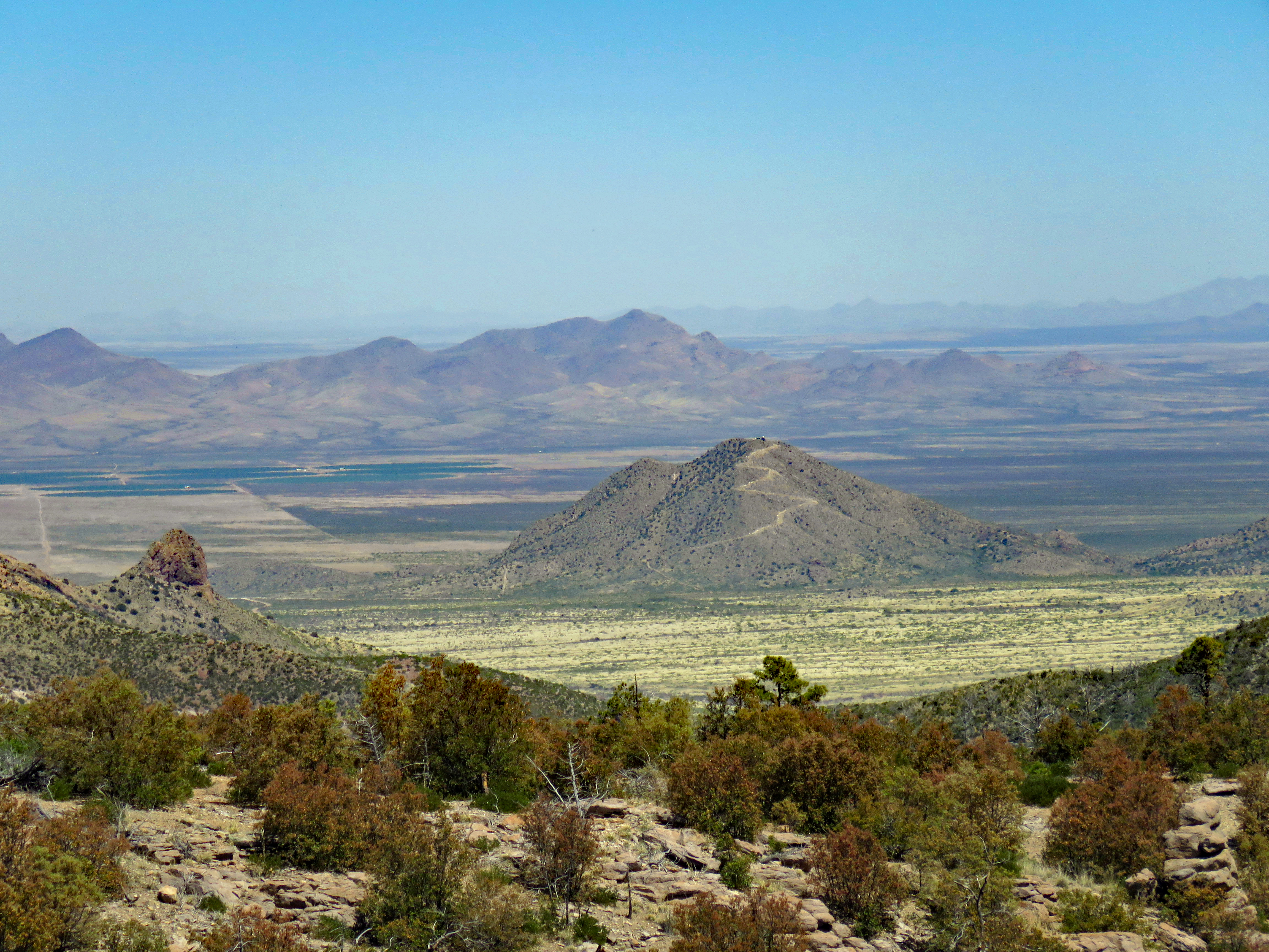
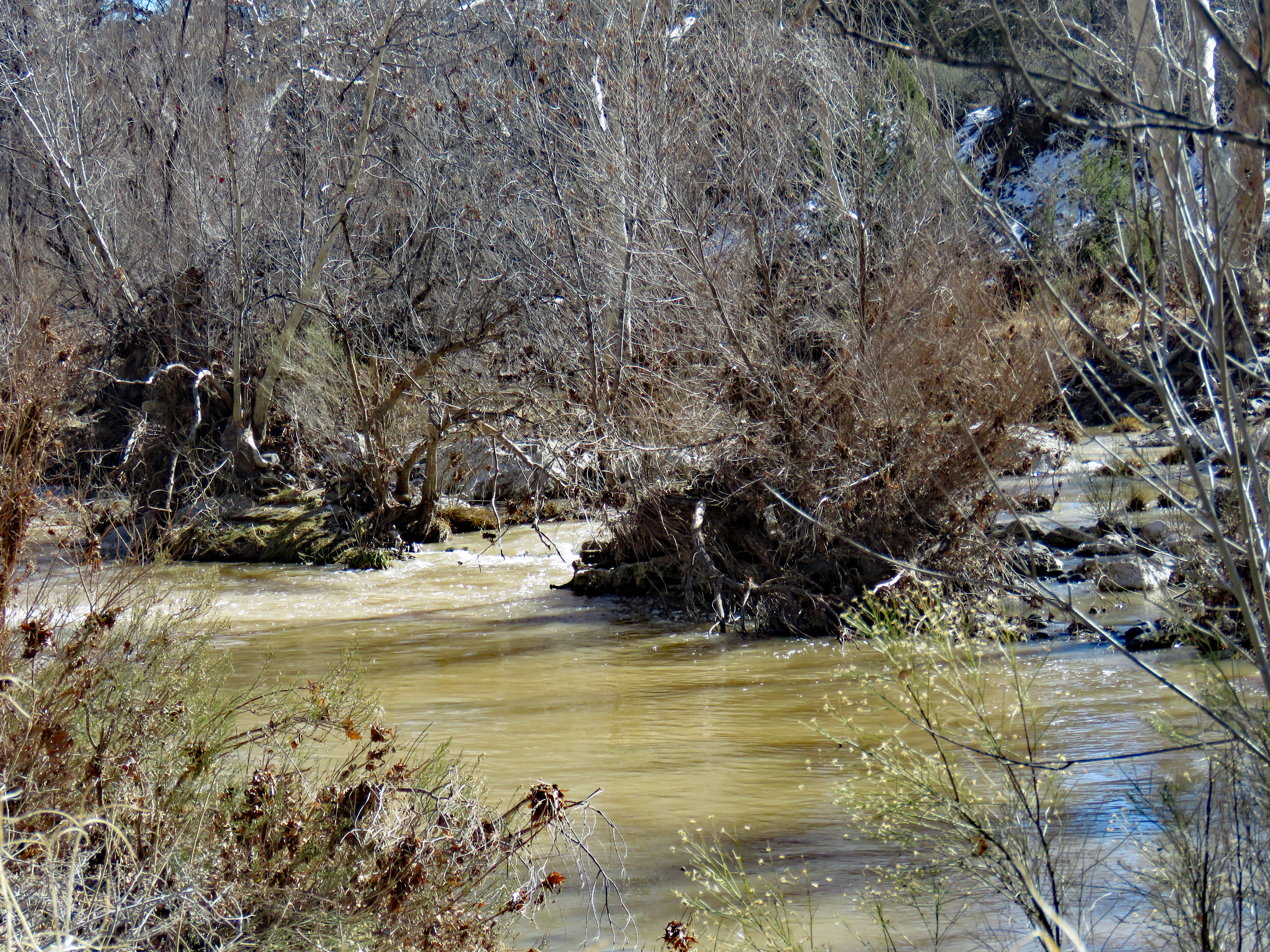
The Chiricahua Mountains are one of the largest ranges in southeastern Arizona. They rise abruptly from a relatively flat plain of desert and semiarid grassland. Isolated mountains, separated by broad, flat valleys, is terrain known as basin and range province. On our drive there, we went through miles of pecan orchards in the flat valley to the north.
Four biomes converge in the Chiricahua Mountains which gives the area great biological diversity, both plant and animal. The Sonoran and Chiricuhuan deserts and the Rocky Mountain and Sierra Madre ranges all meet here. We figured out why so many birders spend time in southeastern Arizona and southwestern New Mexico. It’s basically a birder’s paradise with many Mexican species at the northern limit of their range.
Archeologists believe that the first people arrived in this area about ten thousand years ago. These nomadic Paleo-Indians evolved into the Archaic culture known as the Cochise culture, followed by the more sedentary agriculture-based Mogollon culture. These people abandoned their homes here about A.D. 1300 to 1400. From the early 1400s the Chiricahua Apaches lived a nomadic life in and around the Chiricahua Mountains. The encroachment of settlers and miners led to a protracted state of war and in 1886 the Chiricahua Apaches surrendered and were eventually relocated to reservations in Oklahoma and New Mexico.
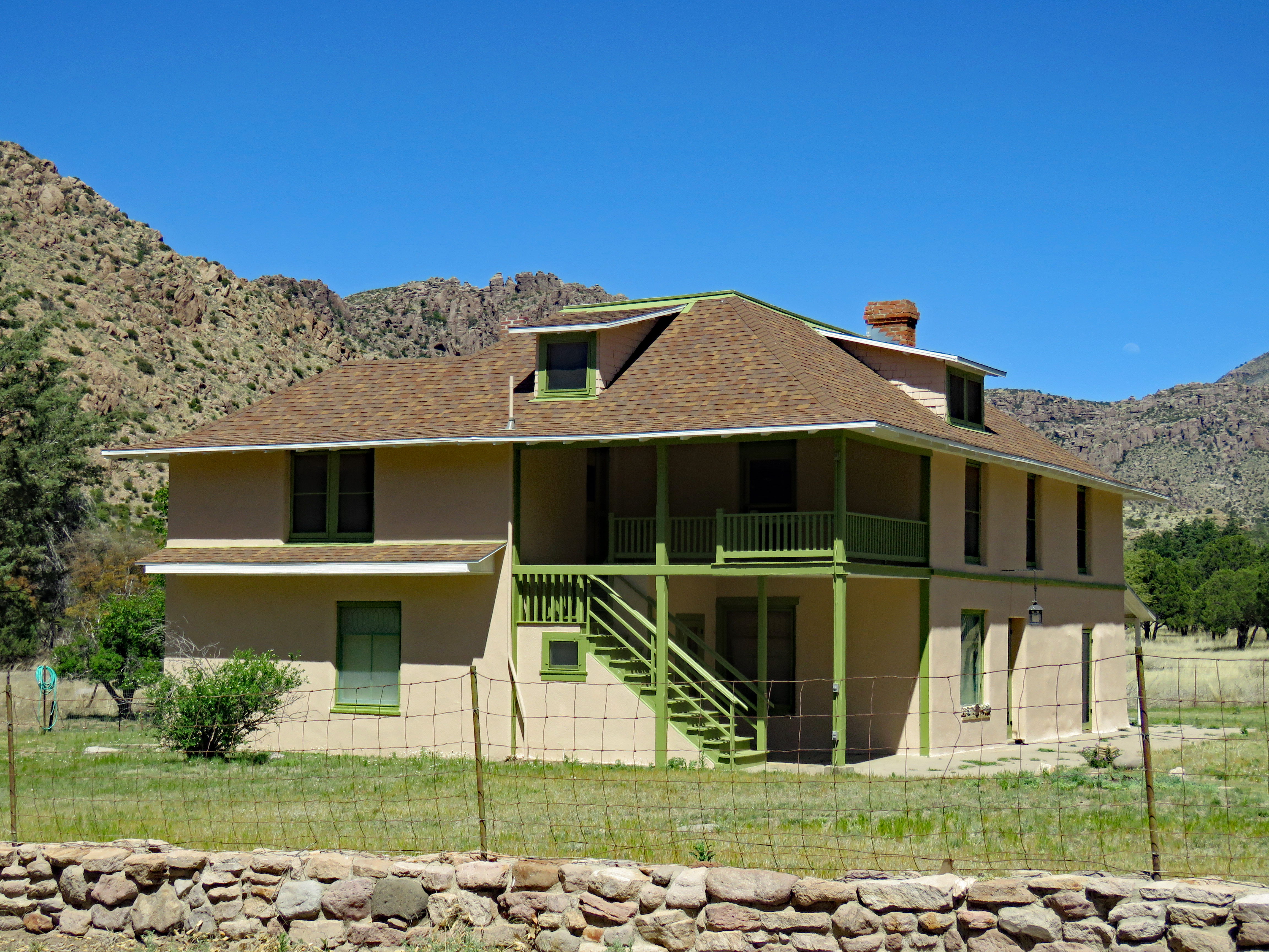
In 1800, the first homesteaders, JaHu and Pauline Stafford, took up residence in Bonita Canyon. Neil and Emma Erickson arrived in 1888 and developed their Faraway Ranch as they raised three children, Lillian, Ben and Hildegarde. Neil served as the first Forest Service ranger of the Chiricahua Reserve. After Neil’s transfer In 1917 to Walnut Canyon in northern Arizona, daughter Hildegarde started providing meals and lodging to paying visitors. Lillian and husband Ed Riggs worked to improve and expand the guest ranch which was in operation until 1970. They dreamt of having the “Wonderland of Rocks” preserved and protected. That was achieved in 1924 with the establishment of Chiricahua National Monument. After the deaths of the three Erickson children, Faraway Ranch became a historic district within the monument.
In 1934 the Civilian Conservation Corps began improving the road and building trails and structures. The park comprises 12,025 acres of which 84% is designated wilderness. An eight-mile drive from visitor center to the summit at Masai Point gives one an overview of this sky island.
We didn’t do much hiking during our visit for several reasons. We had visited Ft. Bowie that morning with its required hike, even though it was April it was already quite hot in the afternoon, and many of the trails either descended or ascended precipitously through the rock formations.
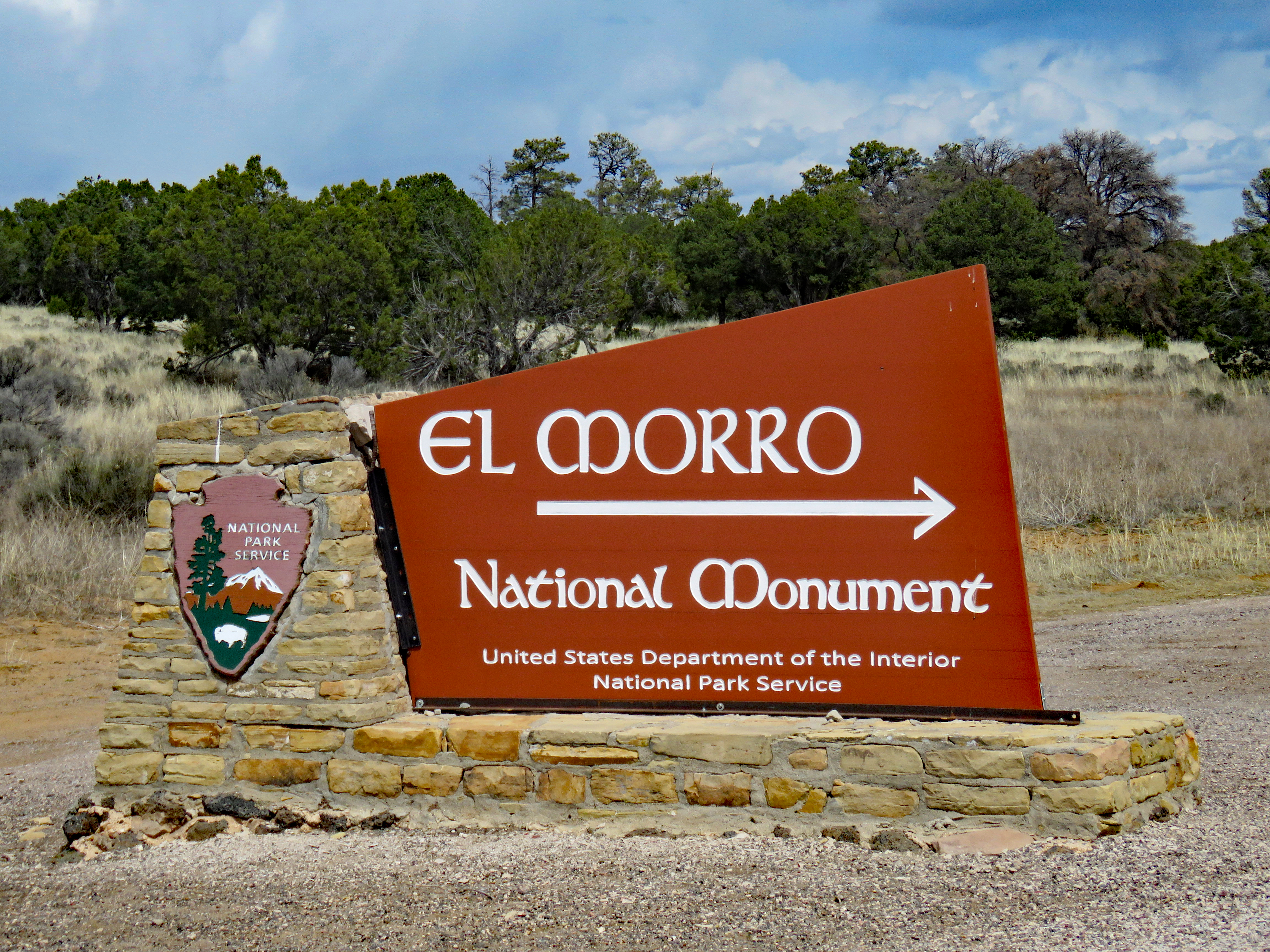
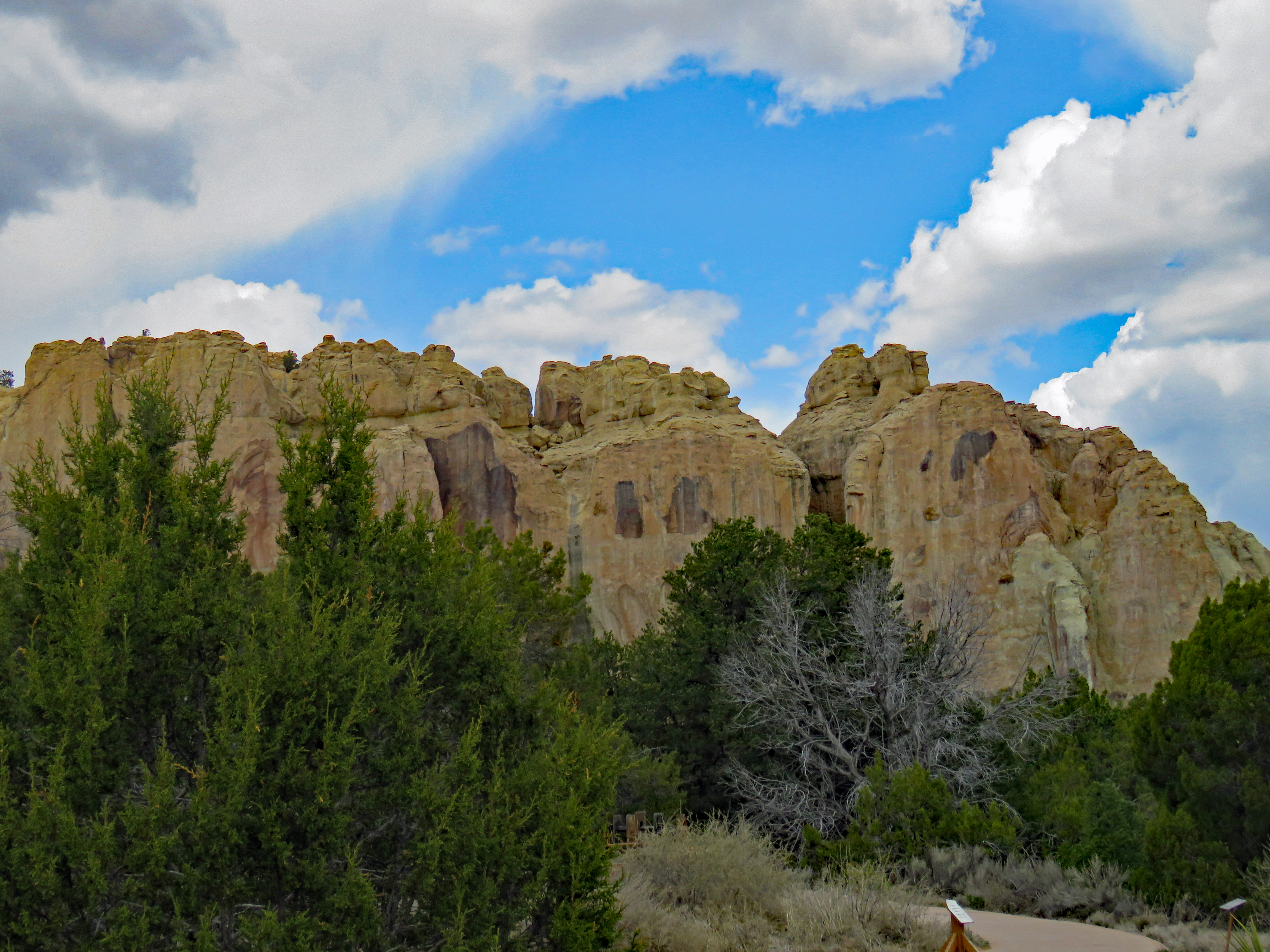
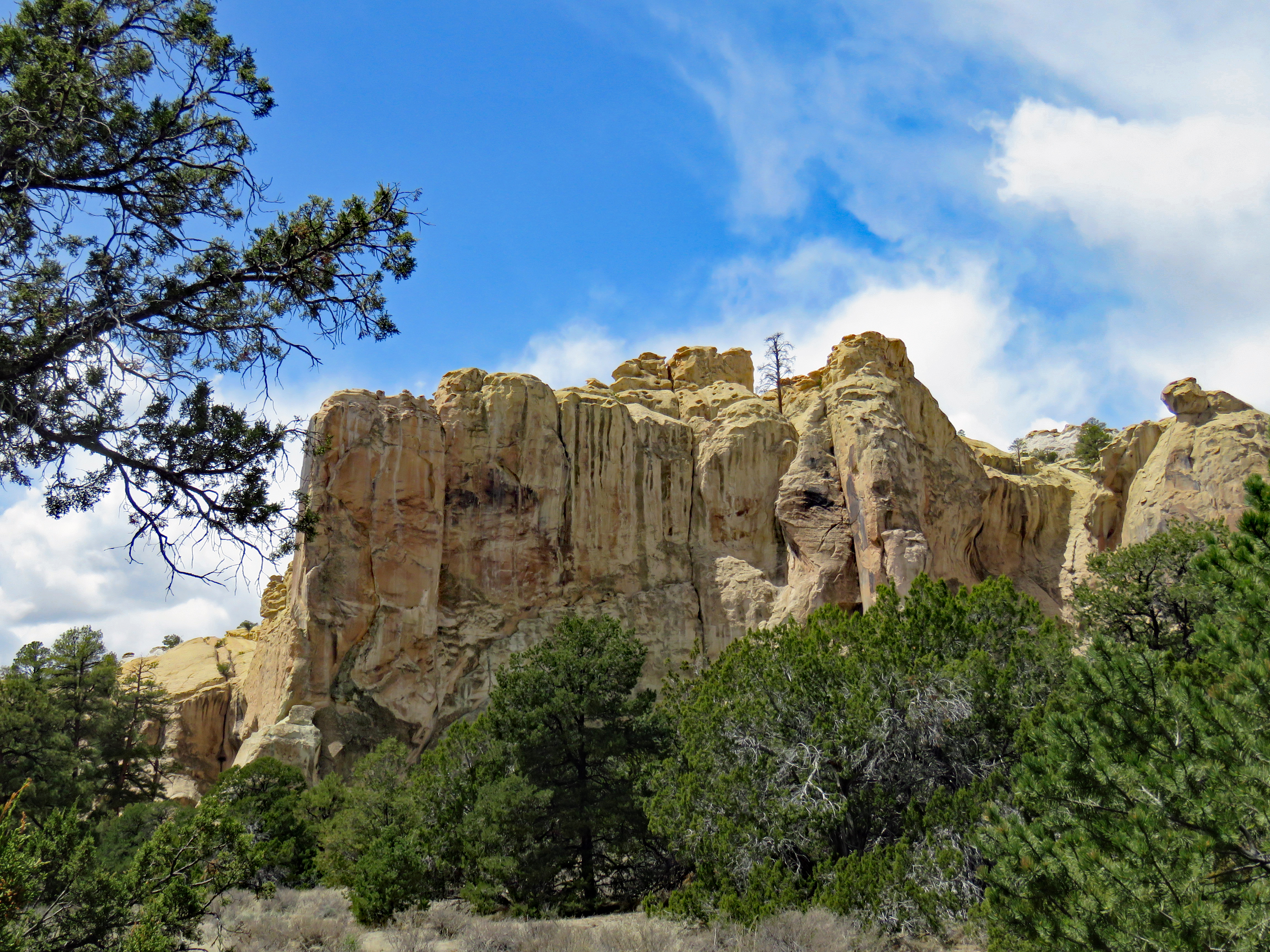
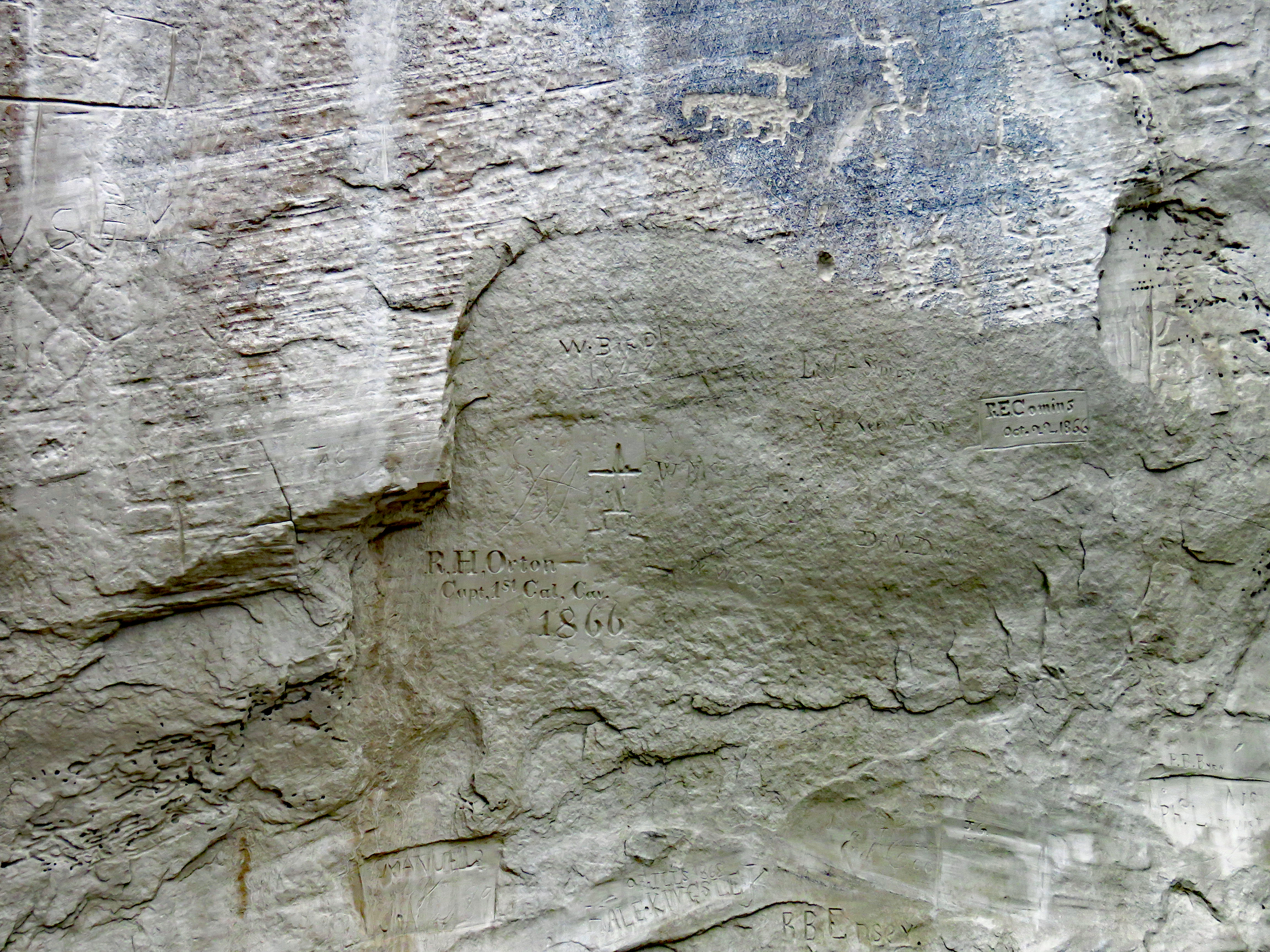
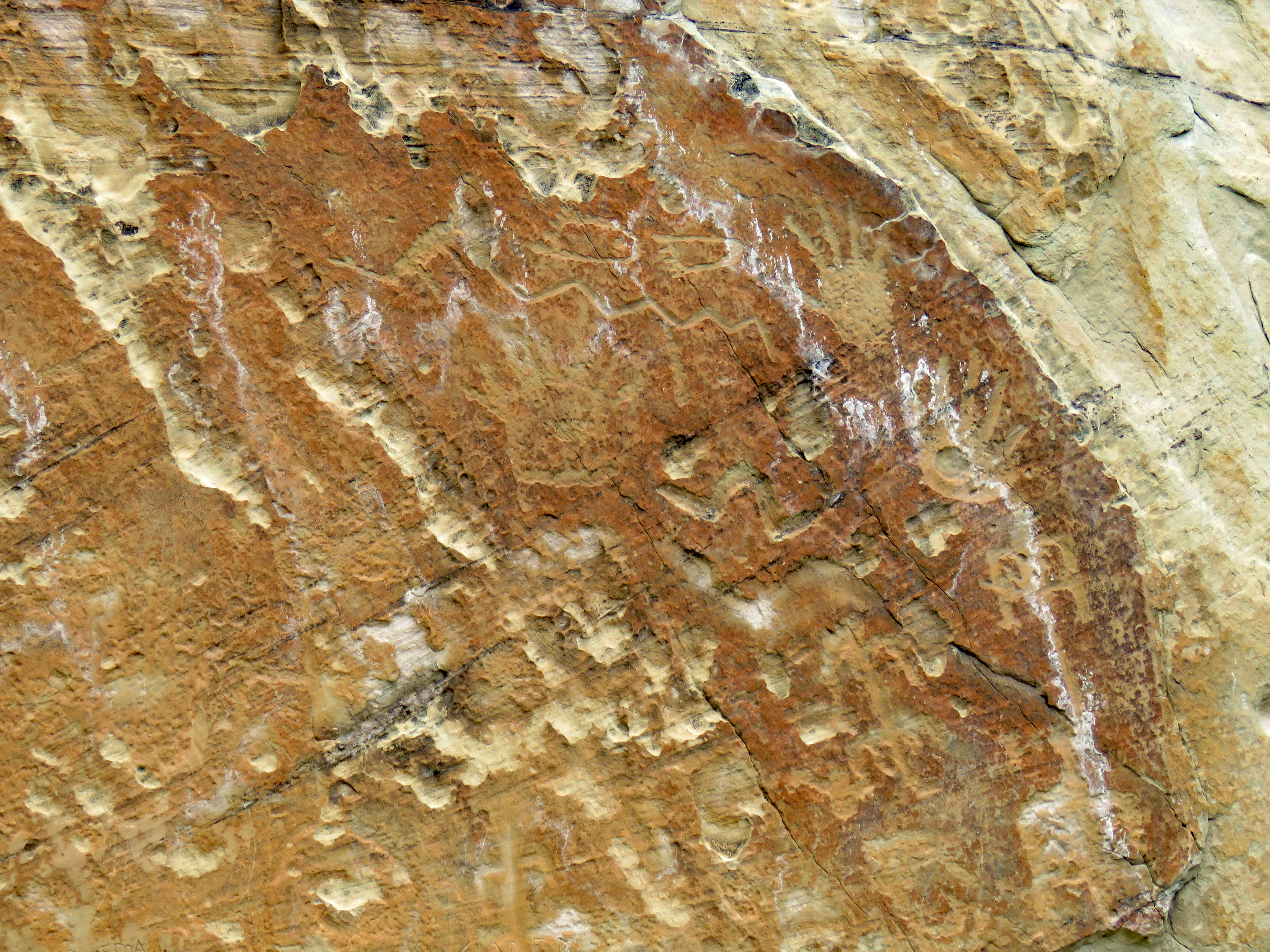
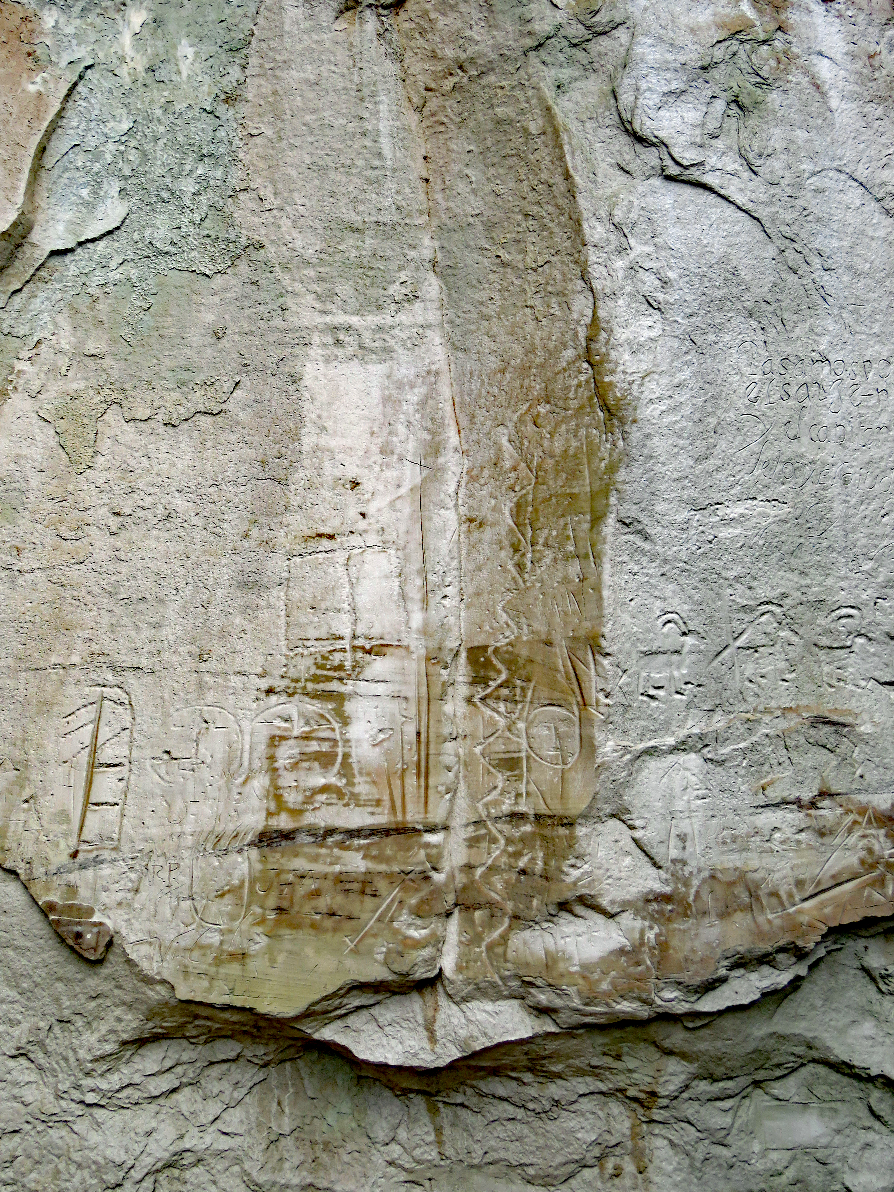
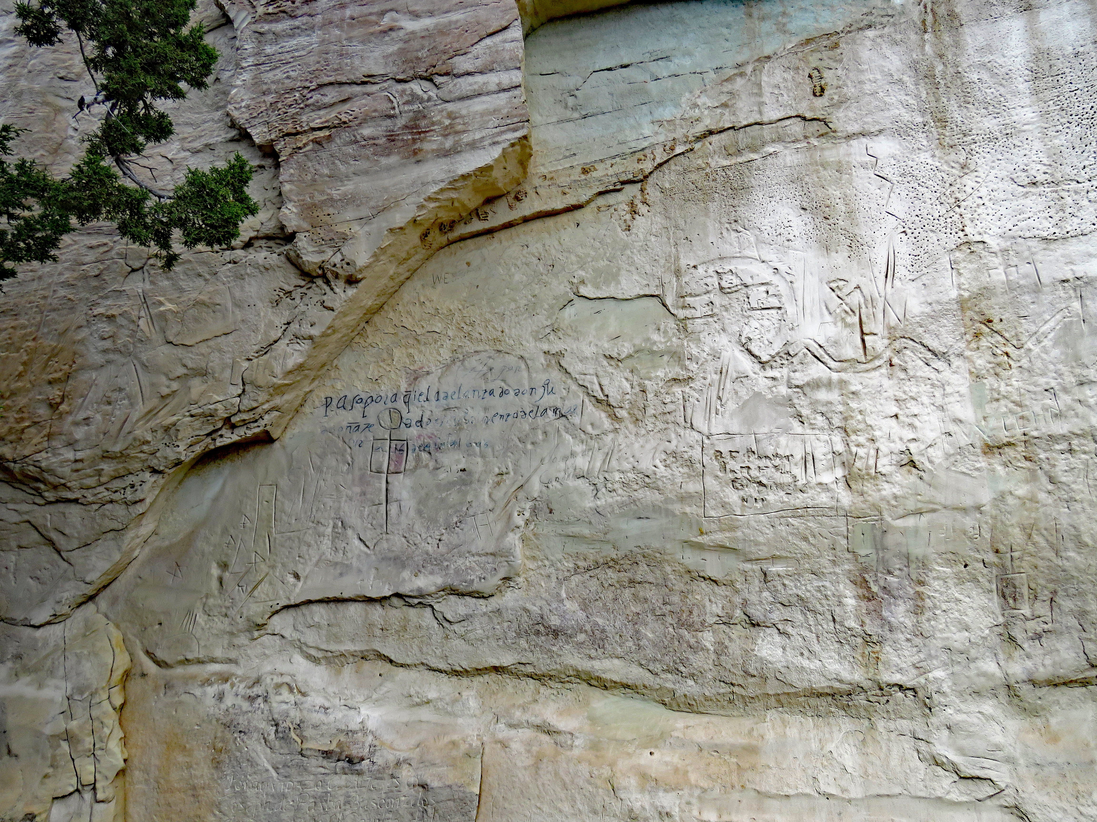
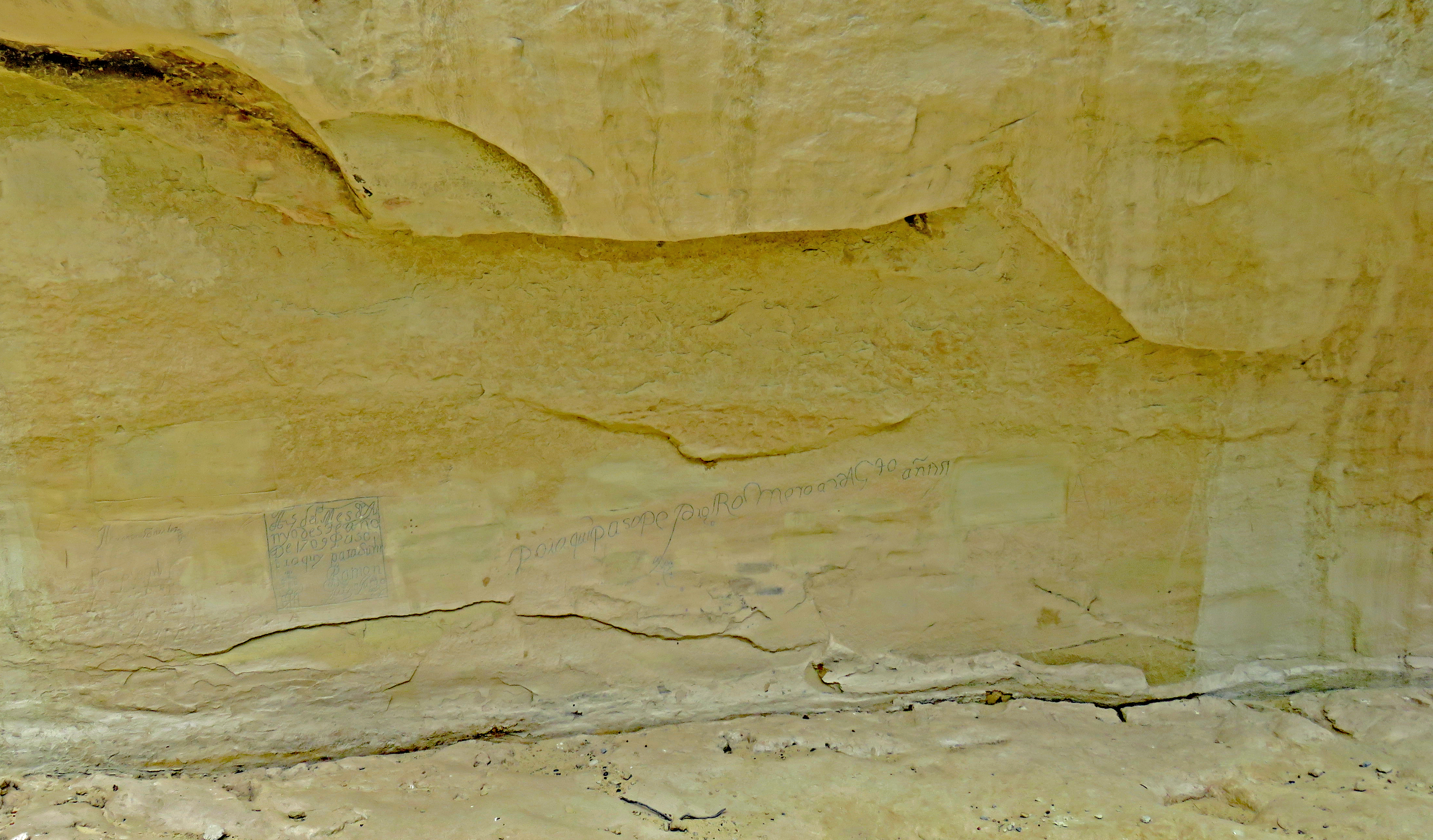
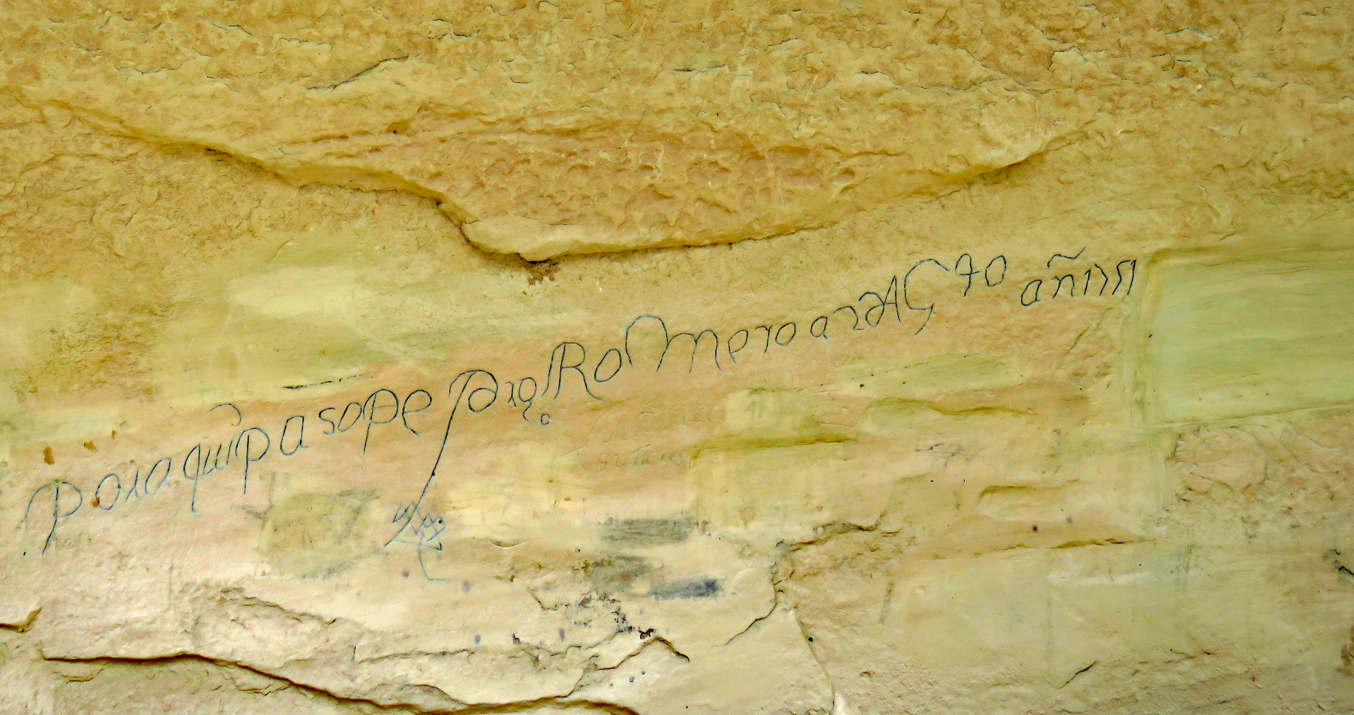
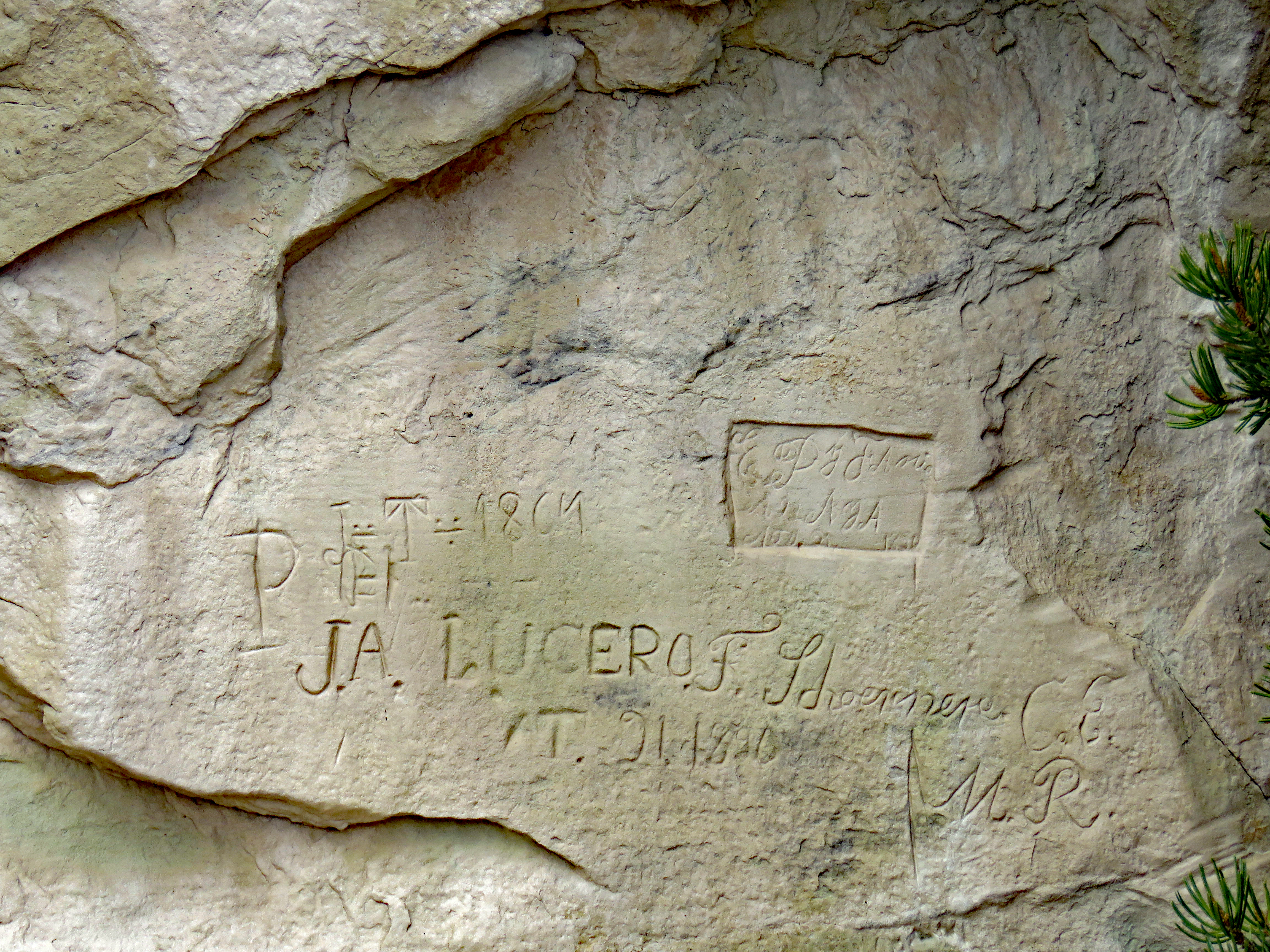
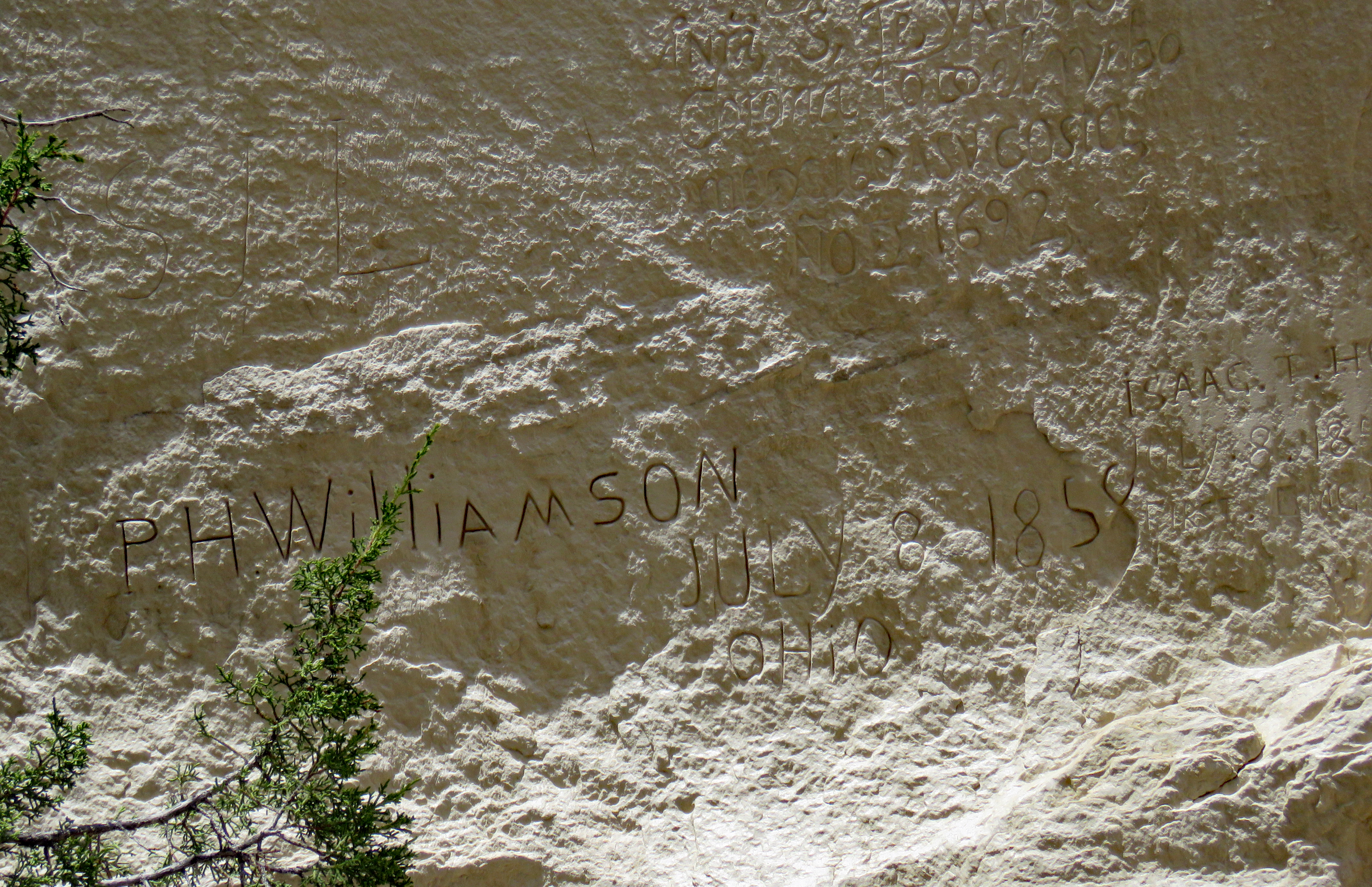
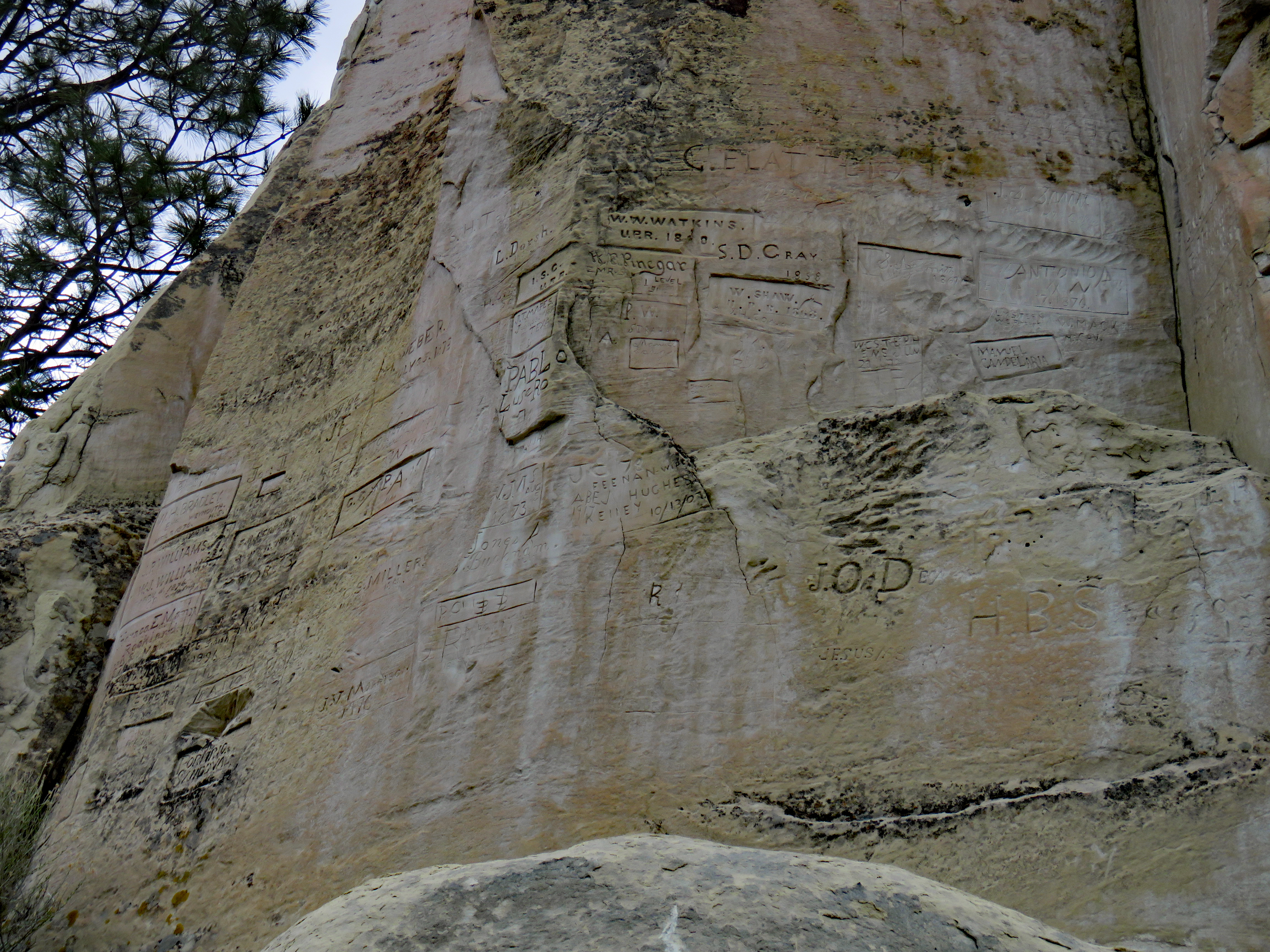
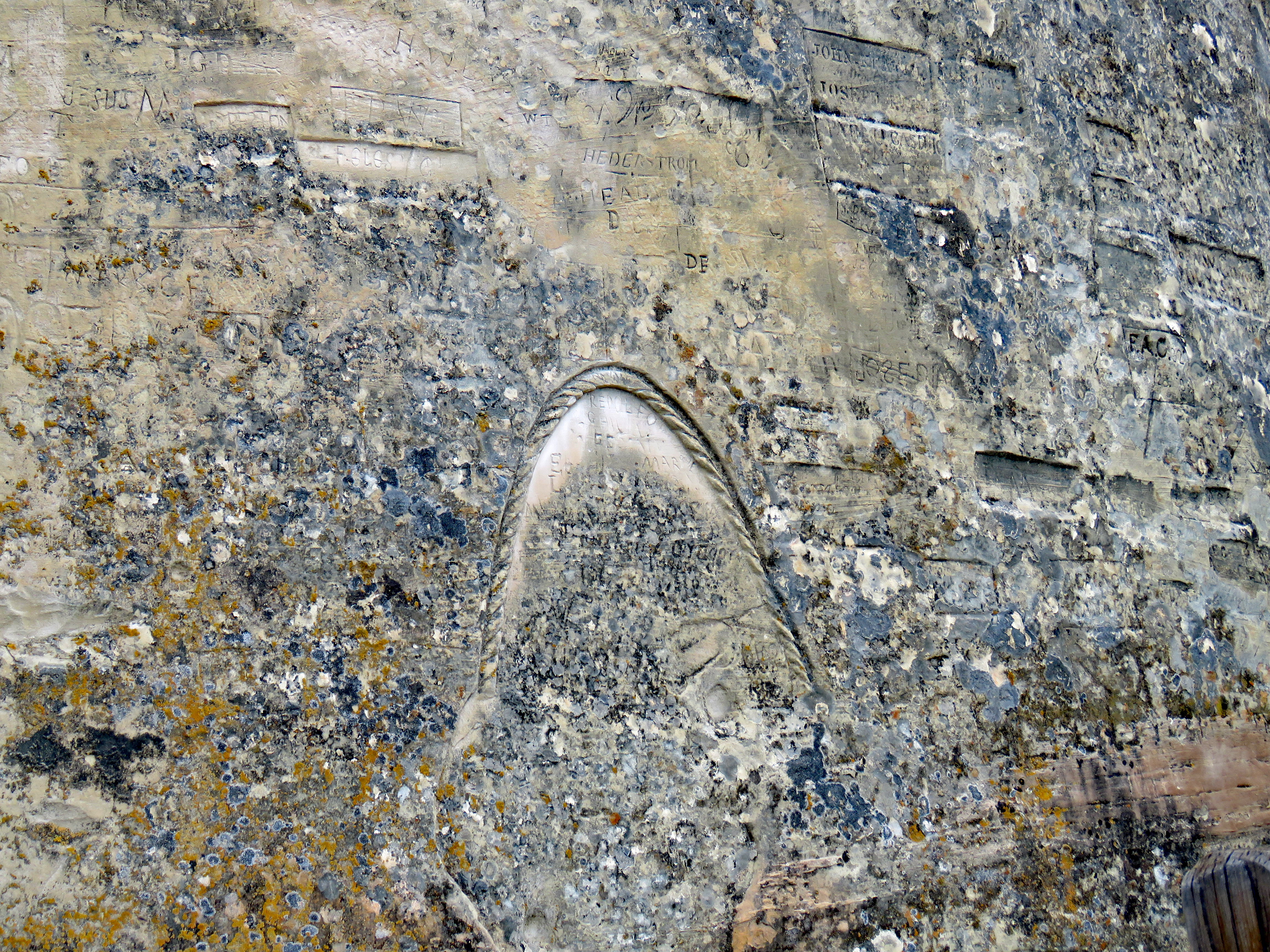
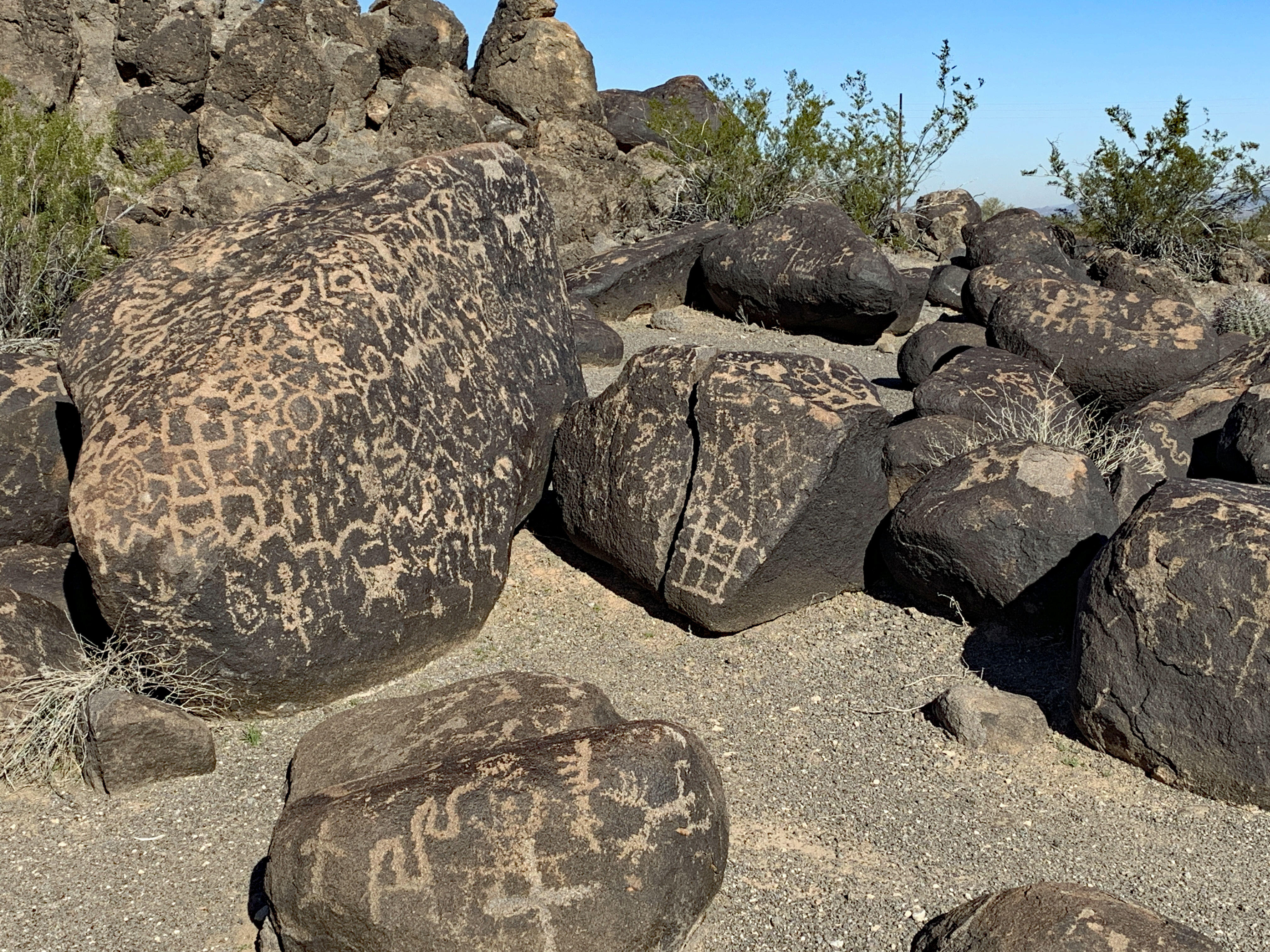
Pasó por aquí – “passed by here” – is definitely the message of El Morro National Monument, located in western New Mexico and somewhat of a hidden gem. This rock is a significant “document” of Southwestern history and provides a timeline of the human history of New Mexico with over 2,000 signatures, dates, messages, and petroglyphs carved into the rock face.
We visited in late April and were significantly impressed. Our time was somewhat limited as we arrived there on a Monday afternoon. Since the visitor center and all park trails are closed on Tuesdays and Wednesdays, we did the Inscription Loop Trail but not the Headland Trail. The day we were there it was overcast and windy but if you visited in the summer, you would definitely want to do the hikes as early as possible and be prepared for heat.
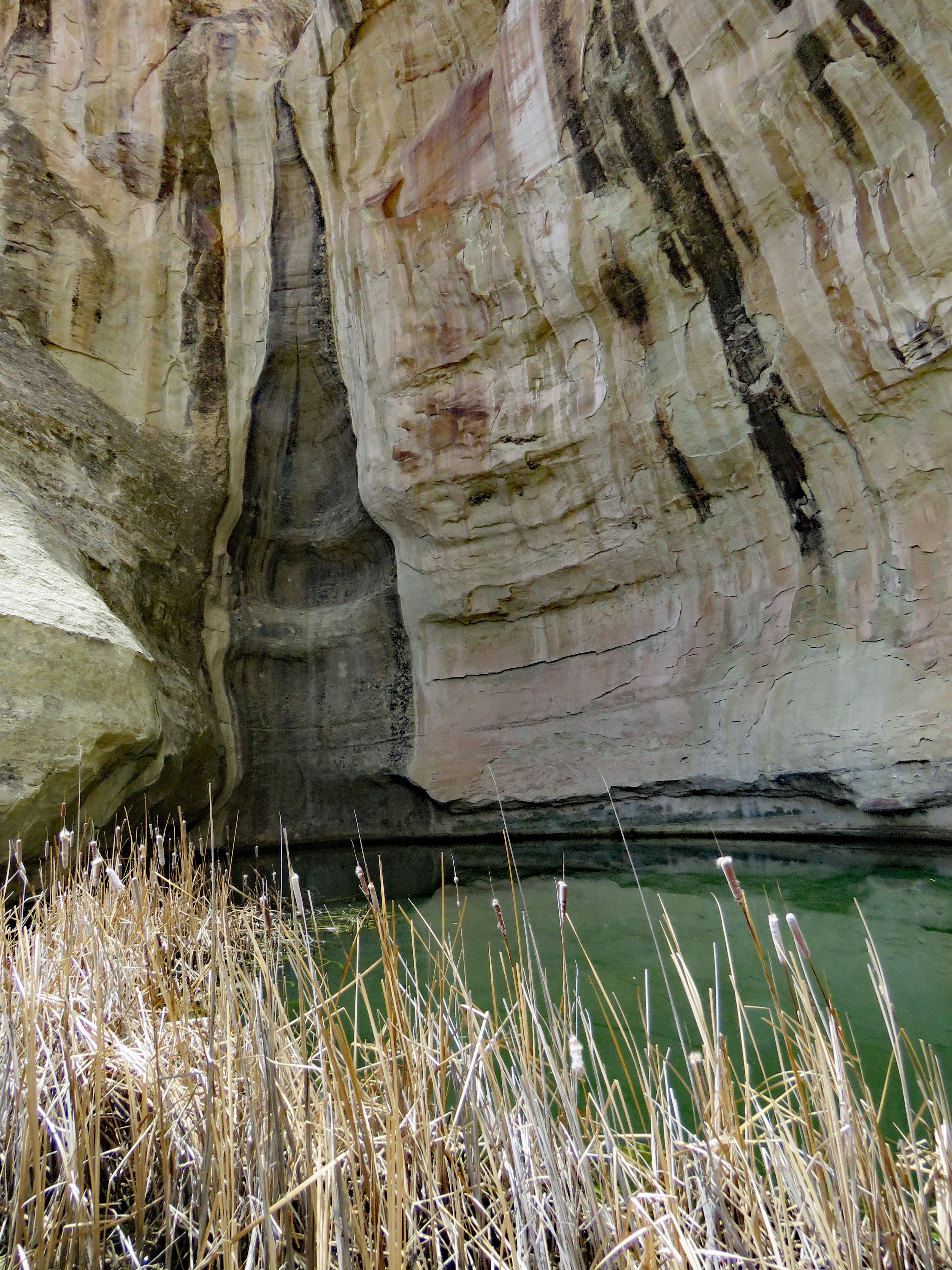
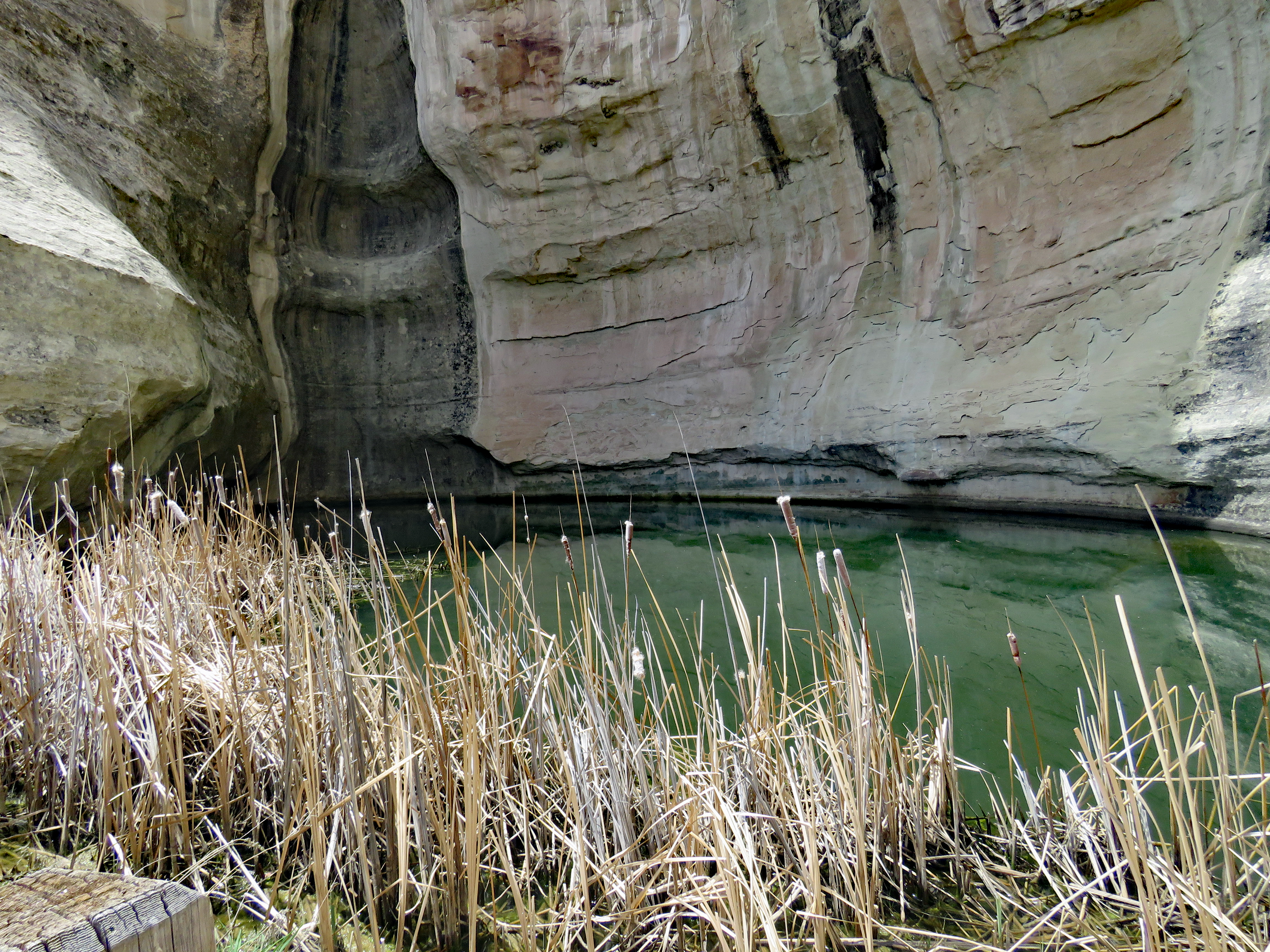
El Morro is a cuesta – a rock formation that gently slopes upward and then abruptly drops off. The real and unexpected draw of this place over the centuries is a waterhole. The pool in the shadow of El Morro was the only reliable water for thirty miles in either direction. Snowmelt and rain coming off the rock filled the pool and the rock shaded it from evaporation by the fierce desert sun. Man later enlarged the pool but it has always had water. Anyone who has spent time in the southwestern desert understands the importance of the El Morro pool.
On top of the rock a prehistoric Indian village – A’ts’ina – was located. Begun around A.D. 1275 and occupied for perhaps two generations, the people of A’ts’ina as well as those living in scattered villages before them, were the first to carve on the rock wall.
The Spaniards were the next to reach the precious pool. The first written history is a journal record on March 11, 1583 of the Antonio de Espejo expedition that they camped at “El Estanque del Peñol” – The Pool by the Great Rock. No inscription of these explorers has been discovered on the rock.
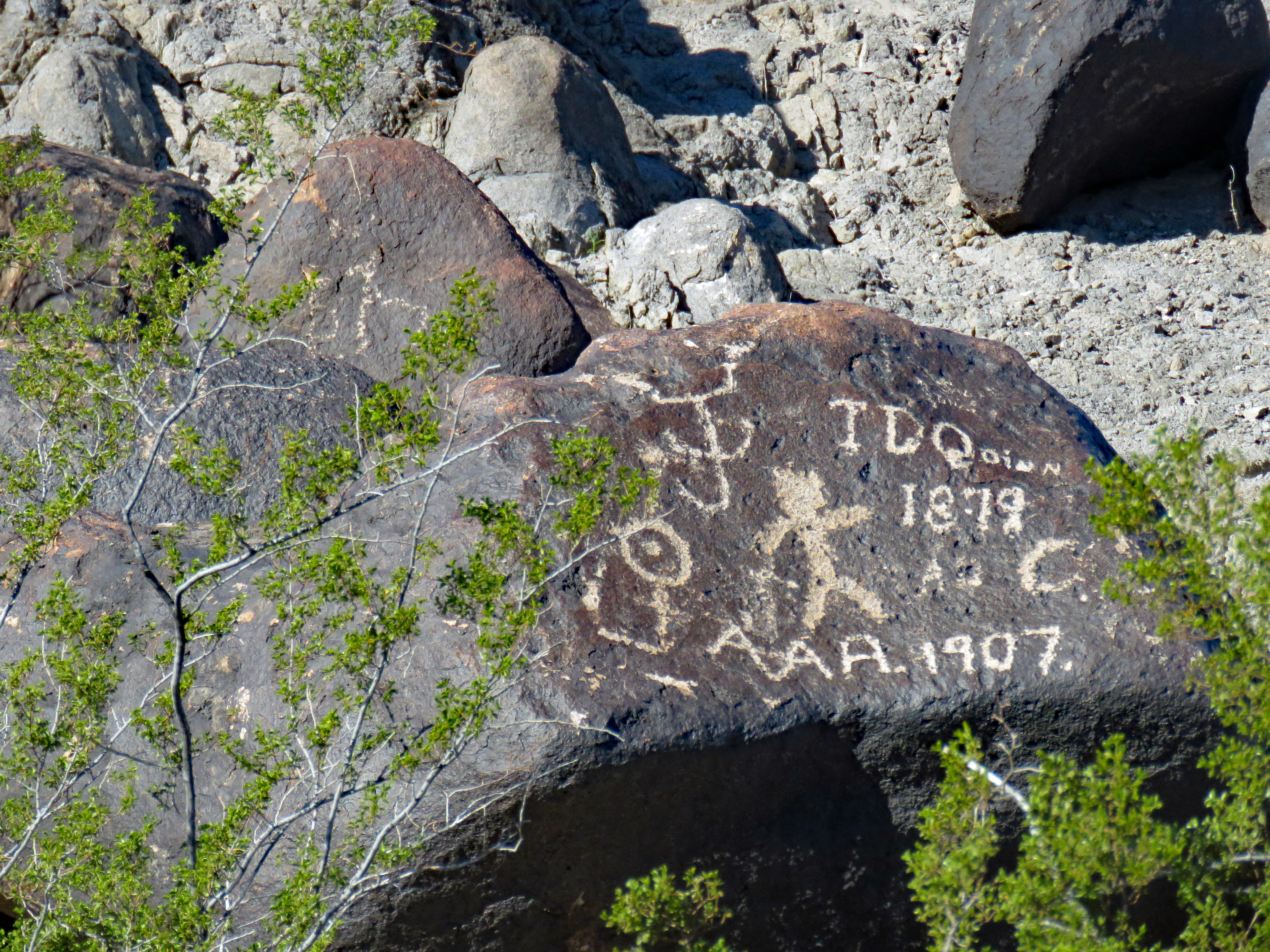
The oldest non-Indian inscription contains the name of Don Juan de Oñate. In 1598, Oñate planted the first Spanish settlement in what is now New Mexico and that same year he visited El Morro calling it “Agua de la Peña” – water of the rock. He didn’t carve an inscription at that time but on another expedition in 1605 they camped at the waterhole and with that visit the rock became a modern history “document.” Fifteen years before the Pilgrims landed at Plymouth Rock, the following was carved on the rock.
“Pasó por aquí el adelantado don Juan de Oñate del descubrimieto del Mar del Sur el 16 de abril de 1605”
“Here passed by the Governor-General Don Juan de Oñate, from the discovery of the South Sea, the 16th of April, 1605”
The phrase Pasó por aquí appears repeatedly on the rock.
The Spanish explorers were pretty proud of themselves and wanted to make sure their deeds were known forever. Some of the inscriptions are quite long and very self-congratulatory. I can’t imagine how long it took to carve some of them with the elaborate scripts displayed. Of course most likely Don Juan de Oñate and other later Spanish leaders had someone much lower in rank do the actual carving.
One of the longest inscriptions may have been Governor Don Juan de Eulate circa 1620 but subsequent damage makes it uncertain. In the inscription the “captain General of the Providences of New Mexico” claims to have put the Zuni at peace and wanting to be vassals of the King because he was such a gentleman and extraordinary and gallant soldier. Not everyone apparently shared that opinion of him as there are deliberate scratches as though someone tried to erase it. These were early as they appear on a copy made in 1849.
In 1629 someone in the party of Governor Manuel de Silva Nieto carved the only poem on the rock. In English it doesn’t rhyme but extols the virtue and valor of Governor Nieto in taking wagons across the route.
In 1632 a group of Spanish soldier set out to Zuni pueblo to avenge the death of the missionary Fray Francisco Letrado and Luján left his mark on their way by.
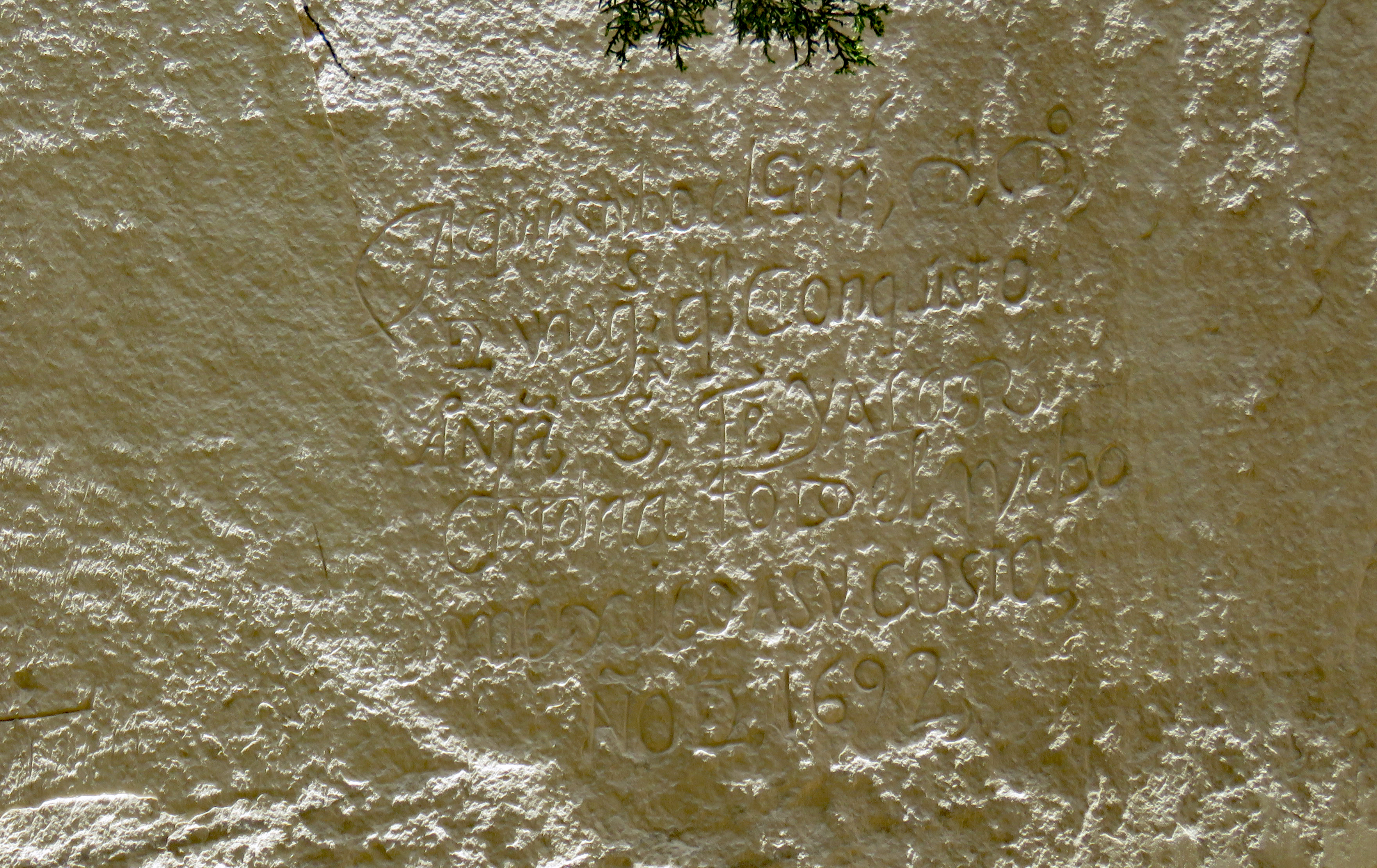
Twelve years after the Pueblo Revolt of 1680 expelled Spaniards from New Mexico, General Don Diego de Vargas in 1692 succeeded in the reconquest of New Mexico. It is in Vargas’ journal that the term “El Morro” appears, Spanish for a headland or cliff.
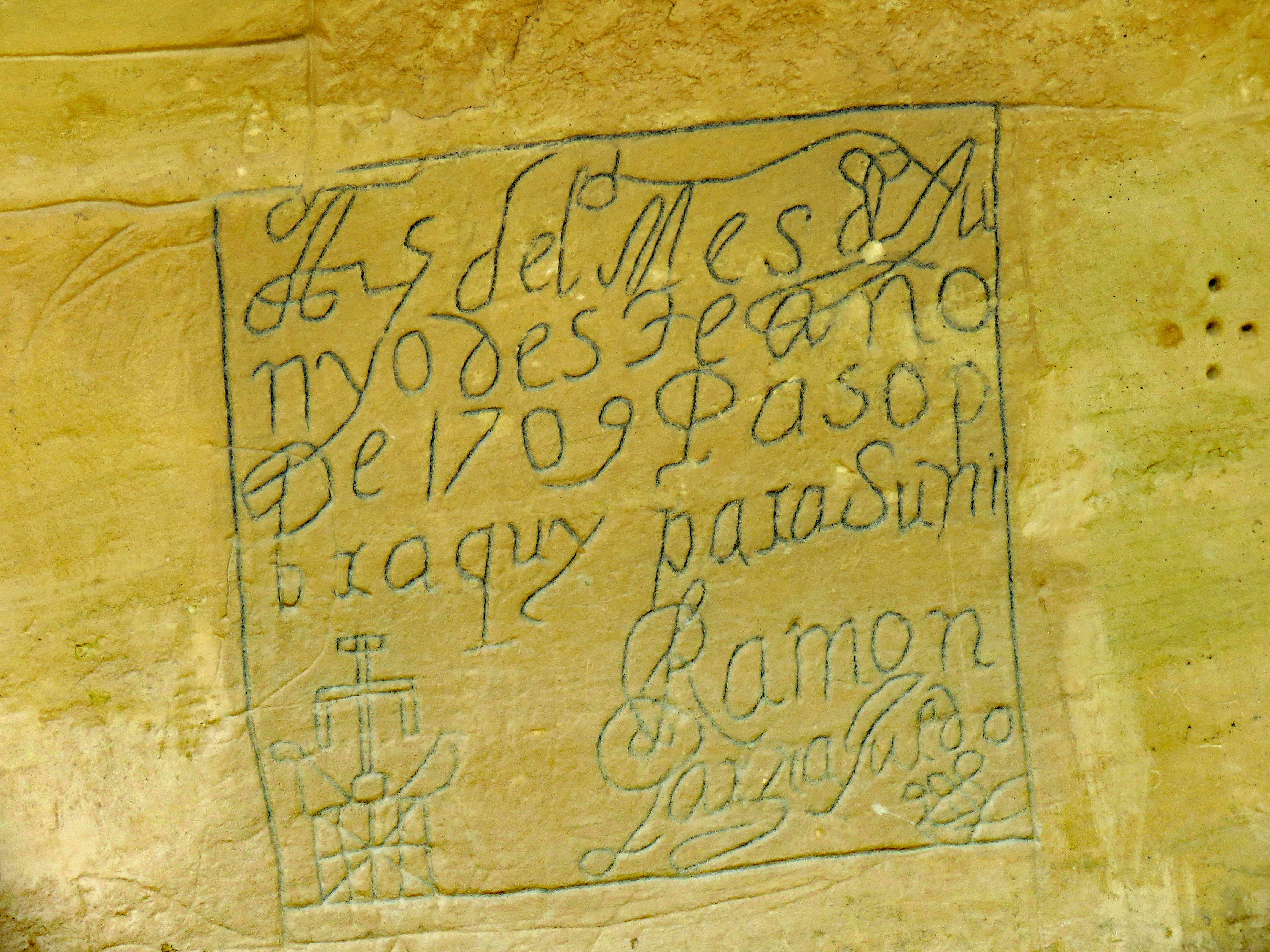
The last dated Spanish inscription on the rock is from 1774 and simply says: ”Por aqui paso Andres Romero.” Nothing else is known of Andres Romero.
In 1821, the territory fell under Mexican rule. There are no inscriptions from the Mexican period (1821-1846). New Mexico became a U.S. territory as a result of the U.S.-Mexican War (1846-1848).
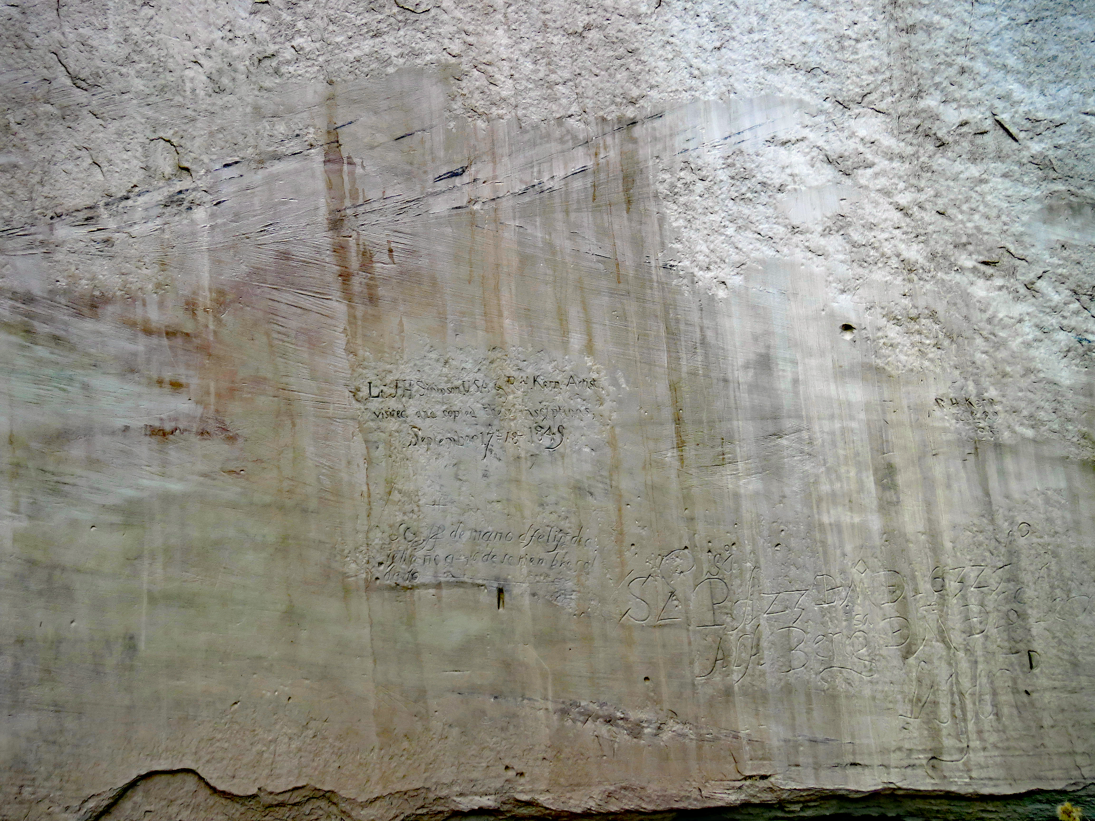
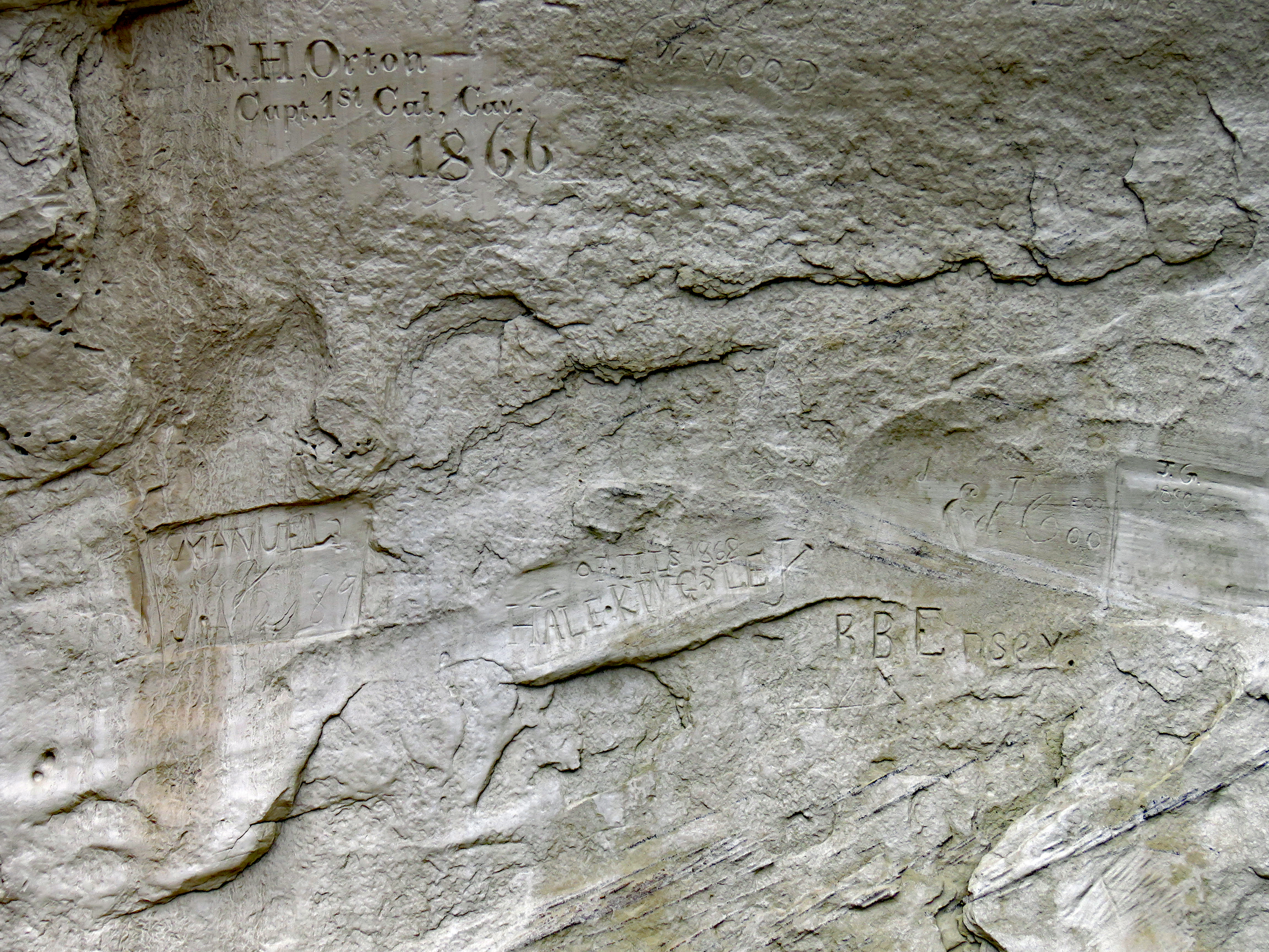
In 1849, Lt. James H. Simpson and artist Richard Kern of the U.S. Army Topographical Engineers made the first English descriptions of El Morro and left their own marks. They spent two days there copying inscriptions. Kern’s drawings proved the obliterations on the Eulate inscription were there by 1849.
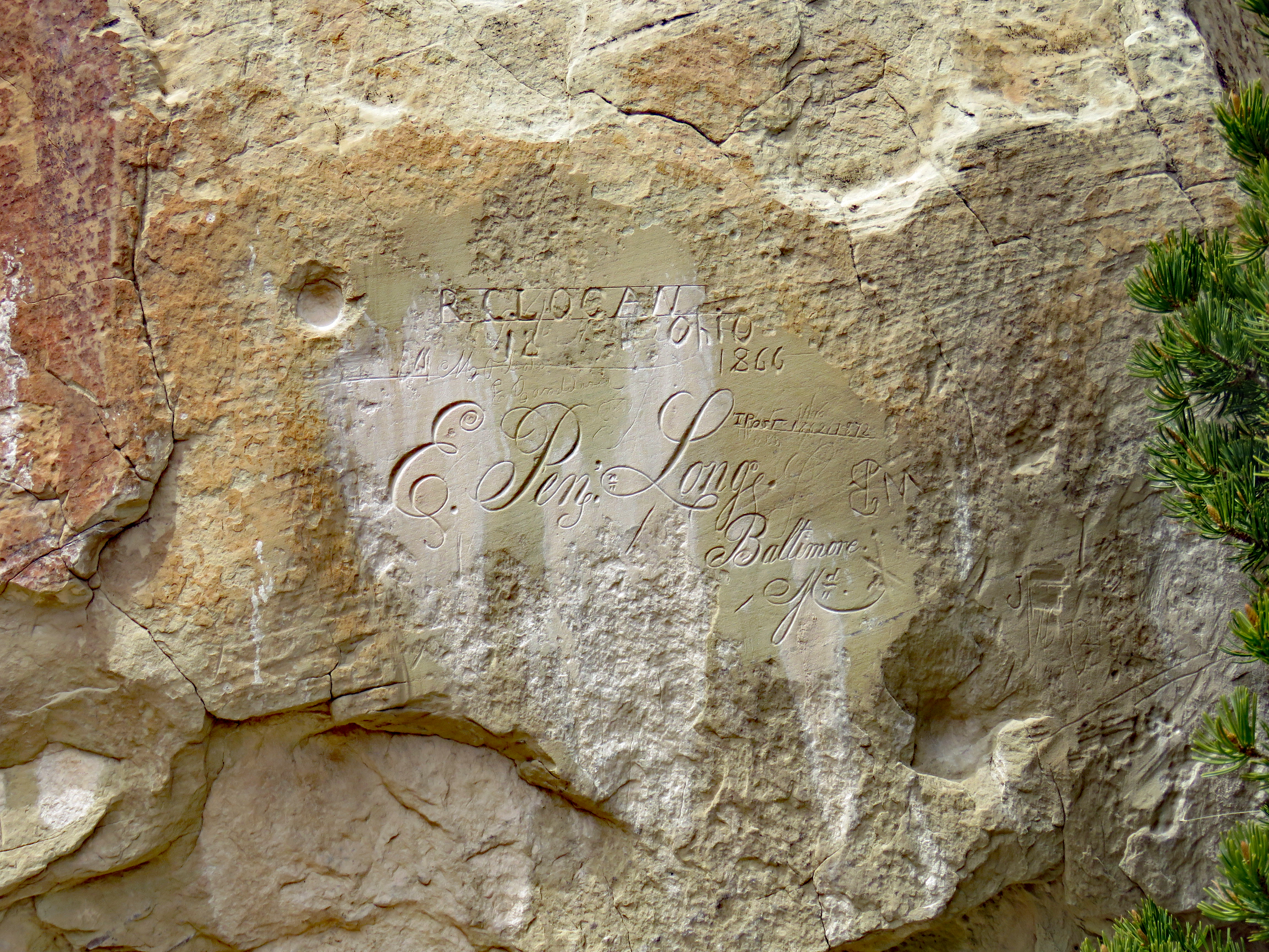
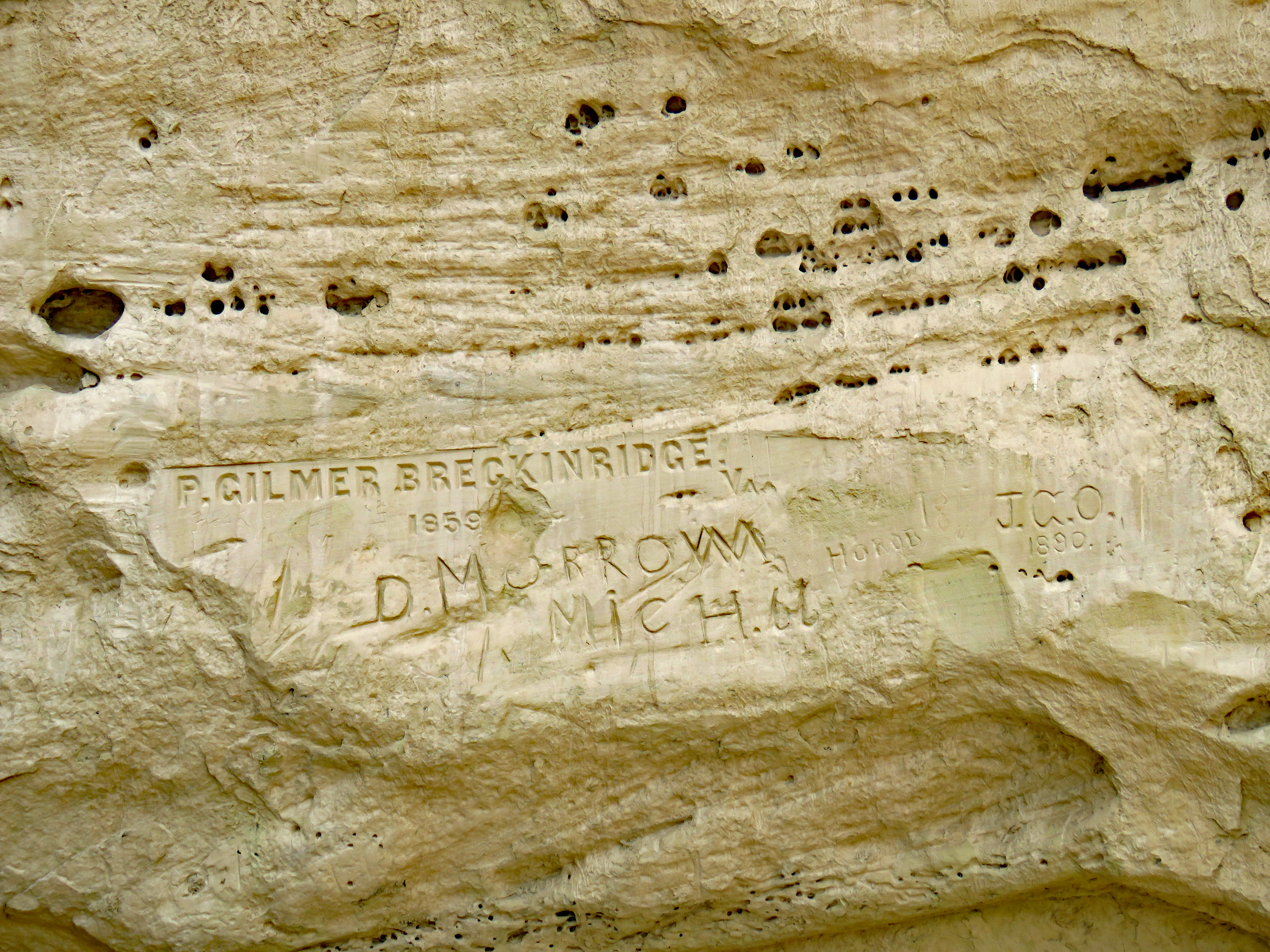
In 1857, the U.S. Army decided to experiment using camels and to pioneer a new route to California. They first stopped at El Morro in August of 1857 but names were carved on a subsequent trip in 1859.
The commander was Lt. Edward Fitzgerald Beale and the man in charge of the camels was P. Gilmer Breckinridge. E. Penn. Long and F. Engle, Jr. were also part of the group now referred to as “US Army Camel Corps. The camels did well but the experiment did not lead to use of camels by the military, mostly because of negative reactions of army horses and teamsters to the unfamiliar animals.
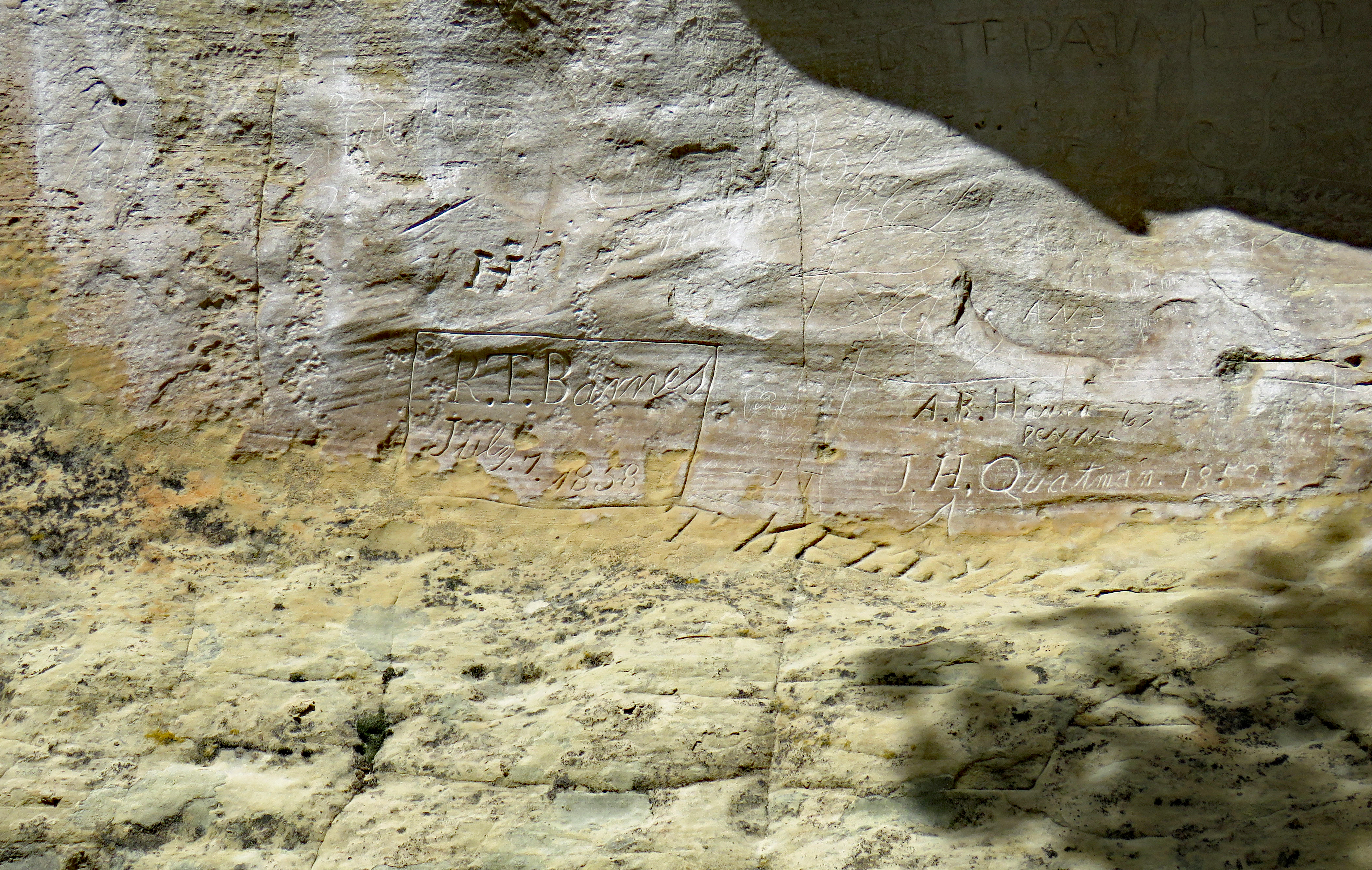
Twenty-six Anglo names appear on the rock from July 1858. This was the first emigrant wagon train to use this route to the West Coast. After leaving El Morro, they encountered all kinds of major difficulties and their story in itself is rather extraordinary.
Numerous names, all carved in 1868, add “U.P.R.” That was the year the Union Pacific Railroad sent a survey party past El Morro, planning to lay track along this route to California. Instead the Santa Fe built a line about 30 miles north. Travel was revolutionized and the prominence of the pool at the base of El Morro passed.
The Zuni called it A’ts’ina, “place of writings on the rock.” The Spaniards called it El Morro, “the Headland.” Anglo-Americans called it Inscription Rock. Long before its establishment as a national monument, members of the local community felt strongly about protecting Inscription Rock and the thousands of signatures at its base. Largely due to this community support, when the Antiquities Act was signed in 1906 by President Theodore Roosevelt, El Morro became the second monument created.
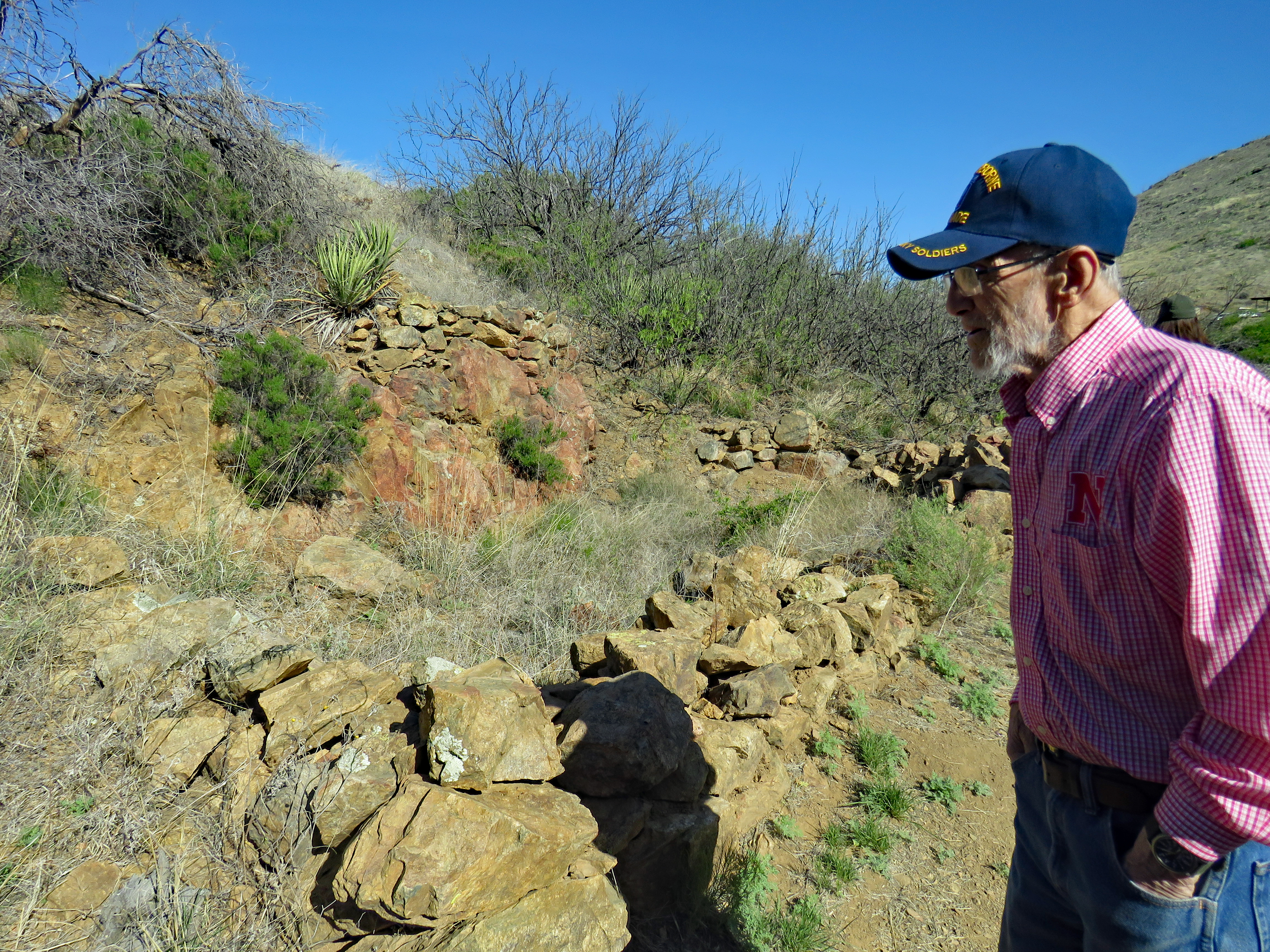
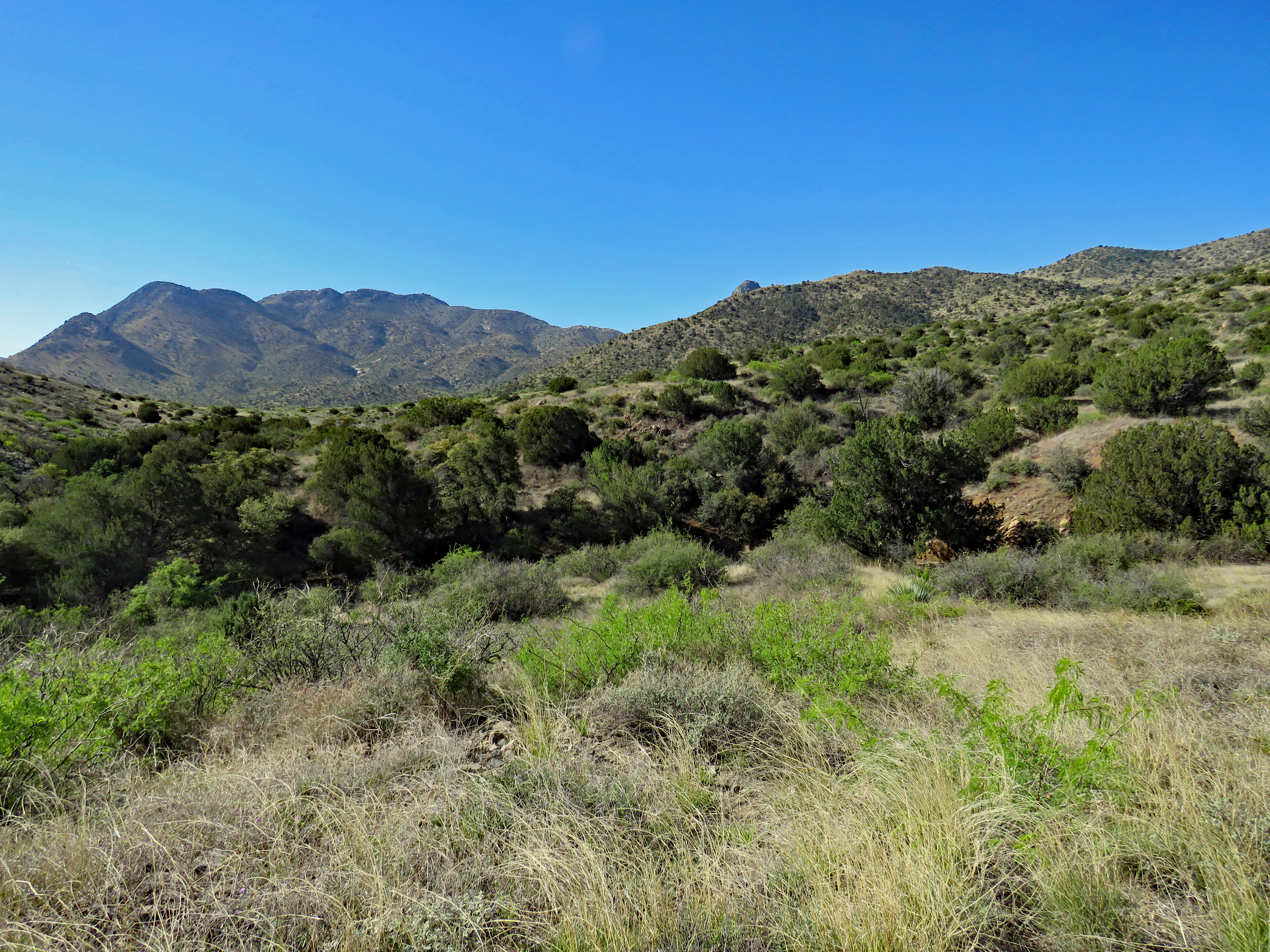
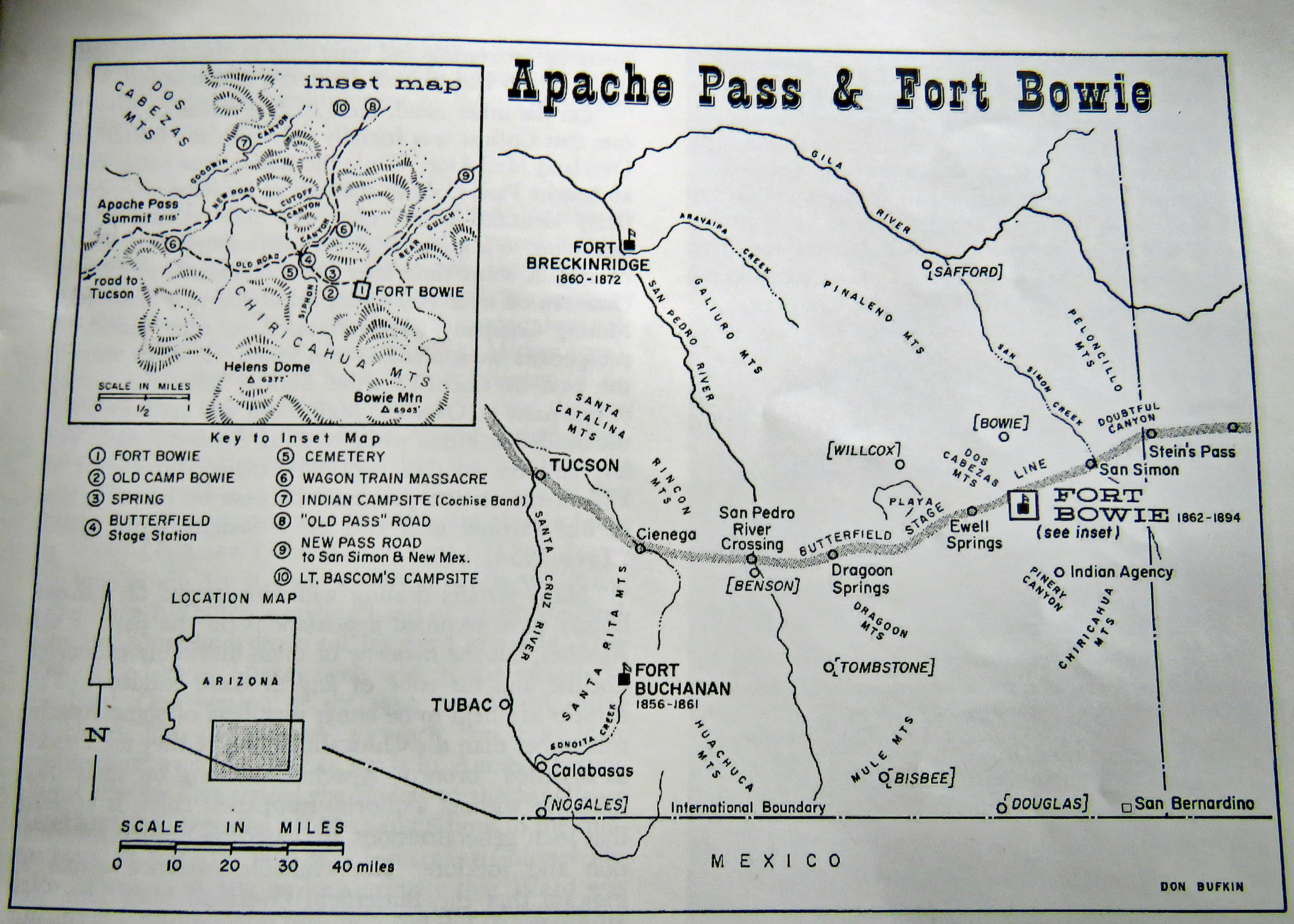
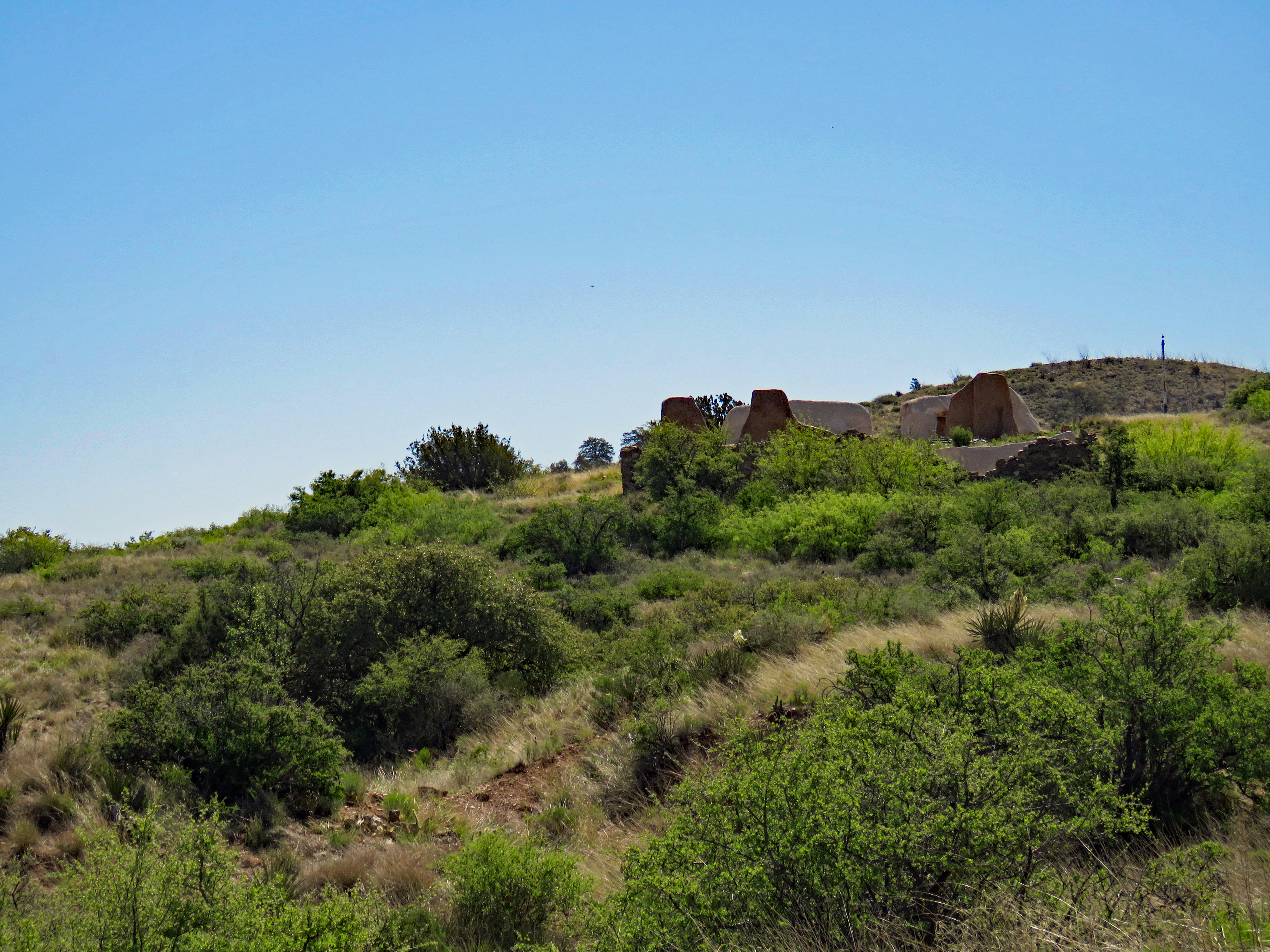
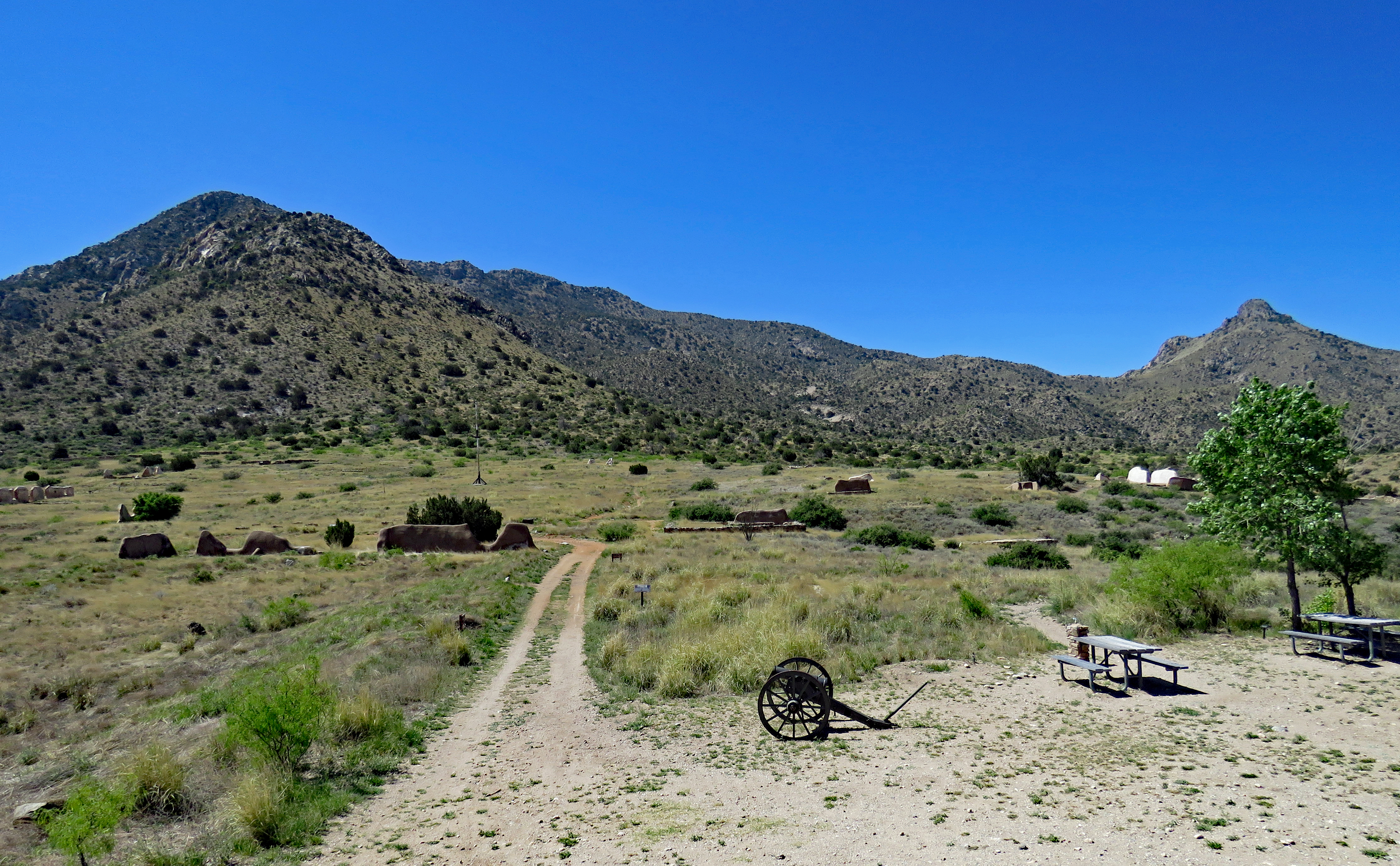
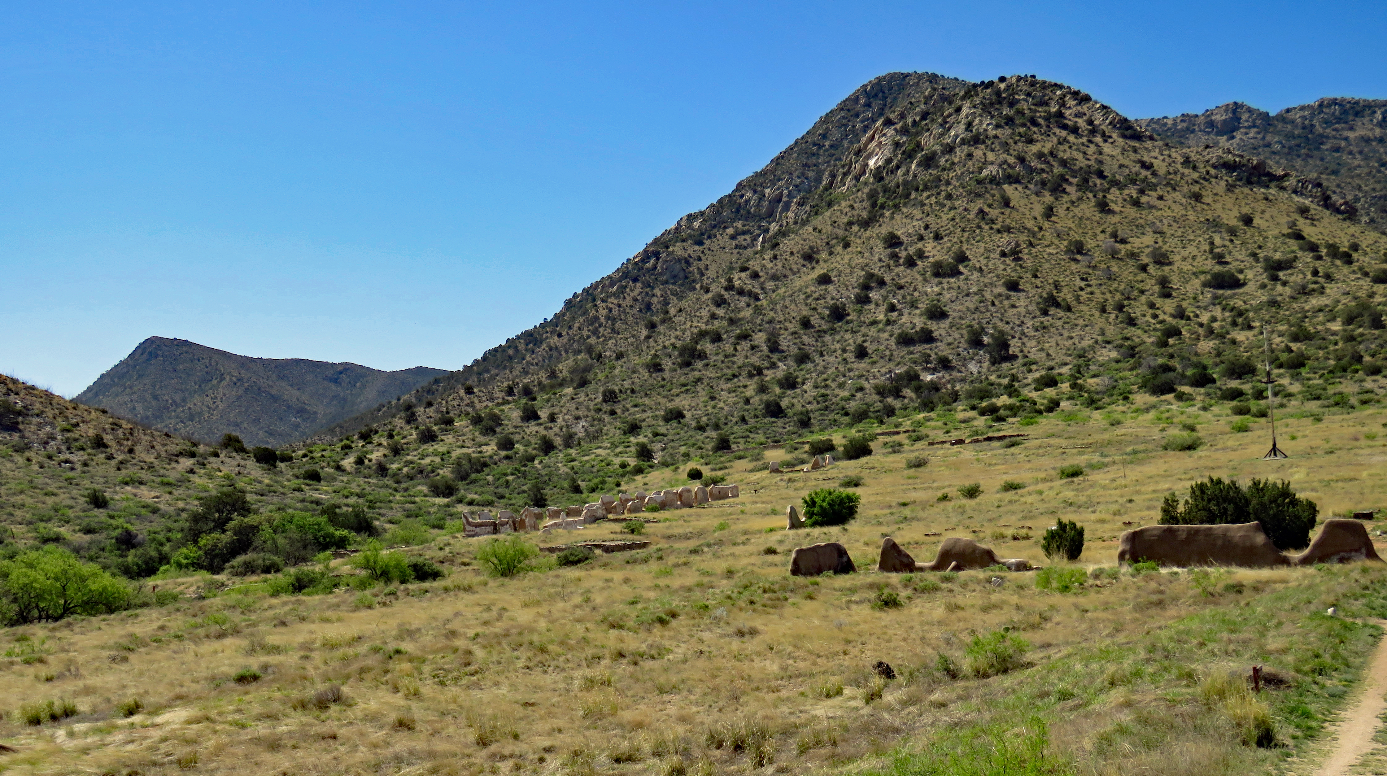
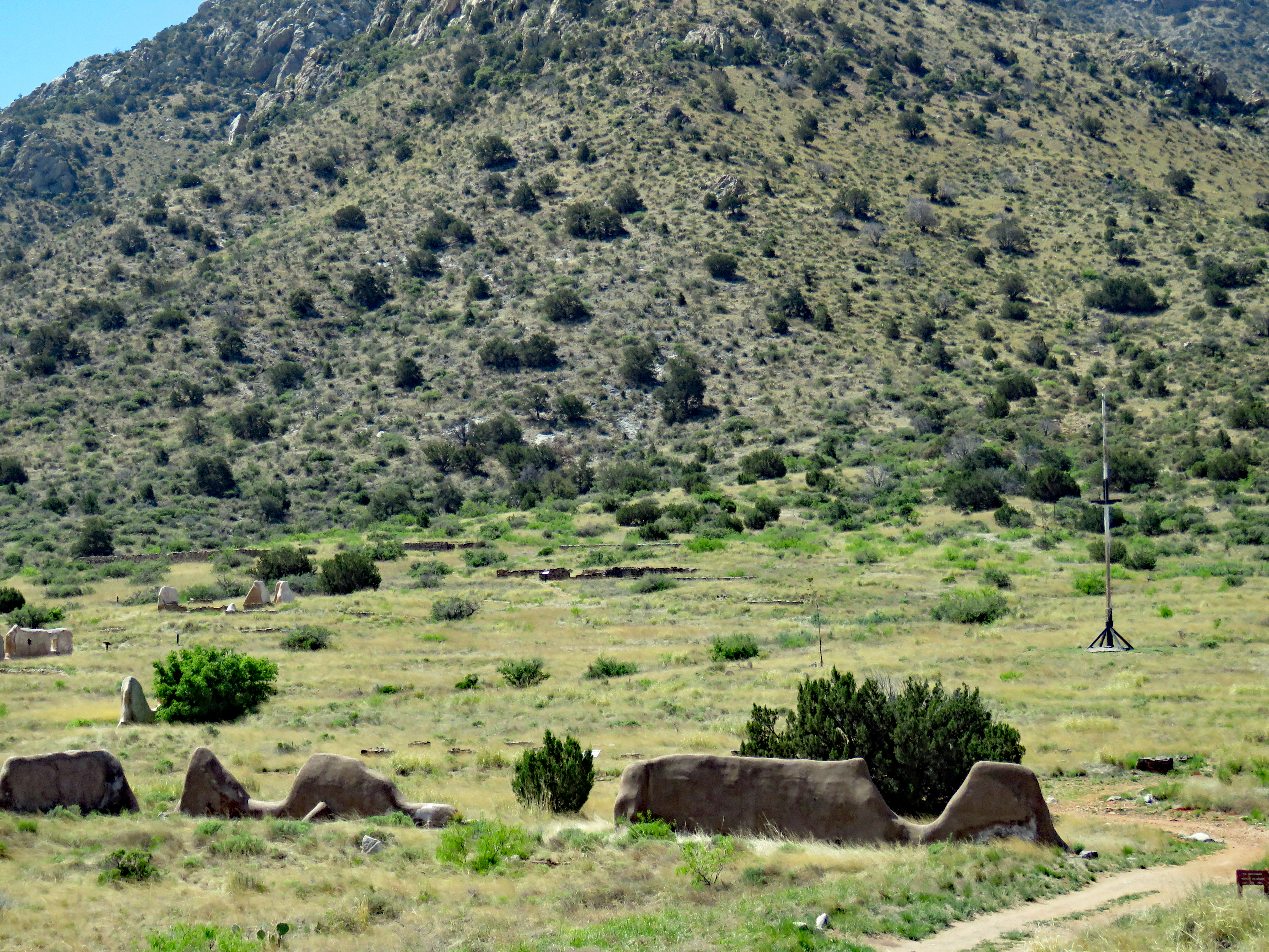
A 3-mile roundtrip hike to the visitor center? That’s correct. Fort Bowie National Historical Site in southeastern Arizona is unique in the National Park system in the fact that you have to hike to the visitor center.
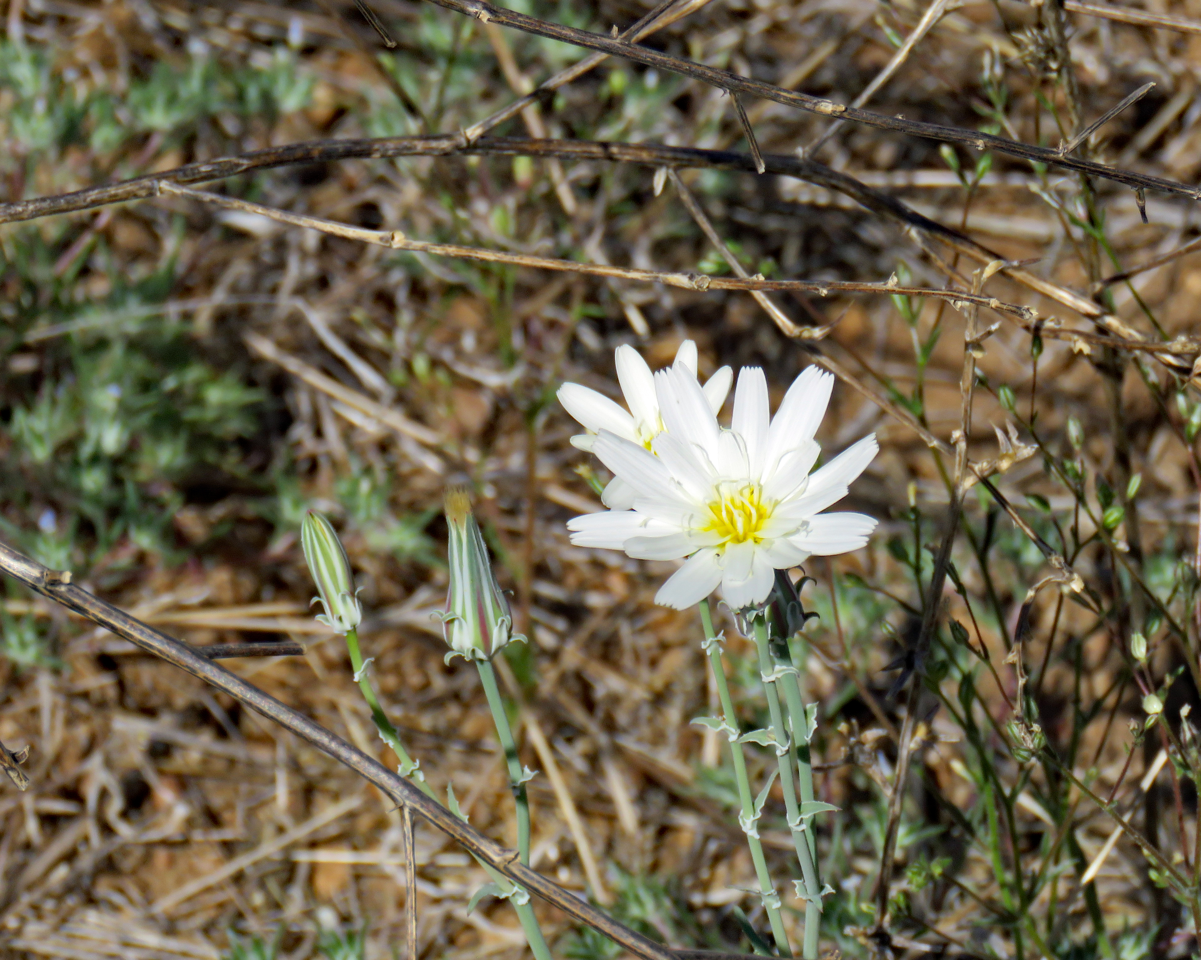
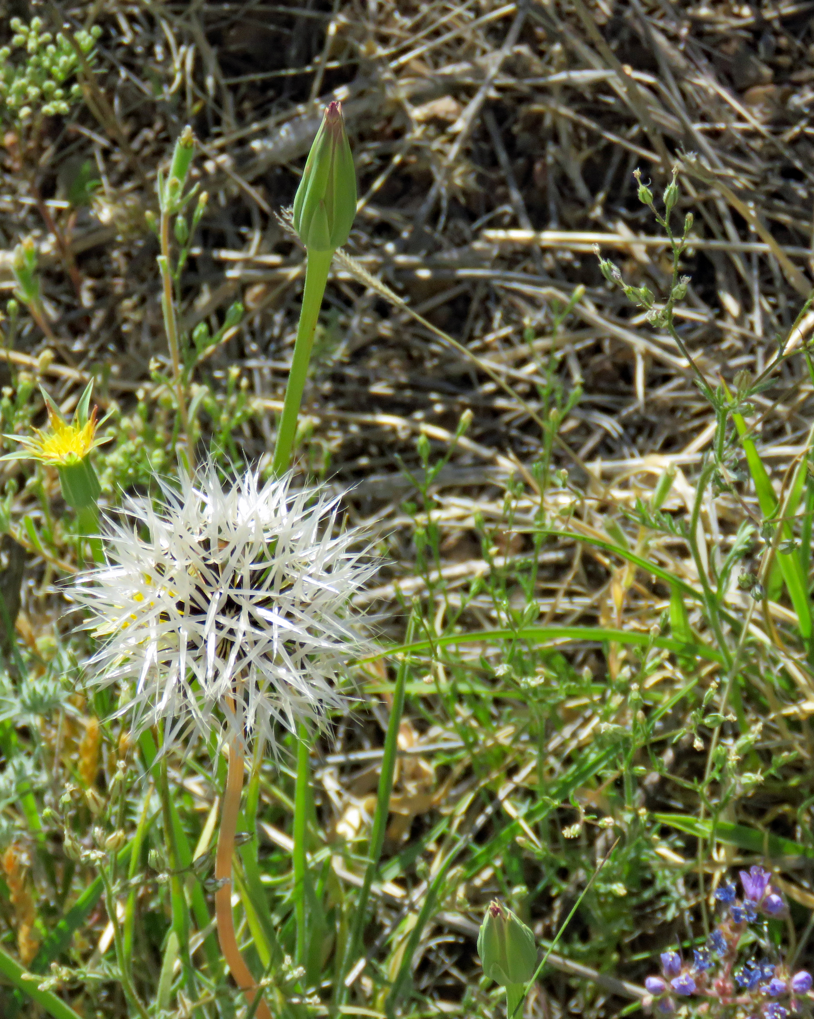
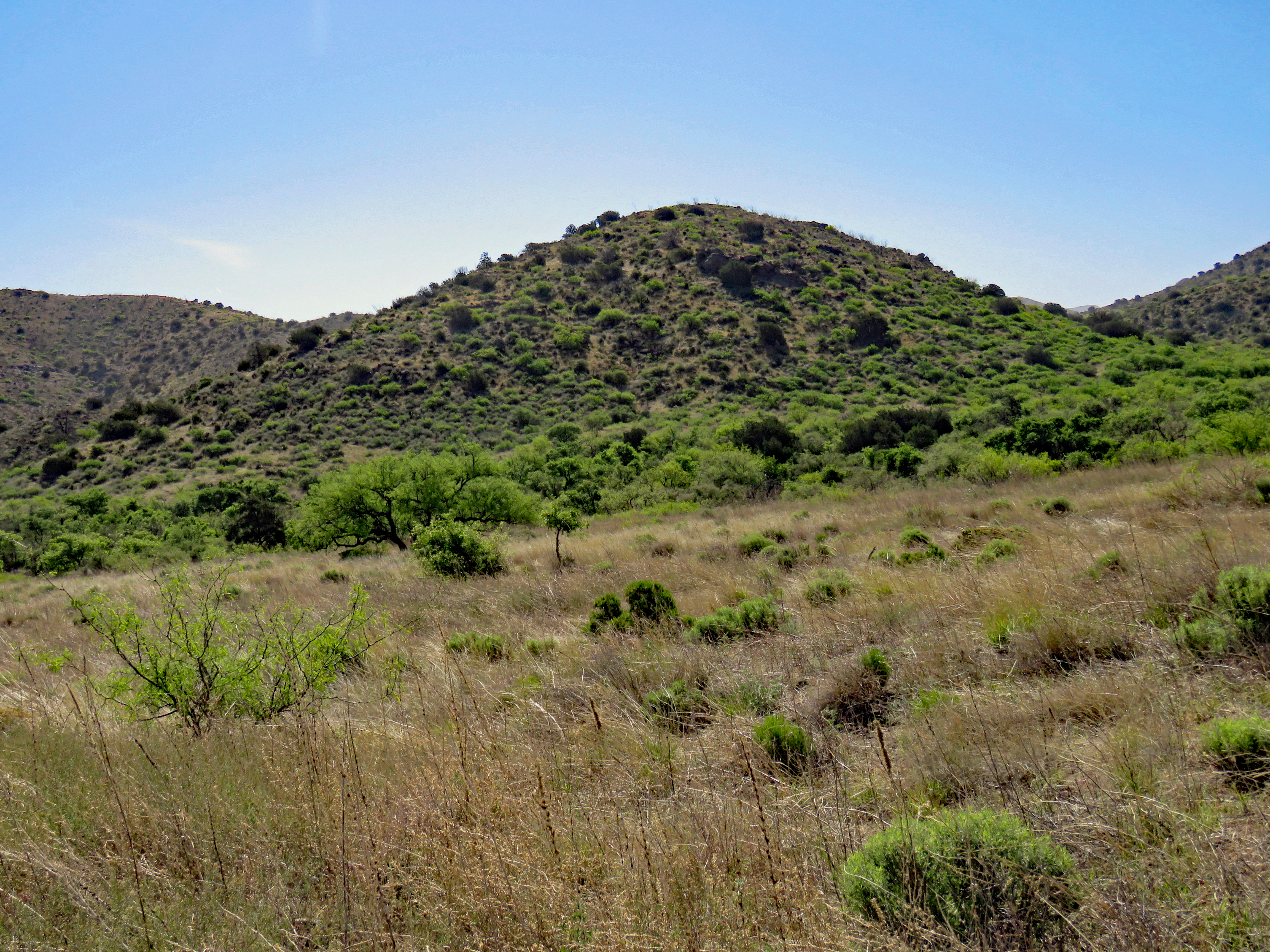
We visited in late May and planned it so our hike would be in the morning as by afternoon it gets hot and there is almost no shade on the trail. It is a moderate hike with a number of interpretive signs along the way detailing events that occurred there.
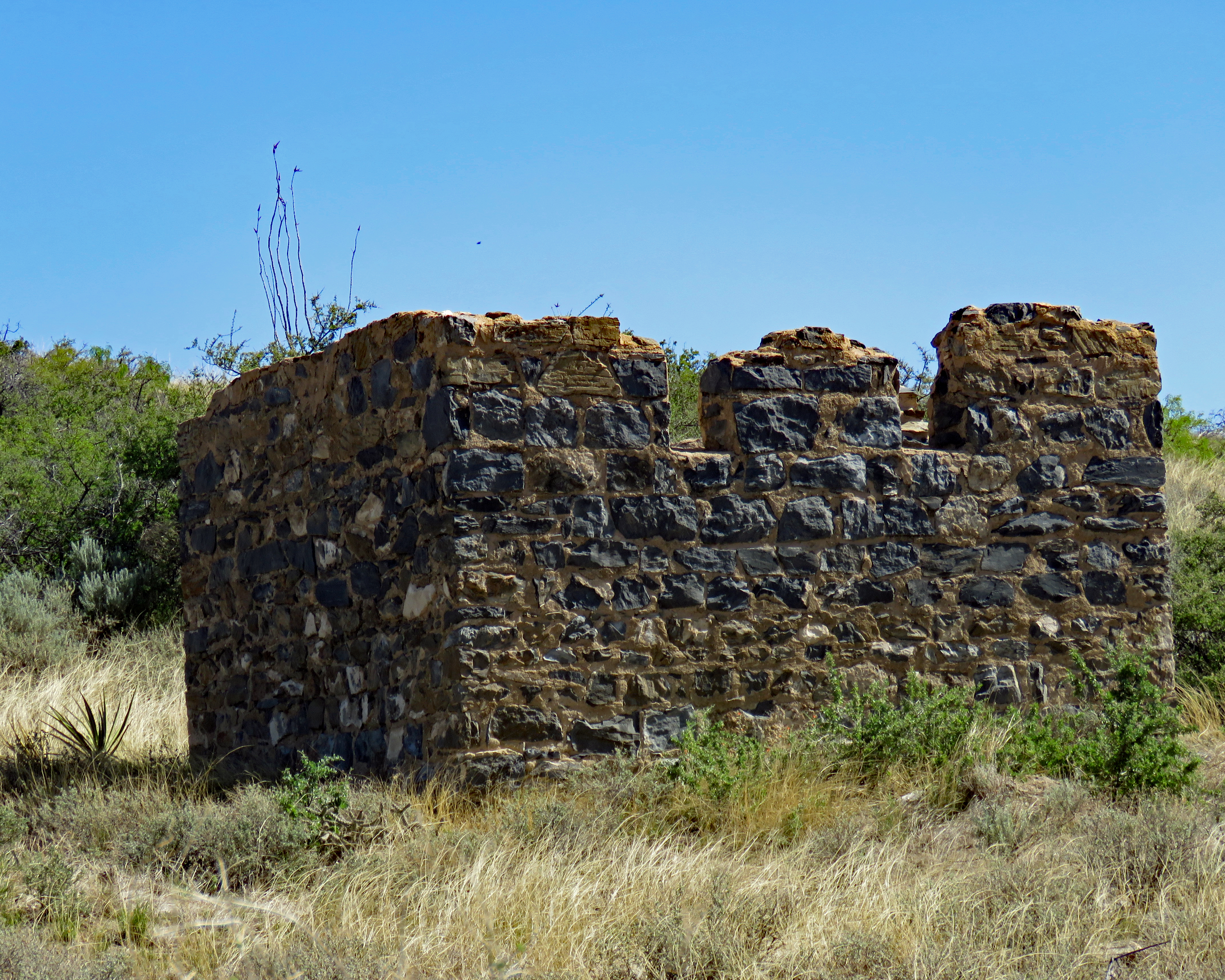
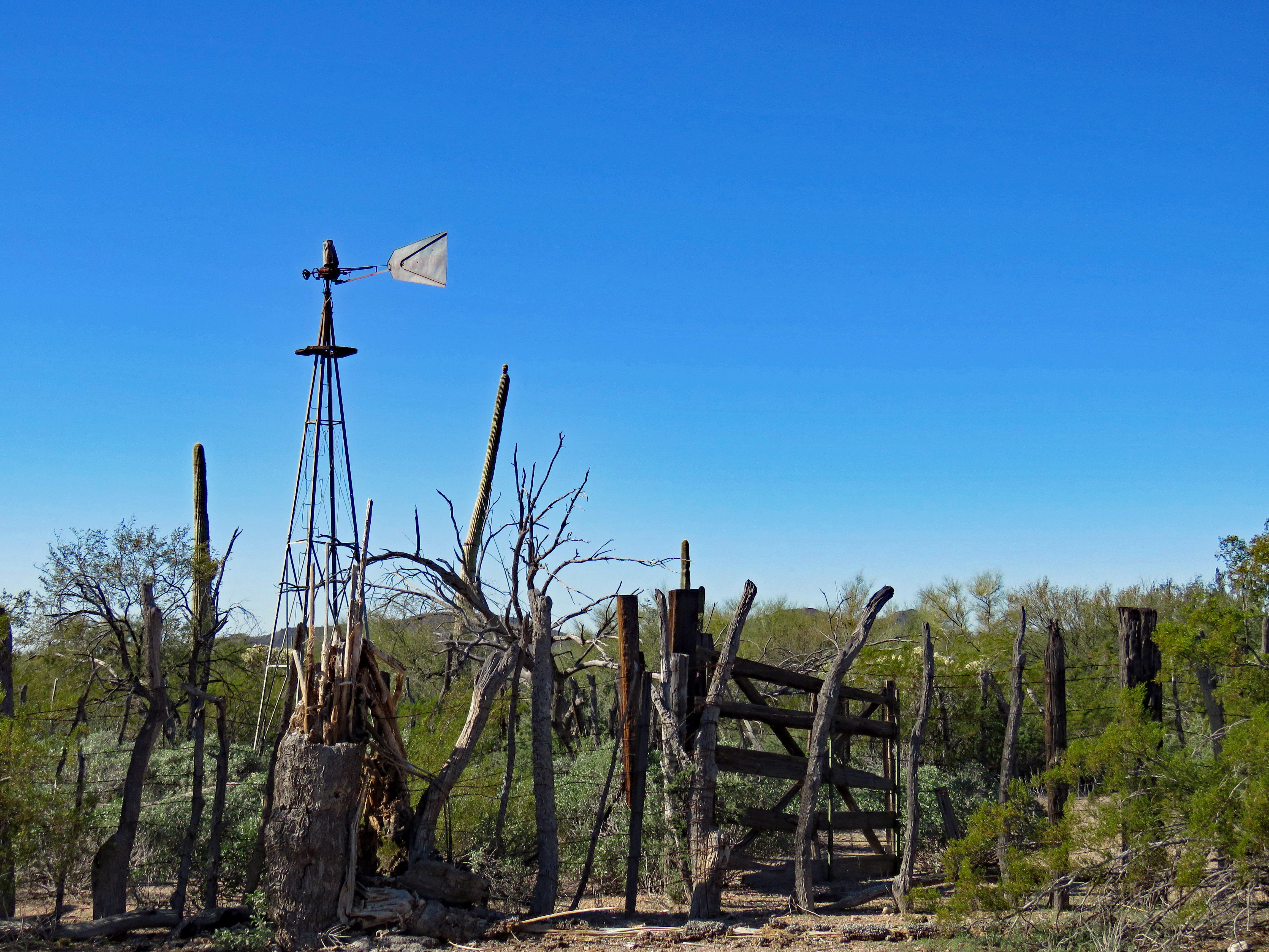
Remnant of a miner’s cabin
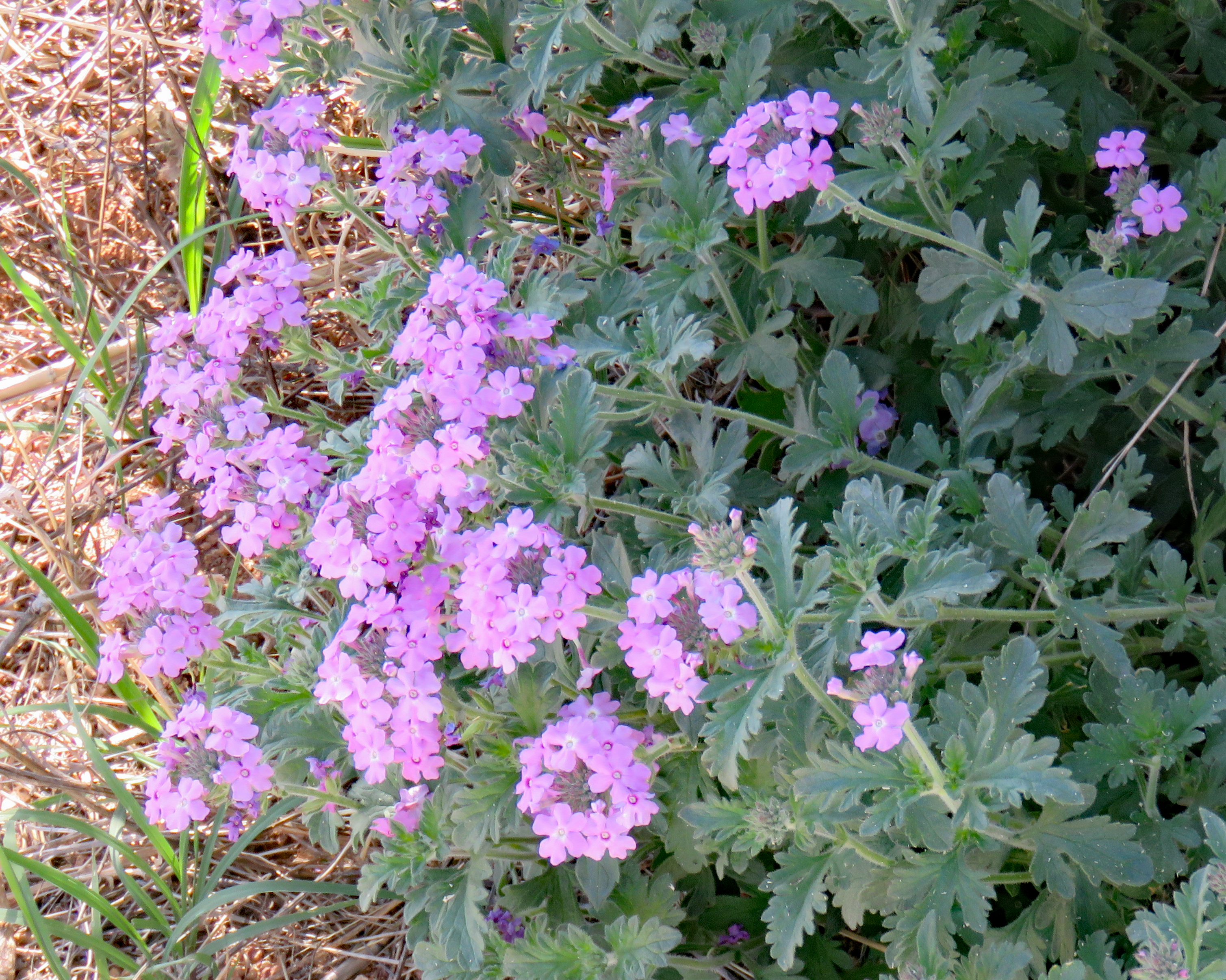
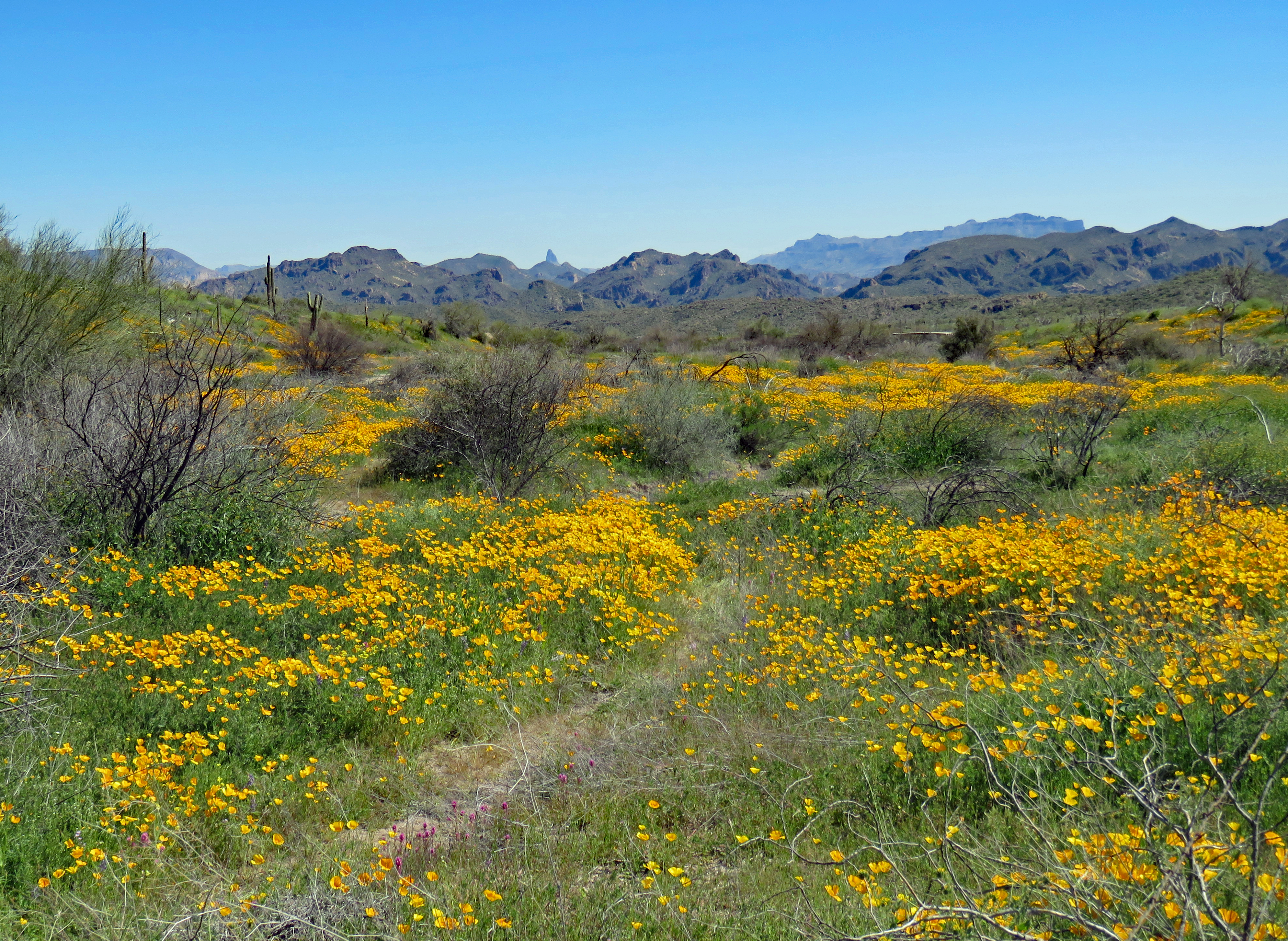
Wildflowers were also in bloom.
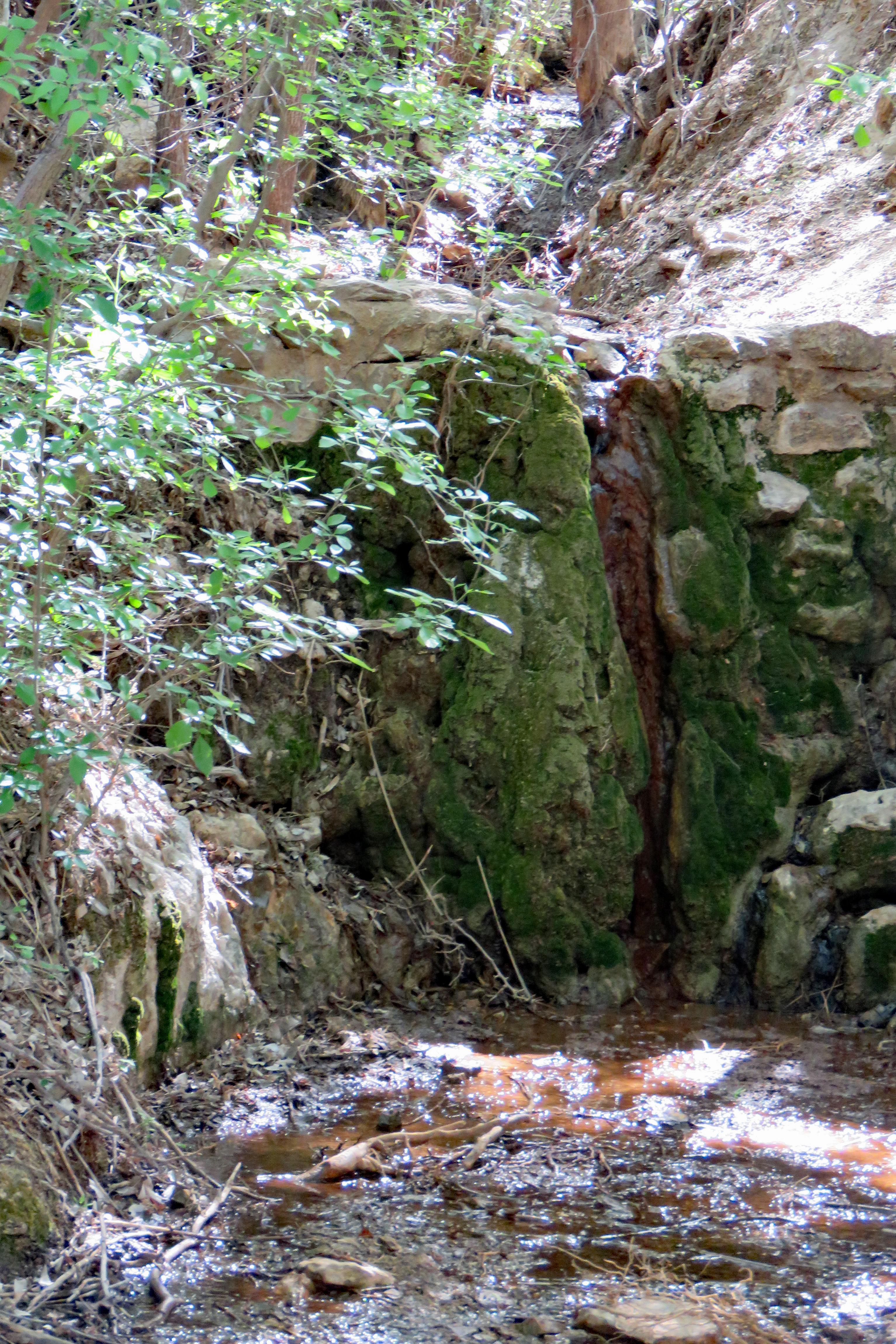
In this arid land water is always a primary concern. Because its springs were an unfailing water source, in the 1800’s Apache Pass drew natives, travelers, emigrants, and soldiers. Conflicts and violence frequently resulted.
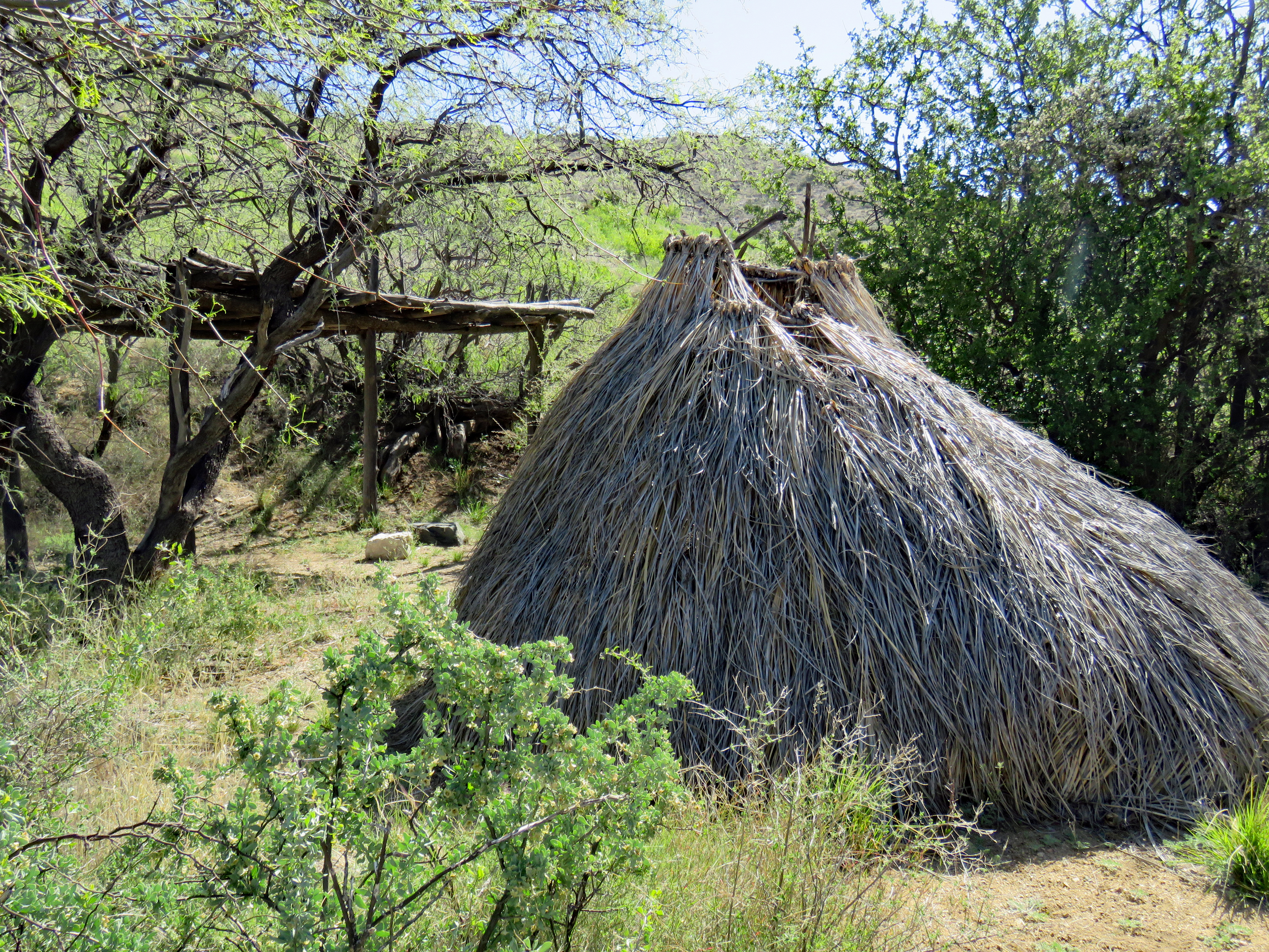
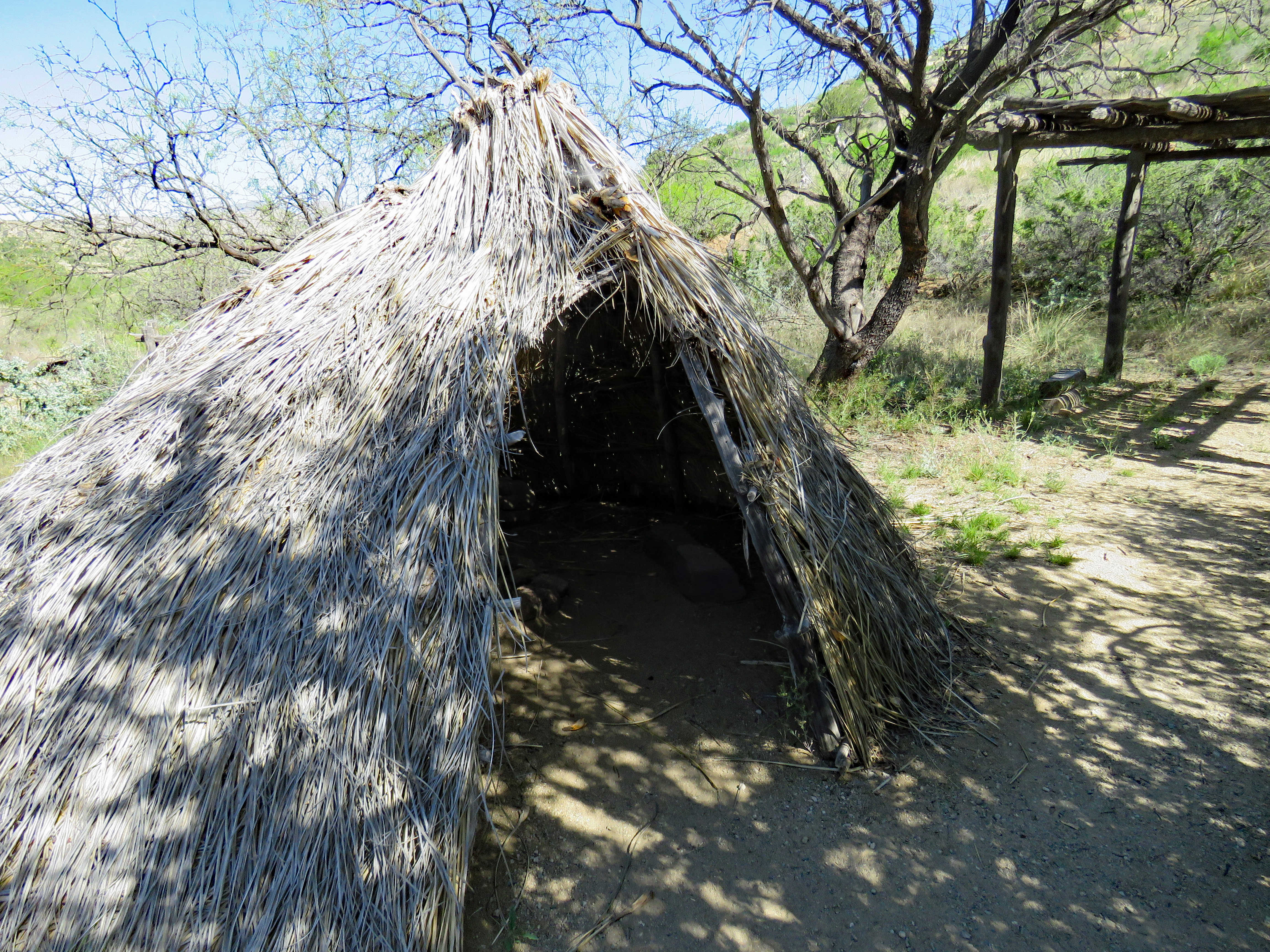
Typical Chiricahua camp
Apache Pass was on the course of an Indian trail and the Chiricahua Apache seasonally inhabited the area around Apache Spring. Prior to 1851 the pass was known to certain travelers but after 1851 a definite route appears to have been developed.
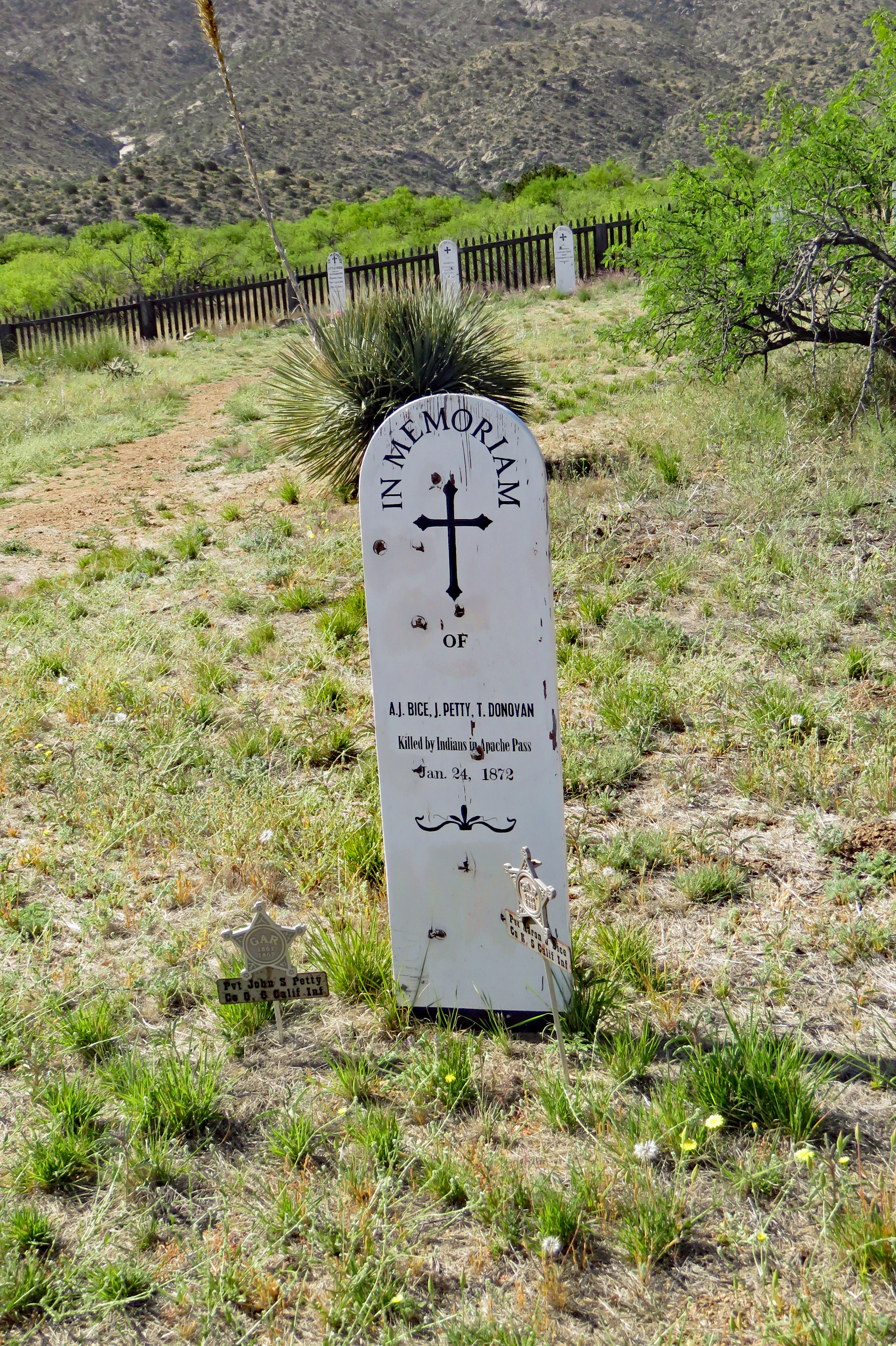
By 1856 Apache Pass was on the line of a military road from Fort Thorn, New Mexico to Tucson and on to Fort Yuma, California. Sometime between 1854 and 1858 a wagon train from Texas headed westward was ambushed by Apaches led by the father of Cochise. The train was destroyed, over thirty persons were killed and a number of women were taken captive. This was one of the first recorded tragedies associated with the pass.
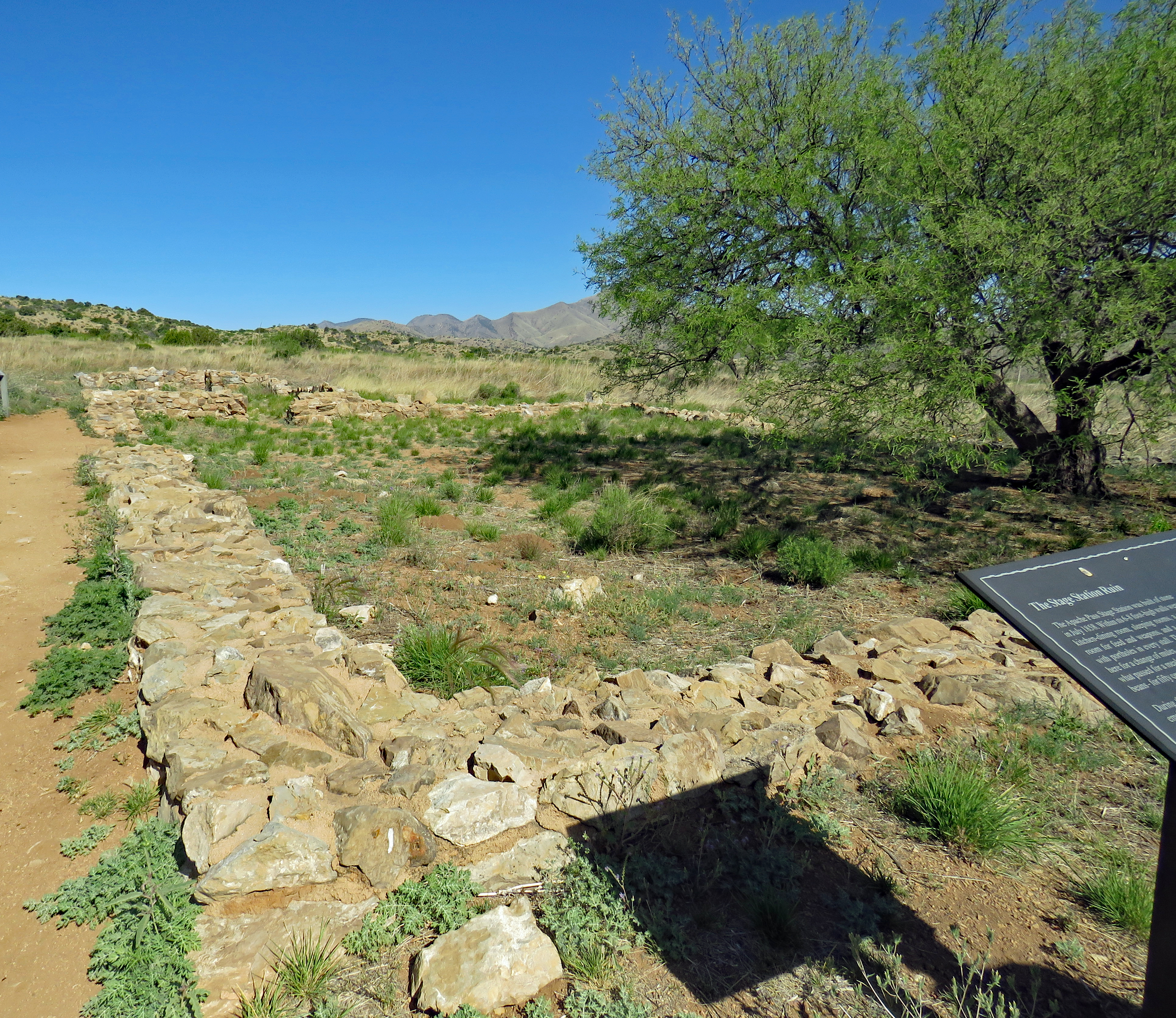
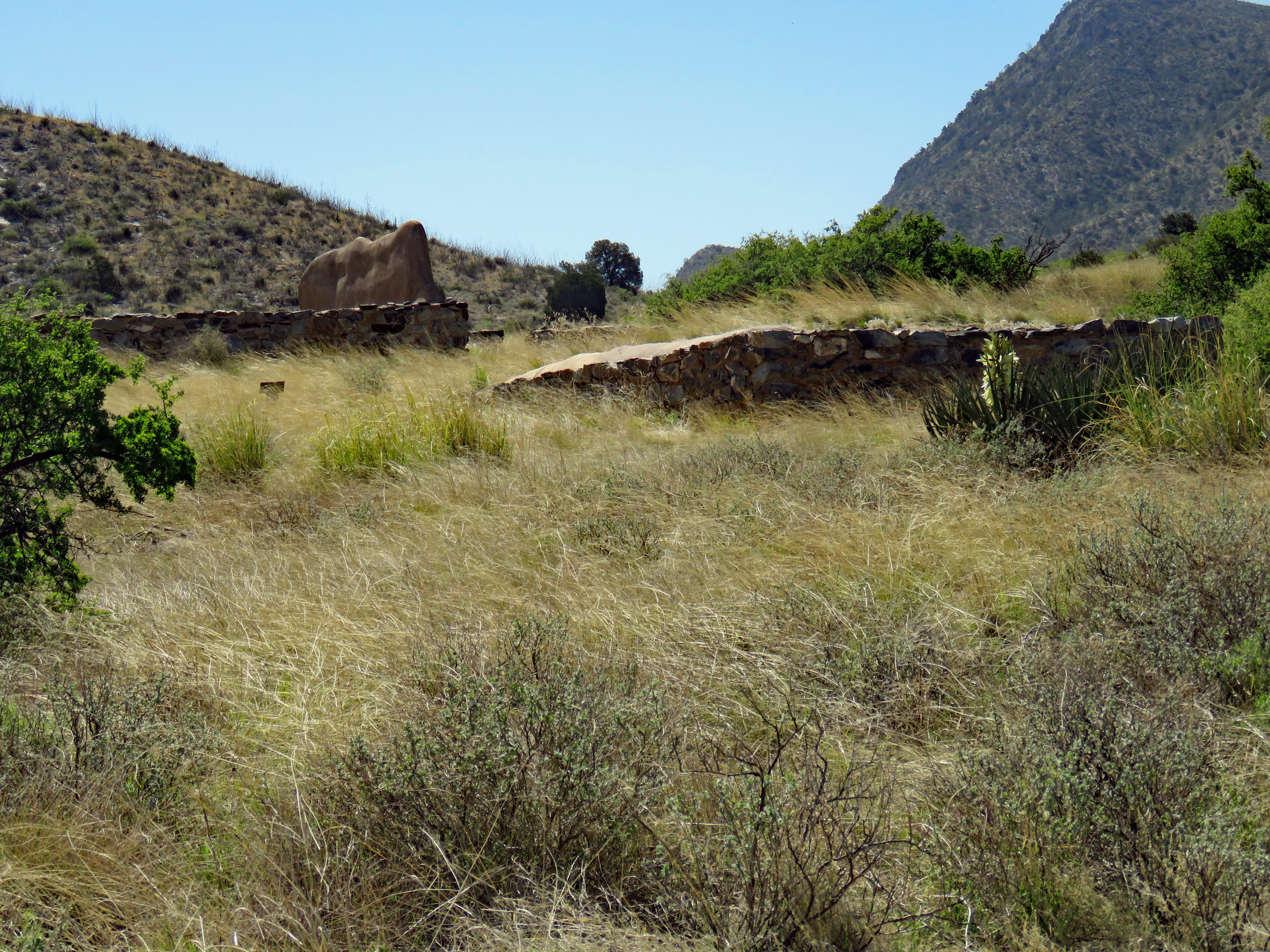
In 1857, the government awarded John Butterfield a contract to carry mail by stagecoach between Saint Louis and San Francisco. The 2800 mile route was to be traversed within 25 days. In 1858, the Apache Pass stone stage station was built. It was a low, square building with protecting enclosures. For over two years, the Chiracahuas permitted the stages safe passage through the pass and, in exchange for gifts, they provided firewood for the stage station. The Butterfield stages passed the station twice a week, the east and west bound coaches meeting there on Sunday and Wednesday. The station was abandoned in 1861 when the southern route was closed on the eve of the Civil War.
Remains of Butterfield Stage Station
Up to February 1861 the Chiracahua Apaches camped in and around Apache Pass and the chief of the tribe, Cochise, was said to be on generally friendly terms with the Americans. However that winter a situation developed between two men who clearly did not understand each other. “The Bascom affair” sparked the Apache Wars of the southwest which raged for the next ten years.
In October 1860 a band of Apaches raided the ranch of John Ward, stole some stock and kidnapped a young boy named Felix Tellez. Ward wrongly believed Cochise and his band of Chiracahuas were responsible and he demanded military authorities confront Cochise, and recover his stock and the boy. There seems to be some confusion as to the timeframe in which Ward reported the losses to the military as well as when orders were issued and actually carried out. At any rate, Lt. George Bascom (age 23, native of Kentucky and graduate of West Point) and 54 men headed into Apache Pass arriving on February 3, 1861.
They camped northeast of the stage station and thus began “The Bascom Affair.” February 4th Cochise inquired at the stage station the reason for the arrival of the troops and was told they were on their way to the Rio Grande. There are several versions of the events but the general consensus is that in some manner, Bascom lured Cochise into his tent, after having instructed several of his soldiers that at a given signal they were to surround the tent and prevent any of the Indians from leaving. Cochise informed Bascom that neither he nor his band were responsible for the missing boy and cattle (later proven to be true). He said if given time, he would find out who was responsible and secure the return. Bascom gave his soldiers the signal and told Cochise that he was holding him and his party as hostages until the boy and cattle were returned. Cochise used a concealed knife, slit the tent and, surprising the soldiers, escaped up the hill.
Bascom’s Campsite
February 5th, Bascom moved his camp toward the stage station. Cochise and several of his followers approached and said he wanted to talk with Bascom. It was apparently his plan to capture some of the men and exchange them for Bascom’s prisoners. A skirmish ensued with the Apaches capturing one stageman. The following day, Cochise offered to trade this man for the Indian hostages. Bascom refused unless the Ward boy was also included. Things went from bad to worse and sporadic fighting bloodied Apache Pass for the next two weeks. During that time a number of atrocities occurred, including the death of the hostages held by the Apaches and the hanging of the Apache hostages held by the Army. The Ward boy was never recovered from the Apaches but later he made his appearance in history as an Apache scout, guide and interpreter for the U.S. Army under the name of Mickey Free.
To assure safe passage through the pass, on July 8, 1861, Captain Thomas L. Roberts was ordered to establish a base at the Butterfield Stage Station. Approaching on July 15th, they found themselves under fire from Apaches on the heights above both sides of the trail. They reached the stage station but were unable to reach the spring which was essential to their survival. The Battle of Apache Pass was brutal and lasted for two days. After this, the decision was made to establish a fortified position in the pass.
Apache Spring
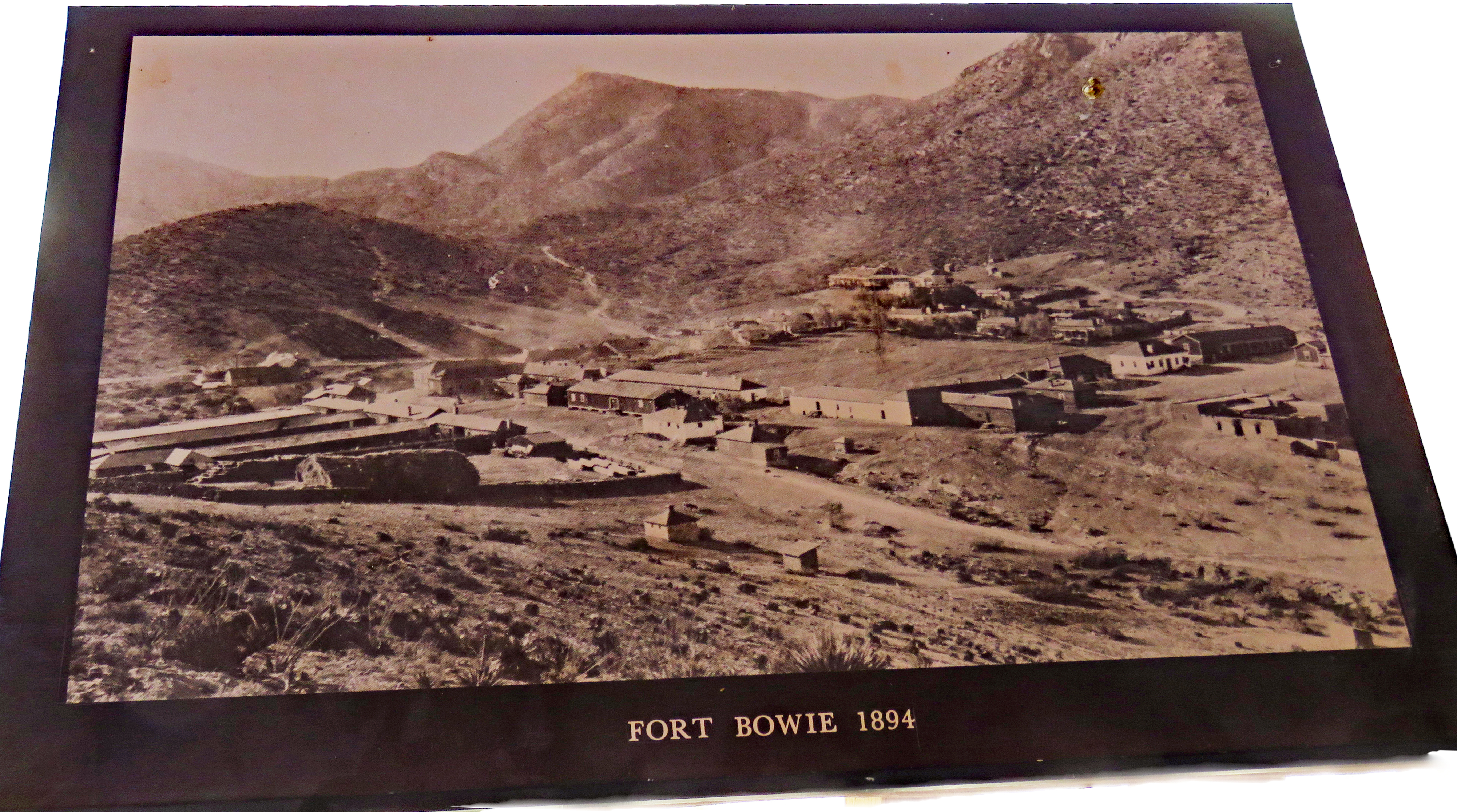
Camp Bowie was officially established July 28, 1861 and construction began immediately. The location chosen proved to be ill-conceived and in February 1868, instructions were received directing the construction of the new Fort Bowie which was quite large. The post was laid out according to traditional design, with the roughly square parade ground running more or less in an east- west direction and the officers’ quarters located on the south periphery of the square. There were generally about 300 soldiers – infantry and cavalry – based at the fort but roughly half of them would be on patrol elsewhere guarding springs and escorting wagon trains through the Apache territory. Even though there were such amenities as running water and even an ice-making plant, it was not a desirable posting. However there were few desertions due to its remote location and the threat of the Apaches in the area.
Throughout the time of Fort Bowie, hostilities with the Chiracahua Apaches continued. In 1872 Cochise surrendered, accepting a reservation of their selection. Cochise died in 1874 and by 1876, the government decided to remove the Apaches from that reservation to San Carlos. Geronimo was among a group of leaders who fled. Once again hostilities resumed.
For more than 30 years Fort Bowie and Apache Pass were the focal point of military operations eventually culminating in the surrender of Geronimo in 1886 and the banishment of the Chiricahuas to Florida, Alabama, and later Oklahoma. October 17, 1894, Troops B and I, Second Cavalry marched out of Apache Pass and Fort Bowie’s long history of action and service in the field was at an end.
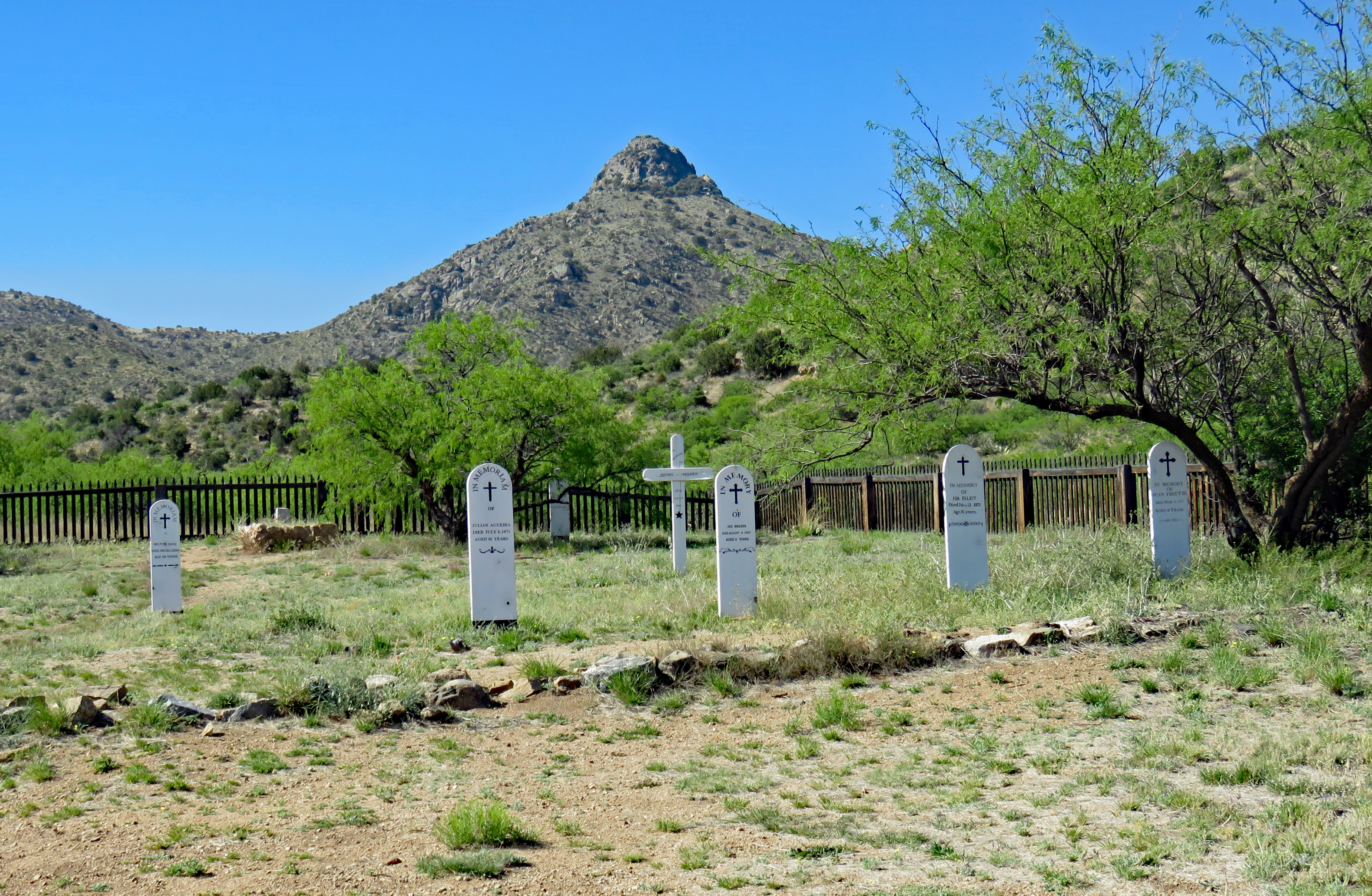
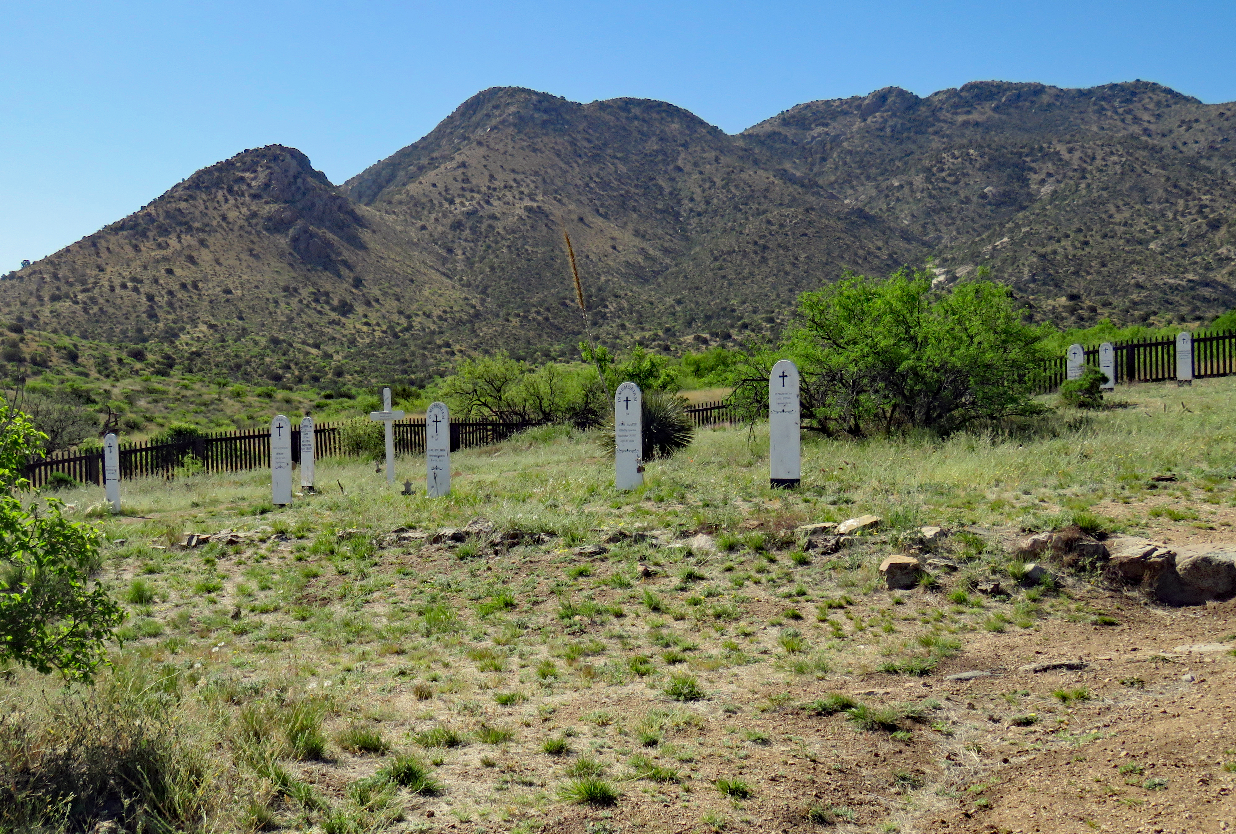
The Post cemetery predated the establishment of Fort Bowie itself. In 1862, soldiers of the California Column were interred there. Also interred there were military dependents, civilian employees, emigrants, mail carriers, and three Apache children, one of which was Geronimo’s young son. Five months after the Fort’s closure the remains of 72 soldiers, dependents and “unknowns” were removed for reinterment at the San Francisco National Cemetery. Twenty-three civilian graves remain.
The three-mile hike was certainly worth the effort. This was another off-the-beaten path place where you can learn so much.
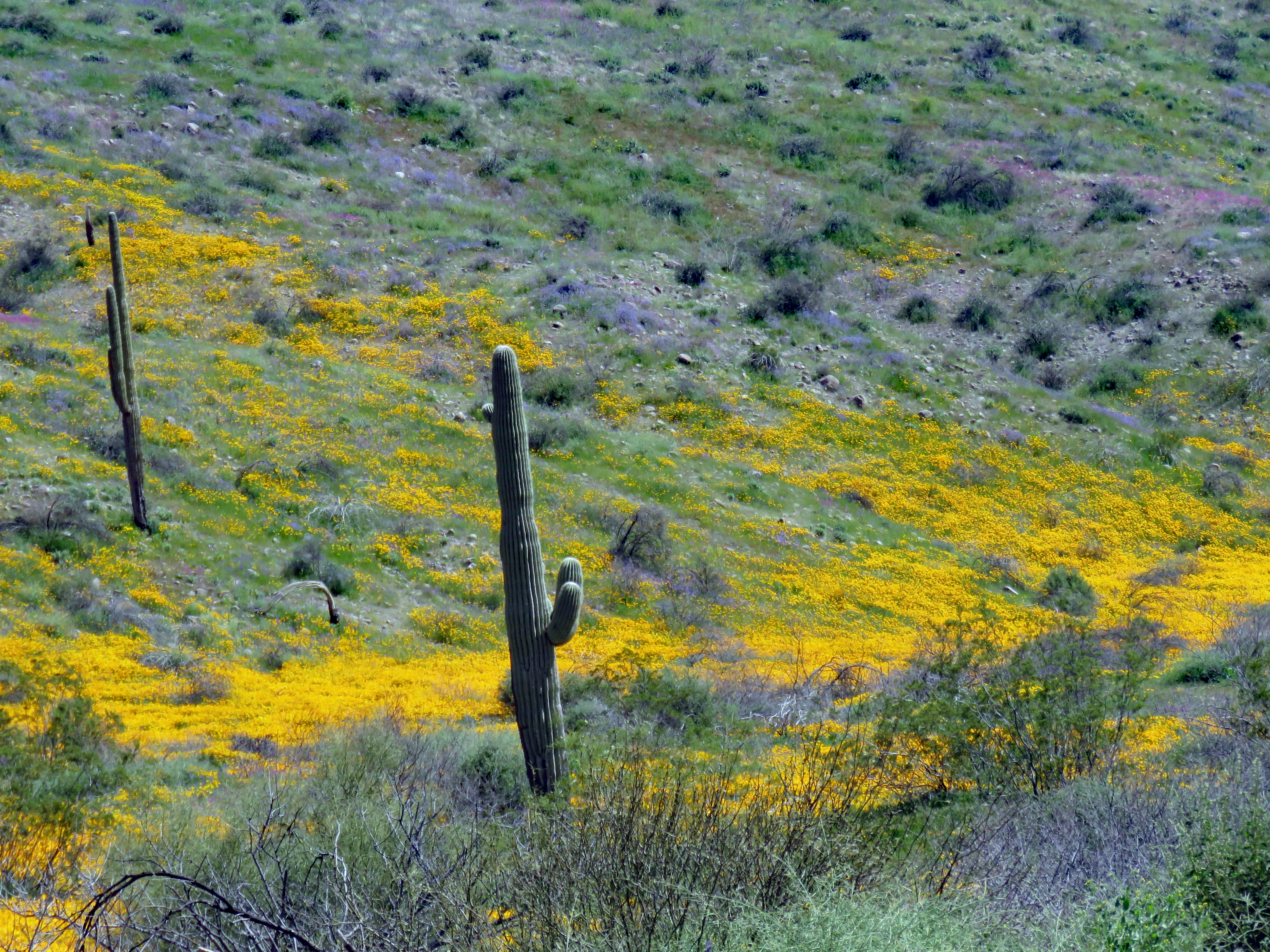
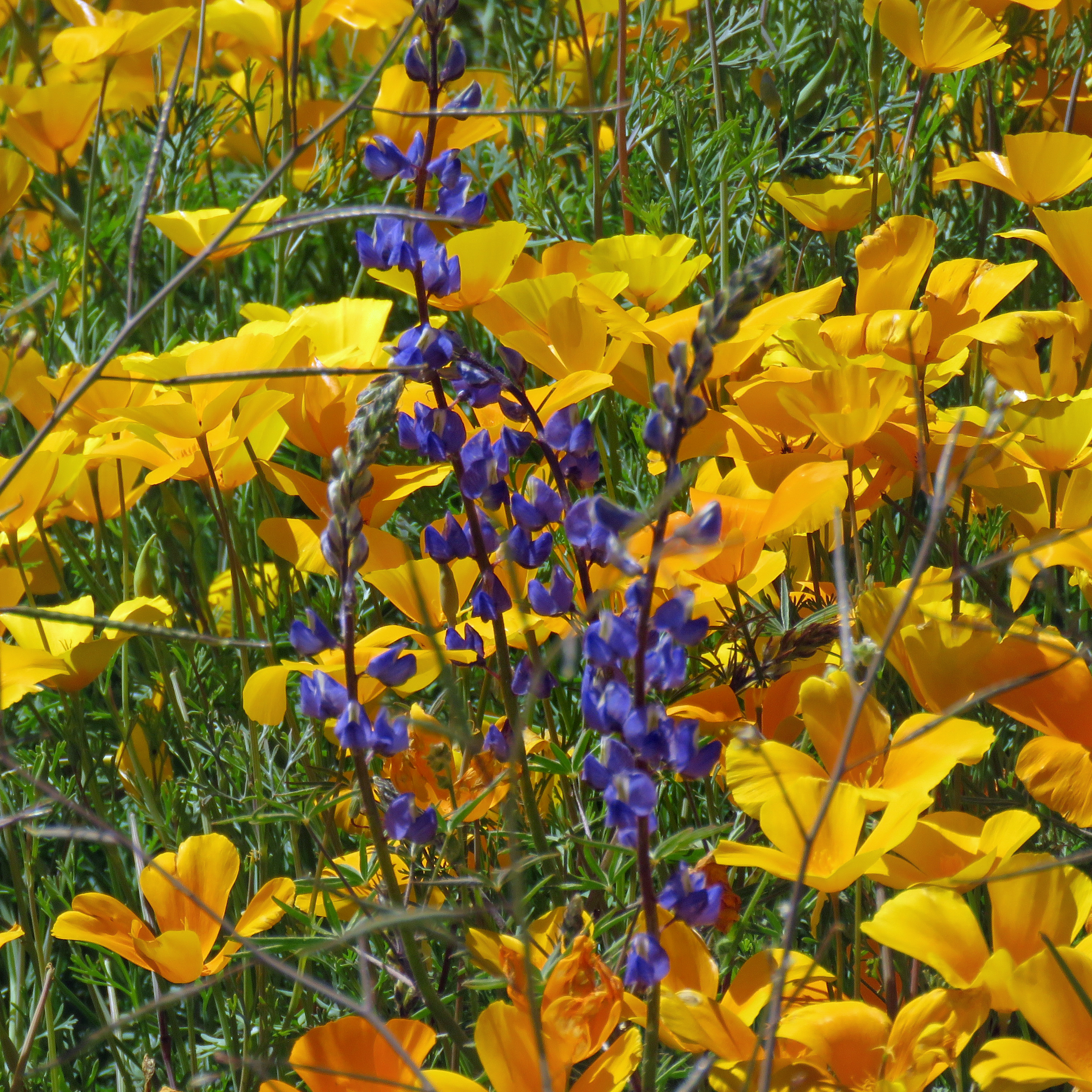
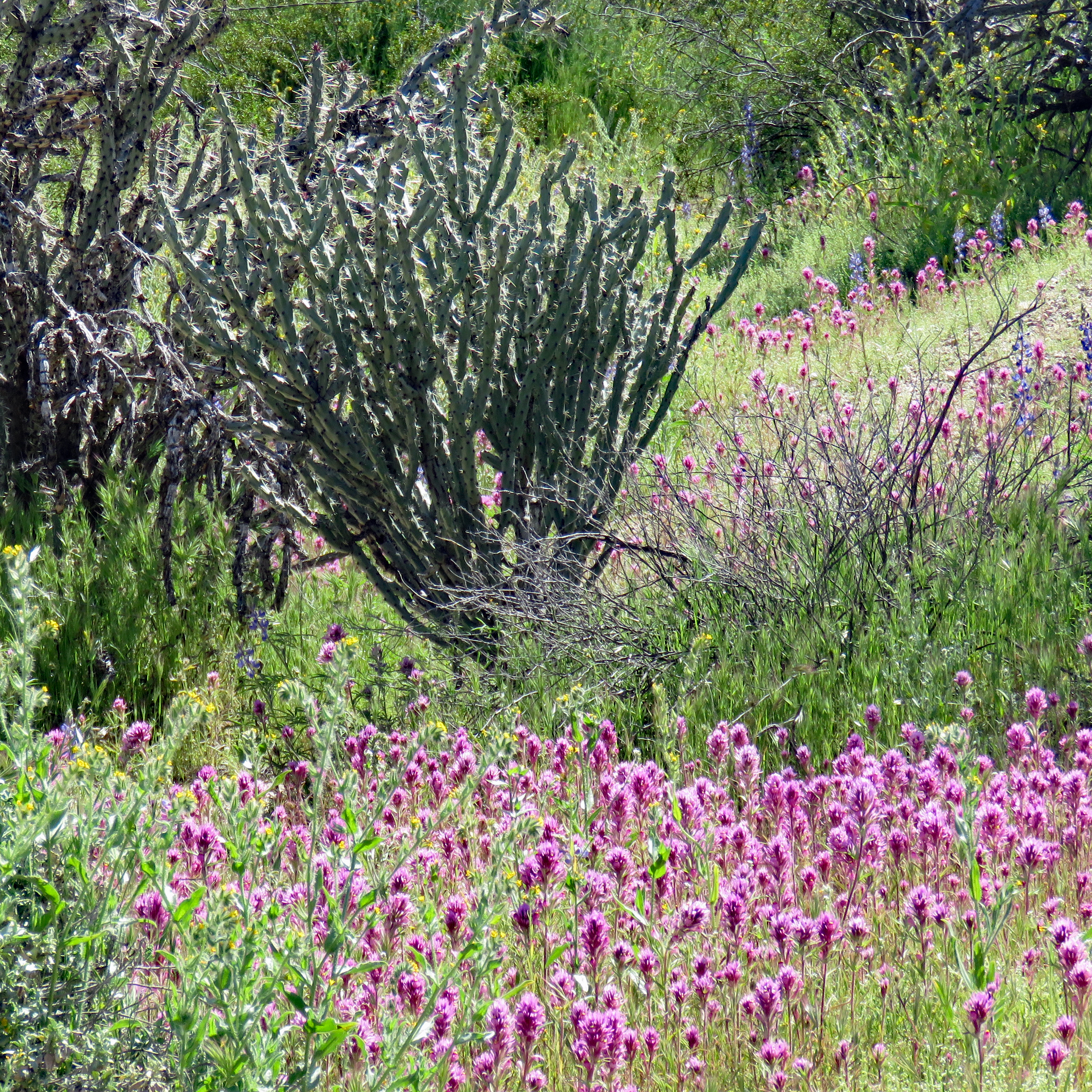
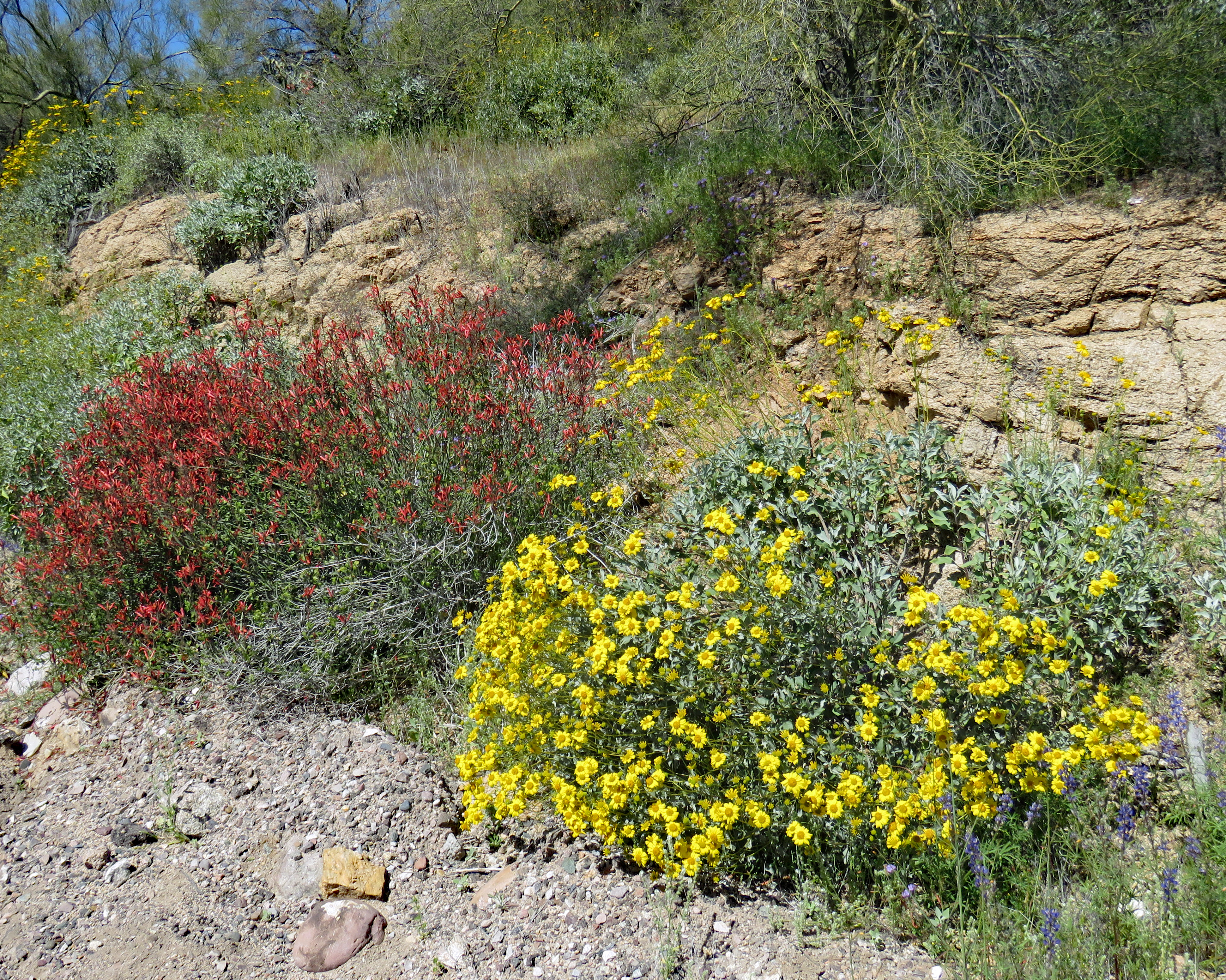
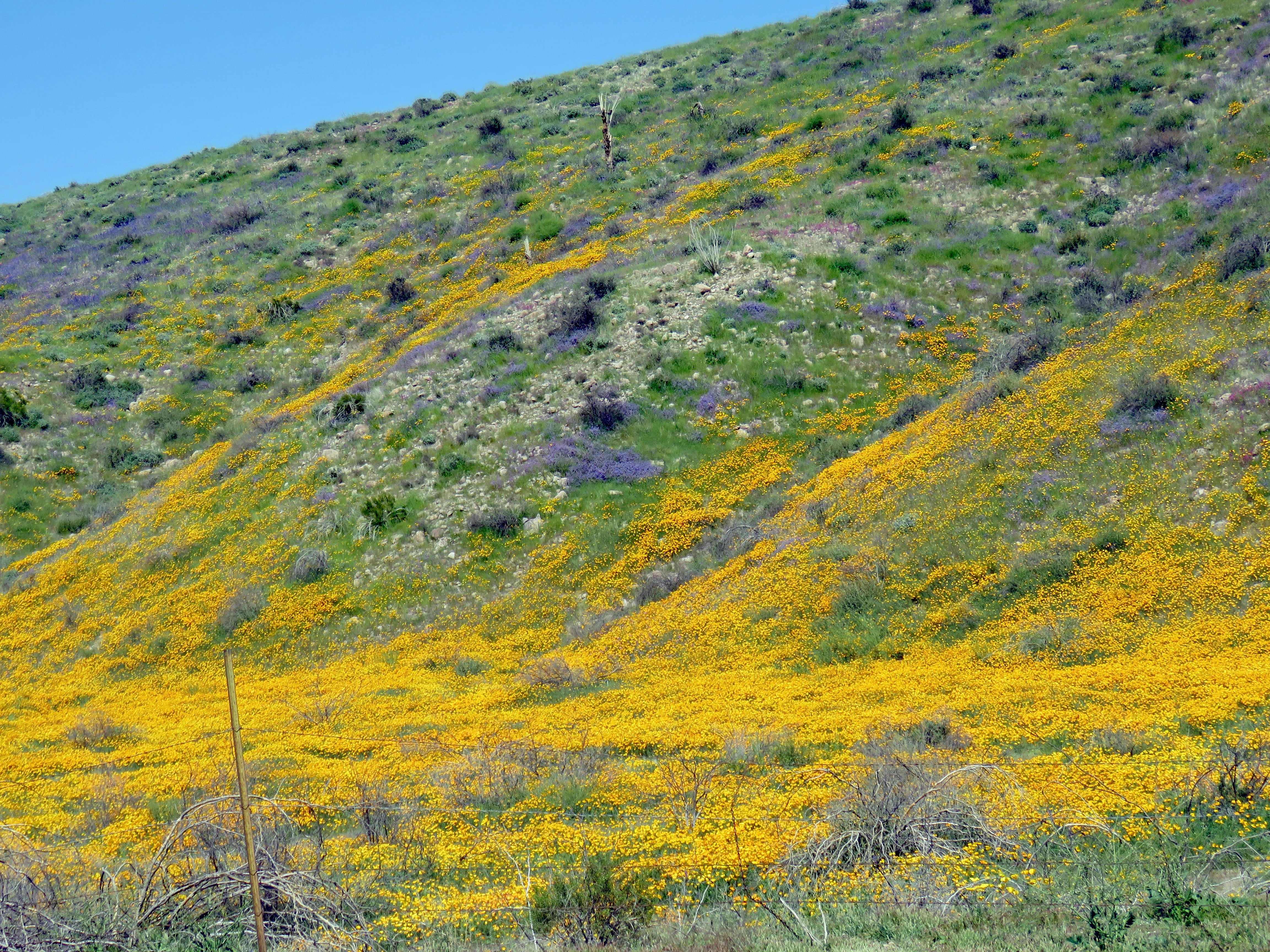
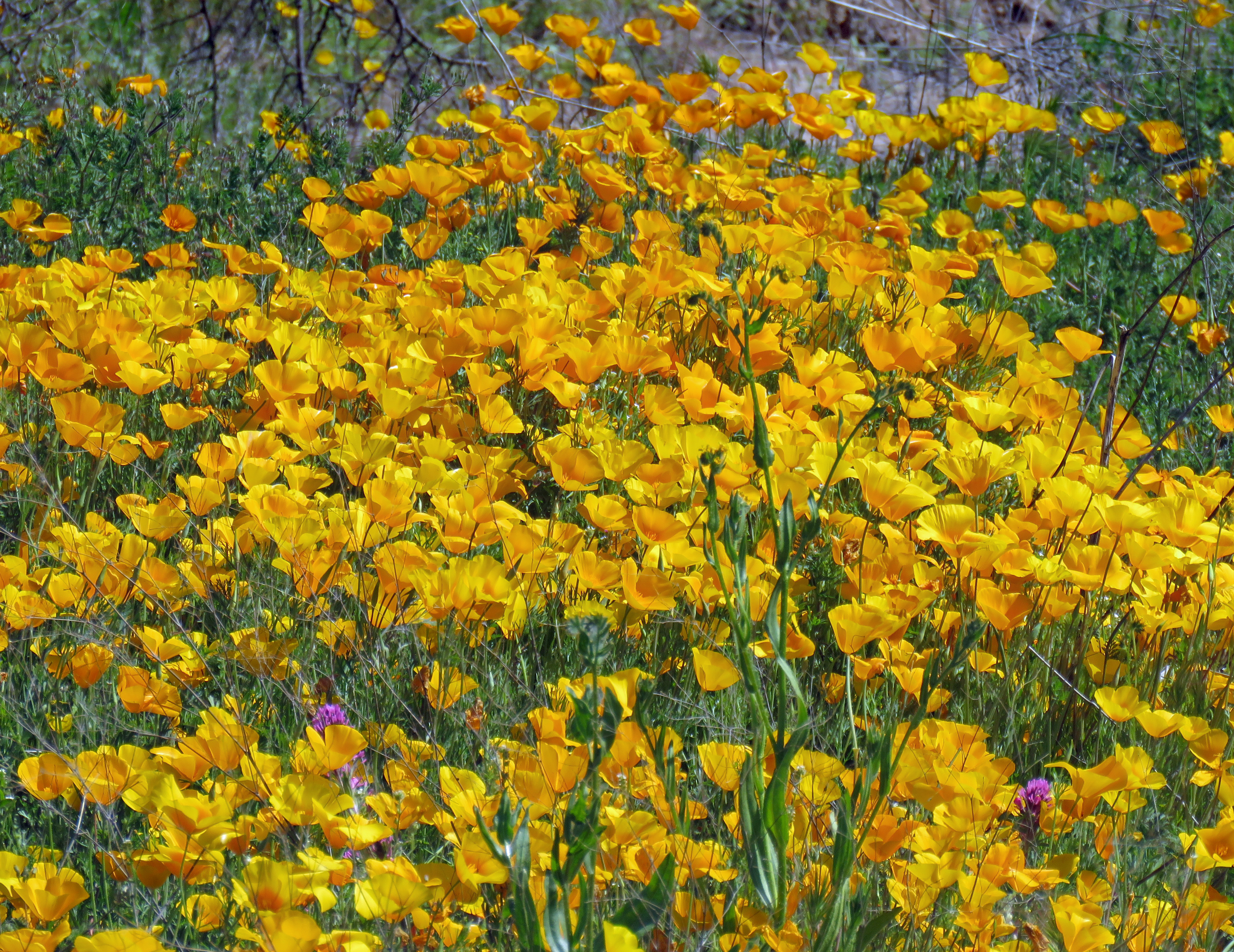
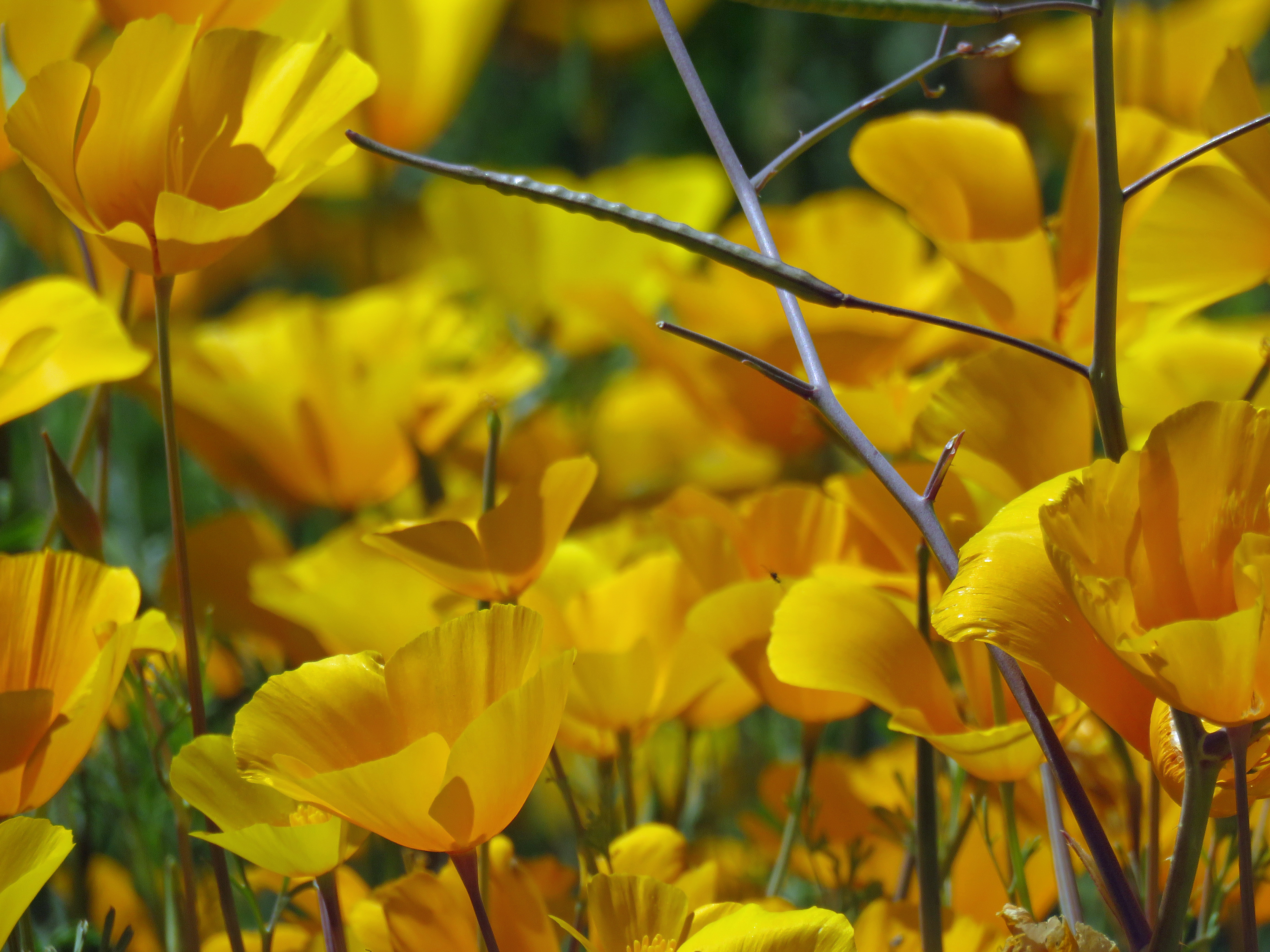
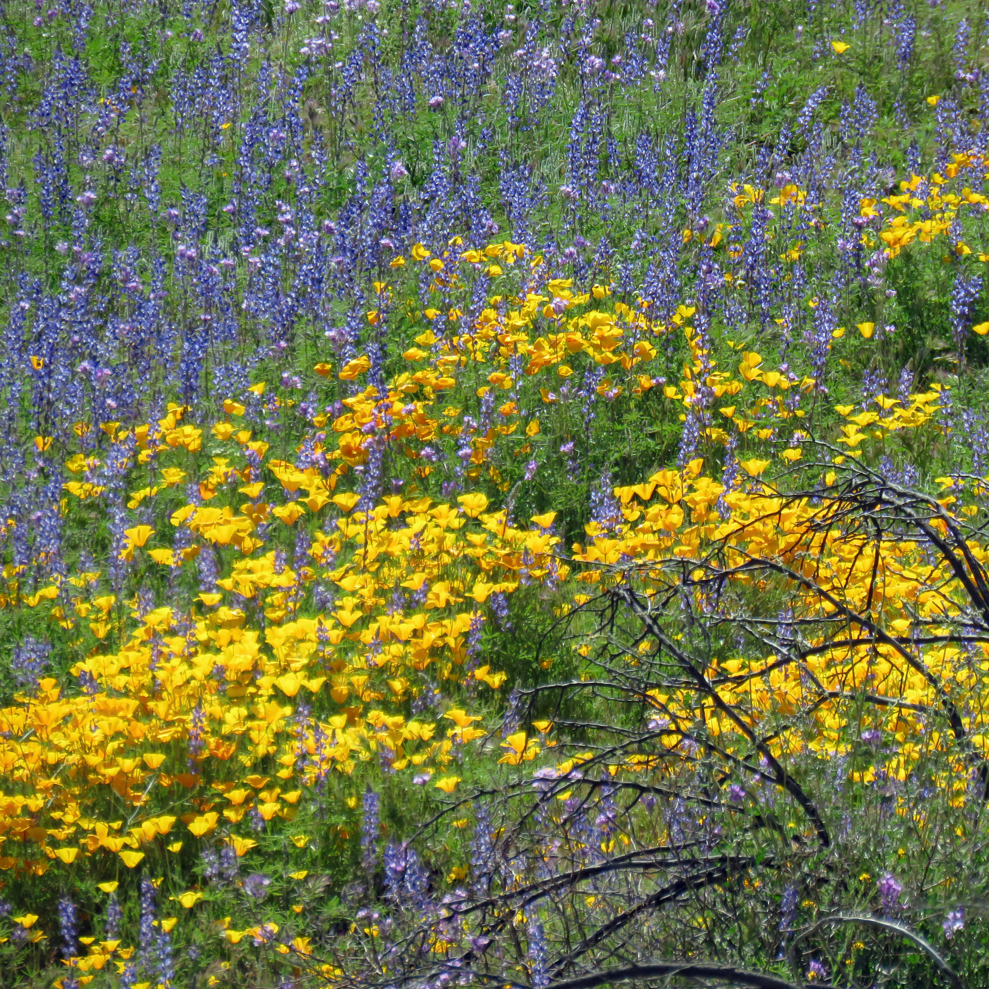
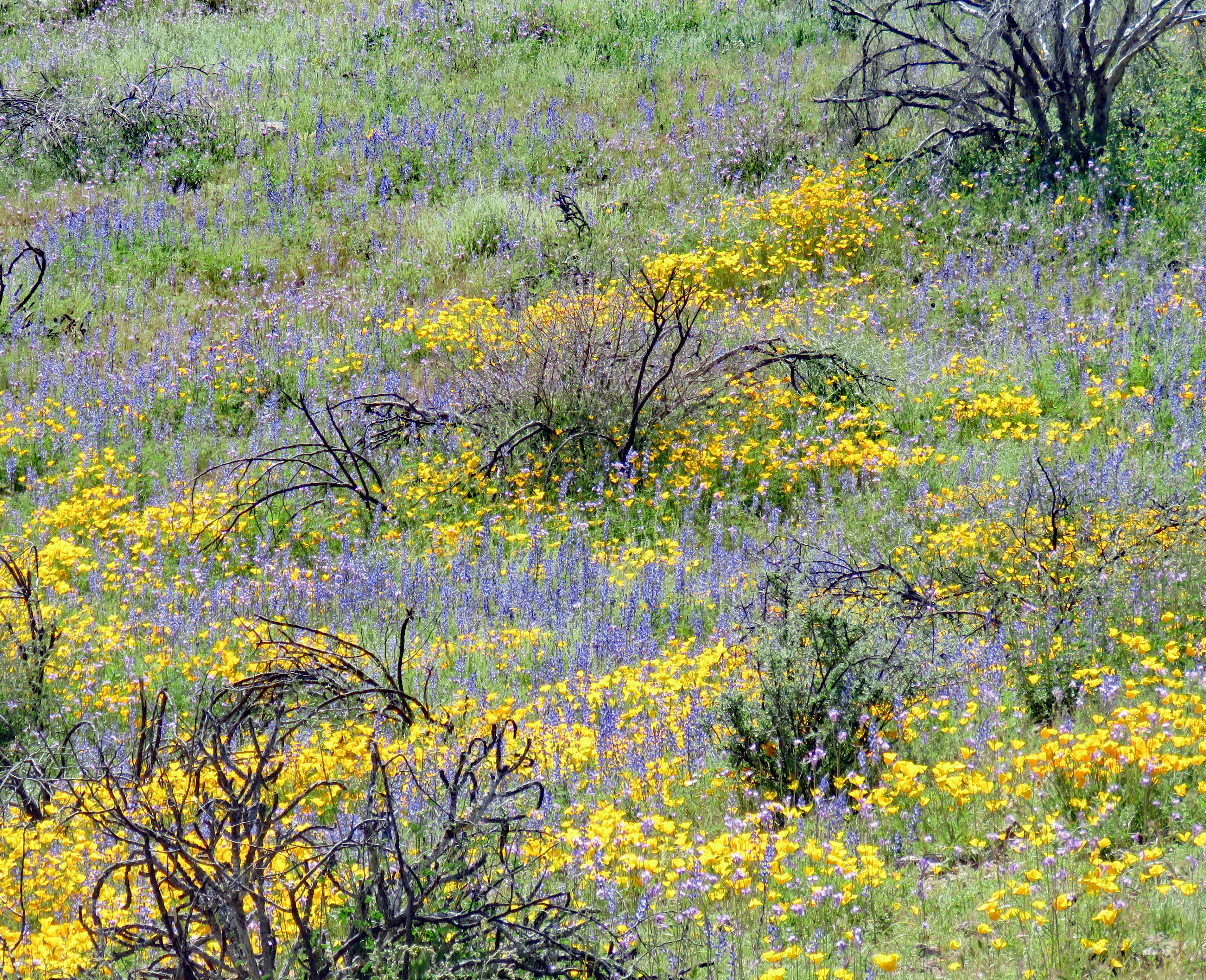
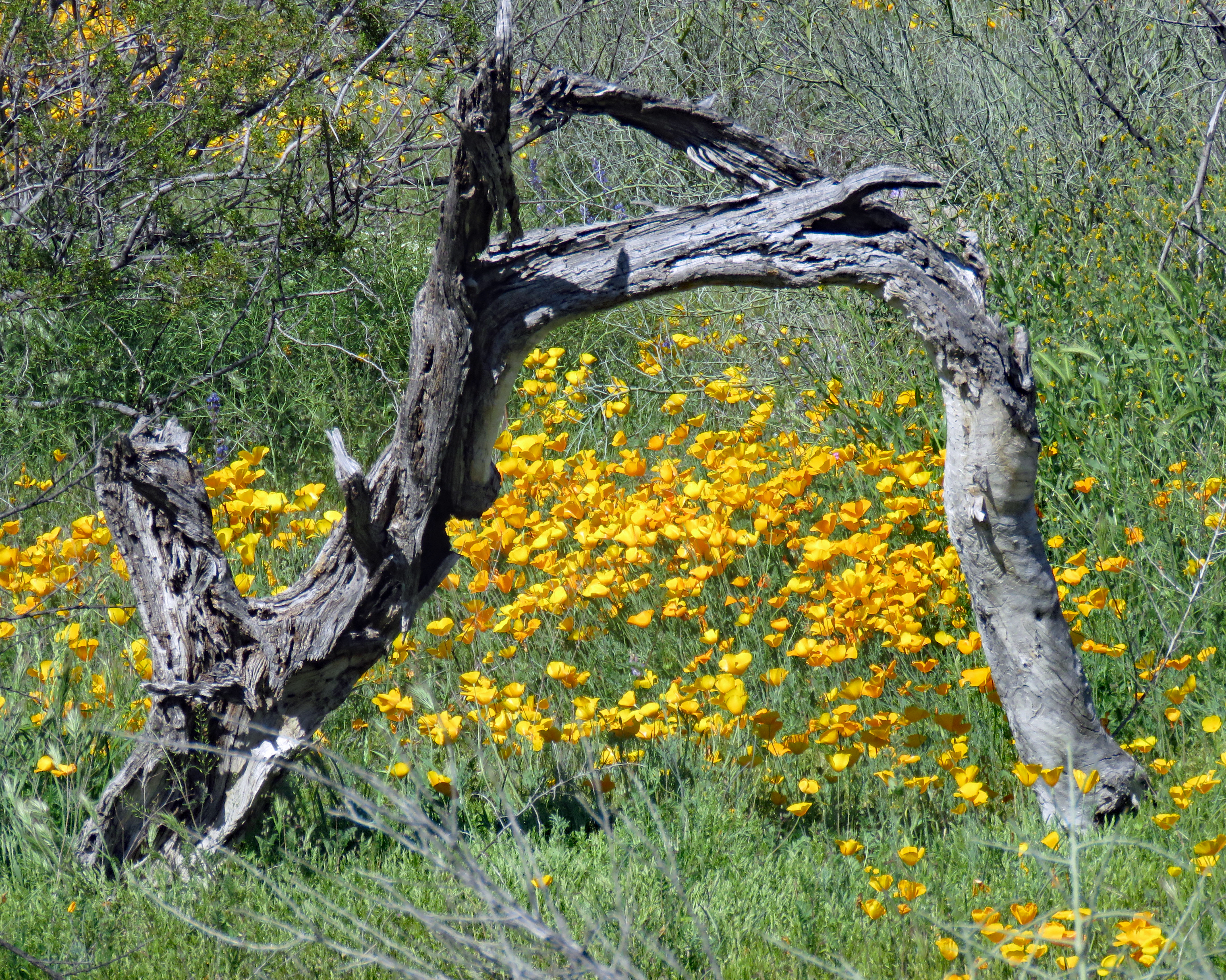
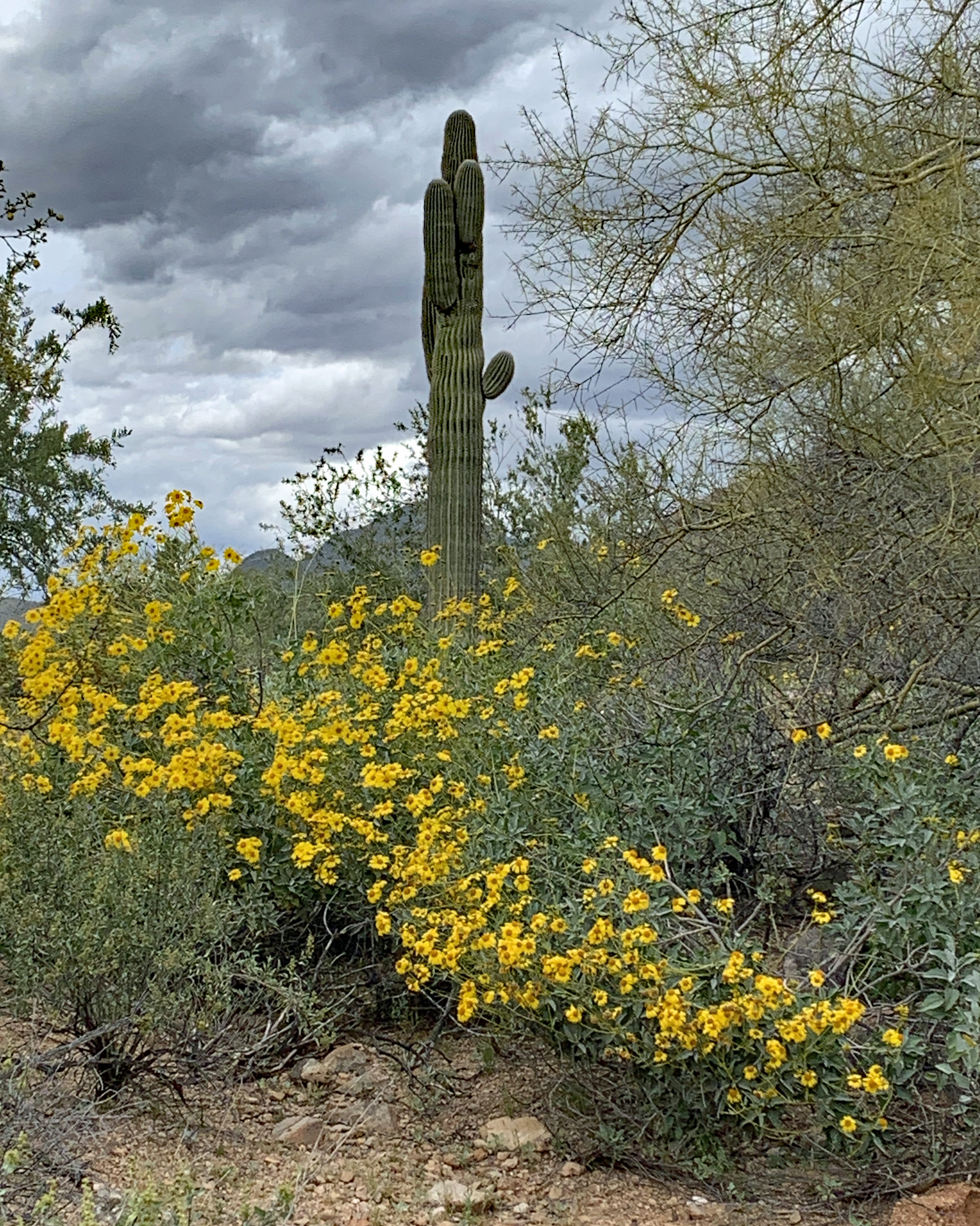
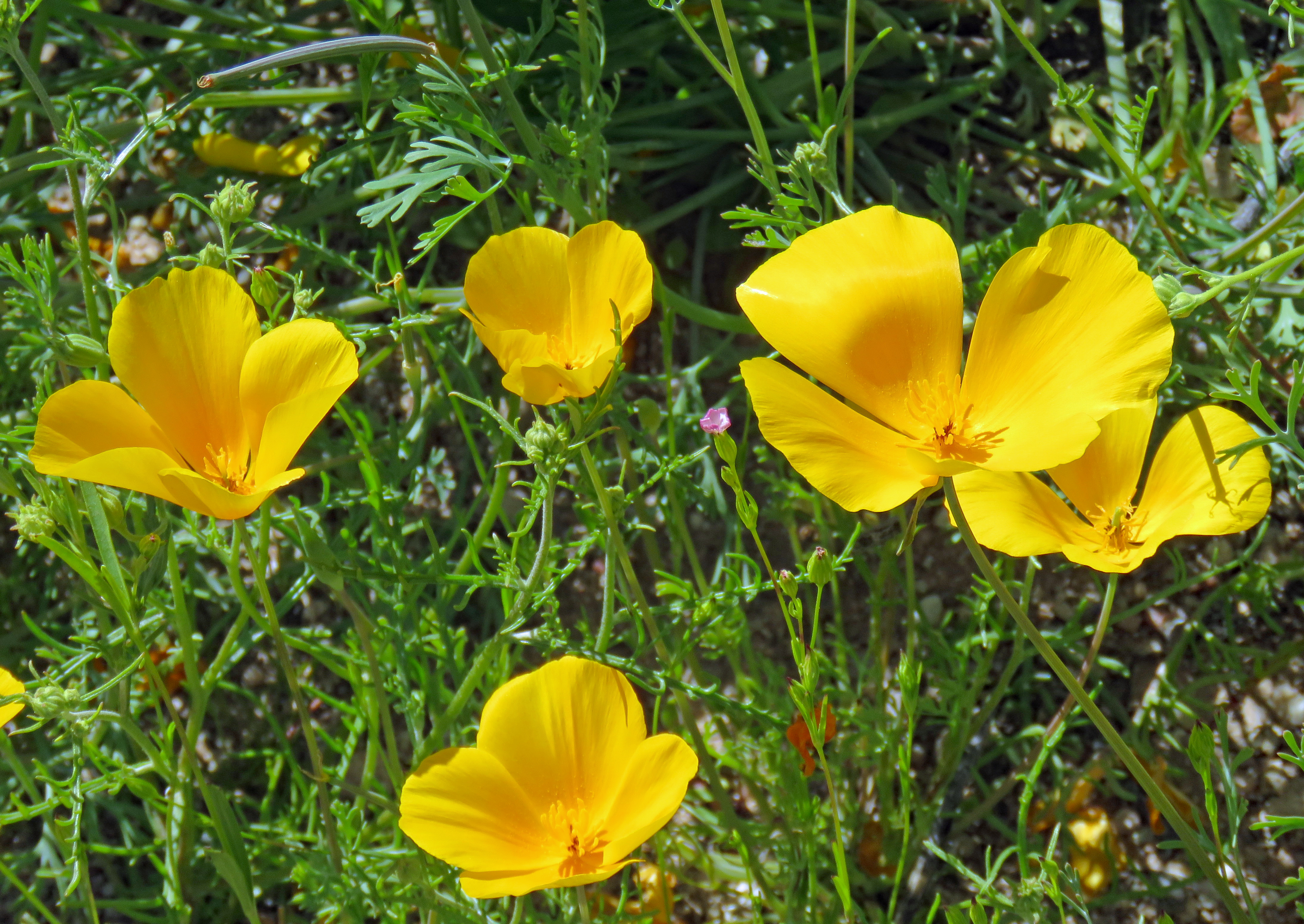
At the end of March, we made a quick trip to the Valley of the Sun. Due to a wet winter, the wildflowers were blooming in wild profusion. Northeast of Phoenix on the Bush Highway between Saguaro Lake and Hwy 87 we found amazing displays. It was impossible to see the massive fields of yellow poppies and not just feel happy. They were so amazing you had to smile. There were other wildflowers – brittlebush, lupines, wild clover and more – that helped emphasize the brilliance of the poppies but the poppies dancing in the breeze stole the show.
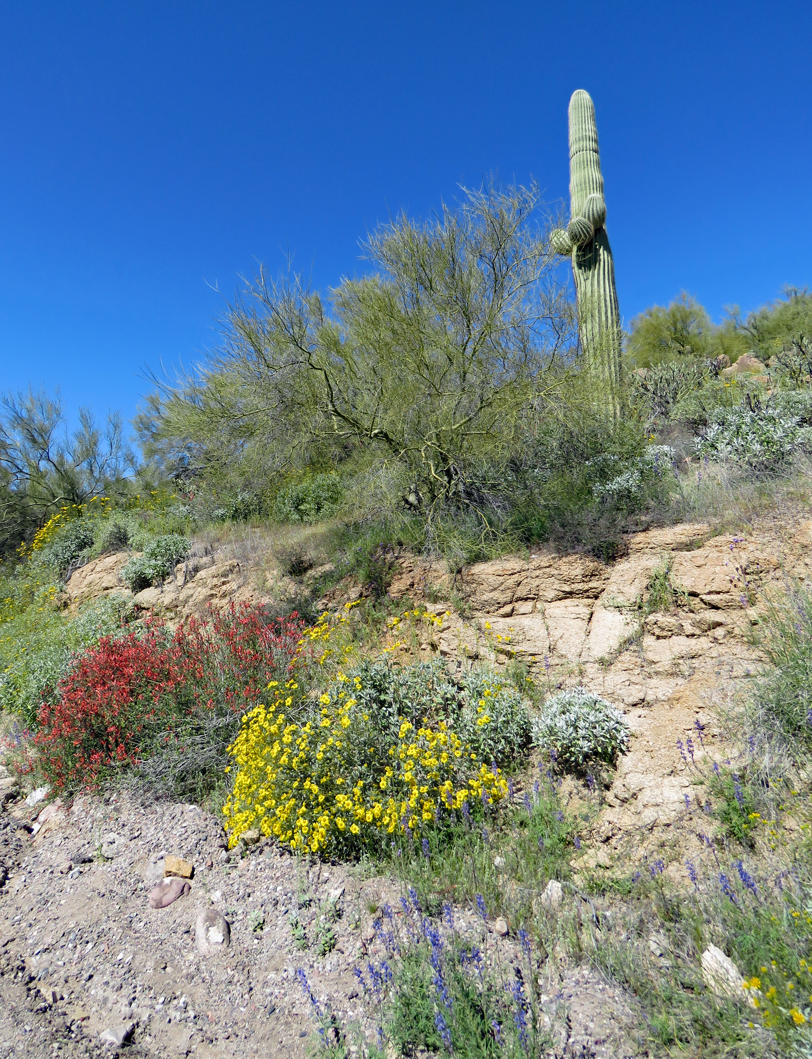
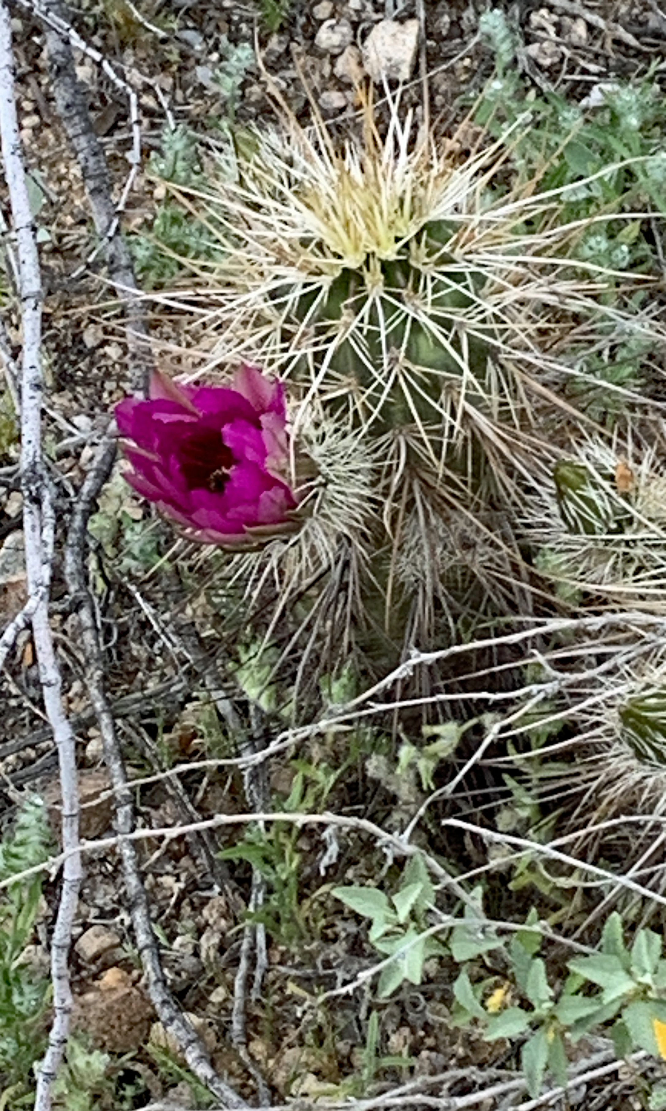
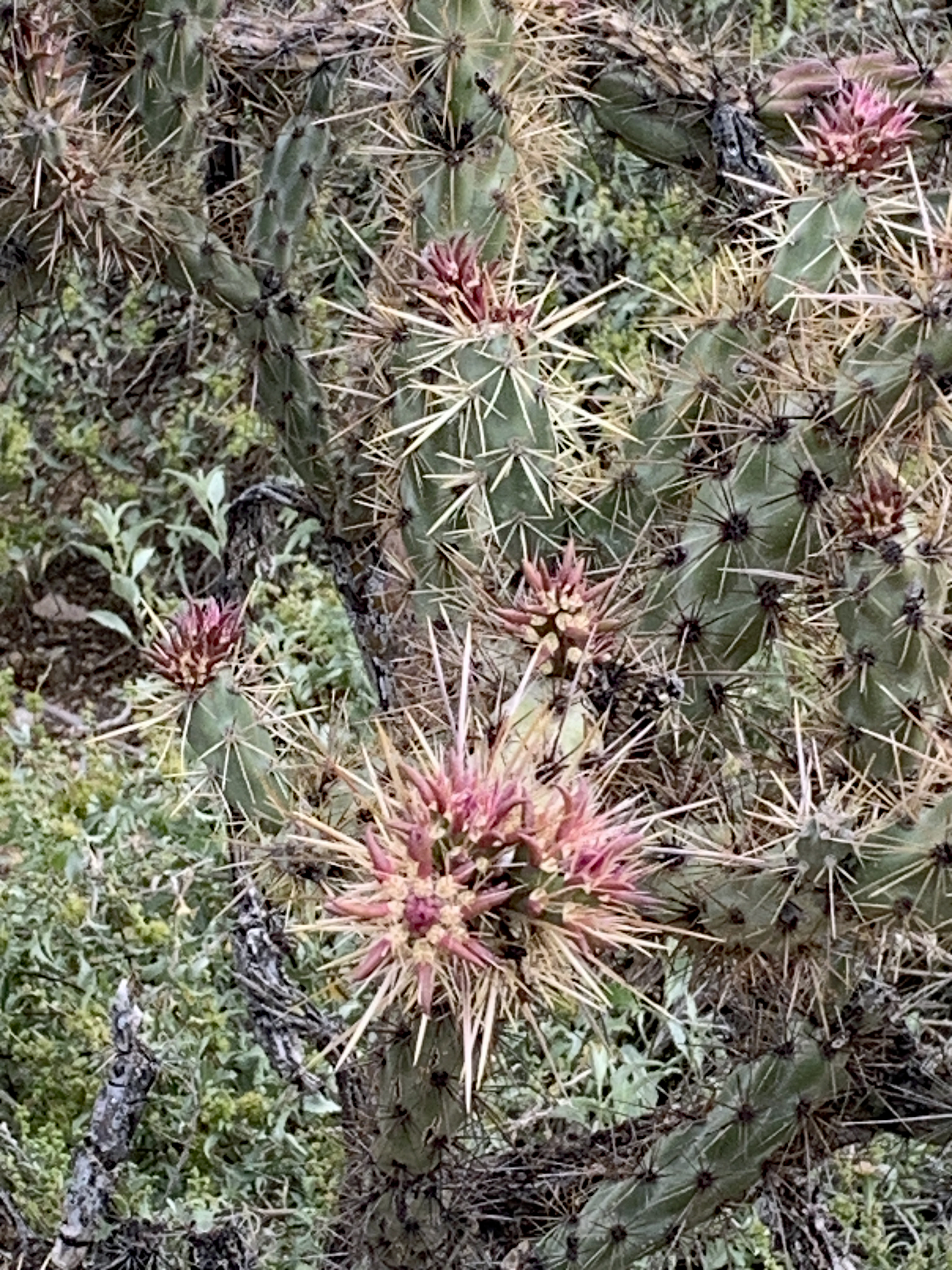
The Nature Trail at Scottsdale Mayo Clinic provided a different kind of “flowery” experience. The cacti aren’t quite blooming yet but they are promising to show off soon too.
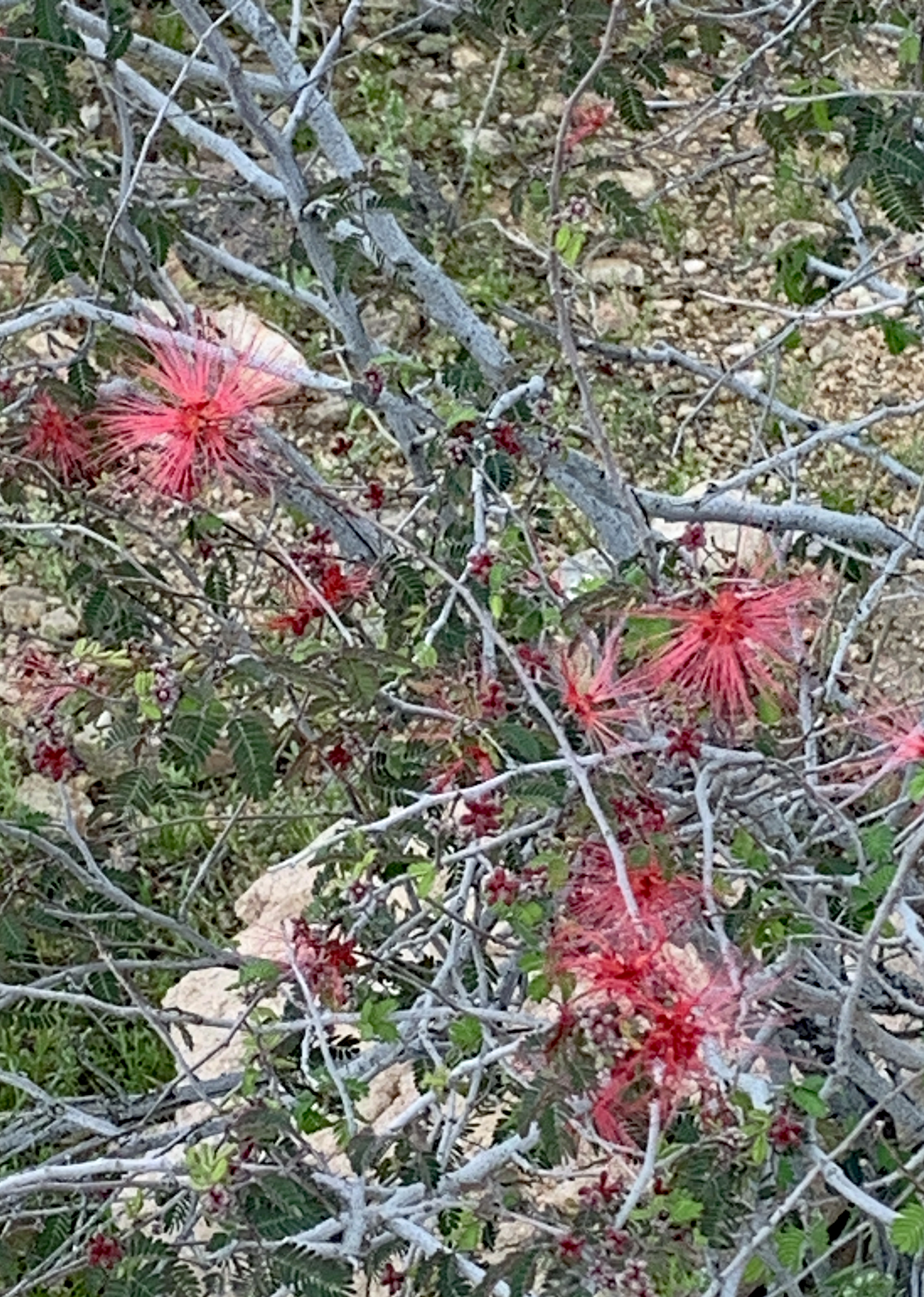
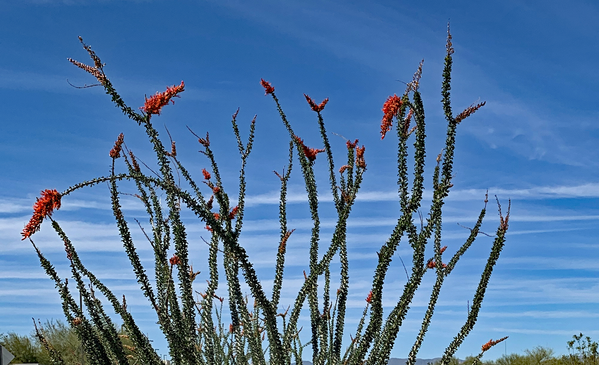
We found fairy duster bushes, brittlebush and an ocotillo in full bloom.
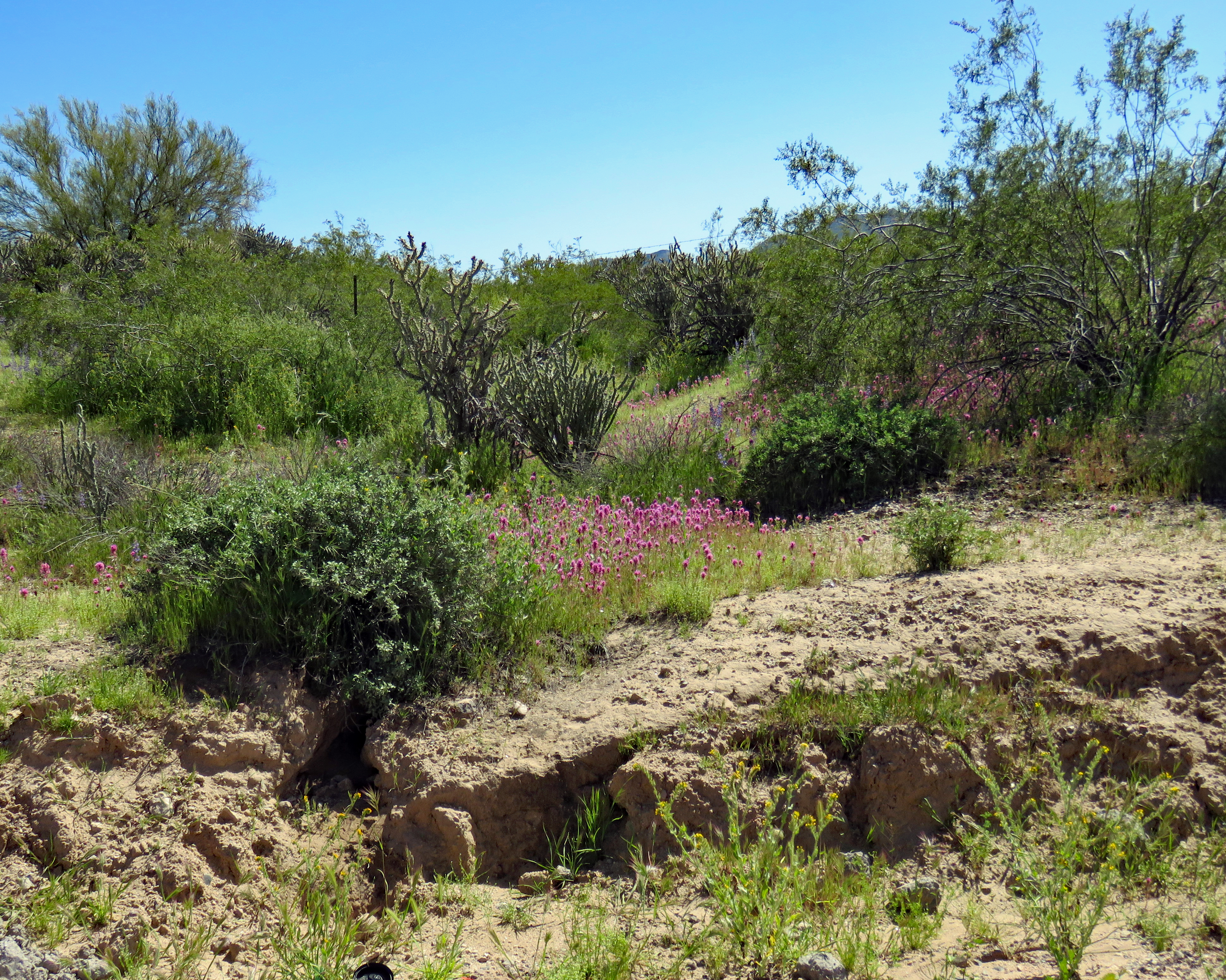
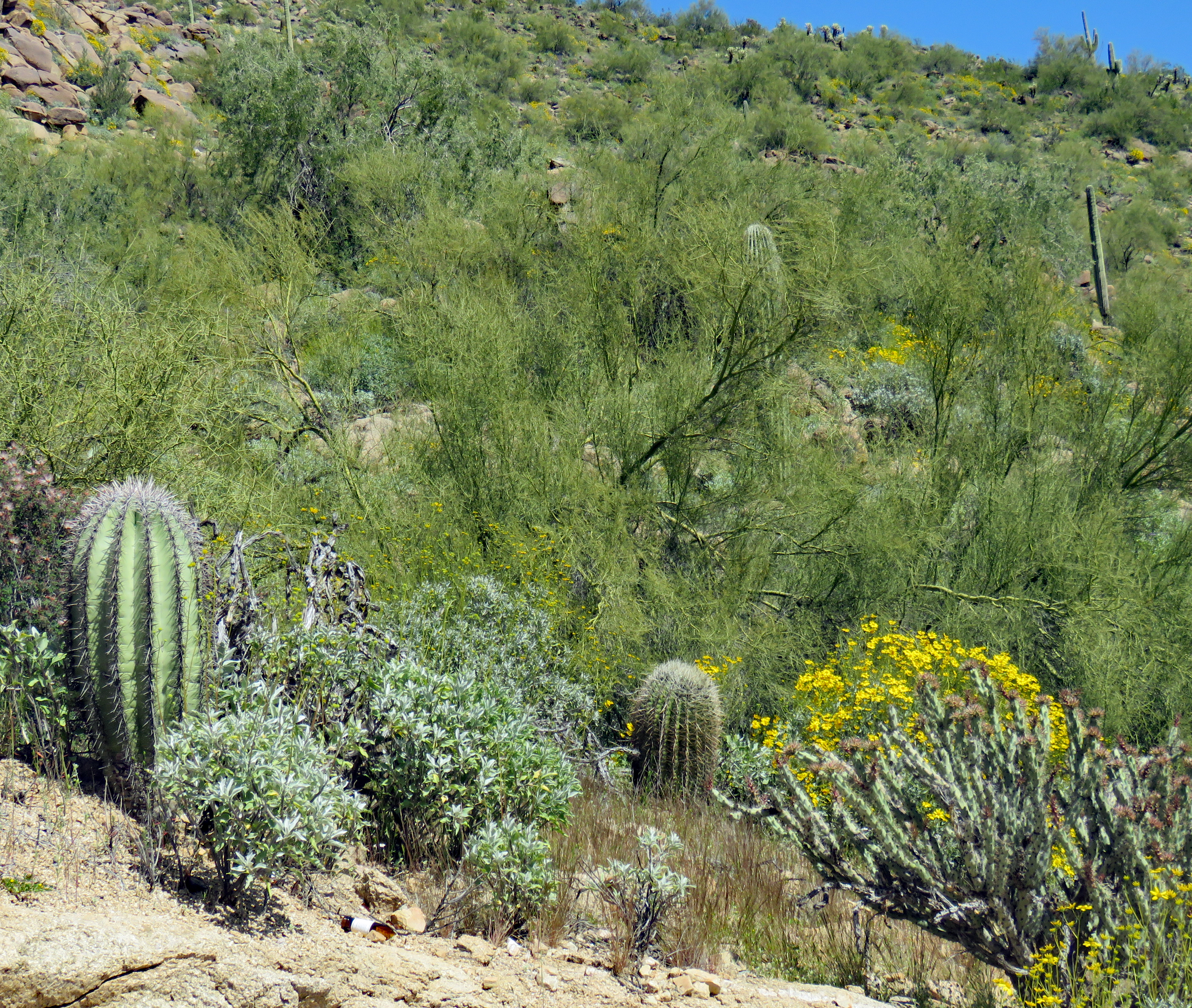
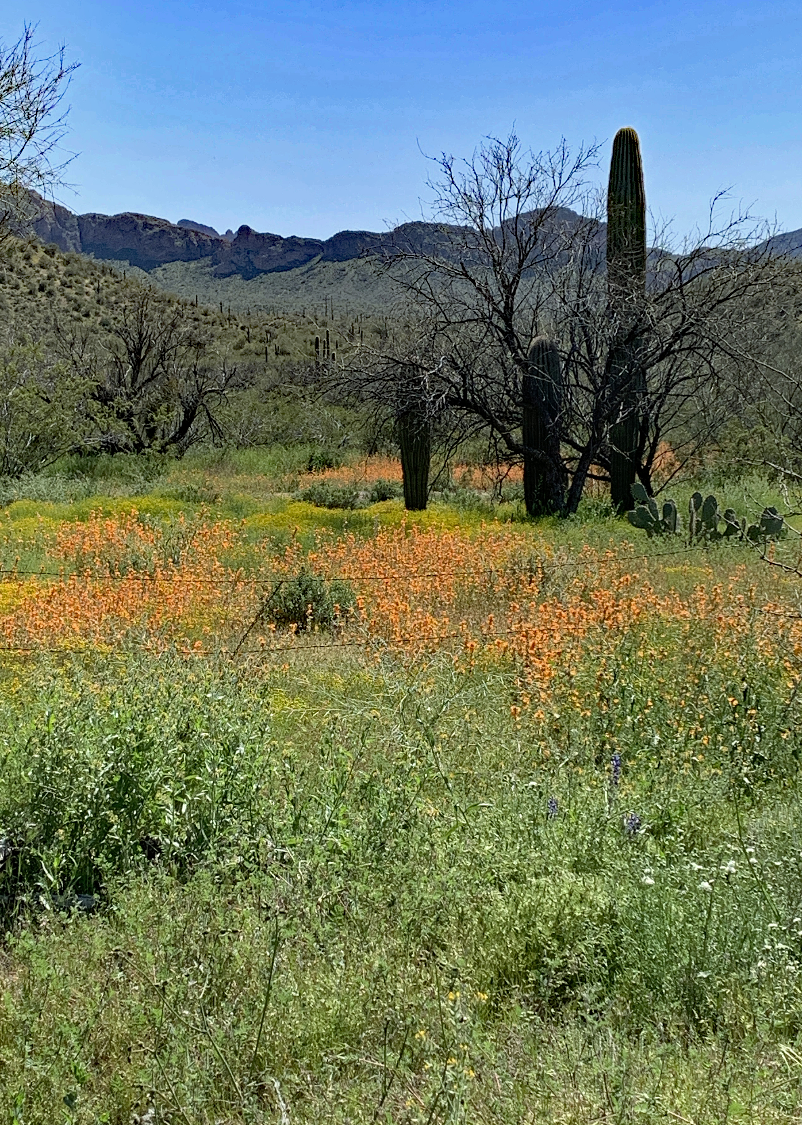
The desert was extraordinarily green and Mother Nature was demonstrating why Spring is such a joyous time full of hope.
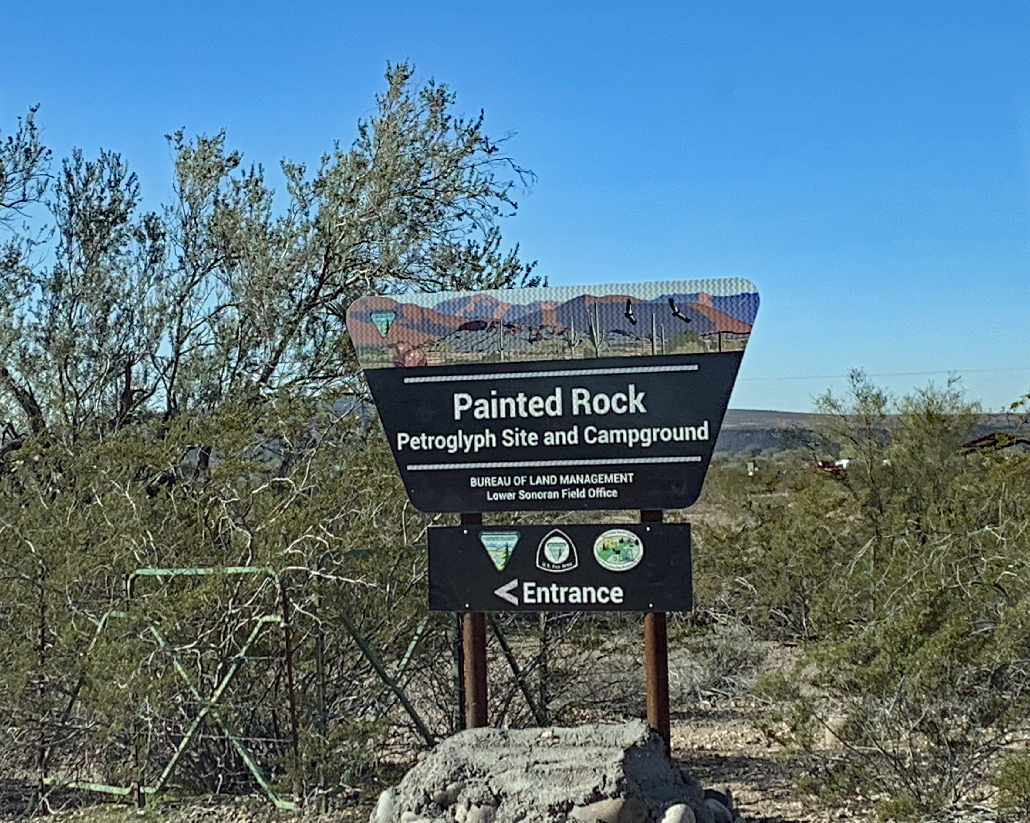
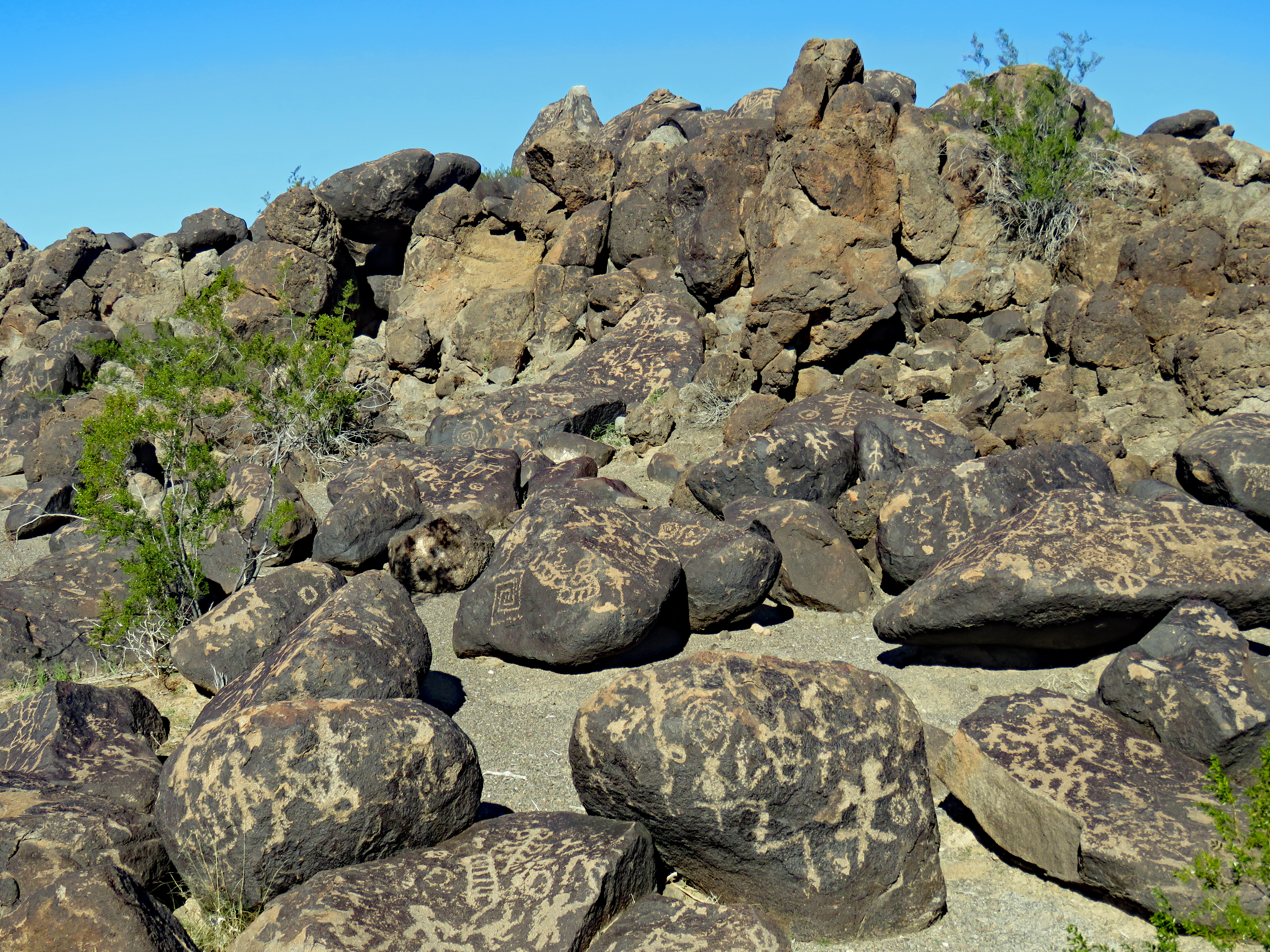
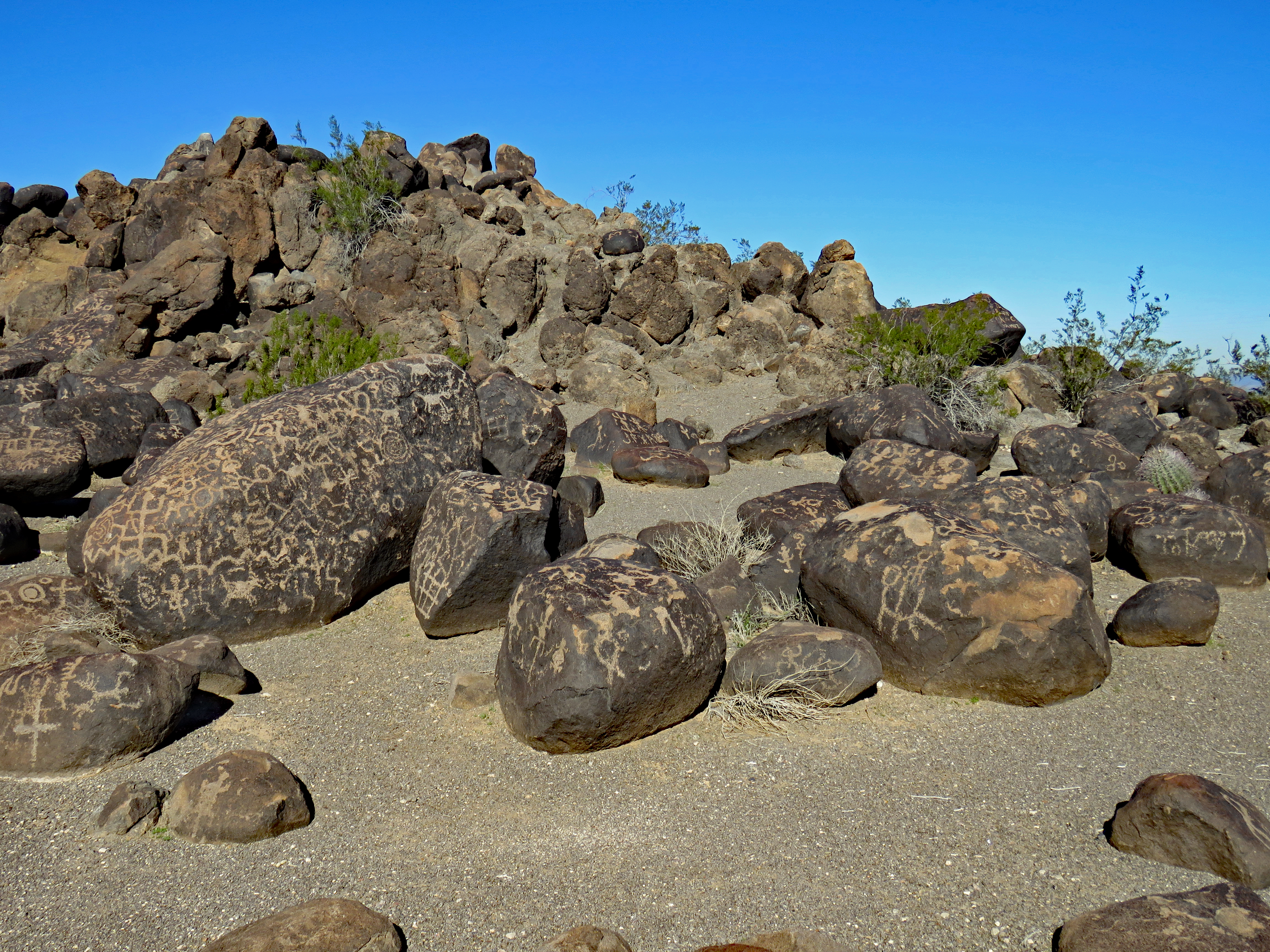
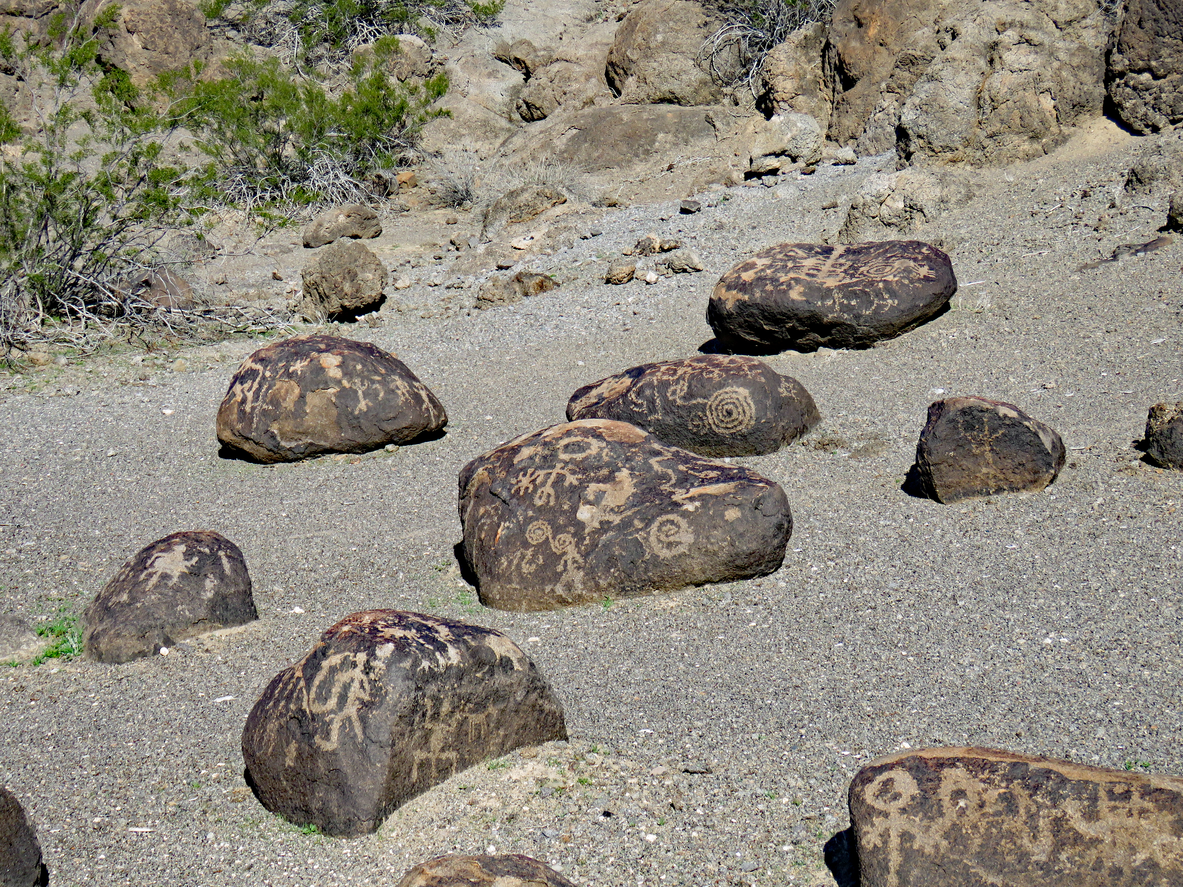
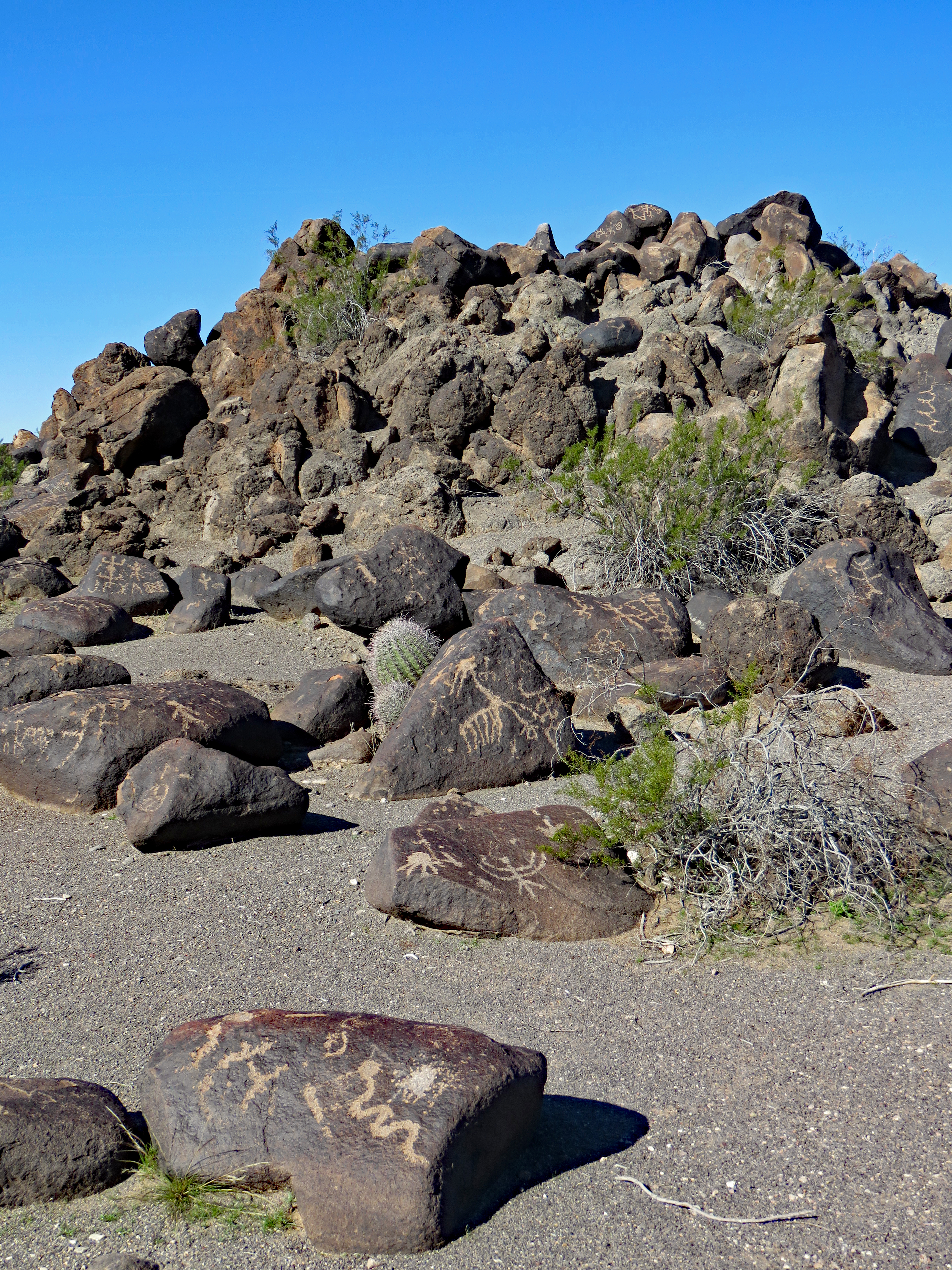
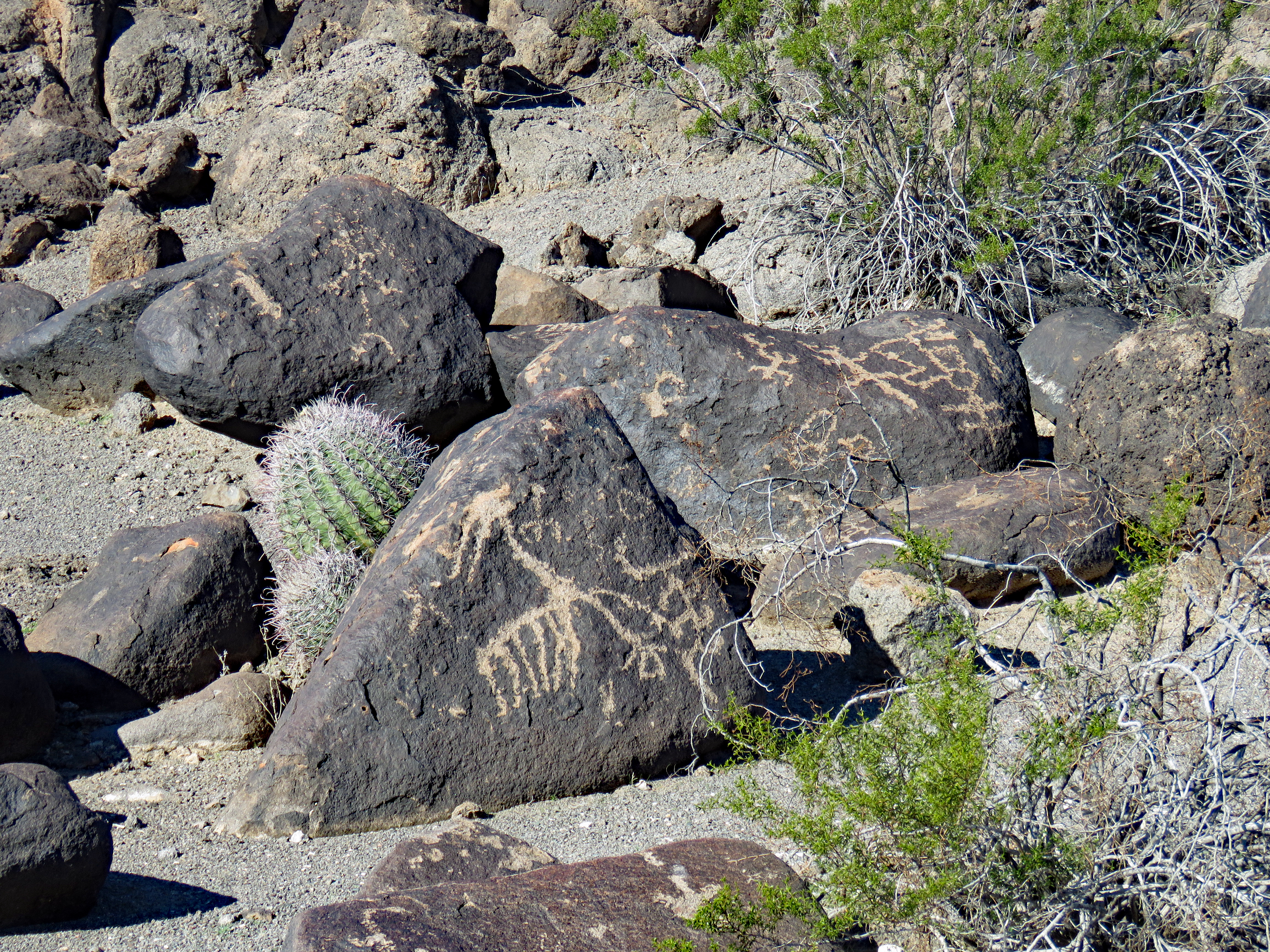
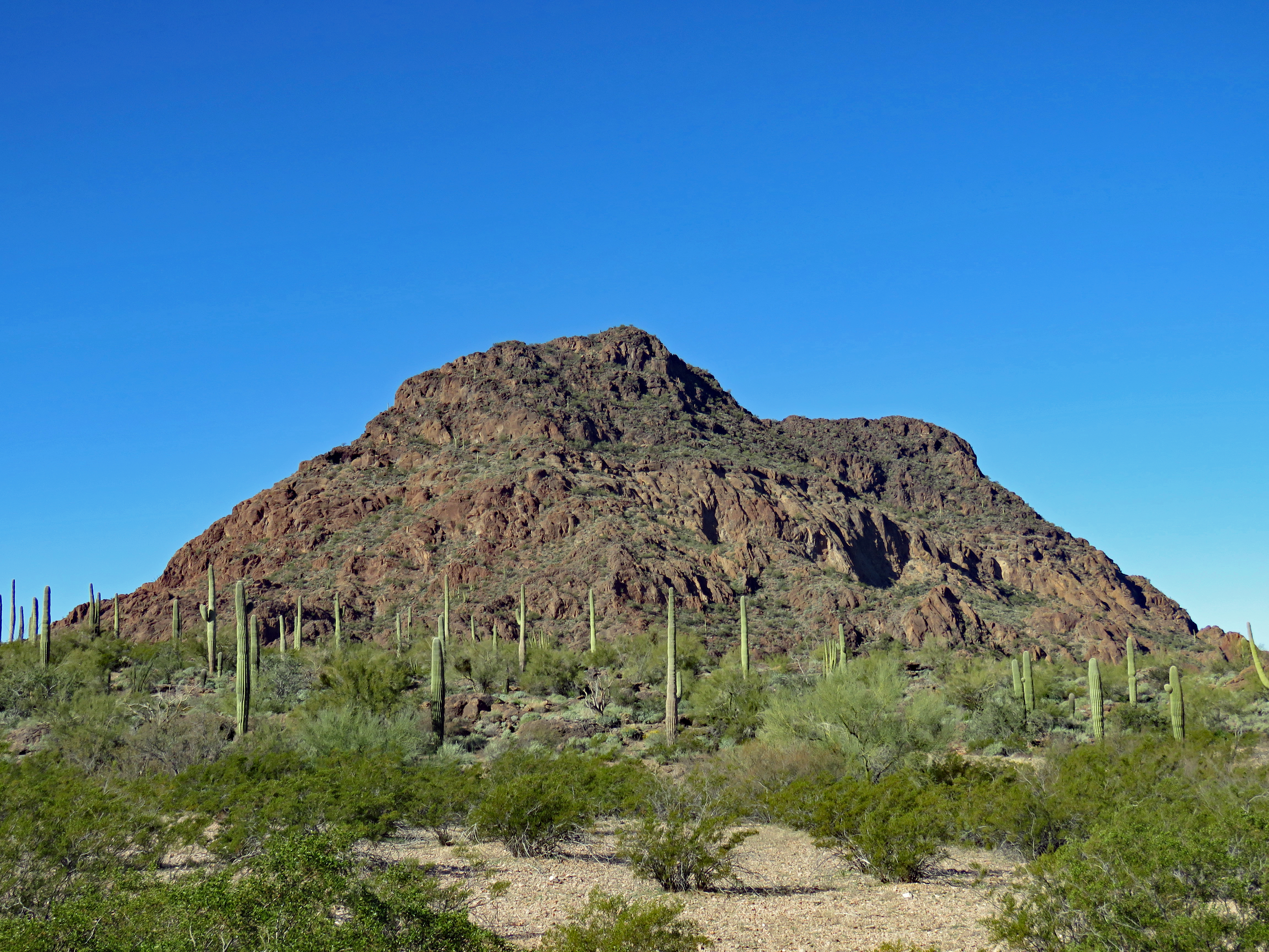
Painted Rock Petroglyph Site in Arizona was something I stumbled across when planning our trip to Organ Pipe Cactus National Monument. Since I’m always interested in petroglyphs and our country’s history and prehistory, I inserted Painted Rock into our itinerary and it proved to be well worth the extra miles and time.
This site is quite surprising in a number of ways.
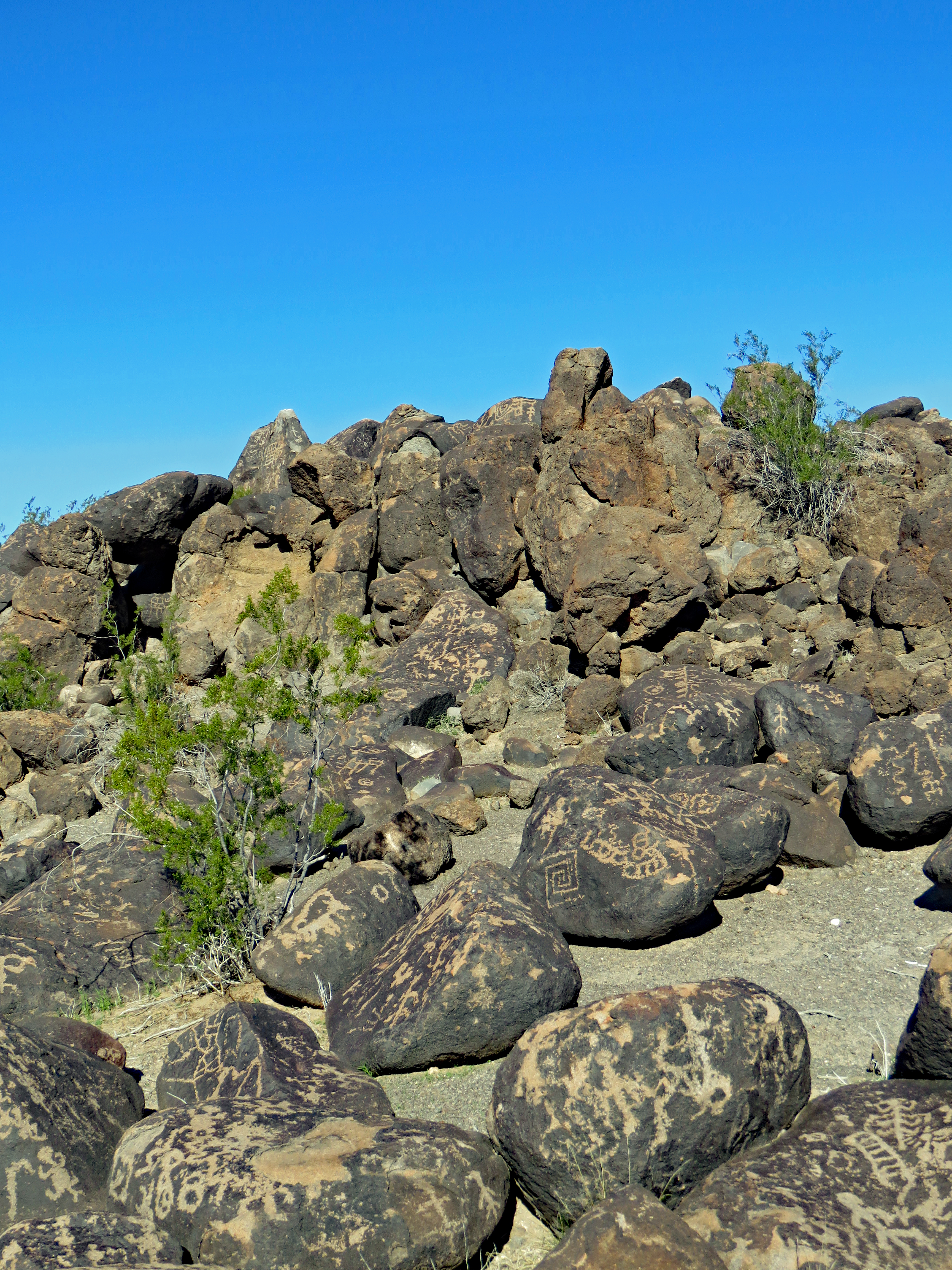
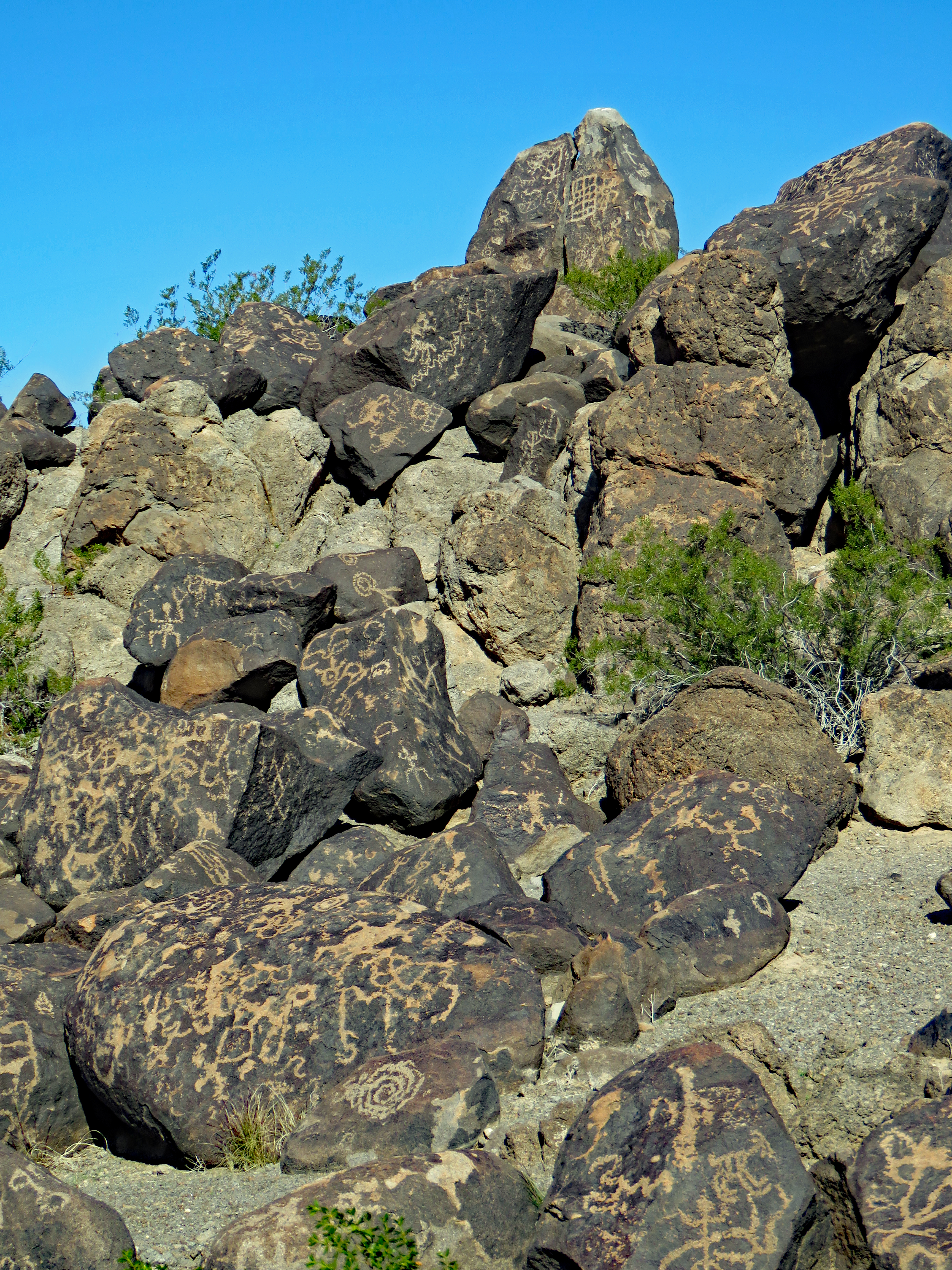
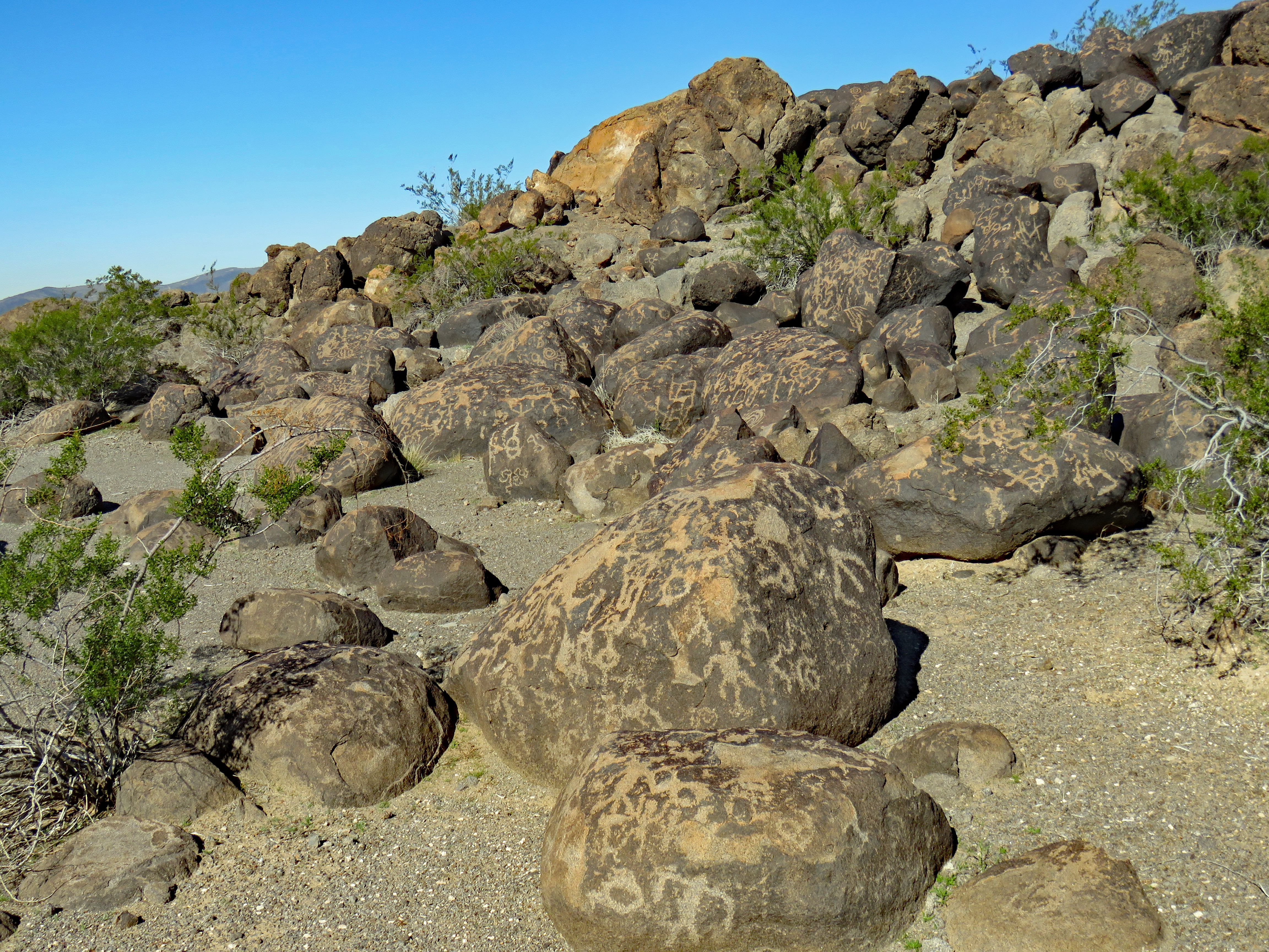
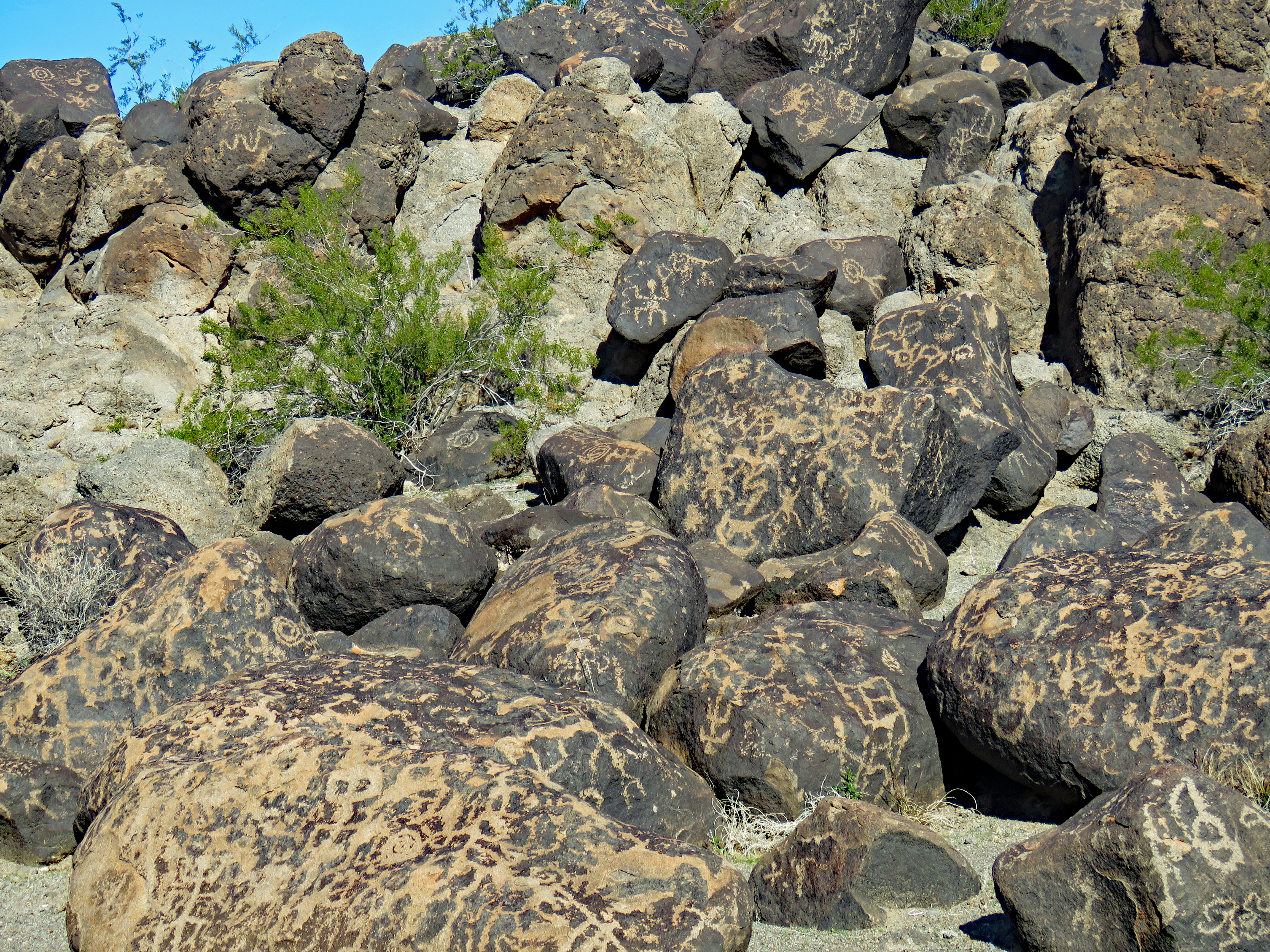
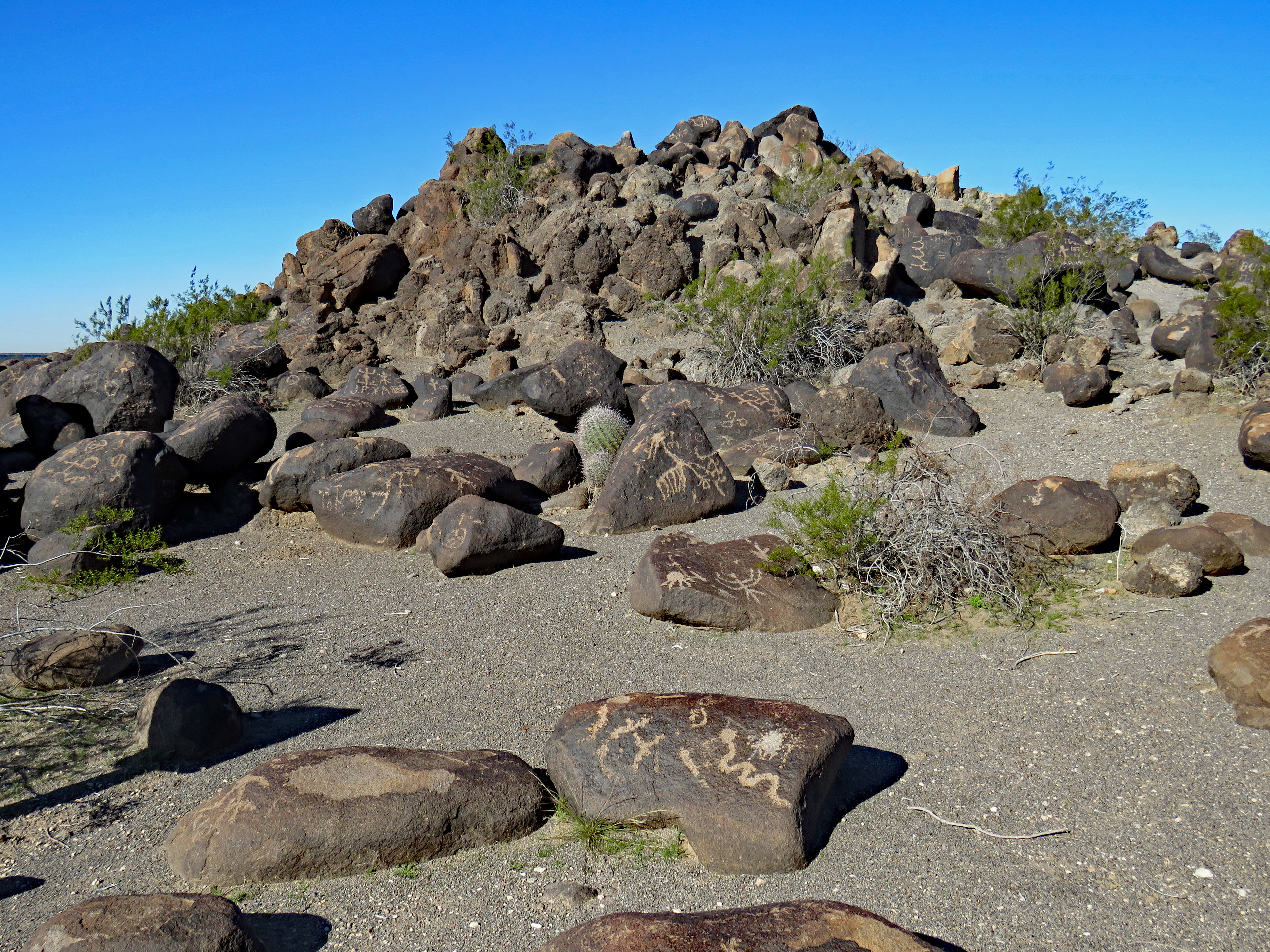
In area the site is not very big. It’s an oval granite outcrop overlain with basalt boulders about 400 feet long and 20 feet high with two small knob tops. The path around the whole site is roughly a quarter of a mile. This solitary outcrop stands out on a flat desert plain.
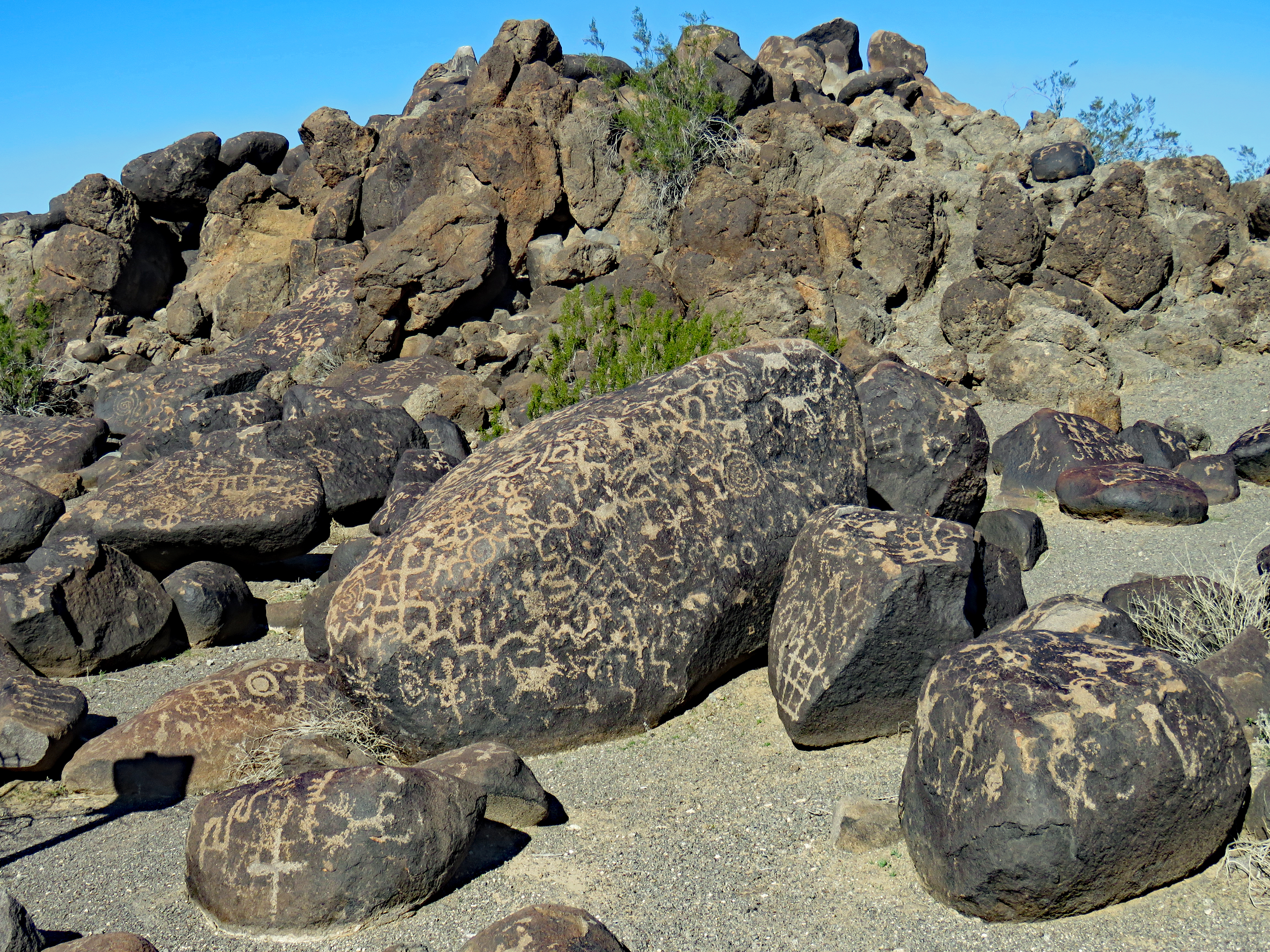
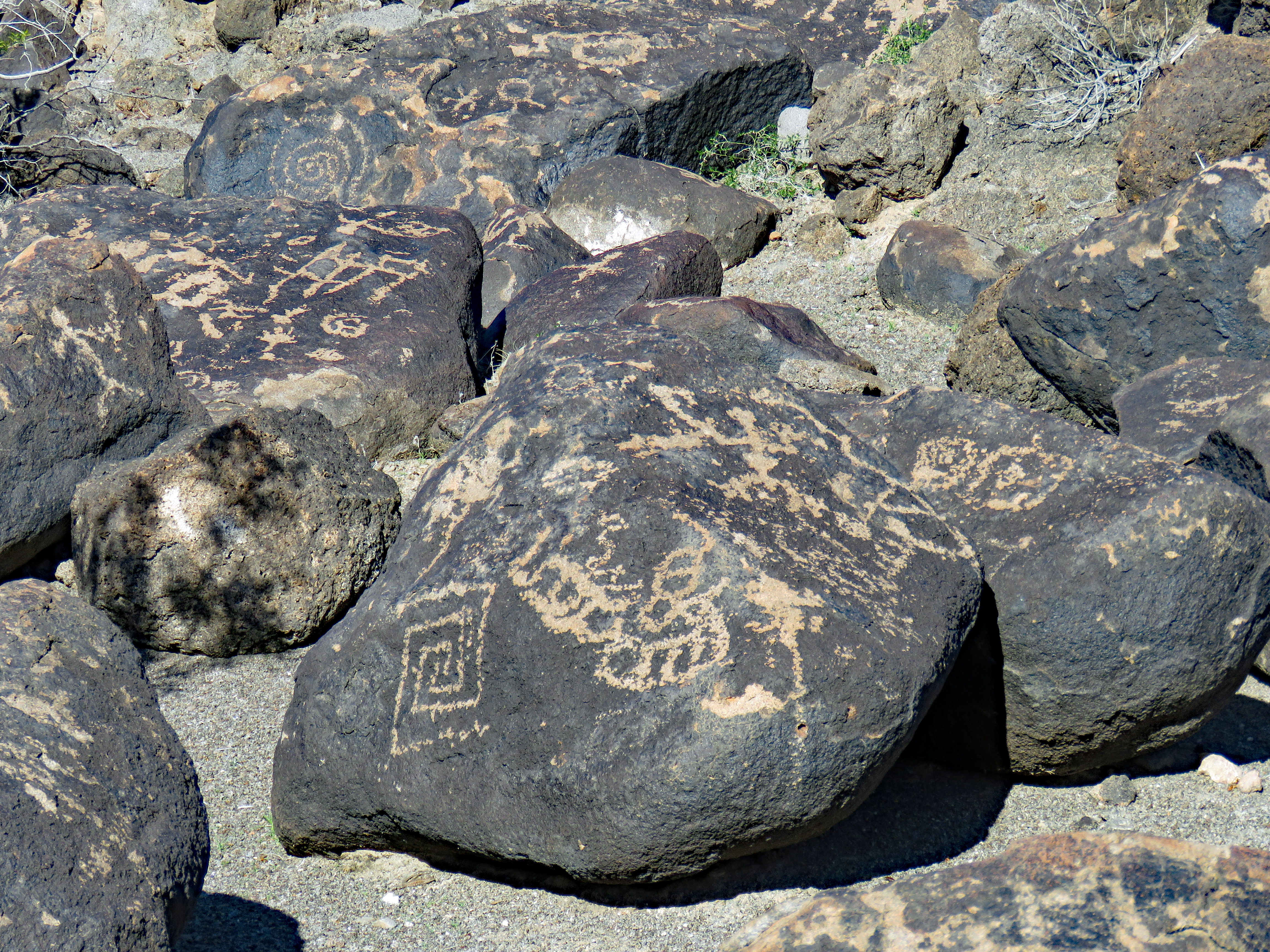
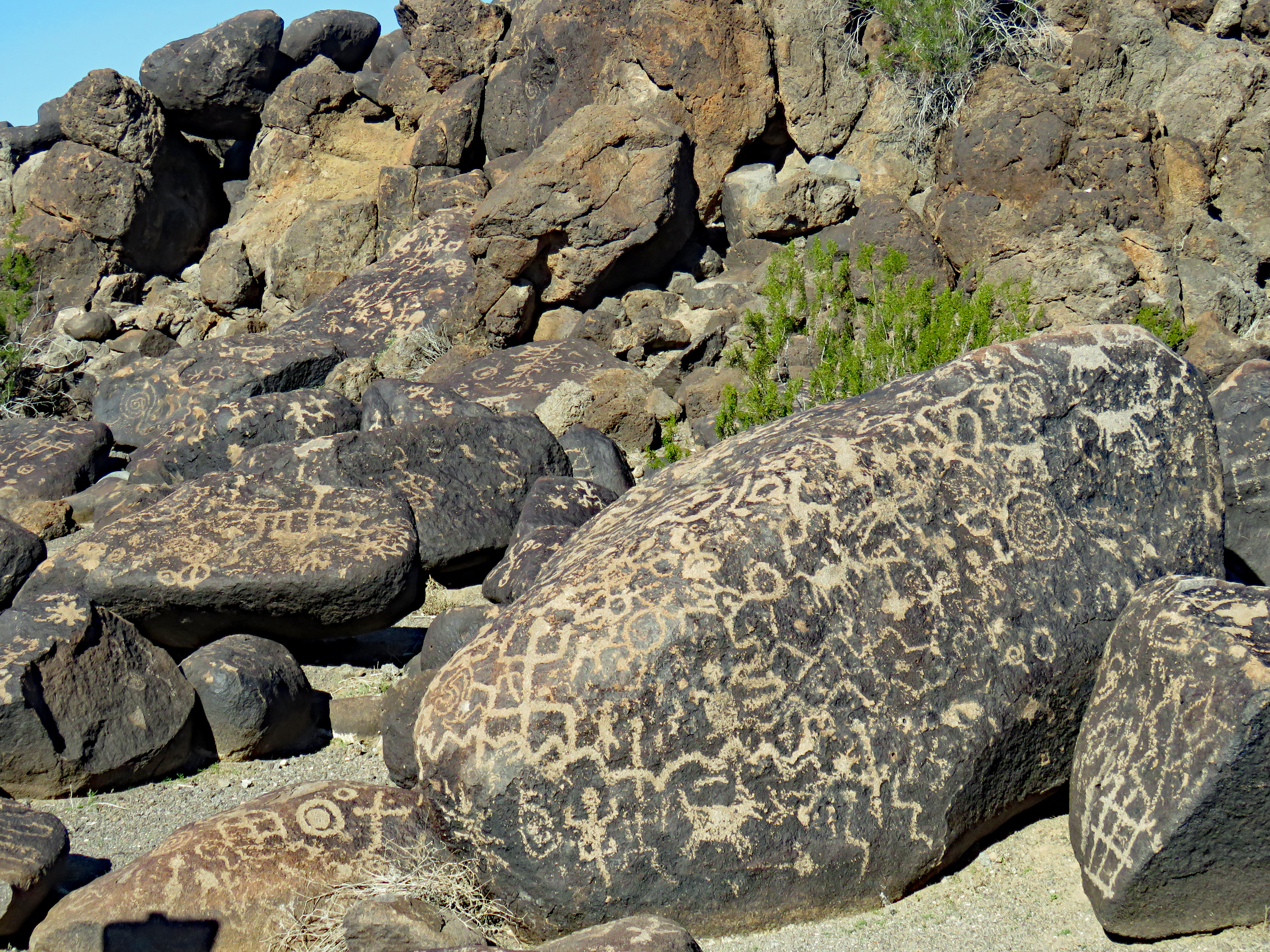
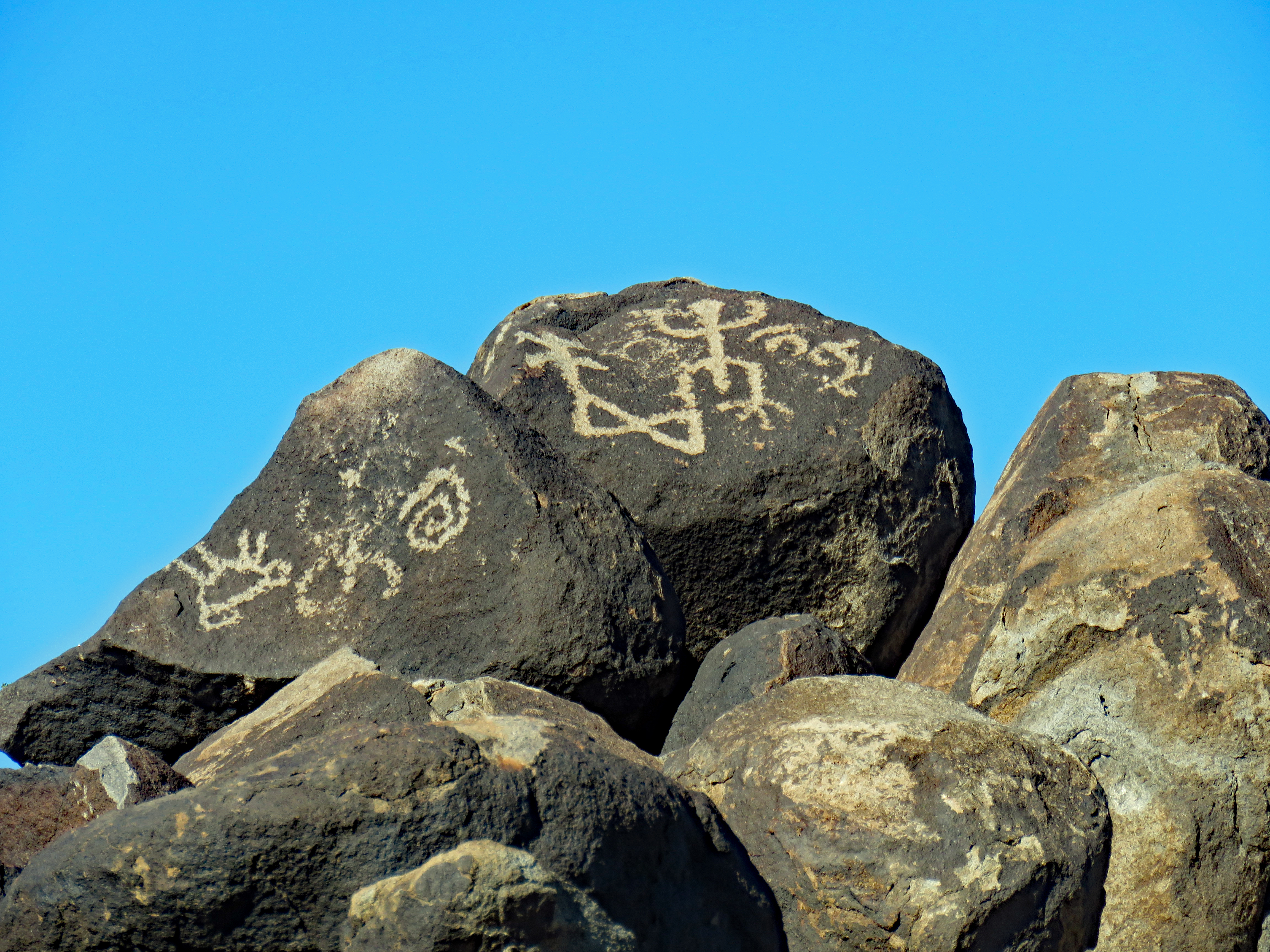
This site contains about 800 petroglyphs pecked onto the basalt boulders. Most of the petroglyphs are concentrated on boulders on the eastern edge but petroglyphs face in all directions from that edge.
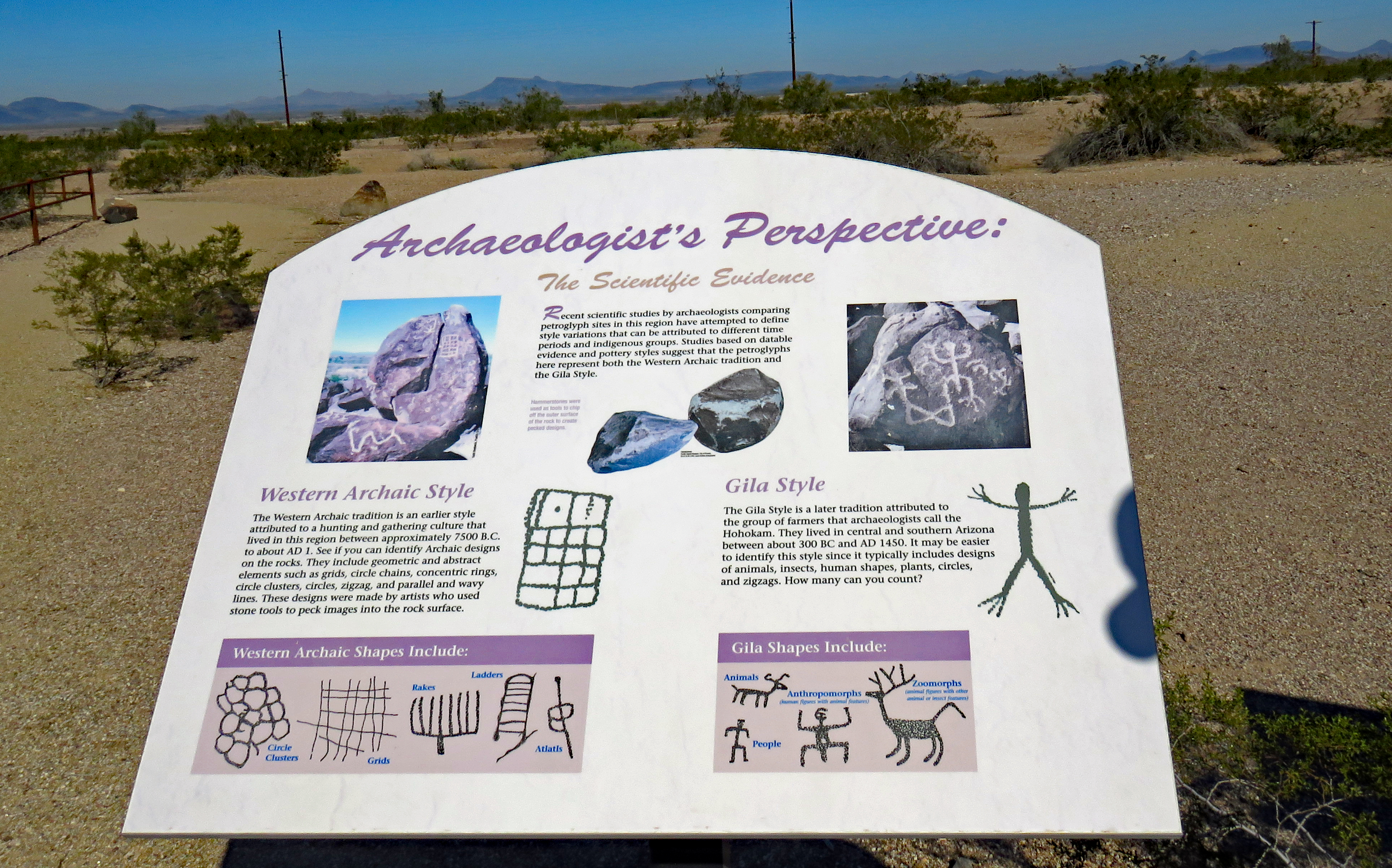
Although considered a Hohokam rock art site, there are also characteristics of Patayan and Archaic origins. A number of Native American tribes recognize ancestral connections to Hohokam and Patayan traditions and cultural properties and the Painted Rock Petroglyph Site is considered a sacred traditional place.
Based on archeological clues, local communities probably began creating the petroglyphs by at least 1,400 years ago. At that time people lived in this area year-round, farming on the Gila River floodplain. That river no longer flows here due to diversion by dams, irrigation, etc.
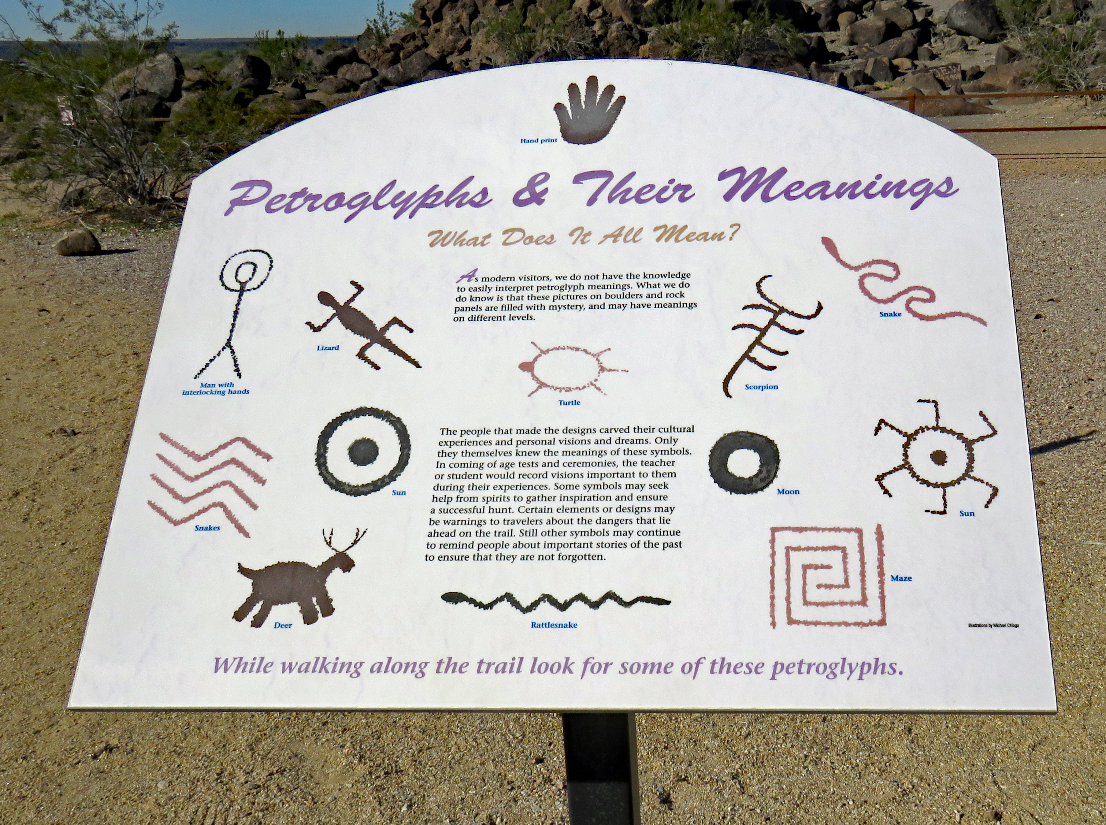
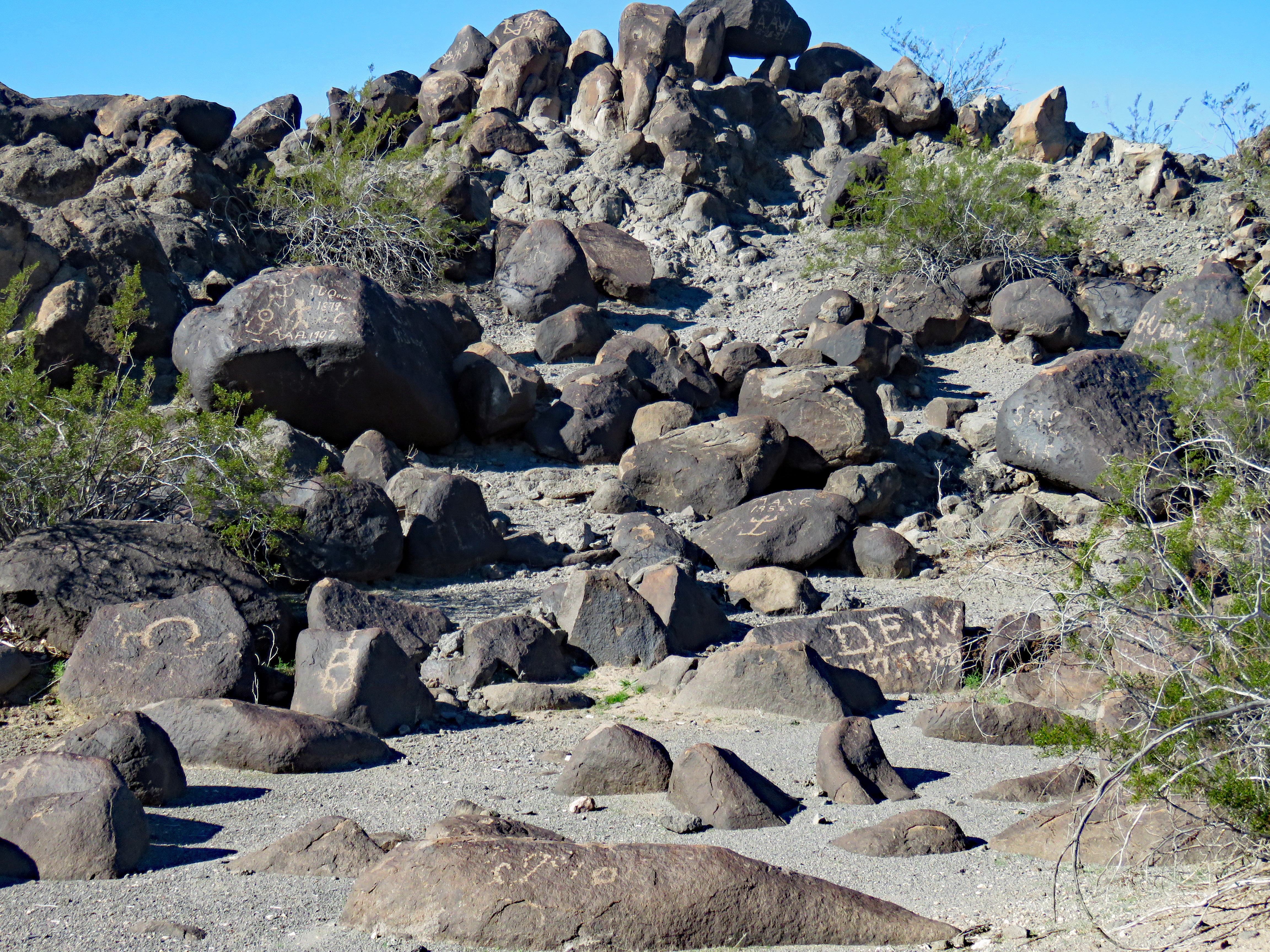
This site contains petroglyphs by prehistoric indigenous people as well as inscriptions made by people who passed through during historic times.There were many important trails that passed this site, some of which have been traveled for thousands of years. Historically, this area has been well-traveled.
In 1775, the expedition of Juan Bautista de Anza passed this way on their journey, complete with soldiers, padres, settlers and livestock, to settle and secure northern California for Spain.
In 1846, the Mormon Battalion led by Col. Philip St. George Cooke marched from Santa Fe to San Diego to help secure California from Mexico and passed through this area. Interestingly, Jean-Baptiste “Pomp” Charbonneau was a guide for the Mormon Battalion. Charbonneau was Sacagawea’s son who was born on the Lewis and Clark Expedition in 1805. Nicknamed “Pomp” by Capt. Clark, Charbonneau led an incredible life and was the only member of the Corps of Discovery to set foot in Arizona.
In 1858, Congress funded a stage line. To improve communication and travel from east to west, the Butterfield Overland Stage Route was the result. Mail, freight and passengers could travel from St. Louis to San Francisco in 23 days until 1879 when the railroad was constructed.
For thousands of years people have lived and traveled along this corridor known as The Southern Trail. Not far away, today’s Interstate 8 continues that tradition of east-west travel.
We’ve been to a number of petroglyph sites but the sheer concentration in such a small area was amazing. This solitary mound of boulders in a remote desert environment is a record of man’s passage.
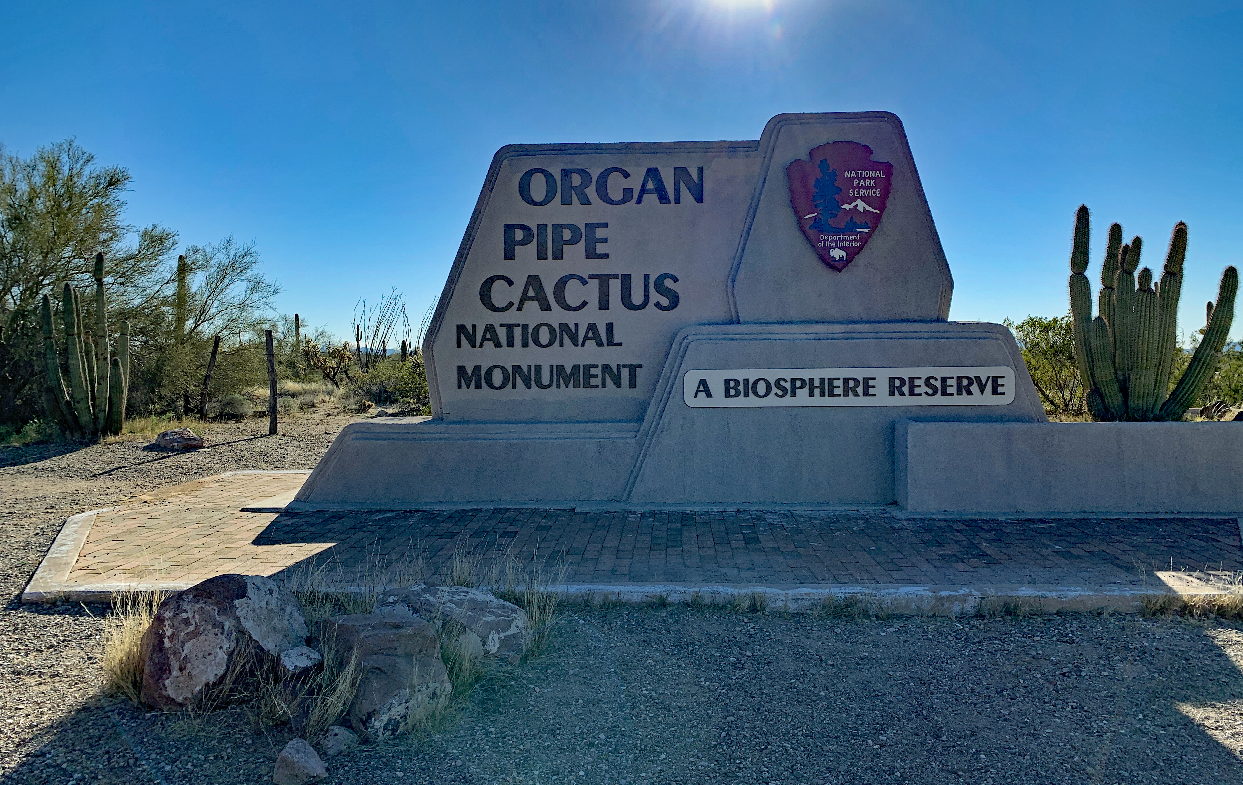
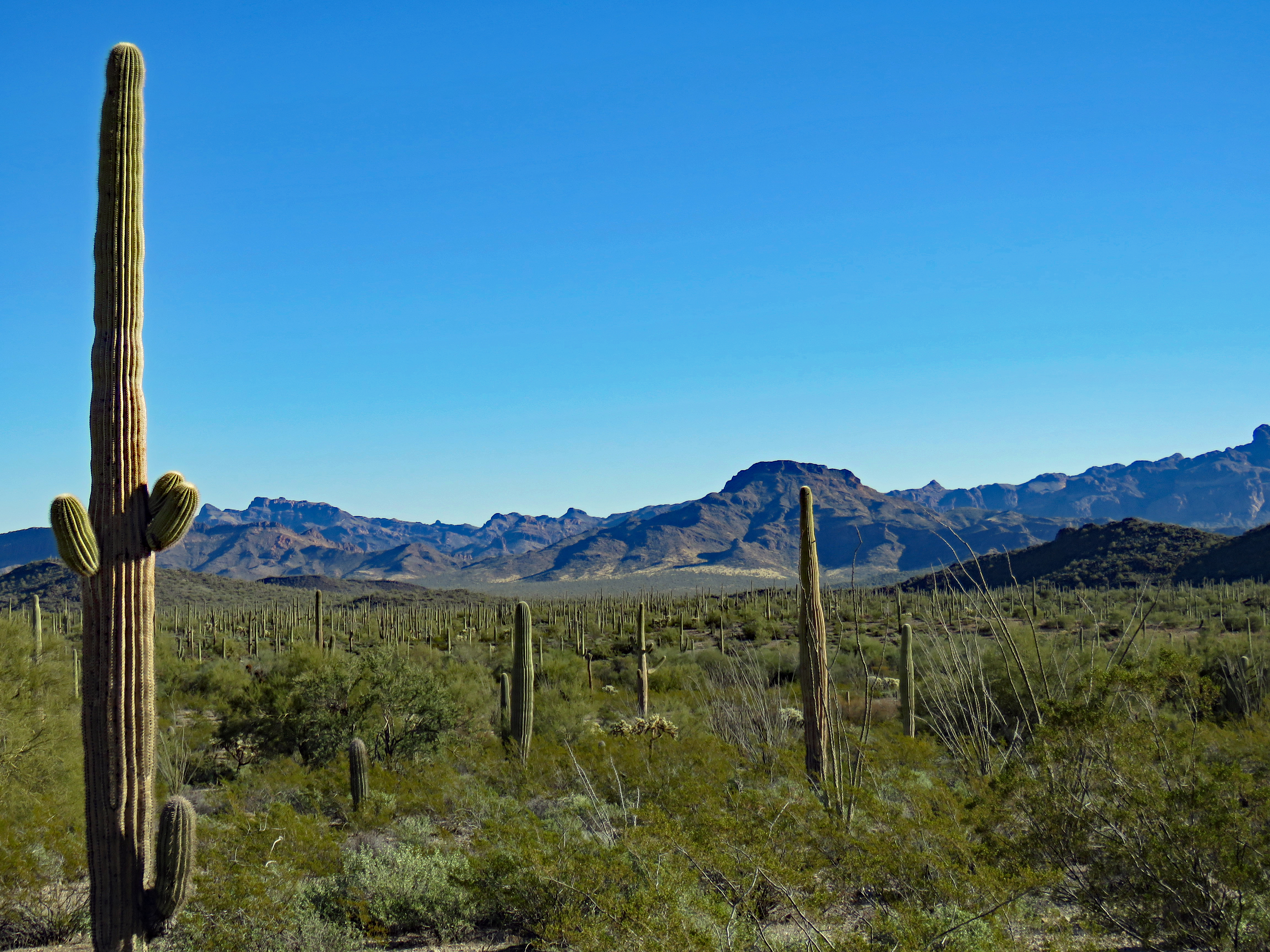
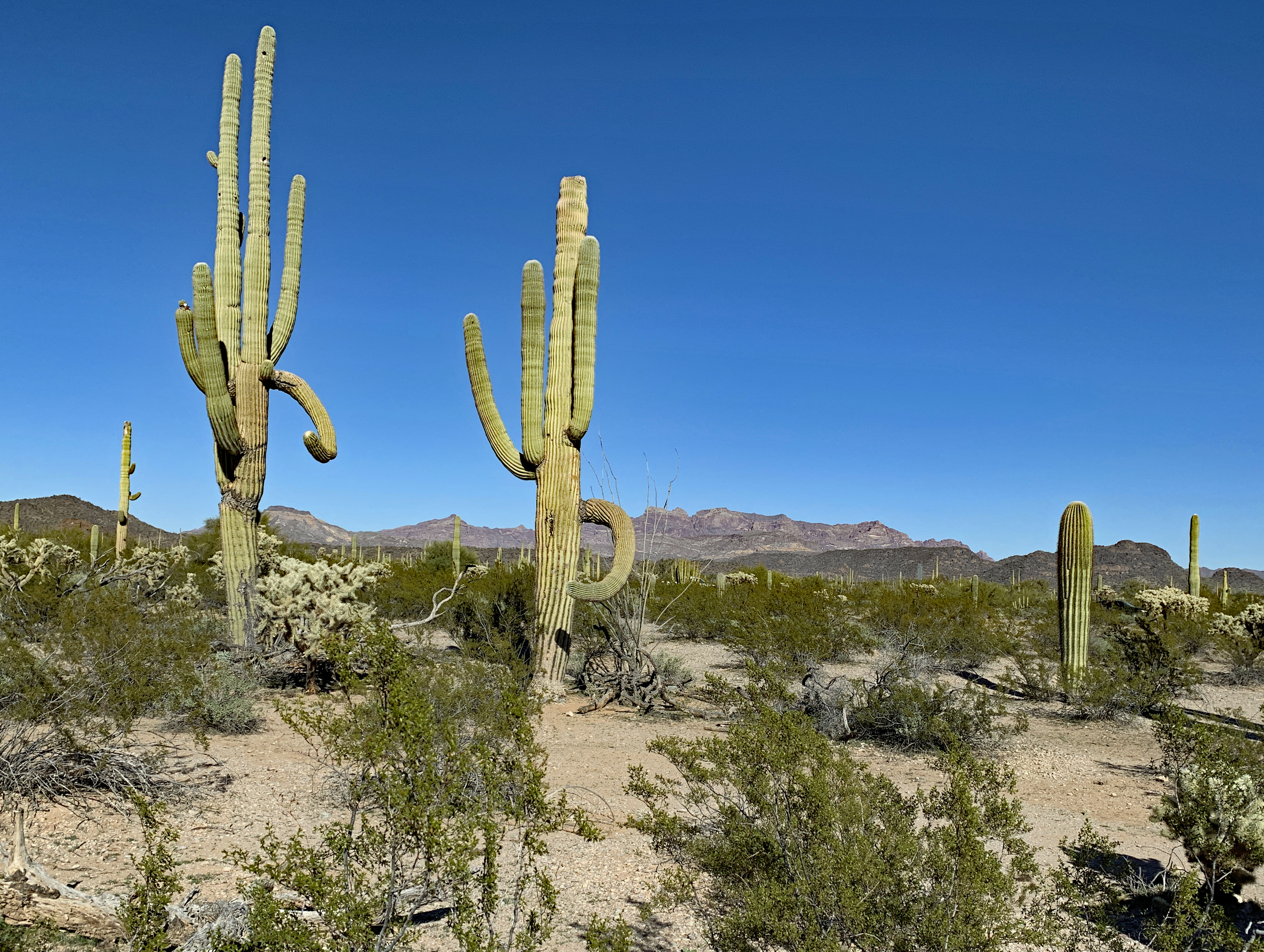
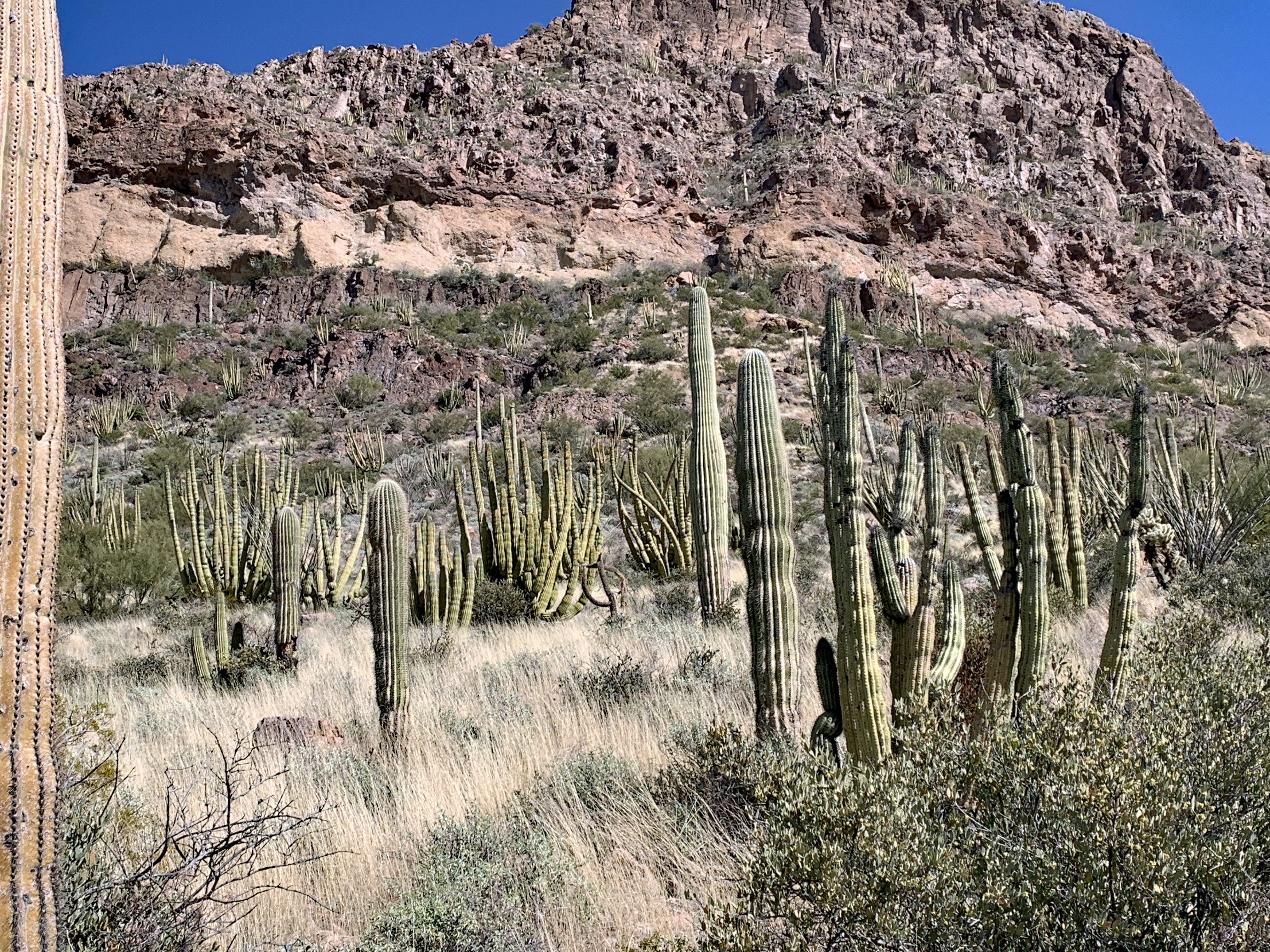
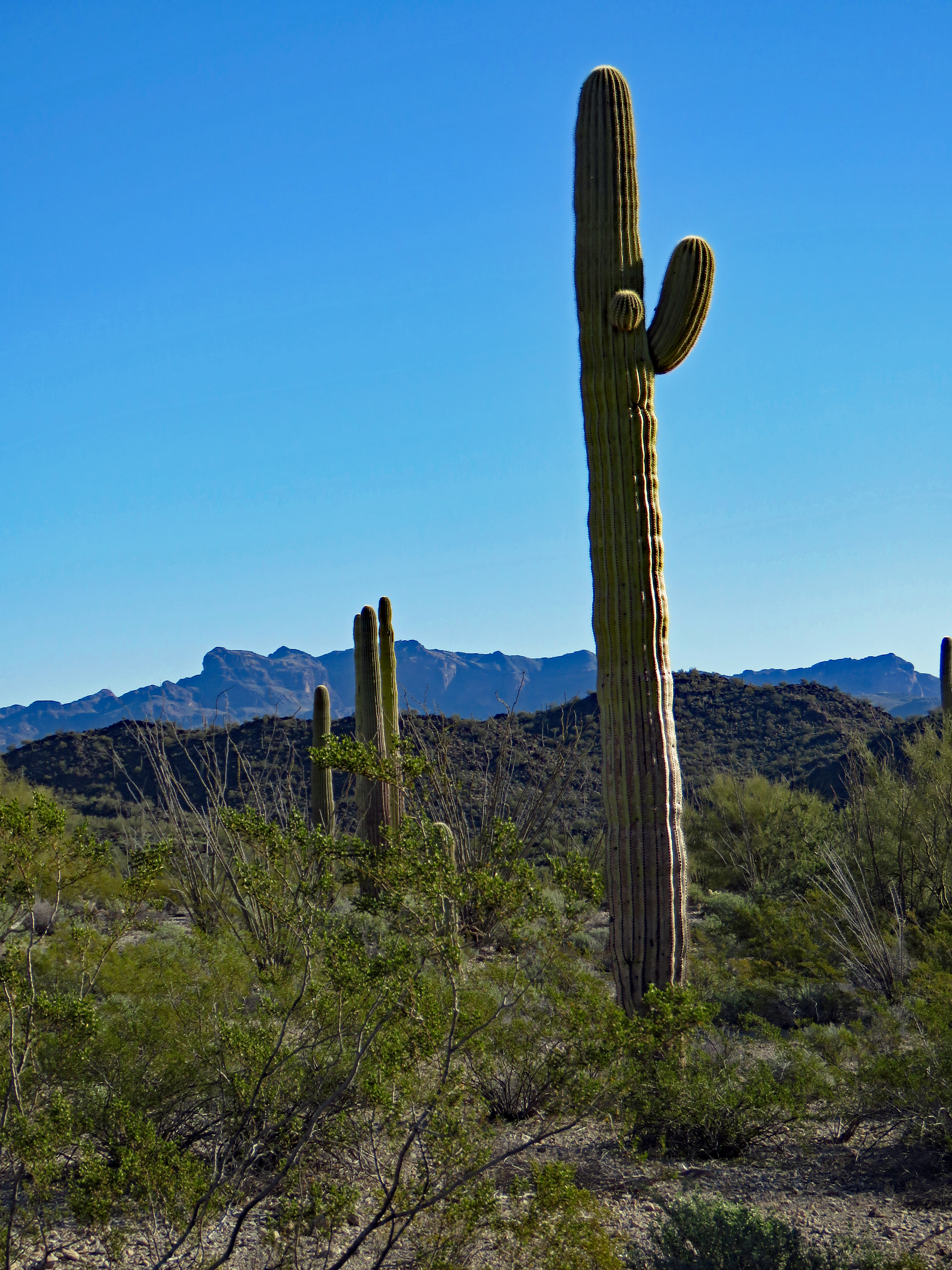
What’s so special about Organ Pipe Cactus National Monument? After all, there’s Saguaro National Park easily accessible right outside Tucson. Organ Pipe NM is a good three-hour drive from Tucson and a desert is a desert, right? Turns out that’s not quite true.
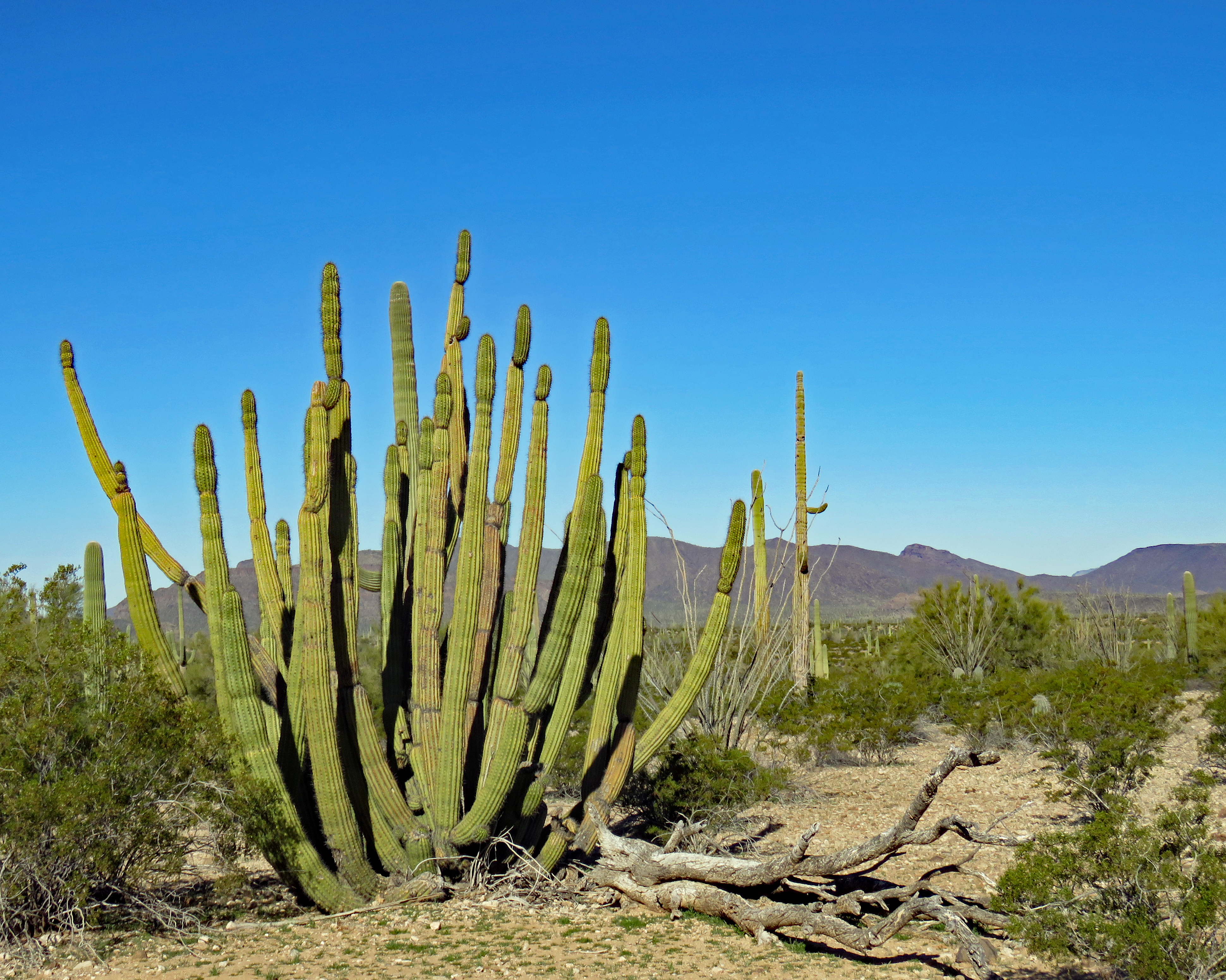
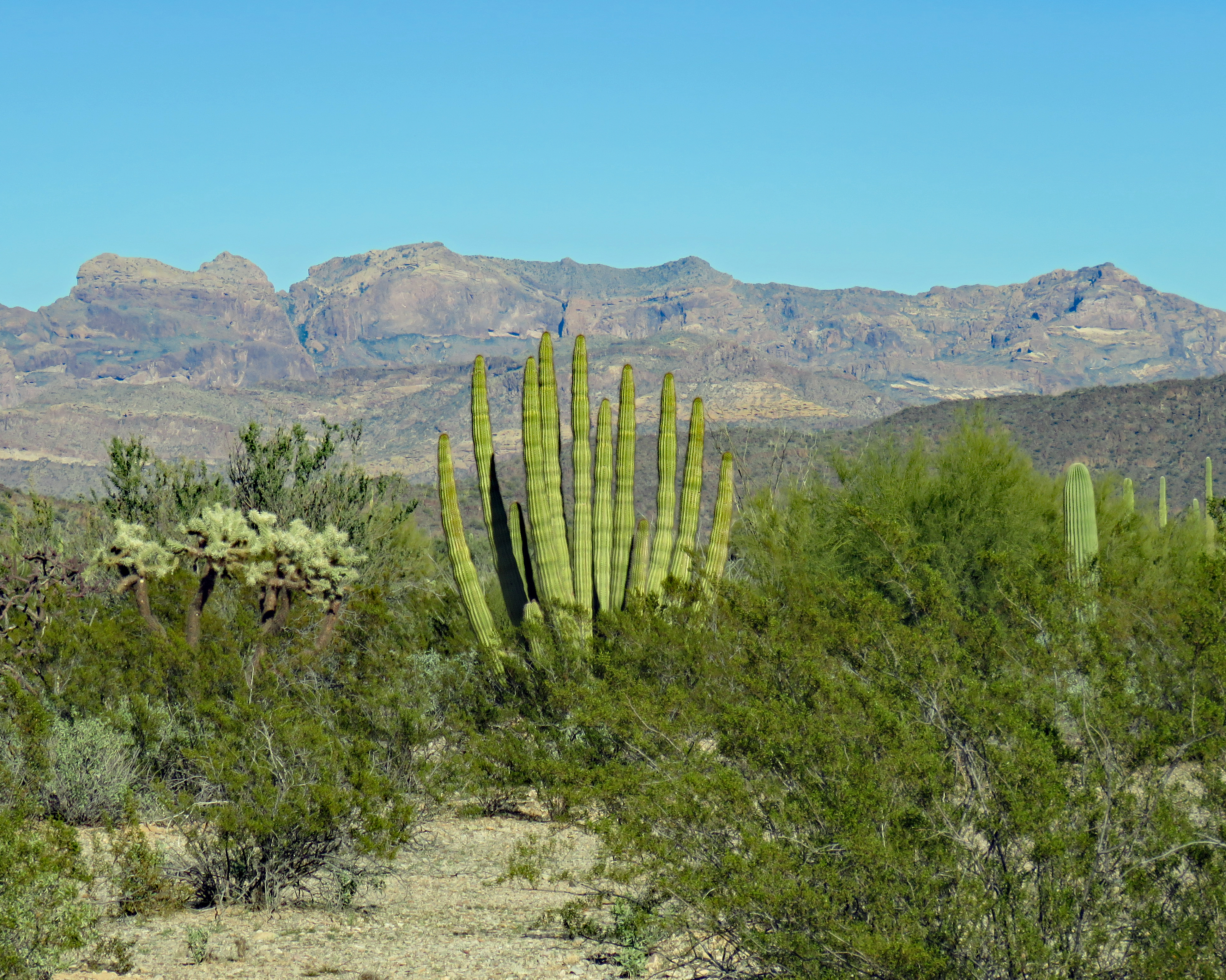
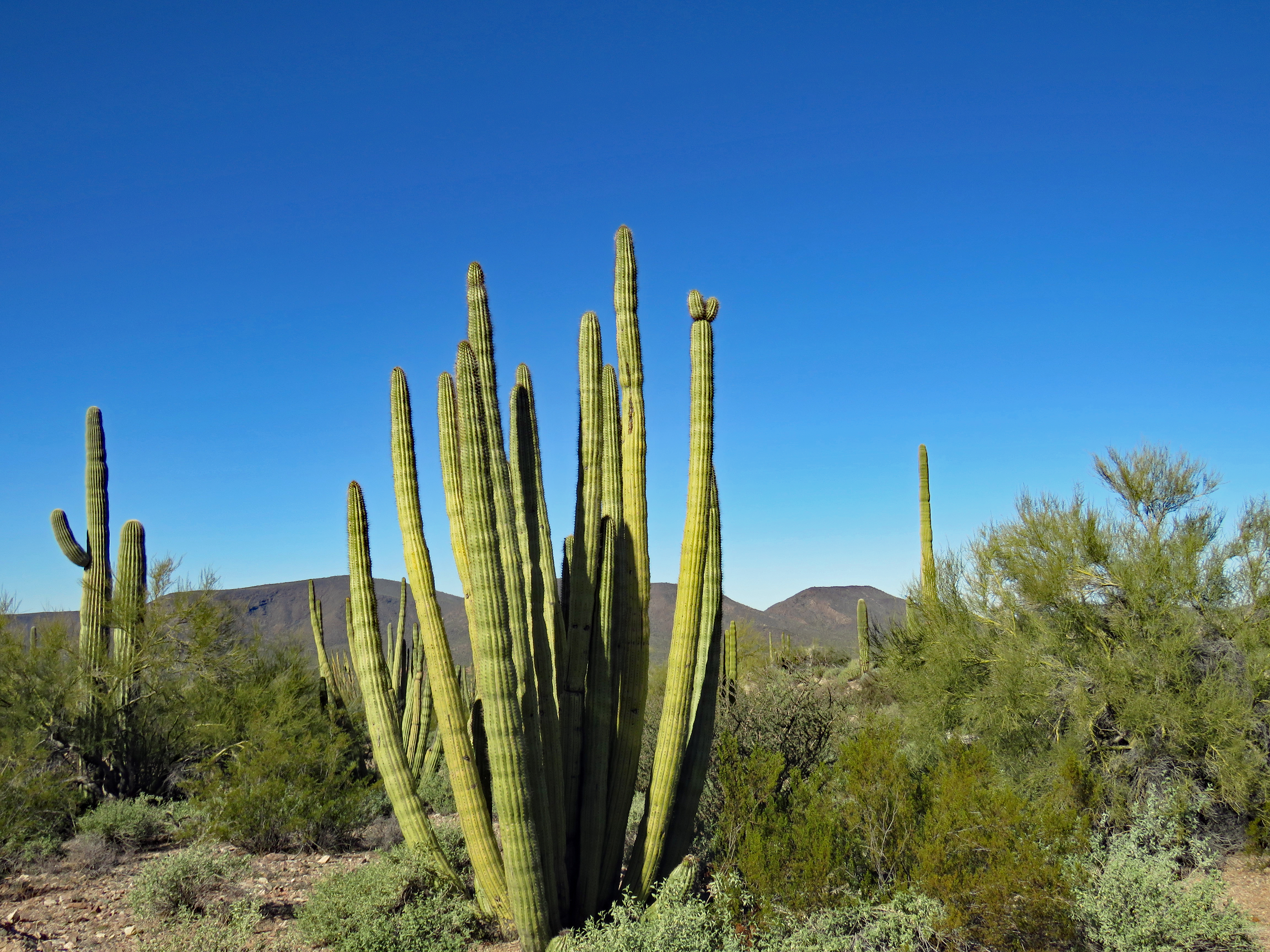
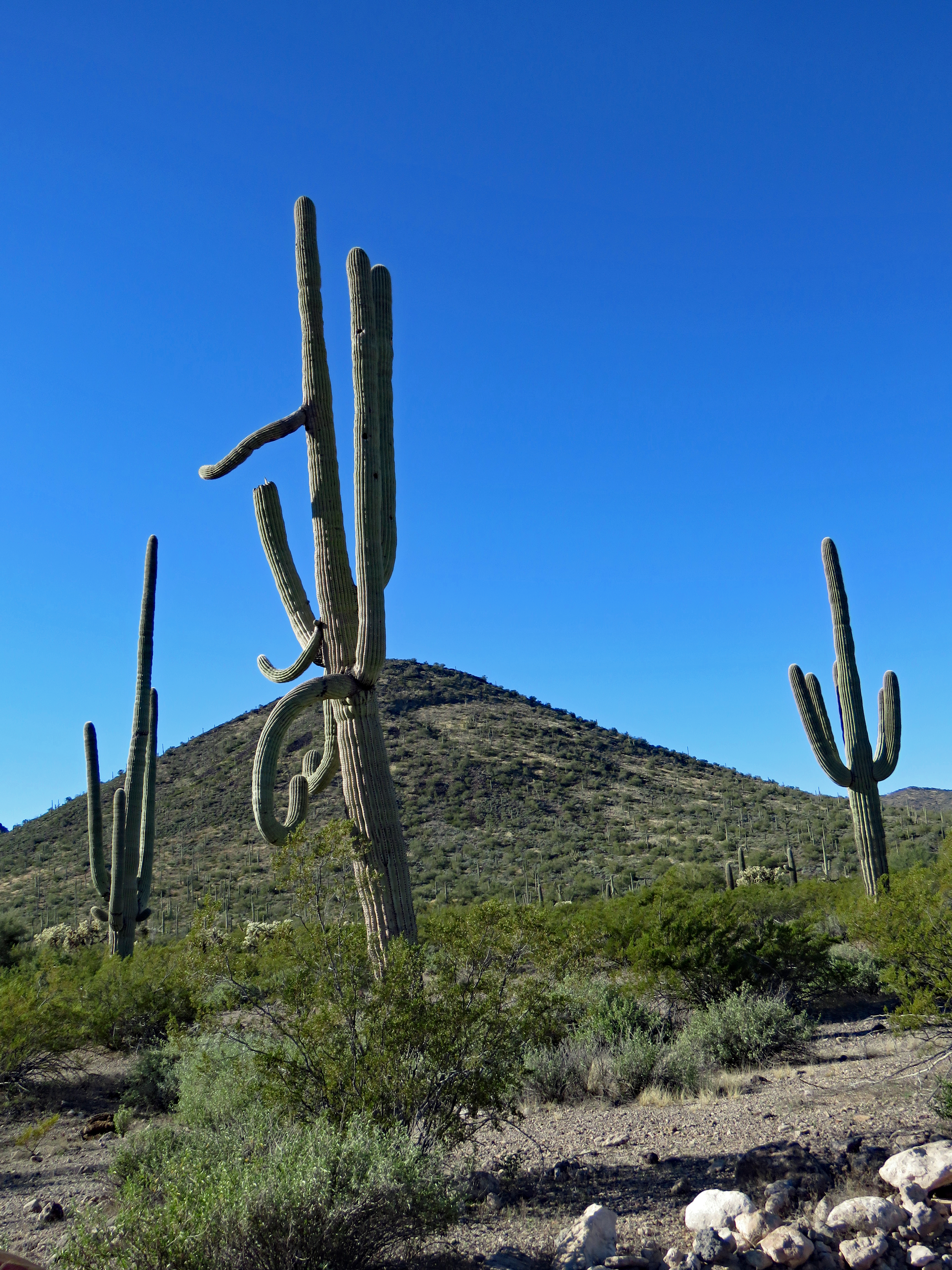
Organ Pipe Cactus NM is unique in that the organ pipe is a large cactus rarely found in the United States. It is delicate and very fickle and doesn’t grow in other American deserts. Frost restrains forests of them from growing further north. The organ pipe is a many-stemmed cactus without any apparent trunk, resembling an old-fashioned pipe organ. Some specimens grow twenty-five feet tall and have a hundred arms. Each arm is pleated with twelve to nineteen ridges. The fruit provides sustenance for both animals and people.
Organ Pipe NM was created in 1937 to preserve a representative area of the Sonoran Desert, part of a movement in the National Parks to protect not just scenic wonders but also the ecological wonders of the country. In 1976 it became a first-generation UNESCO biosphere reserve for the conservation of the unique resources of an intact Sonoran Desert ecosystem.
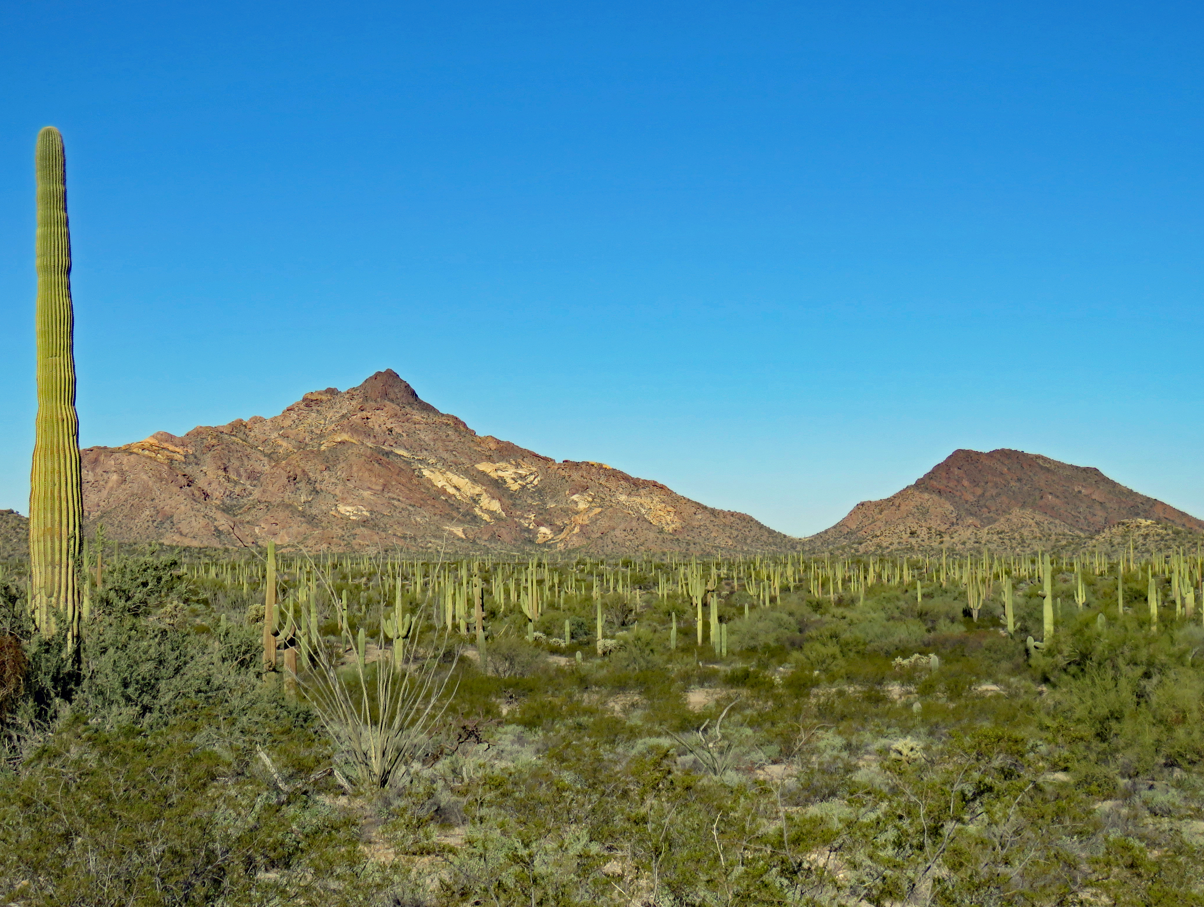
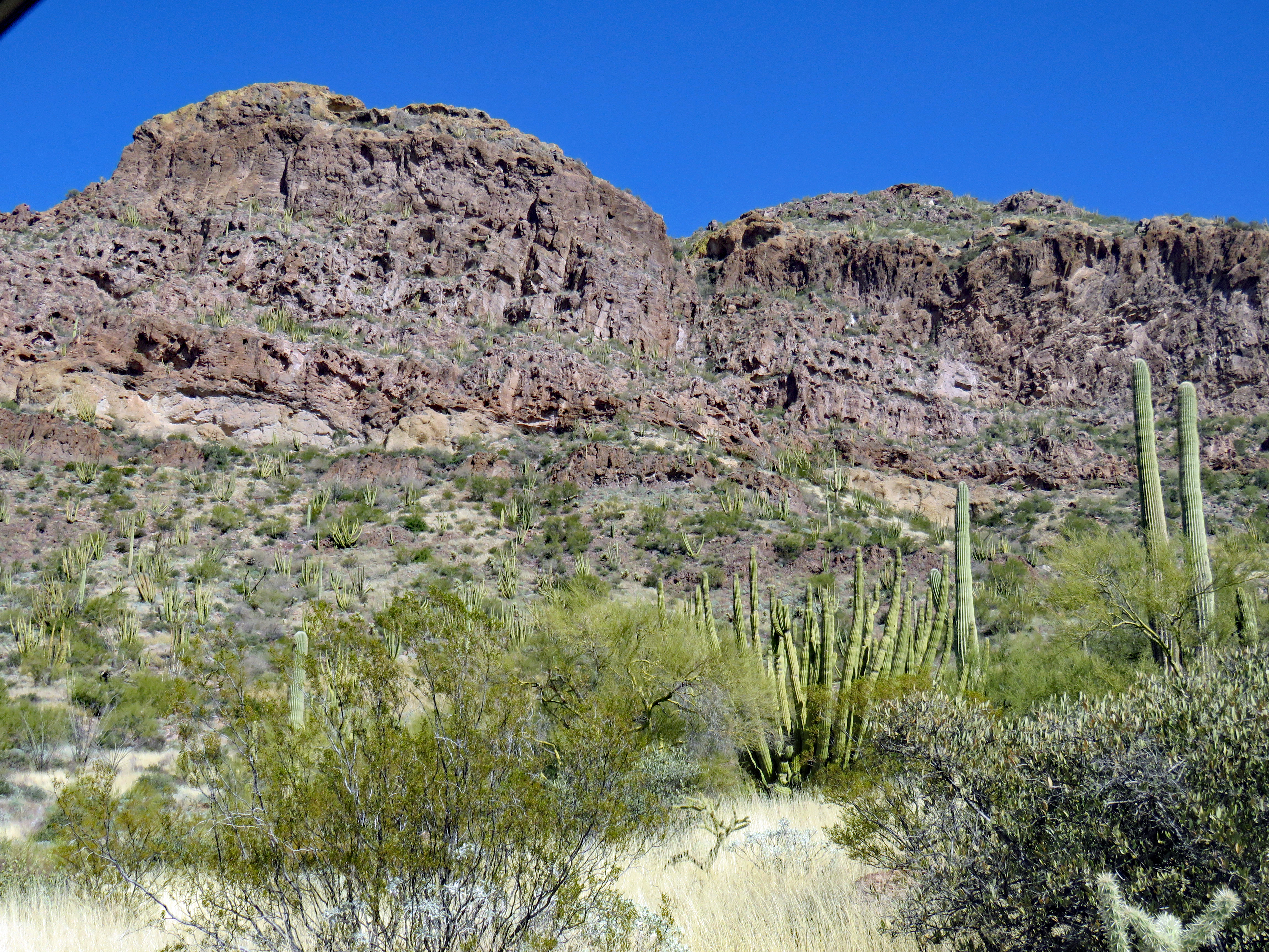
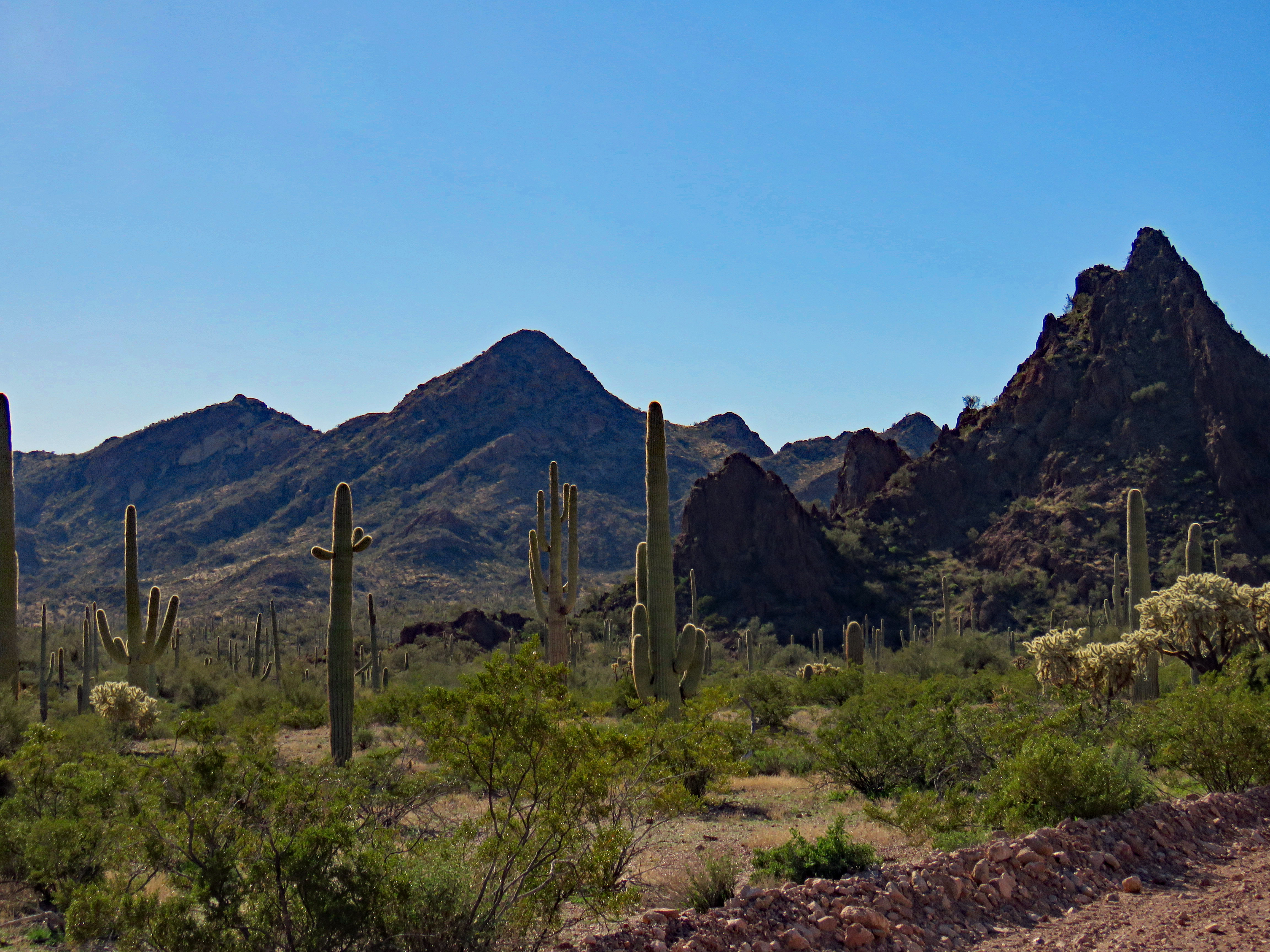
Organ Pipe NM straddles two Sonoran Desert plant communities, the Lower Colorado River Valley and the Arizona Upland and includes elements of a third, the Central Gulf Coast. Biologically the Sonoran Desert is the richest and most diverse of North America’s four arid regions.
The Colorado River Valley community is drier with saltbush, creosote, and bursage.
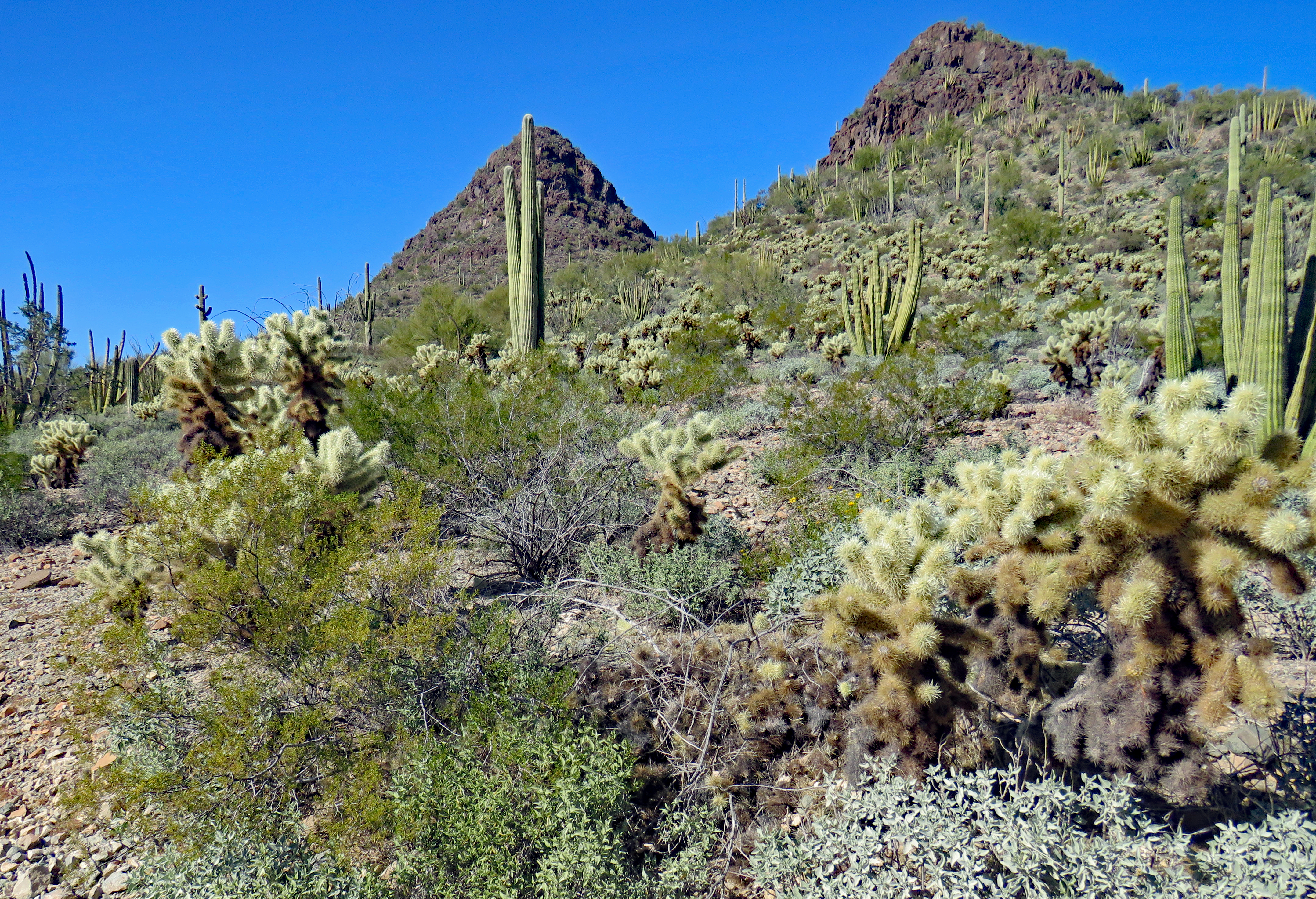
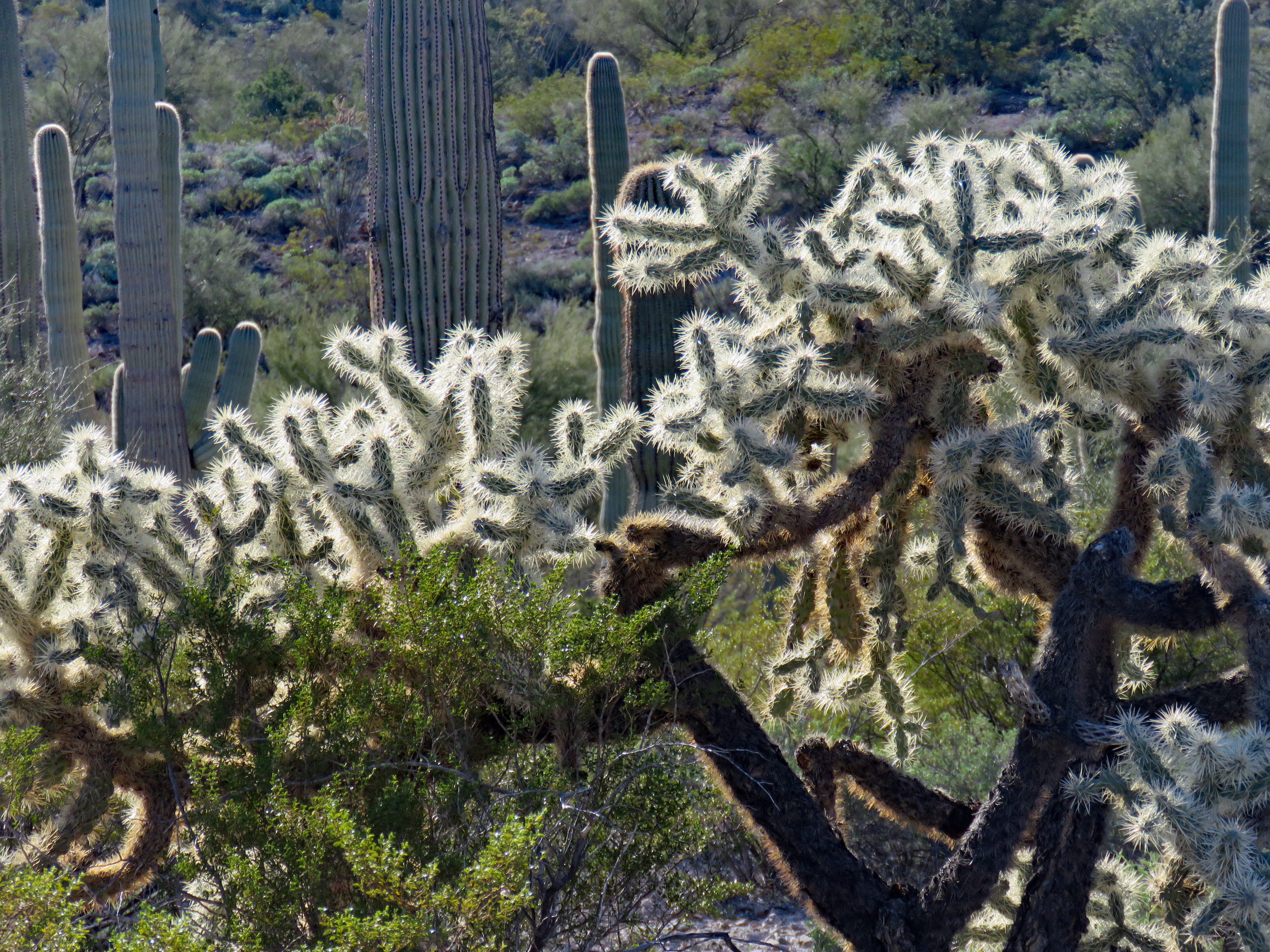
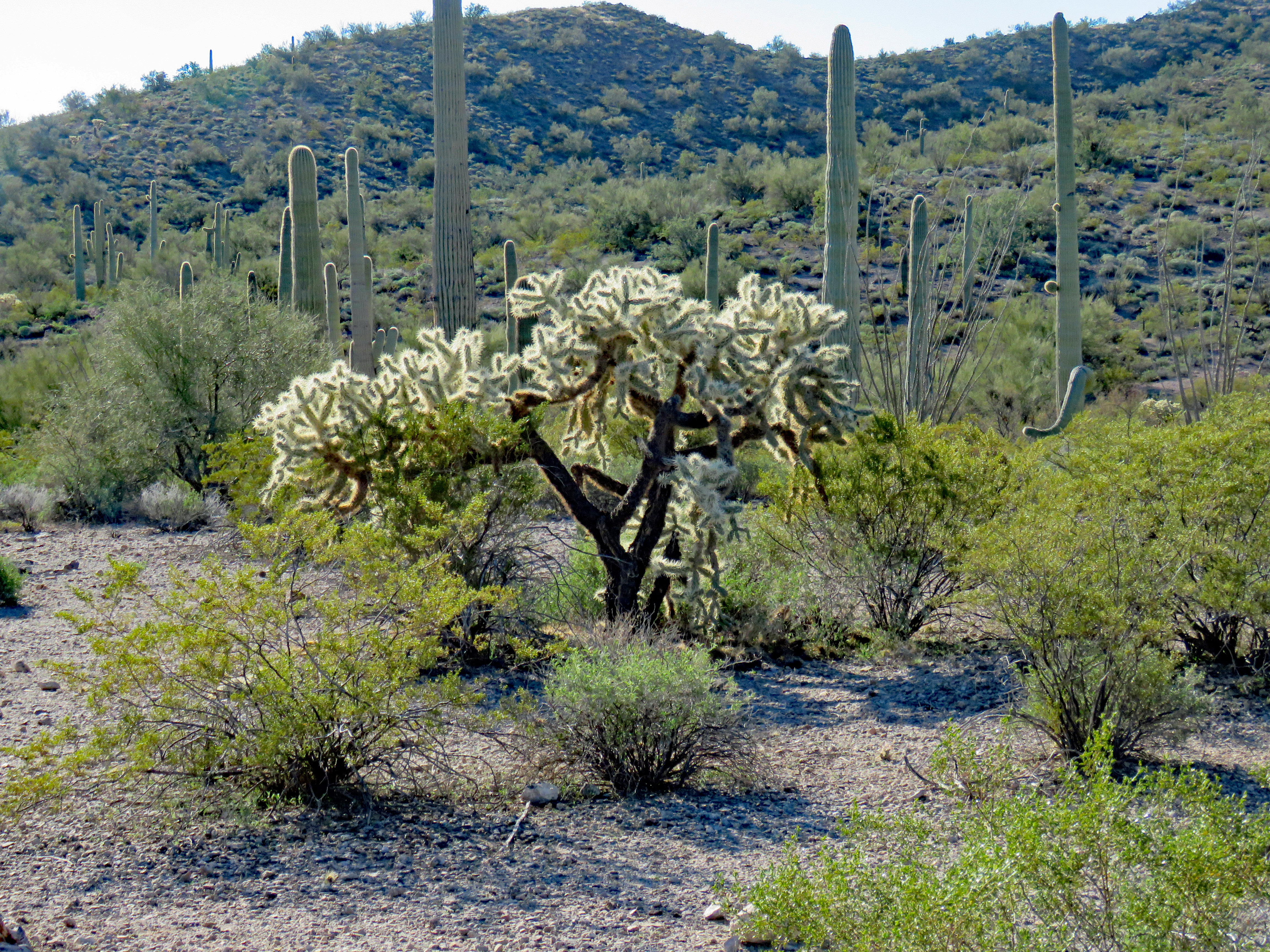
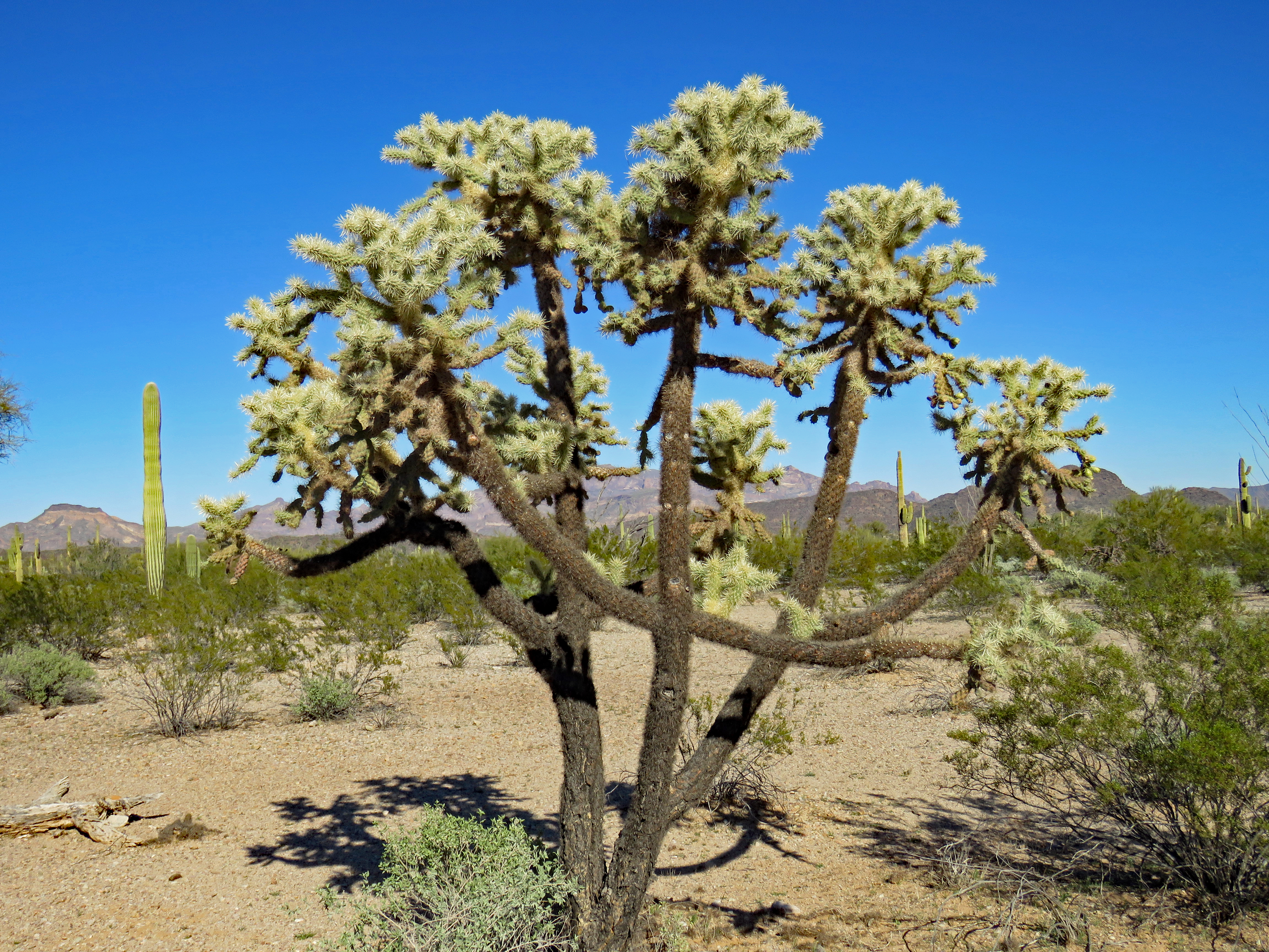
Cholla
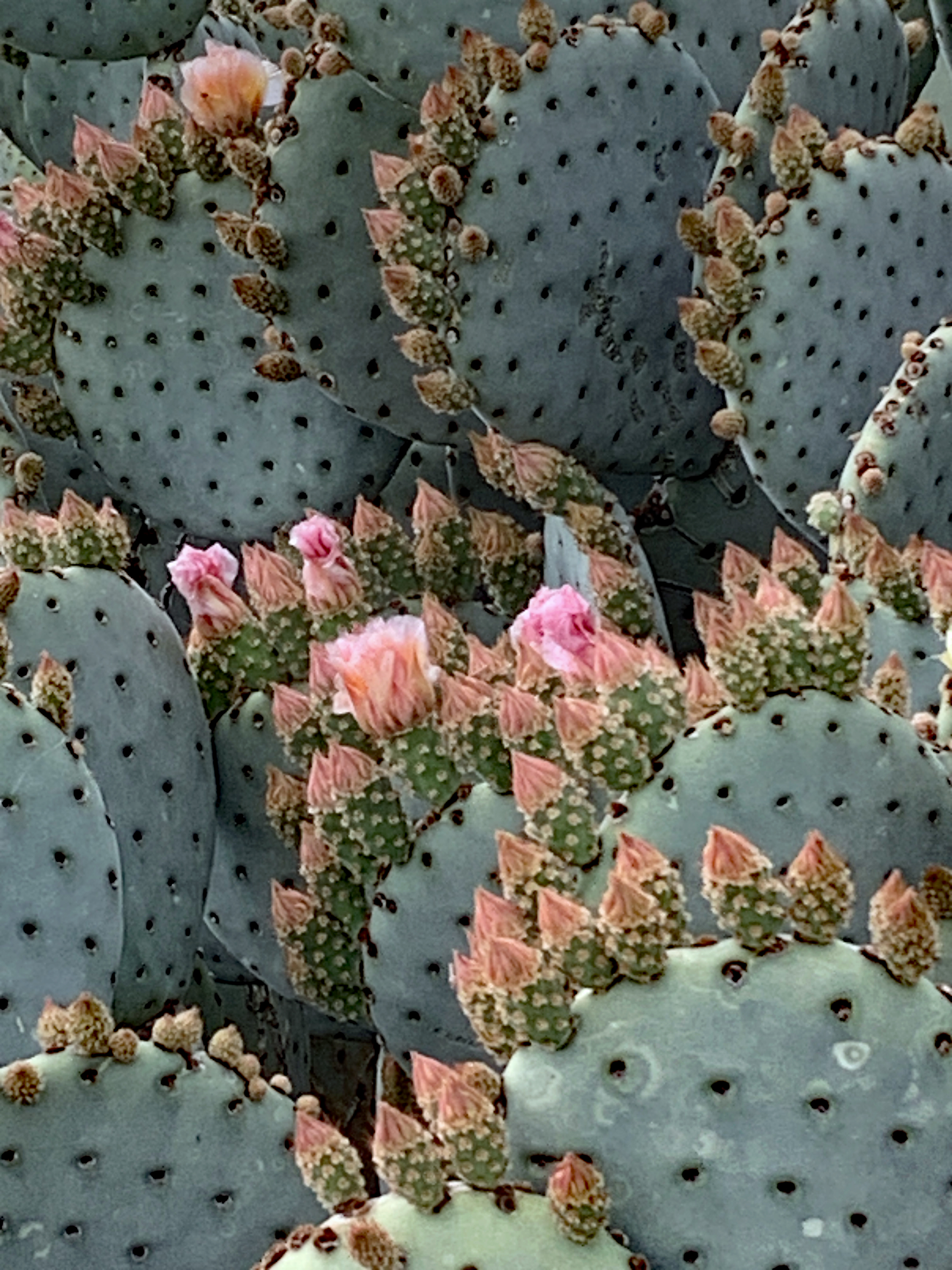
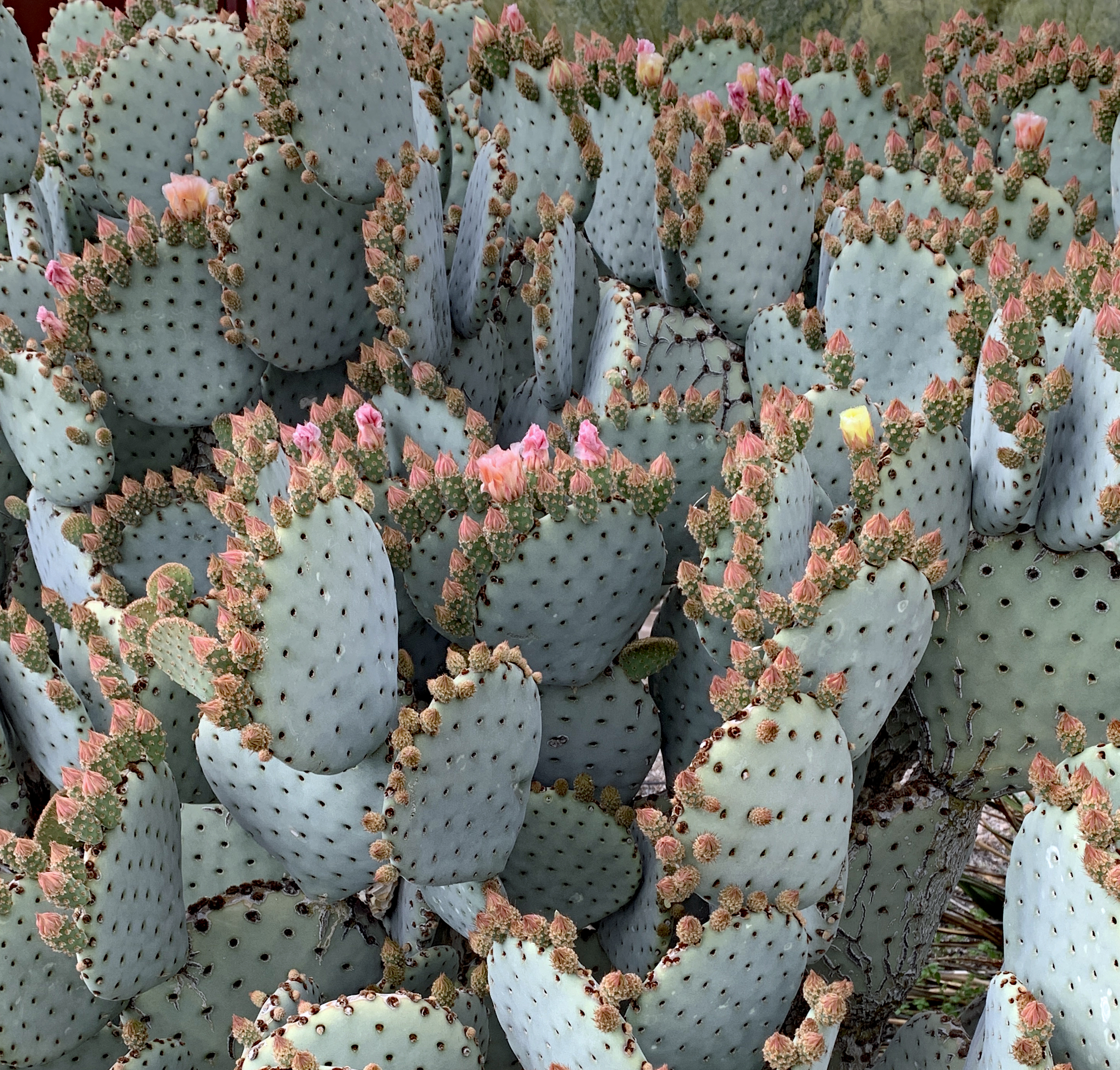
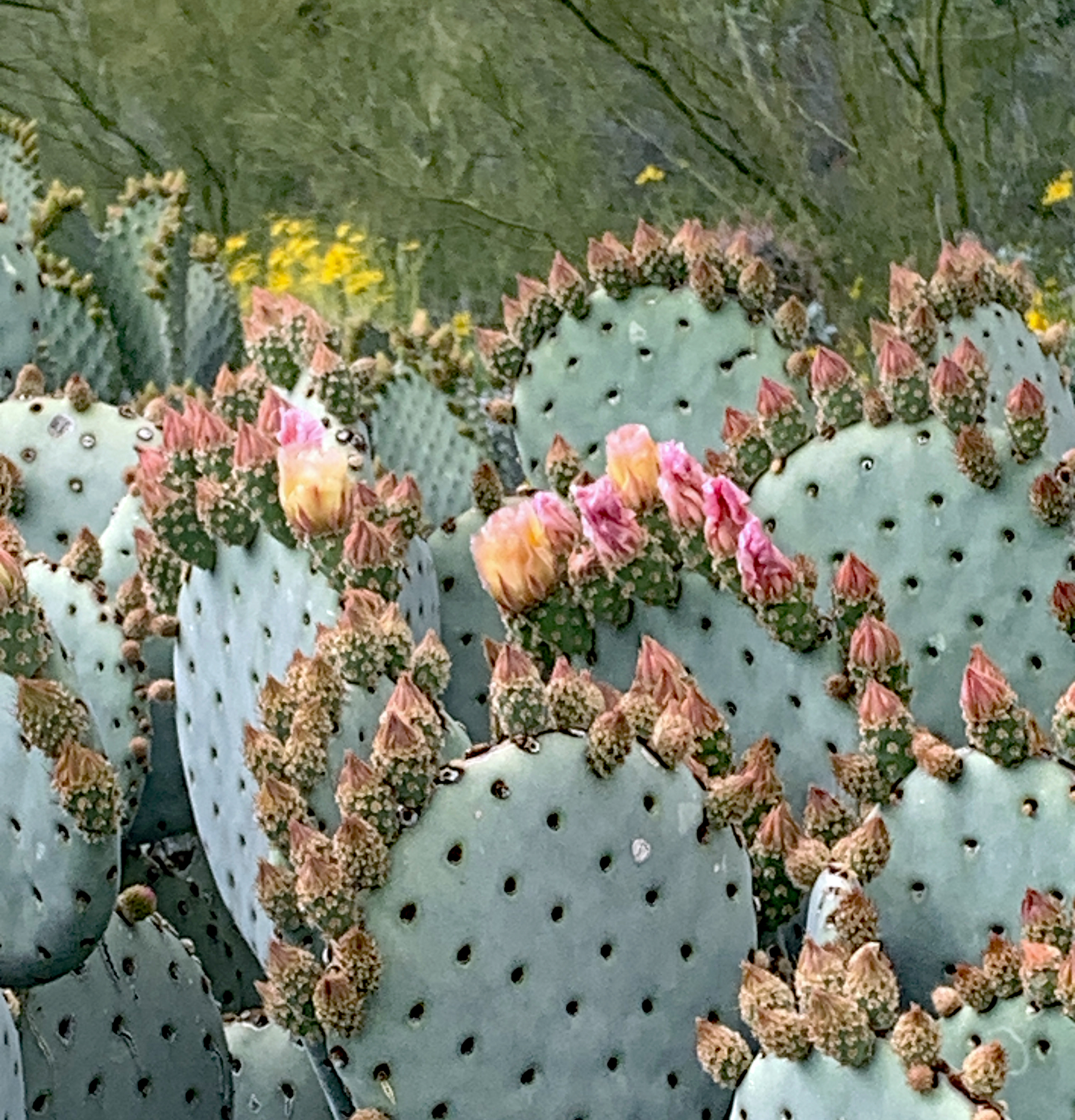
The Arizona Upland is slightly wetter and higher and as a result more lush and greener. This community includes most of the large cacti, ironwood, mesquite, jojoba, agave, juniper and spring wildflowers. Late January we were too early for spring wildflowers but we were able to identify many other plants.
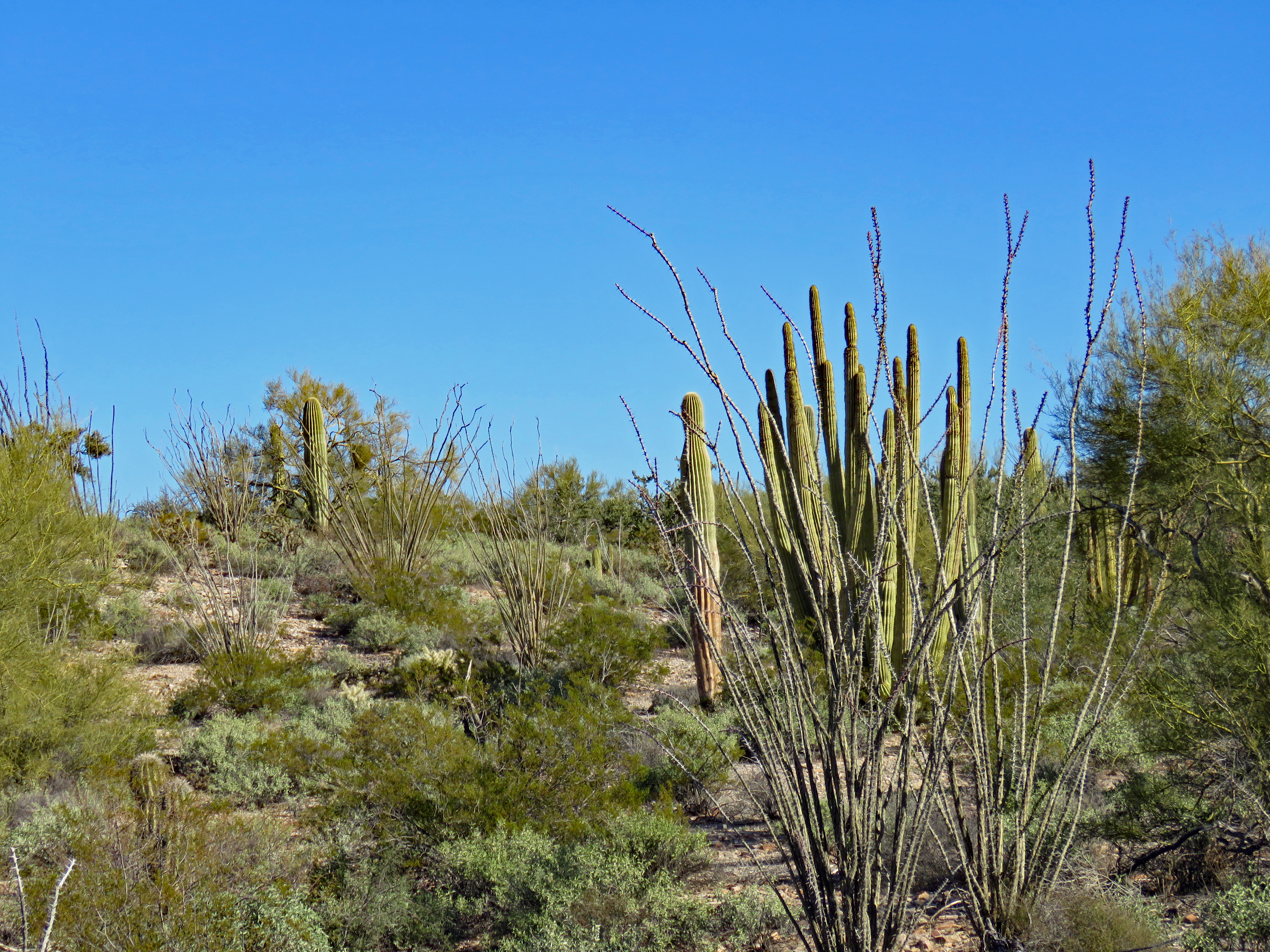
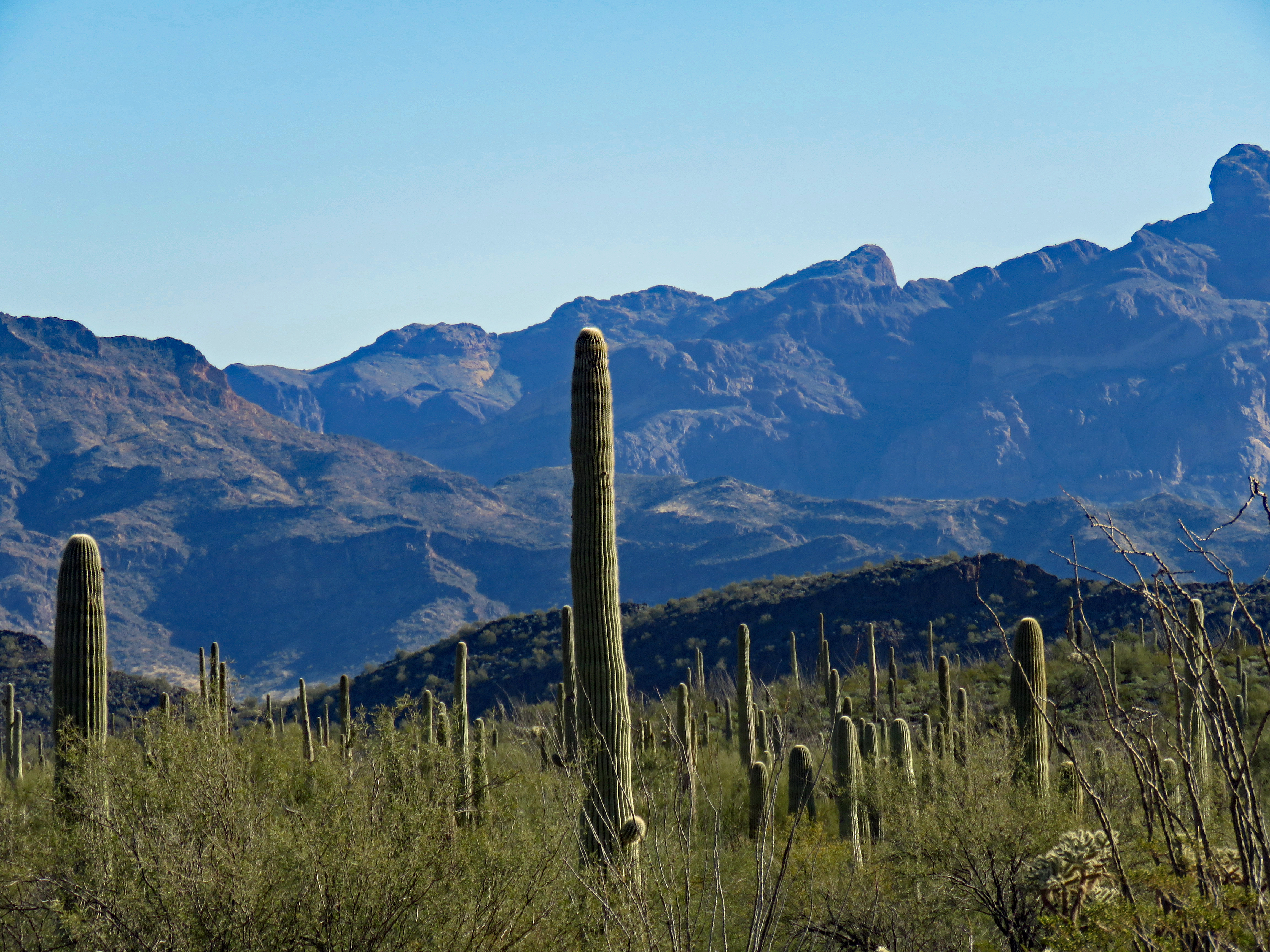
SaguaroOcotillo, Creosote and Brittlebush
Within the monument, signs of long and diverse use by American Indians, Mexicans, and Europeans intersect significantly archeologically, geographically and internationally. In 1450 the Hohokam dispersed into Tohono O’odham and Hia Ced O’odham cultures. The Tohono O’odham have special rights within the monument and Quitobaquito Springs is the O’odham Nation’s sacred pond. In 1540 a member of the Coronado Expedition was the first European to cross the region. In 1821 Mexico gained independence from Spain and Organ Pipe remained a part of Mexico until the Gadsden Purchase in 1853. Mining and ranching were the main economic forces prior to establishment of the monument in 1937. Special permits allowed ranching to continue and in 1941 Congress passed an act to allow mining within the monument for the duration of WWII. All grazing rights were terminated in 1959 and the final cattle were removed from the park in 1975.
First stop at Organ Pipe NM is the Kris Eggle Visitor Center. Kris Eggle was a law enforcement ranger at Organ Pipe who was killed in the line of duty in 2002 and the visitor center was renamed in his honor. At the visitor center we picked up information on the two scenic drives and set off to explore the park. (These scenic drives are unpaved).
Visitor Center Nature TrailView from Visitor Center
We took both drives and the differences in the two Sonoran desert ecosystems became readily apparent. There’s the “green” desert and the “dry” desert.
Puerto Blanco Drive is 41 miles and takes 4-5 hours. High clearance vehicles are recommended past Pinkley Peak at which point it becomes a one-way road and is narrow and very sandy in places. The drive circles the Puerto Blanco Mountains around the north past the Dripping Springs Mine trail, Golden Bell Mine, and Bonita Well.
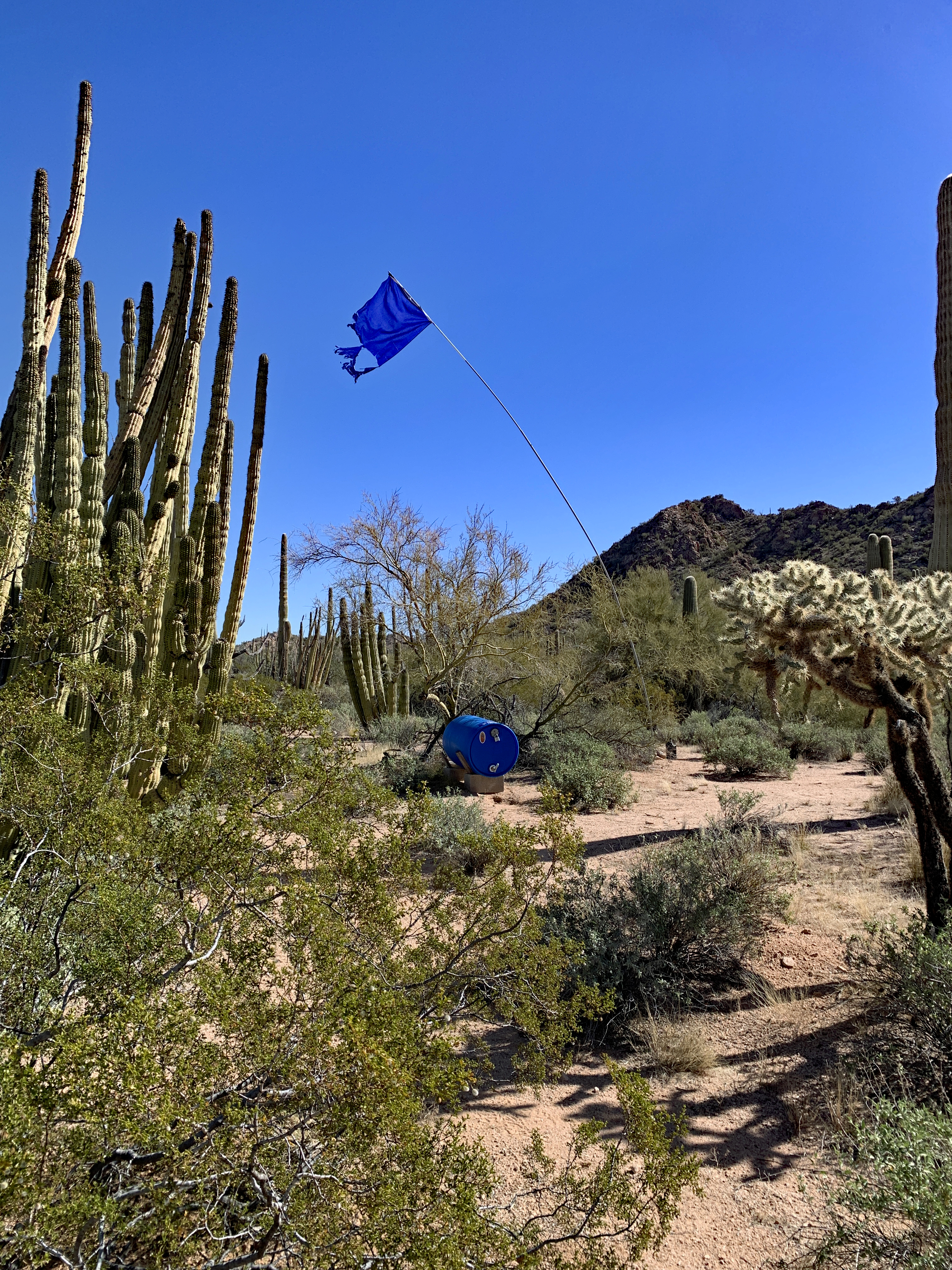
Throughout the Monument, Humane Borders (a non-profit volunteer organization) maintains a system of water stations to save people (wilderness hikers as well as migrants) from death by dehydration. Water stations have proven to be statistically significant in reducing deaths as well as search-and-rescue operations and destruction of natural resources.
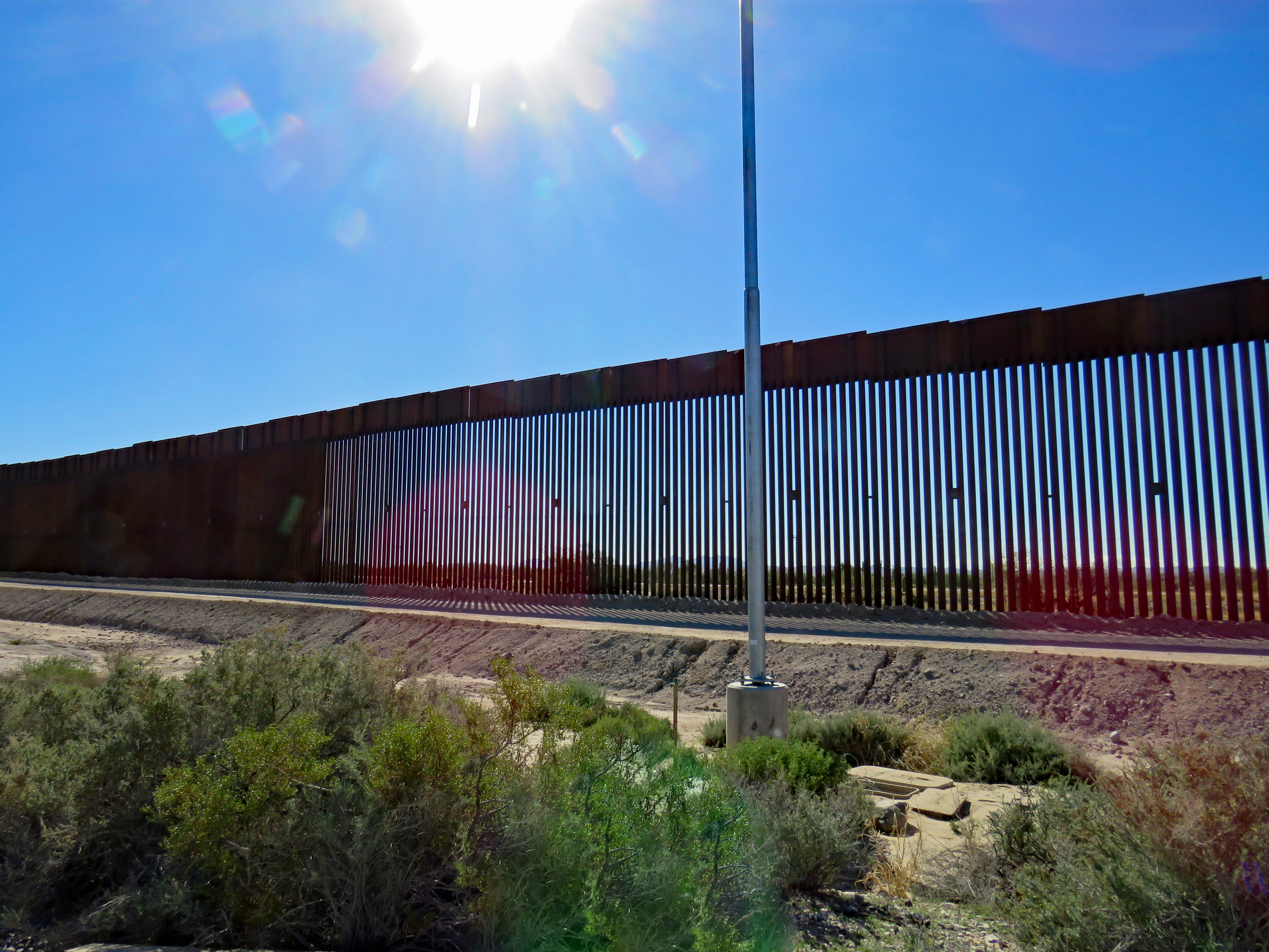
At Quitobaquito turnoff, it becomes the two-way South Puerto Blanco Drive along the southern border of the Monument and, as well, the United States.
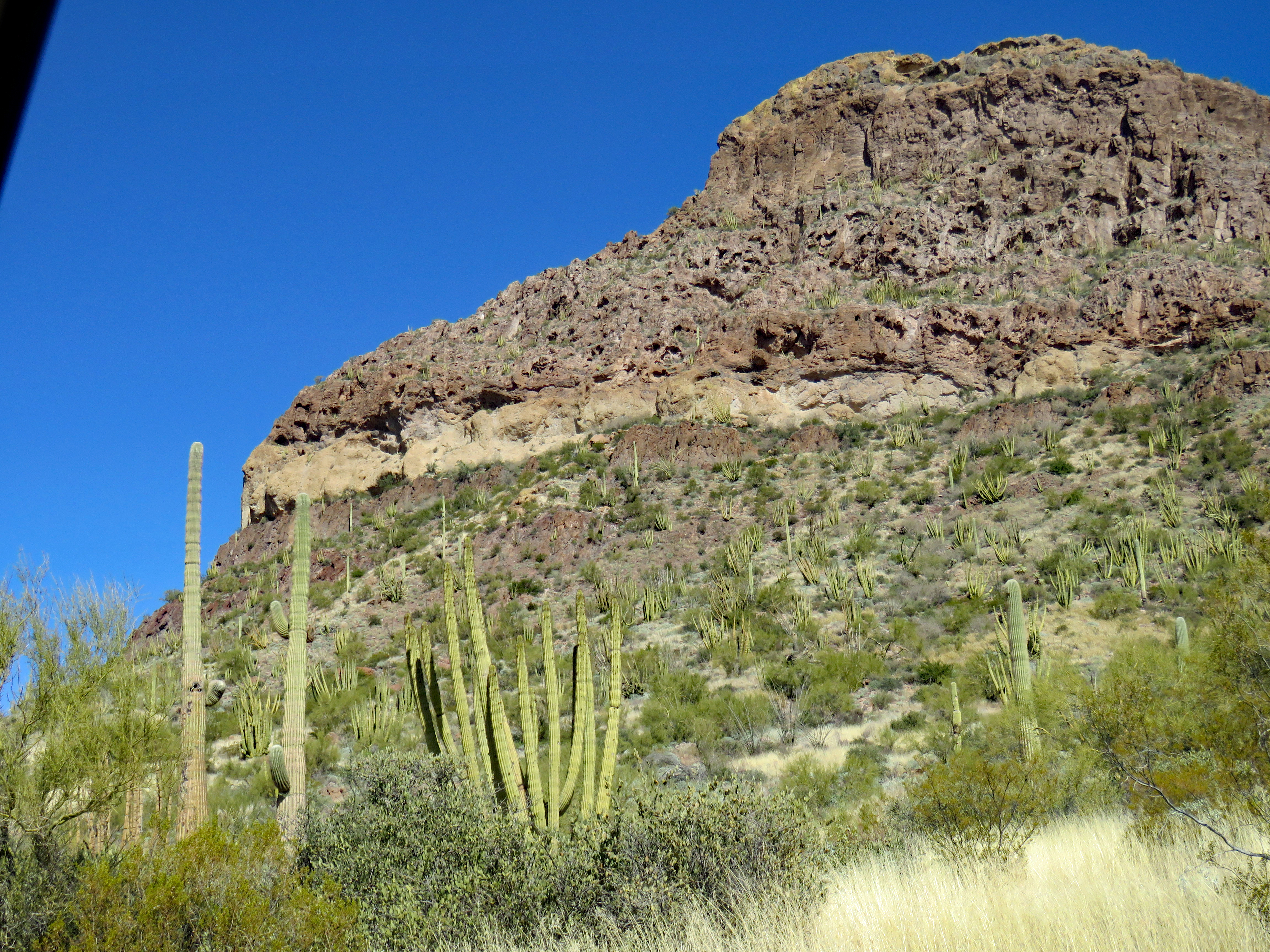
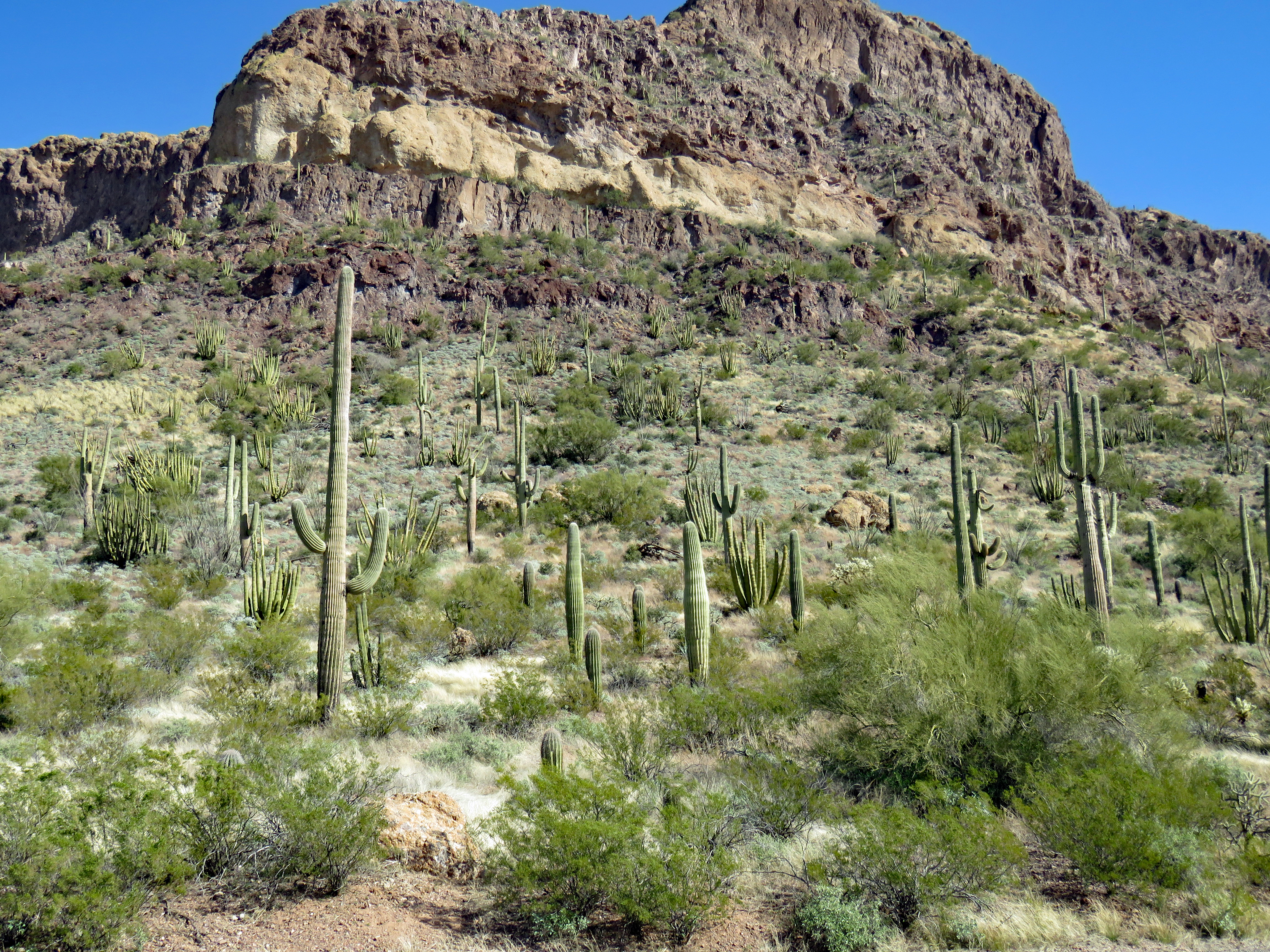
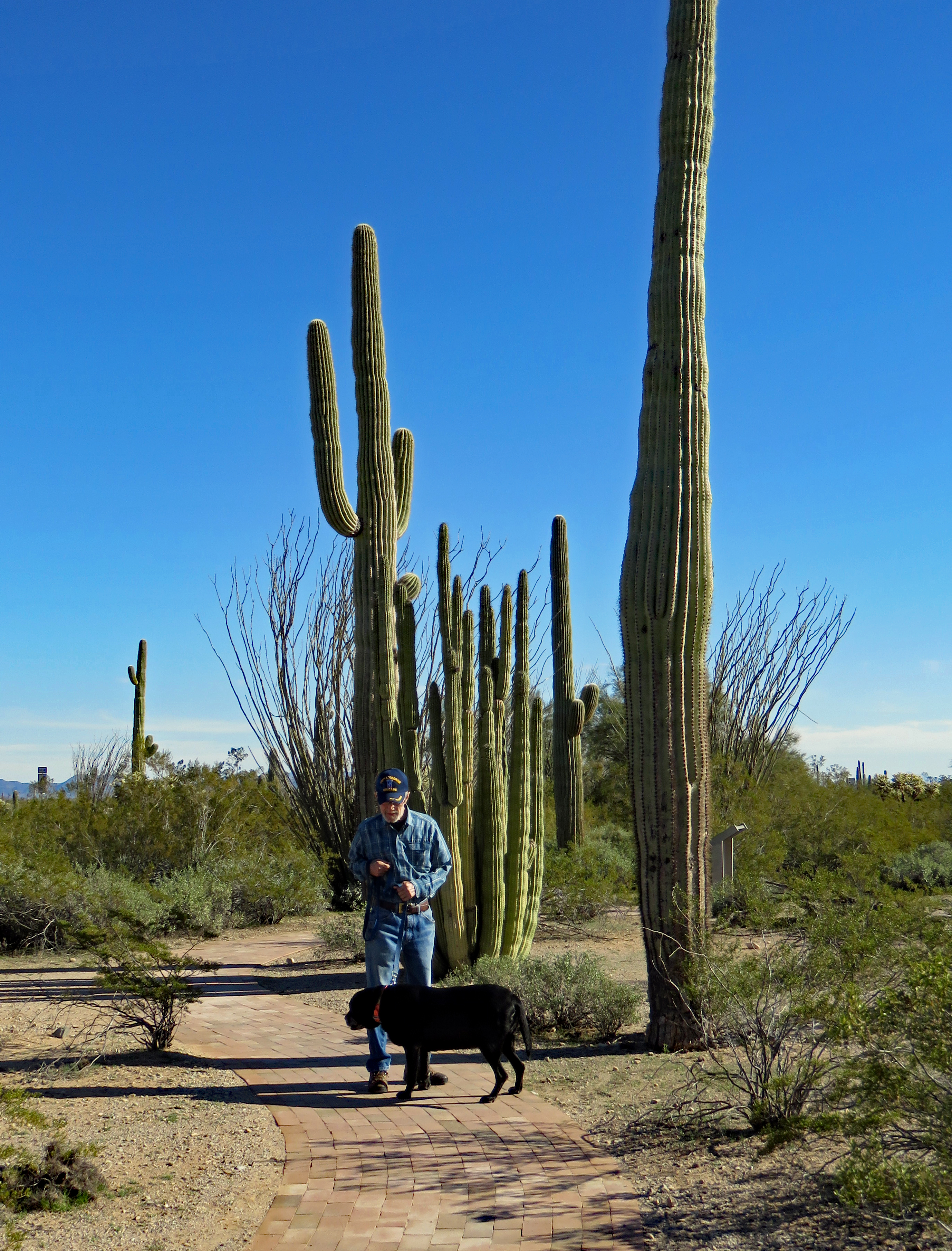
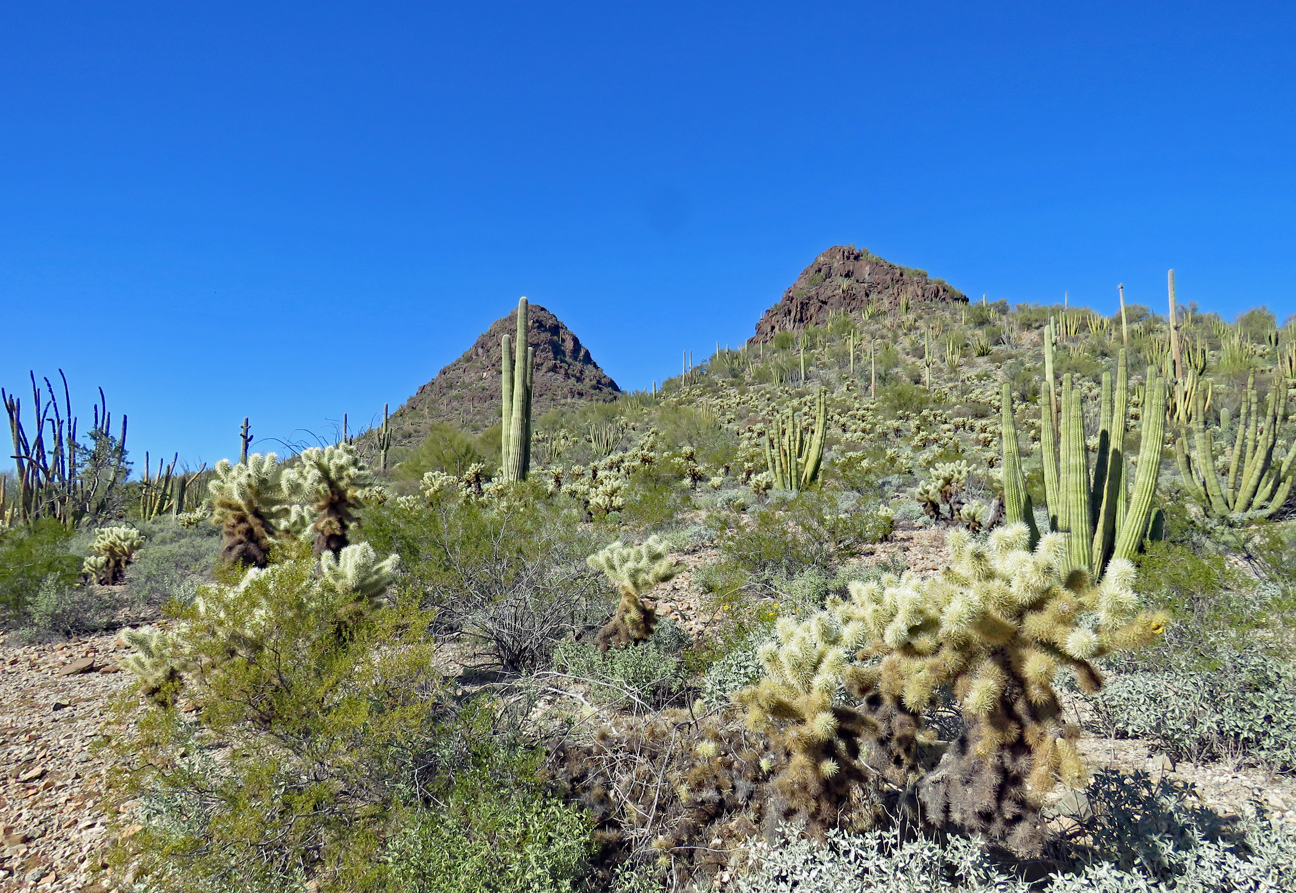
Ajo Mountain Drive is 21 miles and takes 2-3 hours. A one-way circle with an abundance of plants and animals (although we didn’t see any of the animals). The Sonoran Desert is home to over 4,000 species of plants and animals. Organ Pipe NM experiences only a few frosty nights a year which allows the namesake organ pipe cacti to stay warm and flourish. Organ pipe cacti crave the sun’s heat and do not require nurse plants. At night the rocks surrounding the plant release heat stored during the day thus keeping the plants from freezing. They are prevalent on south-facing slopes with little vegetation near them.
Late January was a very pleasant time to visit Organ Pipe National Monument. I’m not sure we would want to go hiking or exploring there in the summer.
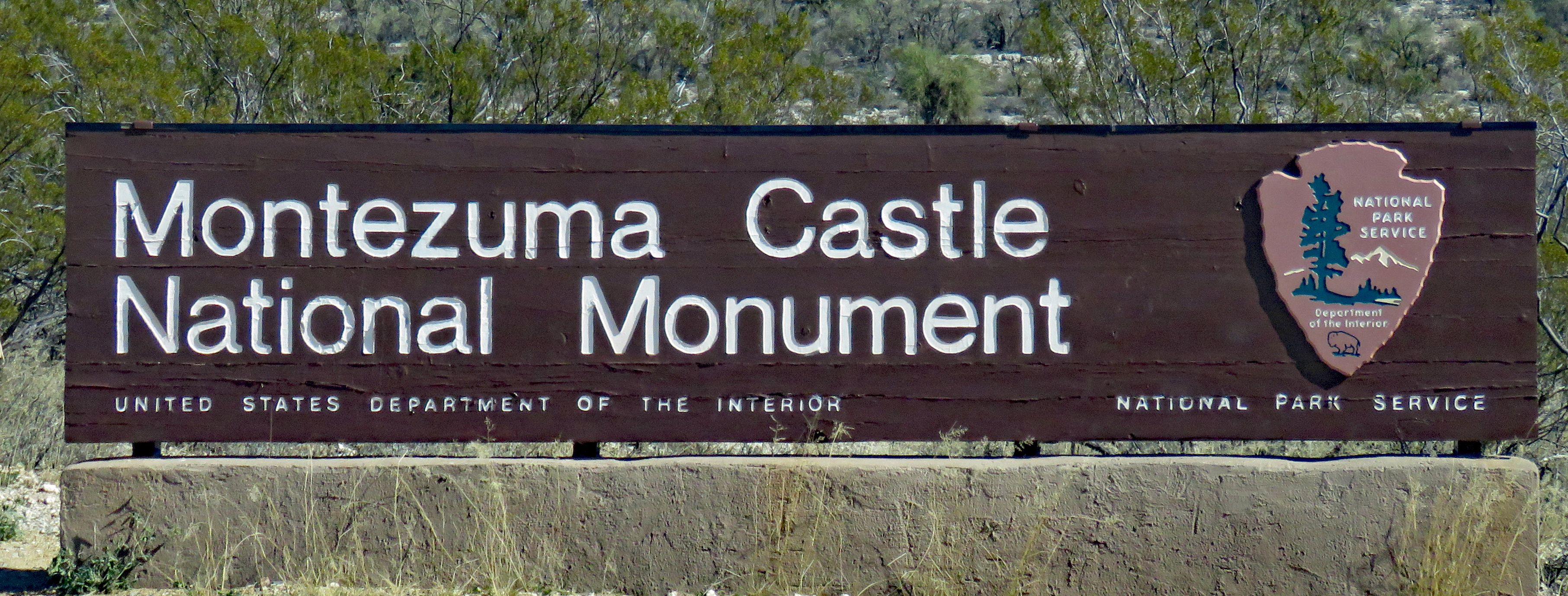
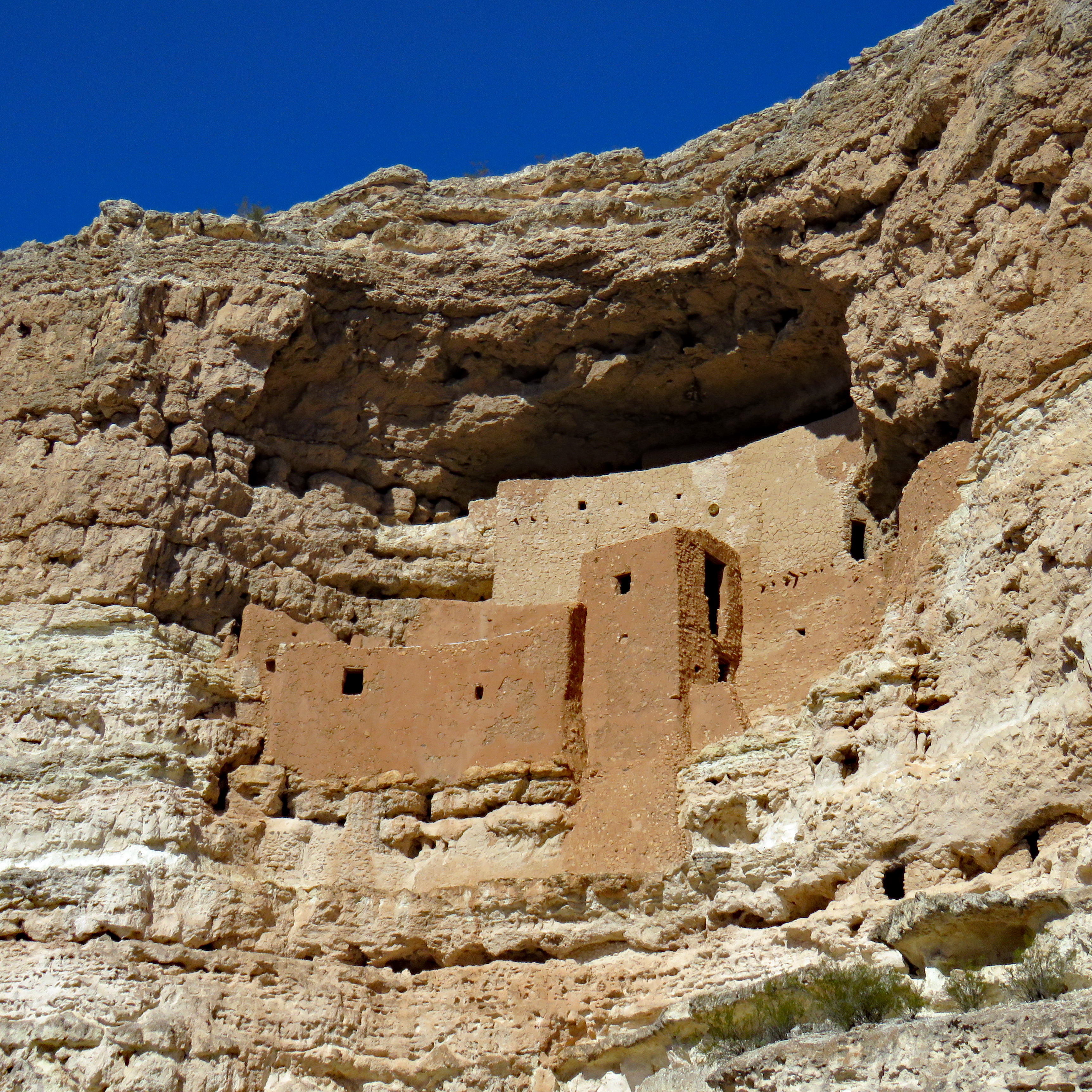
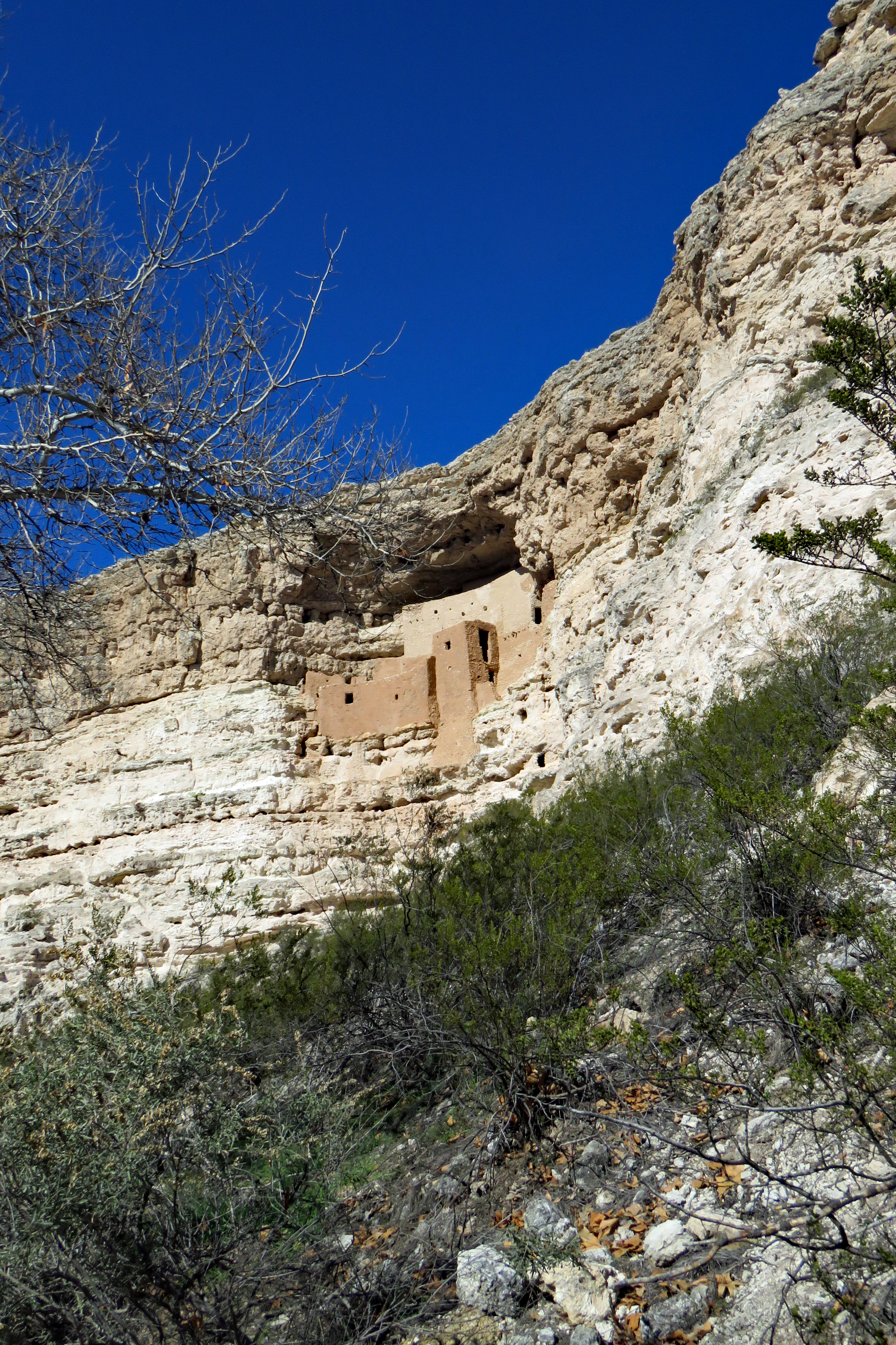
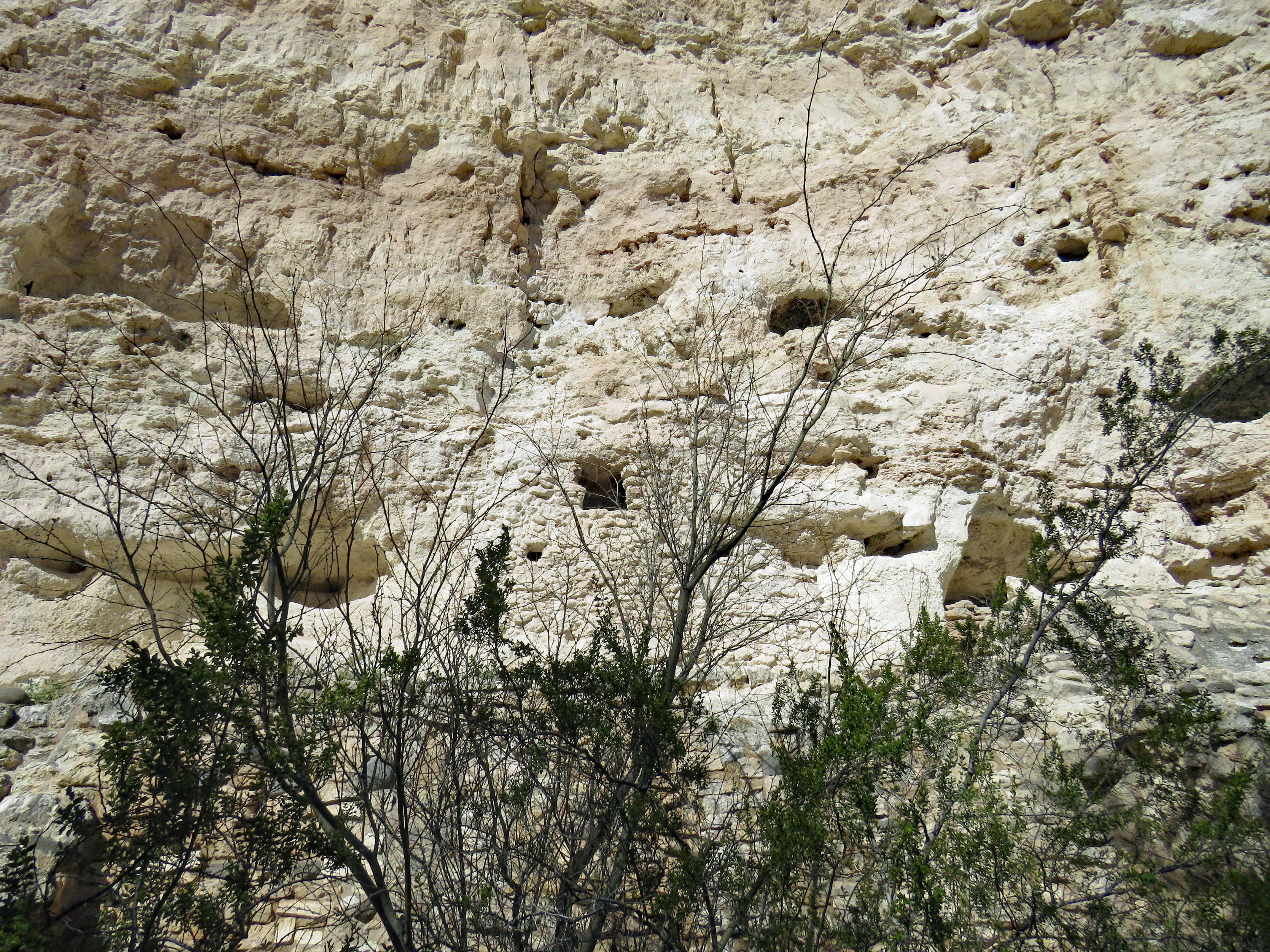
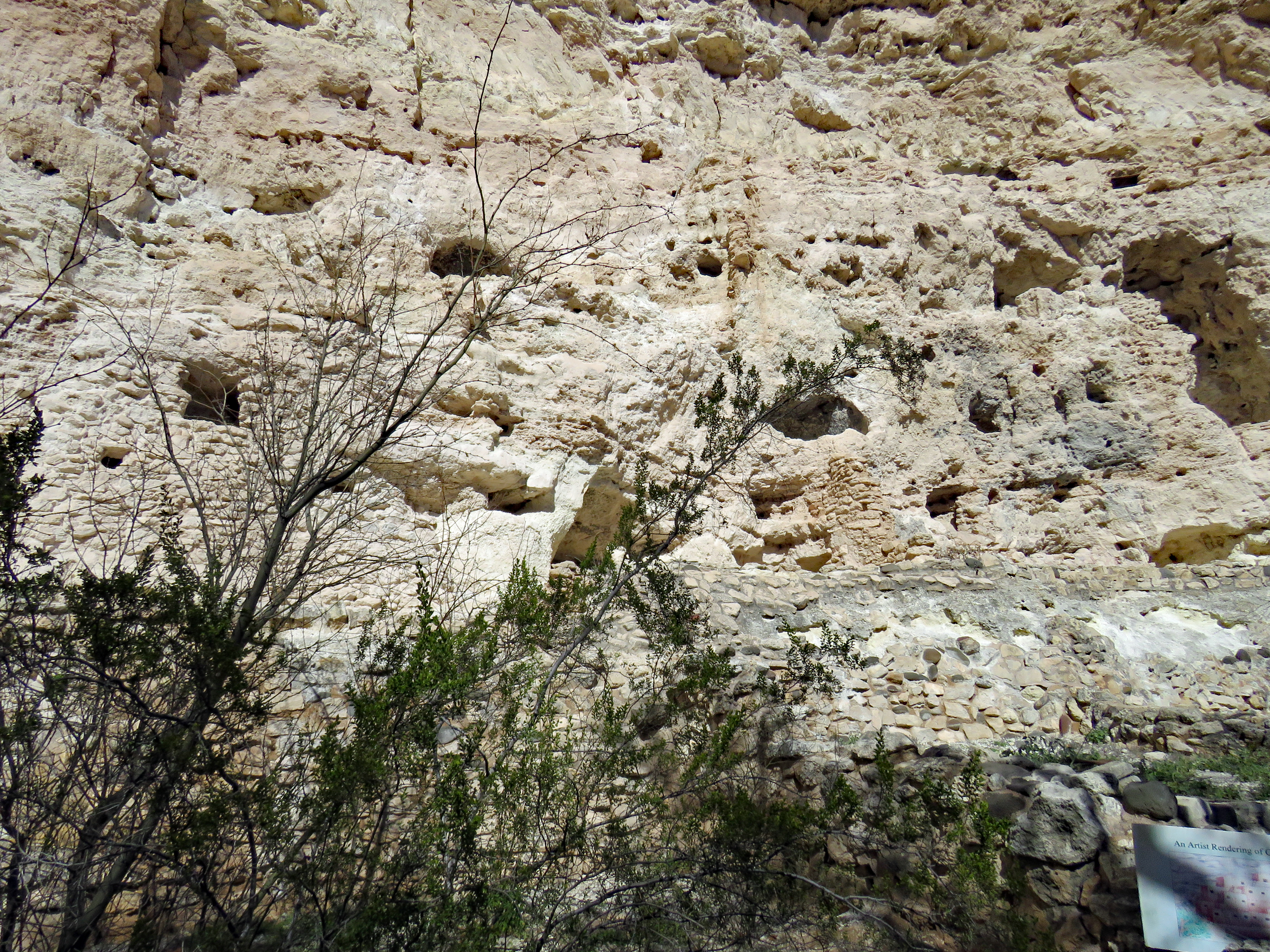
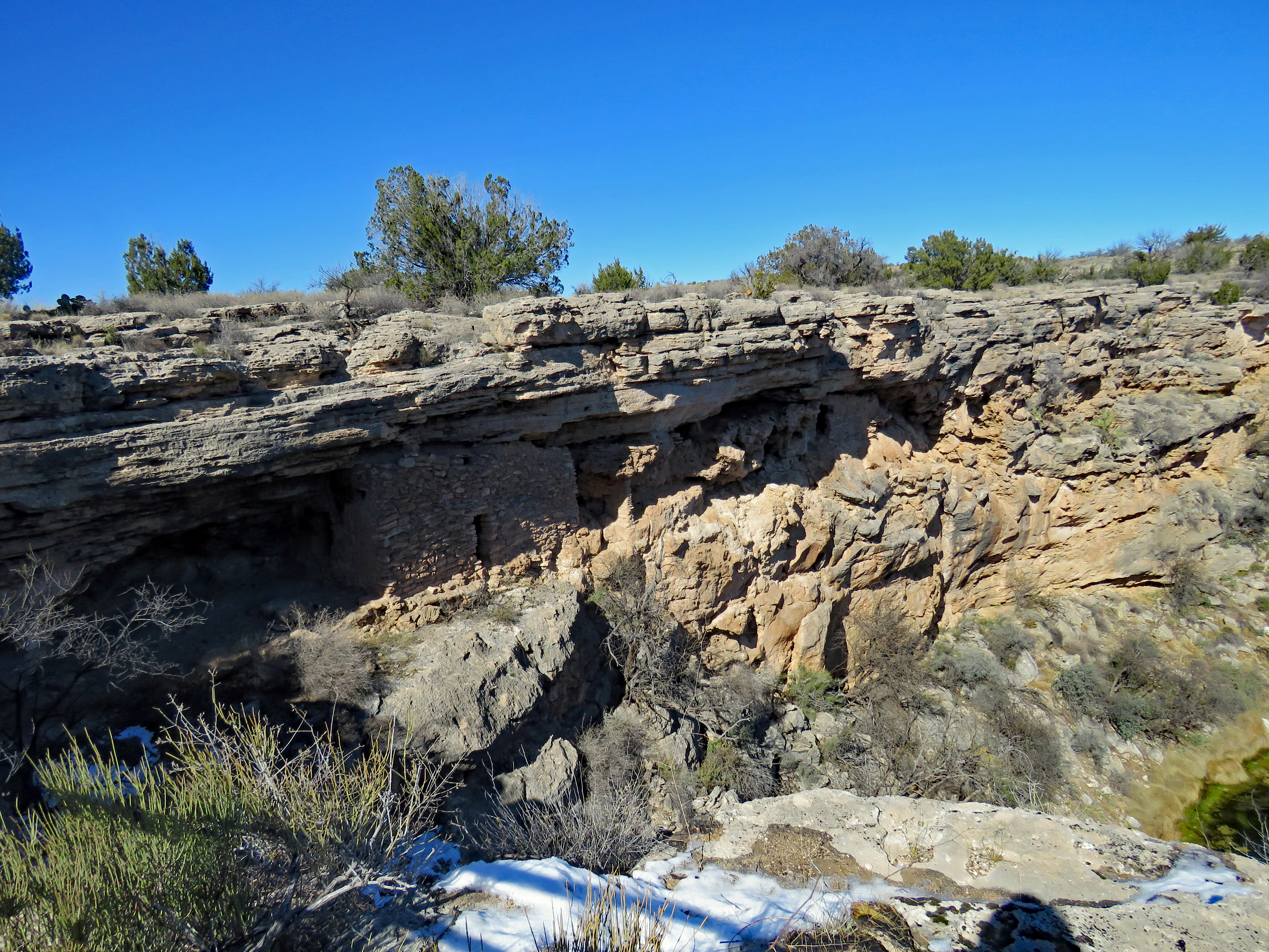
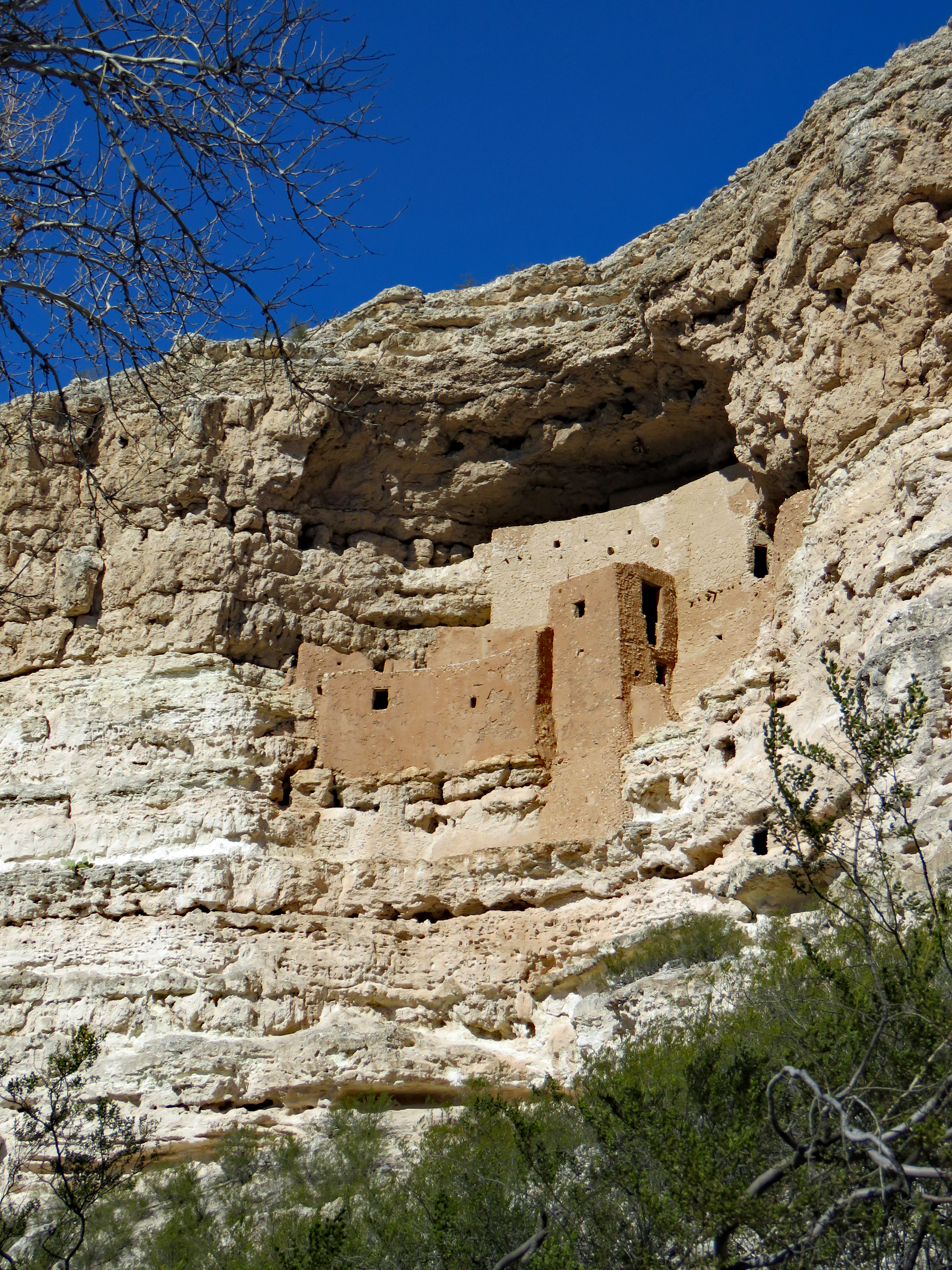
Established in 1906 by President Theodore Roosevelt, Montezuma Castle was one of the nation’s first national monuments. Easy to get to off I-17 between Phoenix and Flagstaff, Montezuma Castle National Monument can be a quick stop and a brief look at an unusual prehistoric building in a cliff wall. Basically a photo-op. Or it can be much more, especially if you take a little time and also go to the Montezuma Well unit.
Montezuma Castle has absolutely nothing to do with the Aztec emperor Montezuma. It was either named in the 1800’s by settlers who thought it was built by Aztec refugees or by the U.S. Army as one ranger related. At any rate, neither Montezuma nor any of the Aztecs were ever close to this area. The “castle” was built by the prehistoric Sinagua people.
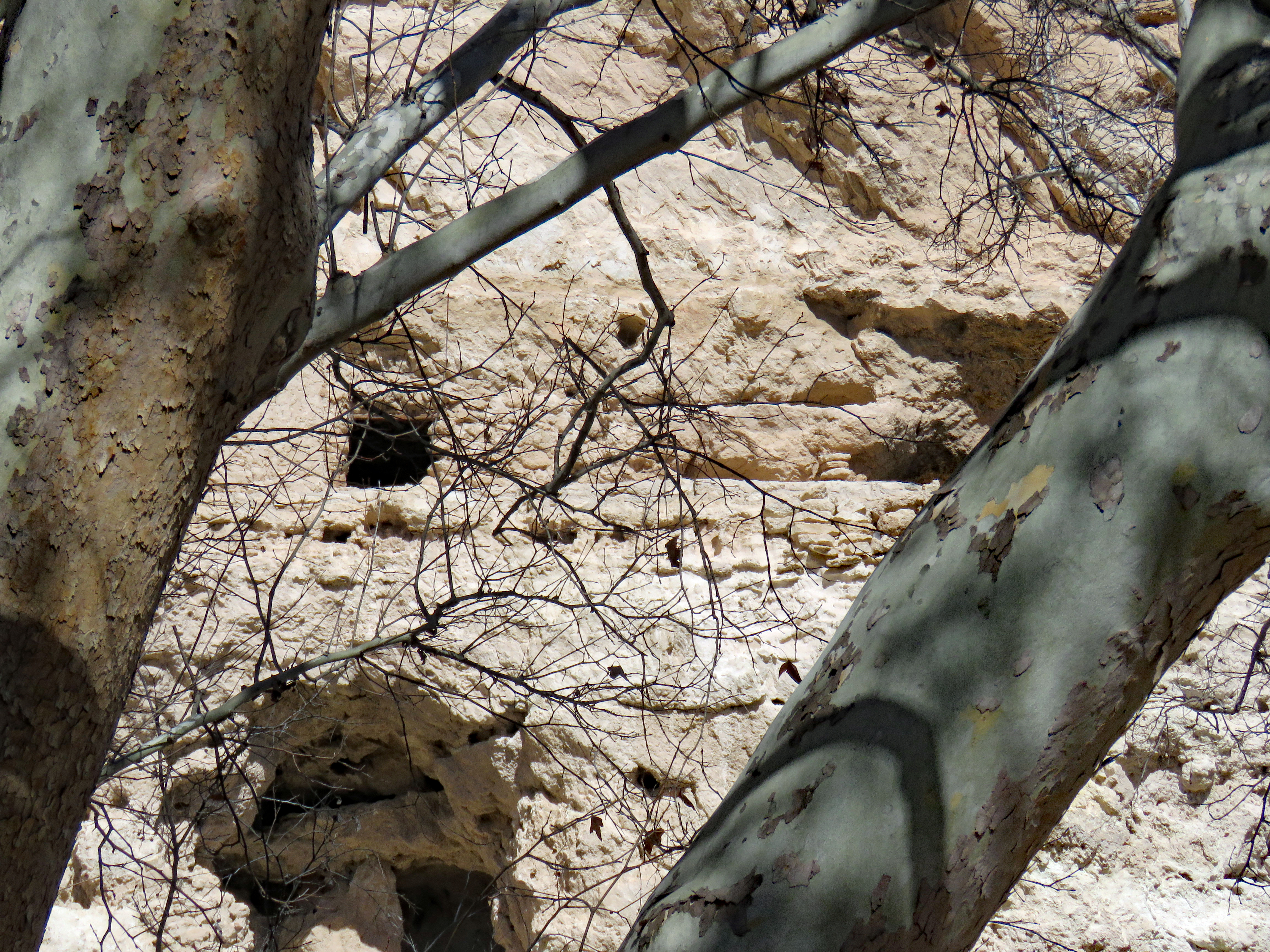
We’ve visited many prehistoric dwelling ruins – pithouses, cliff dwellings, canyon dwellings, pueblos, etc. but there is something very different about Montezuma Castle. I think it has to do with the fact that it appears to be clinging to the side of a limestone cliff and is very vertical. Many of the other ruins are in alcoves in sandstone cliffs or on canyon floors.
Until 1951, all visitors to Montezuma Castle were allowed to enter the ruin by climbing a series of ladders. As visitation and impact on the structural integrity increased so did the difficulty in ensuring visitor safety. All public tours were discontinued. Now the closest you get is the trail at the base of the cliff.
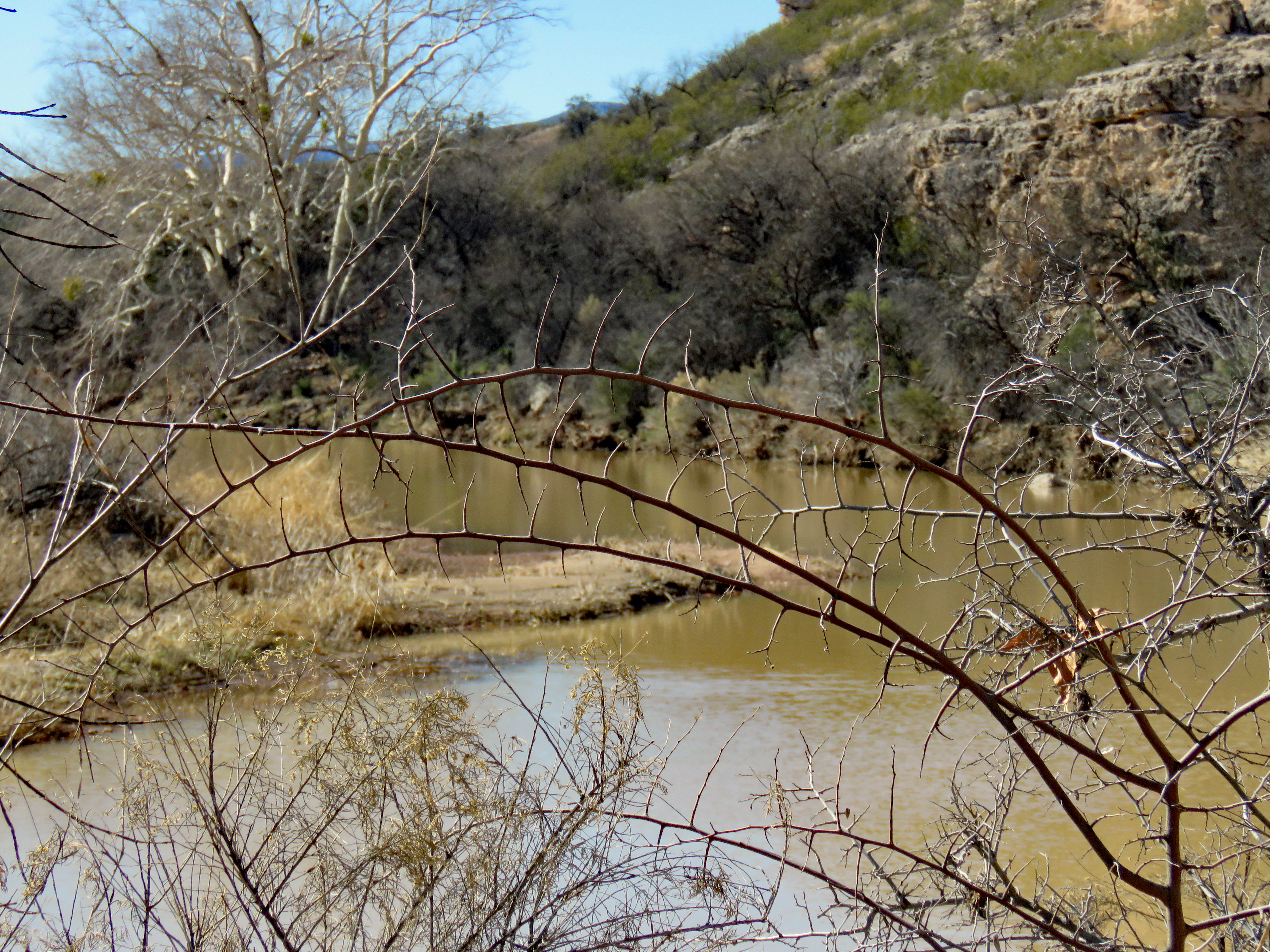
The Sinagua people were living in the Verde Valley as early as 650 CE but they began building permanent living structures around 1050 CE. This prehistoric group was named in 1939 by Dr. Harold S. Colton who first identified the culture. The name Sinagua comes from the Spanish meaning “without water.” Ironically, the Sinagua in the Verde Valley actually had plenty of water. Montezuma Castle resides above the banks of Beaver Creek, a tributary of the Verde River, which was a constant water source. The Sinagua were farmers, hunters and gatherers. They grew corn, beans and squash and gathered wild plants and spread their seeds in cleared spots. They also built canals for irrigation.
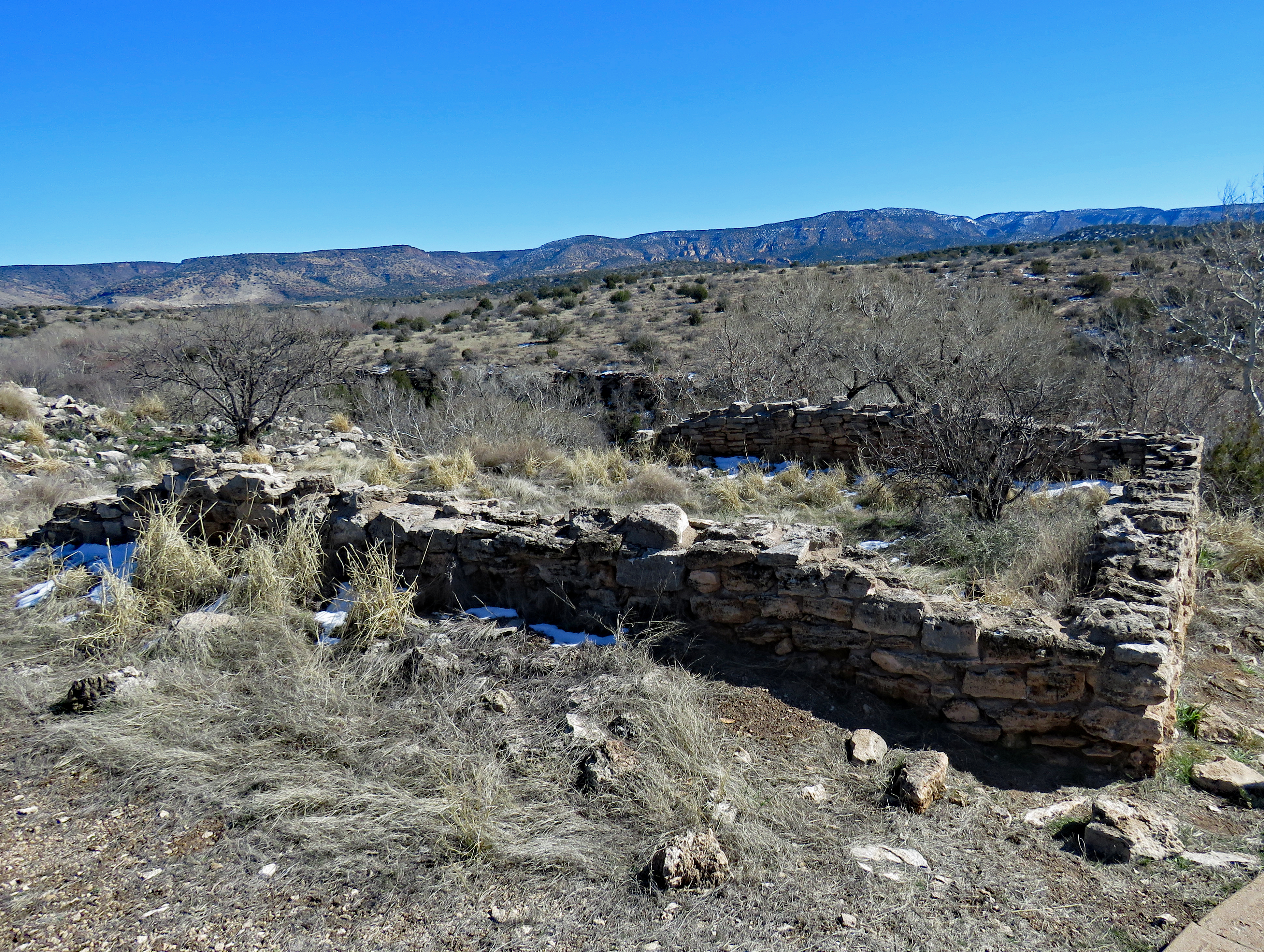
The Sinagua abandoned Montezuma Castle around 1400 CE and it remains whole today because its location naturally protected it from the elements. There are remnants of dozens of other dwellings in this area but none survived as well as Montezuma Castle.
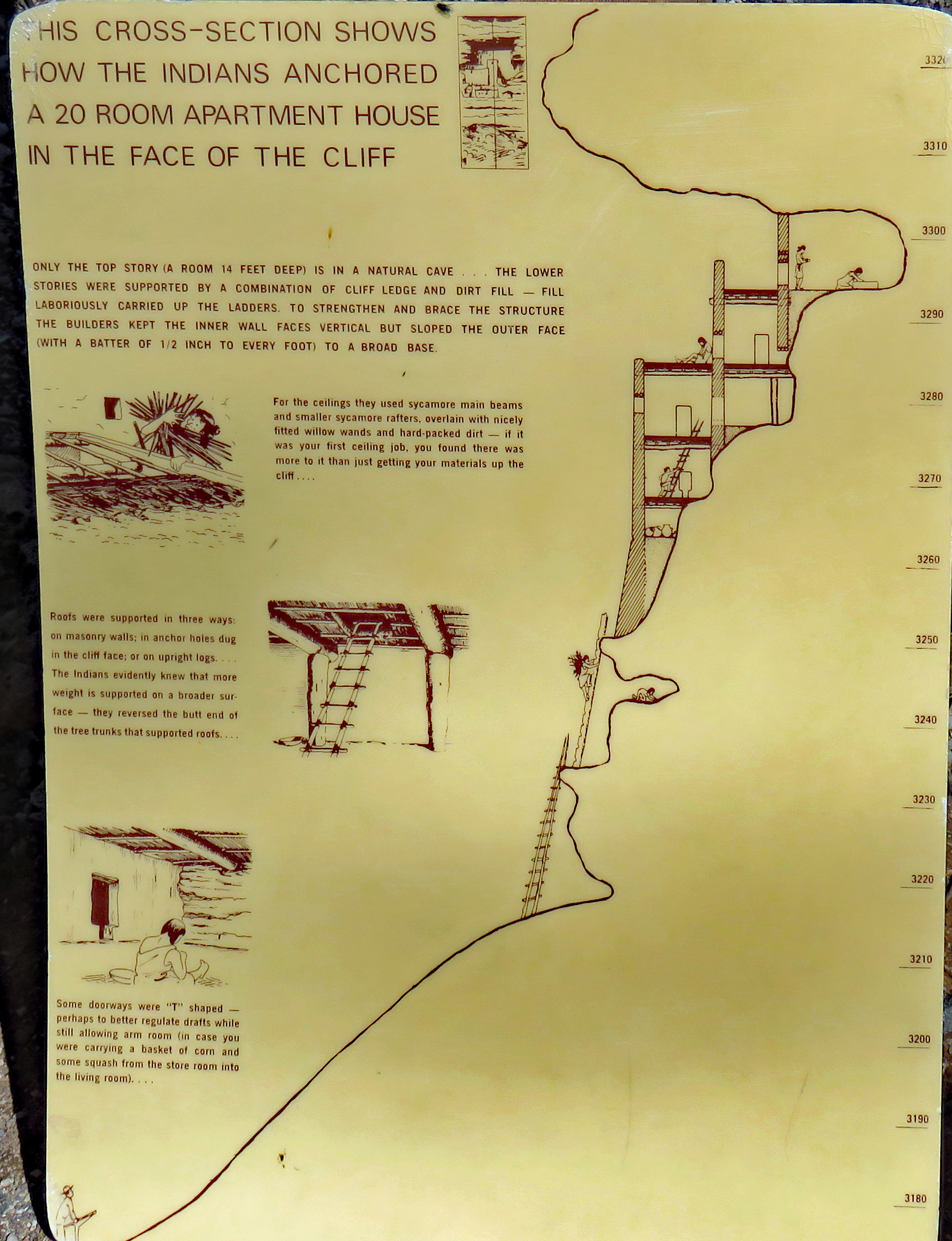
The “castle” is a five-story, 20-room mud-and-stone structure built on ledges into a cavity in the cliff face. The walls are made of limestone rocks stacked and held together with clay. Once the walls were completed, an adobe plaster was used to coat and seal the exterior. It is almost wholly intact. The primary entrance is a doorway in Level 2 with access to other levels through interior ladders via holes in the ceilings. These rooms would have been smoky and dark but inhabitants probably spent most of their time on the open rooftop on Level 5 or in the fields and woods below.
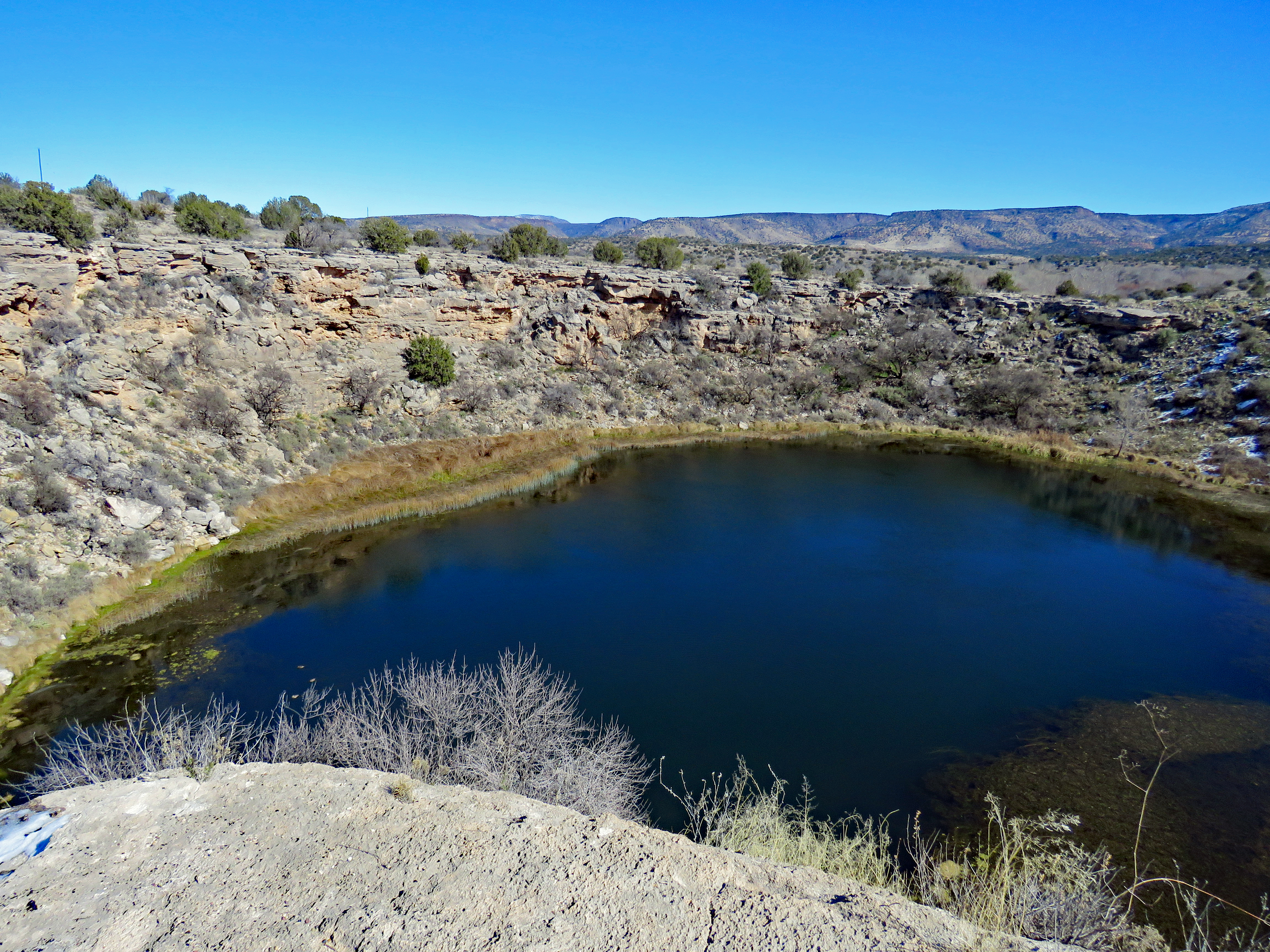
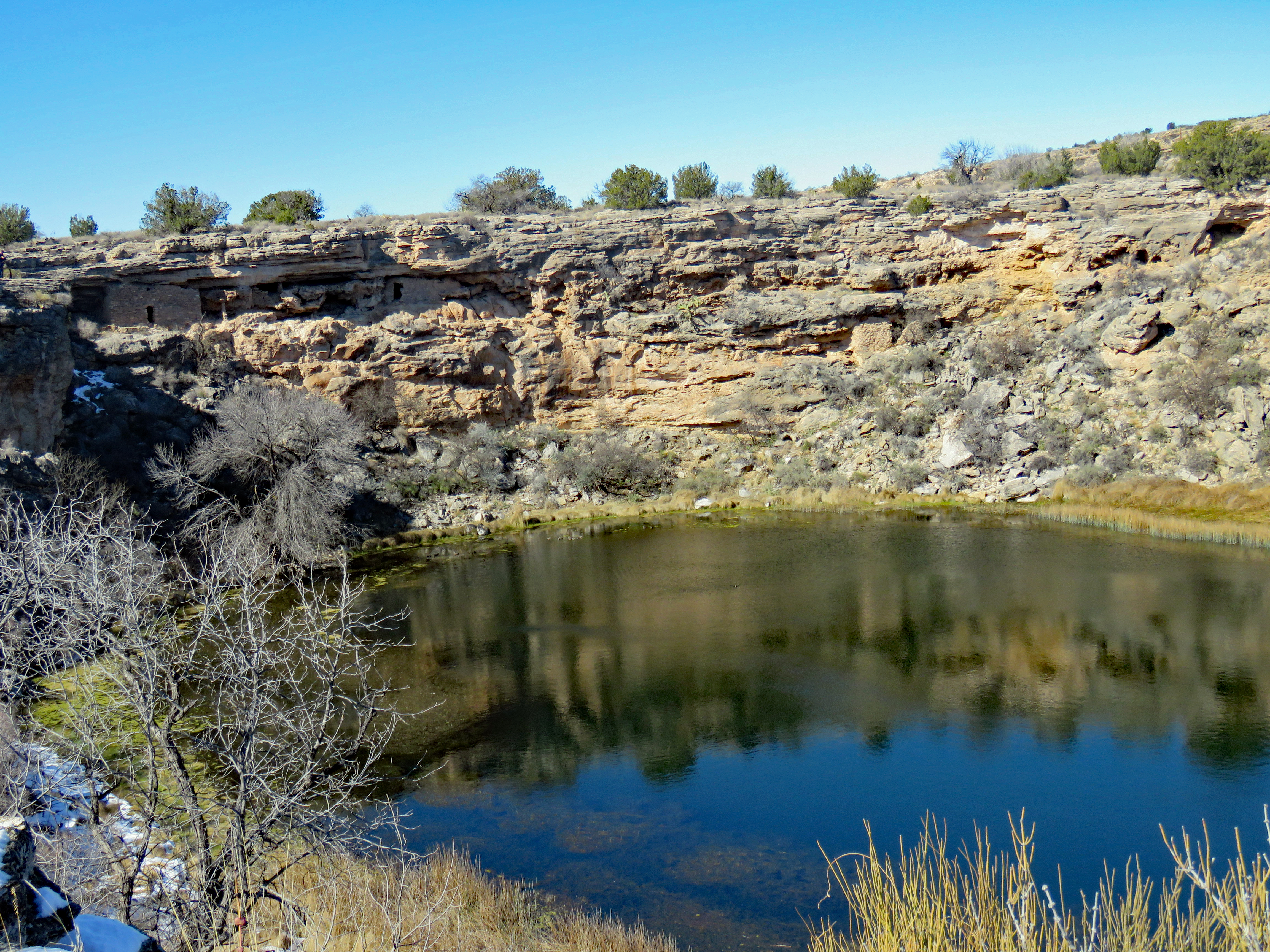
About 11 miles by road from the “castle” is Montezuma Well which became a sub-unit of Montezuma Castle National Monument in 1947. The Well is a natural limestone sinkhole through which some 1,500,000 gallons of water emerge every day. Water is fed into the Well through several vents at the bottom and exits the well through a swallet and cave system. The outlet drains into a prehistoric irrigation canal. The land around Montezuma Well has been home to many prehistoric groups of people since as early as 11,000 CE. Two small pueblos and a small alcove home are observable at Montezuma Well.
The question of the depth of the Well long sparked curiosity. In the late 1800’s Capt. Warren Day tied a rock to a rope, determined it to be 65 feet but announced to his fellow soldiers at Fort Verde that it was bottomless. In 1948 diver H. J. Charbonneau went into the Well and reported the bottom was at 55 feet and composed of fine silt. There have been nine documented dives to the bottom since that first descent.
In 1962 diver G. J. Murray became the first to report that the mysterious bottom was perhaps not the bottom but rather a “false bottom”. This false bottom has been described as an irregular boiling surface like thin mush cooking, quick sand or boiling oatmeal.
In 2006 a team of divers from the National Park Service Submerged Center was invited specifically to study the “false bottom”. They confirmed the false bottom is caused by pressurized groundwater entering the bottom of the well and holding fluidized sand in suspension and causing it to have a boiling appearance.
The water level and temperature remain nearly constant throughout the year. Extreme chemical concentrations in the water make it impossible for fish to live in the Well and organisms living in the water have had to adapt in order to survive. There are five species living in the Well that are not known to occur anywhere else in the world.
One discovery made during the 2006 dive was the correlation of the scientific research with the traditional stories of the Yavapai and Apache people. The stories of the tribal elders said there was a place at the bottom from which once something emerged, it could never return. Everything the scientists tried putting down the holes – cameras, rovers, sensors – kept being pushed back out.
From the Well, one can see evidence of permanent settlement spanning more than 1,000 years. Montezuma Well has long been a refuge on the dry desert landscape.
In early July 2022, we made our third visit to Katmai National Park. Our first time to Katmai in July of 2016, we stayed at Kulik Lodge and we returned there again this time. As before, we thoroughly enjoyed this remote fishing resort.
Our goal this trip was to see the bears again and to tour the Valley of Ten Thousand Smokes. Our bear viewing was successful, Ten Thousand Smokes not so much. The day our tour to Ten Thousand Smokes was scheduled, everything was so socked in that the float plane couldn’t fly us to Brooks Camp to make the tour. Since the tours are limited and booked ahead, we hoped someone would cancel the next day and we could go then. Turned out, it didn’t matter if someone canceled or not as the tour bus to get to the edge of the valley had mechanical issues so the tour was canceled for that day. So it goes sometimes.
This post is mostly about bears as the weather did not particularly cooperate. It was rainy and cold a good deal of the time so fishing and hiking were not the best but we spent a day at Brooks Camp to watch the bears. These bears are amazing and it’s easy to spend hours watching them.
The bears of Katmai are brown bears. Brown bears and grizzly bears are the same species (Ursus arctos), but grizzly bears are currently considered to be a separate subspecies (U. a. horribilis). The difference between grizzlies and brown bears can be fairly arbitrary but generally brown bears have access to coastal food sources like salmon and grizzlies live further inland. As a result of habitat and diet, brown bears are much larger.
About 2,200 brown bears are estimated to inhabit Katmai National Park. Katmai’s brown bears are some of the largest bears in the world. They can stand 3-5 feet at the shoulder and measure7-10 feet in length. When one of these big boys stands up on his hind legs, it’s an impressive sight.
In the spring the bears emerge from their dens thin and hungry. They become eating machines in order to pack on the pounds before retreating in October or November for winter hibernation. The largest and most successful bears can catch and eat up to 40 salmon a day -over 100 pounds and 100,000 calories. When fish are in abundance, they often only eat the portions of the salmon that are the highest in calories (“high-grading”) and leave the rest for gulls, eagles, etc. Large male bears in Katmai can routinely weigh over 1000 pounds in the fall. Adult females average about 1/3 less in weight.
Every fall, Katmai National Park and Preserve hosts Fat Bear Week which is an annual tournament celebrating the success of the bears at Brooks River. In a single elimination tournament, the online community is invited to compare photos of bears when they first visit Brooks Falls in the spring to photos of the same bears at the end of the summer and vote for the fattest of them for the title of Fat Bear. The 2022 winner was bear “747” who has become one of the largest brown bears on earth, perhaps weighing as much as 1400 pounds.
We enjoyed watching Otis who is somewhat of a celebrity at Brooks Falls. Otis is about 27 years old and is an experienced fisherman and very efficient. He catches salmon with the least amount of effort possible. Otis has learned to conserve energy and salvage the most calories possible out of each catch. At his preferred fishing spots, Otis waits for salmon to come to him. He once ate 42 salmon in a sitting using this strategy. Otis has won more Fat Bear titles than anyone. He was the inaugural Fat Bear Tuesday champion in 2014 and Fat Bear Week champion in 2016, 2017, and 2021.
Otis faces strong competition from younger male bears. The average life span for a wild brown bear is about 20 years although many bears live longer than this. The oldest wild brown bears known lived about 35 years.
On the hike to Brooks Falls, we came across an unusual sight – a sow nursing her two cubs. In Katmai cubs generally stay with their mothers for 2 ½ years, separating in May or June of a cub’s third summer.
Brooks Falls is one of the best places for brown bear watching as early in the salmon run the falls creates a temporary barrier to migrating salmon. This results in a particularly successful fishing spot for bears. The viewing platform at Brooks Falls has a limited capacity so you have to wait your turn and are limited to an hour at a time. However, you can get back in the queue to make multiple visits, which we did.
The bears exhibit different fishing styles. These styles are often learned behaviors. Several sows were teaching their cubs to fish in the river below the falls.
We watched one young bear on the edge of the falls attempting to catch salmon. He wasn’t a very good fisherman but he didn’t give up and he did catch some.
Common different styles of fishing include:
Stand and Wait – bears will stand on top of Brooks Falls and wait for salmon to jump close enough to catch in their mouths. They rarely shift position once they have established a place to stand is this can be quite precarious.
Sit and Wait – bears will sit just underneath the falls in several places and wait for the salmon to swim to them
Dash and Grab – bears often chase fish and attempt to pin them to the river bottom with their paws
Snorkeling – bears that snorkel are looking for fish under the water
Stand and Wait StyleSit and Wait StyleDash and Grab StyleSnorkeling Style
The bears of Katmai National Park are fascinating, amazing creatures.
We visited Fort Larned, Kansas, as part of a three-week trip with our camper and were extremely glad we did. Fort Larned is the best preserved Indian Wars’ Era fort along the Santa Fe Trail. We were there in the fall of 2021 and covid-19 restrictions were in place so the museum and orientation film were closed. However, that also meant that we were two of the half dozen visitors so we nearly had the whole place to ourselves. The rangers were helpful, there was plenty of information available and the buildings were well-furnished and well-signed.
Fort Larned didn’t actually exist as a military fort for very long – founded in 1859, by 1870 its mission was greatly decreased, and it was deactivated in 1878. From 1885 to 1966, the buildings housed the headquarters of a ranch but that’s getting ahead in the story.
The Santa Fe trail was one of the trails west that in the 1800’s were the forerunners of today’s modern highways. Between Missouri River ports and Santa Fe, and other points west, along this trail flowed commerce, communication and emigration. The trail crossed the Arkansas River at three principal points, the most important being about seventy-five miles southwest of Fort Larned.
The Santa Fe Trail bisected the traditional homelands and hunting grounds of Great Plains tribes – Cheyenne, Arapahoe, Kiowa and Comanche – and led to conflict. Manufactured goods obtained through trading or raiding made Native American life easier but depletion of resources such as wood, grass and game threatened their entire way of life. William Bent (Bent’s Old Fort National Historic Site), Indian agent for the Upper Arkansas Indian Agency, in 1859 recommended a military fort be built at Pawnee Fork to guard the critical middle sections of the Santa Fe Trail. In the fall of 1859 “Camp on the Pawnee Fort”, a tent camp, was established and a mail station was constructed there. In early 1860 this installation was renamed “Camp Alert”. Later in 1860, a more advantageous site three miles away on a big bend of the Pawnee was selected, construction began and the new post got its third and final name, “Fort Larned”. Hastily erected of adobe and sod, the buildings were somewhat better than the previous tents but left a lot to be desired.
Officers’ Quarters after 1867
With the outbreak of the Civil War in 1861, the Santa Fe Trail took on a new strategic importance. Units stationed at Fort Larned kept military supplies and mail flowing to Union armies in New Mexico and Colorado. Through 1862 and 1863 there were only sporadic incidents but in 1864 serious troubles began. For the Kiowas the war began at Fort Larned and the Kiowa version and the military version of the encounter are very different. However, in both versions, the Kiowas swiftly decamped and took with them the fort’s entire herd of 172 horses. Up the Arkansas, raiding parties of Cheyenne, Arapahos, Kiowas, and Comanches waylaid travelers. Expeditions from Fort Larned struck out at Indian camps, killing and wounding a few and driving them from their tepees, stirring up further hostility. The military remained active into the winter with Battle of Adobe Walls. The Sand Creek Massacre in southeastern Colorado ignited a war across the entire Great Plains. In the travel season of 1865 wagon trains between Fort Larned and Fort Union, New Mexico had to be accompanied by strong army escorts. In October 1865 the Little Arkansas treaties were concluded.
Officers’ Quarters after 1867
Following the Civil War as regular Army returned to Fort Larned and fresh waves of settlers streamed over the Santa Fe Trail, the post’s strategic importance once again rose. It was decided to replace the decaying adobe buildings with stone. Beginning in June 1867, using civilian stone masons, carpenters, plasterers and laborers, nine durable buildings were arranged around the parade ground – barracks for enlisted men on one side, officers’ quarters on a second and storehouses and shops on the other two, Several wooden structures were also constructed. These excellent stone buildings stand today.
Barracks
As part of an overall army reorganization following the Civil War, in 1866 Congress authorized two all-black cavalry regiments – the 9th and the 10th. Capt. Nicholas Nolan commanded Company A , 10th US Cavalry. Although initially reluctant to command a company of African-American soldiers, he came to be impressed by their devotion to duty, hard work and care for their horses. There were incidents of racial animus nearly from the time Co. A, 10th US Cavalry arrived at Fort Larned in April of 1867. January 1, 1869, following a disagreement over the use of the pool table in the Sutler’s store. The Post Commander decided the entire Company A should be punished and sent them to guard the post woodpile in a blizzard. Capt. Nolan protested to no avail. After a bitter, cold night, Co. A returned to find the smoldering ruins of what had been the Fort Larned cavalry stables. The fire had killed 39 of the company’s horses and destroyed hay, grain, saddles and ammunition. The fire had started in the early morning while they were ½ mile away guarding the woodpile. The initial investigation determined that the black troopers were responsible even though they were not in the area at the time. The cause of the fire was never identified and no one was punished. Instead of a full investigation, the 10th Cavalry was sent to Fort Zarah to avoid further trouble. The 10th was the last cavalry unit to be stationed at Fort Larned.
StorehousesShops
After the fort was abandoned in 1878, the land was broken up into separate pieces and sold in various ways. In 1902 E.E. Frizell bought the Fort Larned ranch which was approximately 3000 acres, the vast majority in native grass. The ranch employed several families who resided in the officers’ quarters and the two enlisted men’s barracks were converted into a huge barn. Other buildings were used as machine shops and storage. During the early 1900s the ranch became a favorite picnic ground and over the years tourists came in increasing numbers. The Frizell family welcomed visitors and various organizations began exploring options for establishing a national monument.
HospitalHospital
August 31, 1964, Fort Larned National Historic Site was designated. Most of the buildings, including barracks, commissary, and officers’ quarters, are furnished to their original appearance. We’ve visited a variety of historical forts but Fort Larned was impressive in its adherence to original. I was particularly taken with the commissary which had the usual supplies but also had rows of cupboards labeled with a variety of clothing items by size, belts, shoes, insignia, etc. Even though soldiers had limited changes of clothing it would be necessary to have replacements for men of many different sizes. Fort Larned is the only place we’ve actually seen evidence of this aspect of fort life.
Commissary
In the movies, forts are often depicted with stockades surrounding them but in more cases than not, they were not enclosed. Fort Larned is a prime example of a typical western fort, buildings arranged in a rectangle around the parade ground. Because of the sturdy stone construction, Fort Larned maintains its original character.
All articles and photos on this site are copyrighted. Please contact me if you would like to use any of them. Some photos from this site as well as other of my photos may be found under Contributor: 46travels on:
http://www.istockphoto.com/search/portfolio/9590110/
or
http://www.bigstockphoto.com/search/?contributor=46travels
or
http://www.dreamstime.com
or
https://us.fotolia.com